
Alluri Sitarama Raju was an Indian revolutionary who waged an armed rebellion against the British colonial rule in India. Born in present-day Andhra Pradesh, he was involved in opposing the British in response to the 1882 Madras Forest Act that effectively restricted the free movement of adivasis in their forest habitats and prevented them from practicing their traditional form of agriculture called 'podu', which threatened their very way of life. Rise in discontent towards the British colonial rule in the backdrop of the non-cooperation movement (1920–1922) led to the Rampa rebellion (1922–1924) in which Alluri Sitarama Raju played the major role as its leader. Mustering combined forces of tribals and other sympathizers to the cause, he engaged in guerilla campaigns against the British forces across the border regions of present-day Andhra Pradesh and Odisha states in India. He was given the title "Manyam Veerudu" by the local people for his exploits.

The West Godavari district is a coastal district in the Indian state of Andhra Pradesh with an administrative headquarters in Bhimavaram. As of the 2011 Census of India, the district has an area of 2,178 km2 (841 sq mi) and a population of 1,779,935. It is bounded by the Krishna district and Bay of Bengal to the south, East Godavari district to the east, and Eluru district, Kolleru Lake and Upputeru Drain to the northwest.

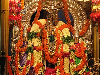
Bhimavaram is a city and headquarters of West Godavari district of the Andhra Pradesh state of India. It is the administrative headquarters of Bhimavaram mandal in Bhimavaram revenue division. It is a part of Eluru Urban Development Authority. As of 2011 census, it is the most populous urban area in the district with a population of 163,875. It is one of the major pilgrimage centers in the state, which is home to Somaramam, one of the five great Pancharama Kshetras.

Vizianagaram district is one of the six districts in the Uttarandhra region of the Indian state of Andhra Pradesh with its headquarters located at Vizianagaram. The district was once the part of ancient Kalinga.Saripilli Dibbilingeswara temple, Jayathi Mallikarjuna Temple are the finest examples of ancient Eastern Ganga Dynasty built monuments in the district. The district is bounded on the east by the district of Srikakulam, north by Parvathipuram Manyam south by Visakhapatnam, Anakapalli, southeast by the Bay of Bengal, and west by Alluri Sitharama Raju district. It was formed on 1 June 1979, with some parts carved from the neighbouring districts of Srikakulam and Visakhapatnam. The district is named after the princely state of Vizianagaram. In 2011, it was the least populous district in Andhra Pradesh.

Visakhapatnam district is one of the six districts in the Uttarandhra region of the Indian state of Andhra Pradesh, headquartered at Visakhapatnam. It is one of the twenty-six districts in Andhra Pradesh state. The district shares borders within the north and east, Vizianagaram district and South Anakapalli district in the south-west and Bay of Bengal in the south.

Tadepalligudem is a city in West Godavari district of the Indian state of Andhra Pradesh. Tadepalligudem is the judicial headquarter of West Godavari. It is a Selection Grade municipality and the mandal headquarters of Tadepalligudem mandal and Tadepalligudem Revenue Division. Tadepalligudem is one of the biggest cities in West Godavari district

Narsipatnam is a census town in Anakapalle district of the Indian state of Andhra Pradesh. It was upgraded from a gram panchayat into municipality in 2012. The town is spread over an area of 42 km2 (16 sq mi) The resting place of the revolutionary Indian freedom fighter Alluri Sitarama Raju is located in Krishna Devi Peta village of From Narsipatnam to labasingi Village 30 km only.. labasingi most popular winter tourism place..so many Tourists enjoy -2 degree's temparature there.. Narsipatnam town is 43 km away from Tuni. And it is 72 km away from Visakhapatnam.

Parvathipuram is a municipality located at Parvathipuram Manyam district of Indian state of Andhra Pradesh. It is the administrative headquarters of Parvathipuram Manyam district and headquarters of Parvathipuram revenue division and Parvathipuram mandal. This revenue division shares a border with various districts in Odisha.

Tuni is a City in Kakinada district of the Indian state of Andhra Pradesh. It is a second biggest city in Kakinada district. Freedom fighter Alluri Sitaramaraju studied here. It is a major commercial marketing centre for more than 200+ surrounding villages in the district. Tuni is a border point for the district of Kakinada. It is known for mango production, with nearly 250 varieties being exported from the area. Tuni City is also known as "Mango City". Tuni is also famous for the production of betel leaves and jute bags. A variety of cashew nuts are also produced in Tuni.
Narasapuram is a town in West Godavari district of the Indian state of Andhra Pradesh. It is a municipality and mandal headquarters of Narasapuram mandal in Narasapuram revenue division. The city is situated on the banks of the Vasista Godavari River. The lace industry is prevalent in the city and its surroundings.
Chodavaram is a town in Anakapalli district in the Indian state of Andhra Pradesh. The town is located on the country's east coast. It falls under Visakhapatnam Metropolitan Region Development Authority. The town has one of the largest cooperative Sugar factories in state.

Padmanabham mandal is one of the 46 mandals in Visakhapatnam District in India. It is under the administration of Bhemunipatnam revenue division and the headquarters is located at Padmanabham. The Mandal is bounded by Bheemunipatnam, Anandapuram mandals in Visakhapatnam District and Bhogapuram mandal in Vizianagaram District. Great freedom fighter Alluri Sitarama Raju was born in Pandrangi village in this Mandal.Rajasagi Suryanarayana Raju, MLA Bheemili from 1972–78 is from this Mandal. Also Rajasagi Appalanarasimha Raju MLA Bheemili from 1985 to 2004 is also from this Mandal.

Payakaraopeta is a City in anakapalli district in the state of Andhra Pradesh in India. Payakaraopeta City is a gate Way of Visakhapatnam. Tuni and Payakaraopeta Cities are Twin Cities in Andhra Pradesh. Payakaraopeta City is fastest growing City in Andhra Pradesh. In the year 2011, The first AC library in united Andhra Pradesh was opened here.

Elamanchili is a town in Anakapalli district of the Indian state of Andhra Pradesh. It is a municipality and also the mandal headquarters of Elamanchili mandal. The town is spread over an area of 39 km2 (15 sq mi), which is under the jurisdiction of Visakhapatnam Metropolitan Region Development Authority. This town has historical importance dating back to 7th Century AD.

Alluri Seetarama Raju is a 1974 Indian Telugu-language biographical action film directed by V. Ramachandra Rao and written by Tripuraneni Maharadhi. The film stars Krishna, Vijaya Nirmala, and Jaggayya and was produced by Padmalaya Studios. Notably, it marks Krishna's 100th film as an actor and is recognized as the first Telugu film made in Cinemascope.

Andhra Pradesh lies between 12°41' and 19.07°N latitude and 77° and 84°40'E longitude, and is bordered by Telangana to the north and west, Chhattisgarh to the north-west, Orissa to the north, the Bay of Bengal to the east, Tamil Nadu to the south and Karnataka to the southwest and west. Andhra Pradesh has a coastline of around 974 km, which gives it the second longest coastline in the nation. Two major rivers, the Godavari and the Krishna run across the state. A small enclave 12 sq mi (30 km²), the Yanam district of Puducherry, lies in the Godavari Delta in the north east of the state. The state includes the eastern part of Deccan plateau as well as a considerable part of the Eastern Ghats.
Dammannapalli is a village in the Kadapa district of Andhra Pradesh, India 3 kilometres (1.9 mi) from Porumamilla. It is part of the Badvel Assembly constituency and the Kadapa Parliamentary constituency.
Chintapalle or Chintapalli is name of places in Andhra Pradesh and Telangana:

Lambasingi is a small village in the Eastern Ghats of Chintapalli Mandal of Alluri Sitharama Raju district in the Indian state of Andhra Pradesh. It's also referred as "The Kashmir of Andhra Pradesh". With an altitude that of 1000 m (3280 ft) above sea level, the area is cooler than the surrounding plains and is covered in moist deciduous forest cover. There are several coffee, pine, and eucalyptus plantations around the area and some small attempts to grow apple and strawberry.

Alluri Sitharama Raju district, also known as Alluri district and by its initials as ASR district, is a district in the Indian state of Andhra Pradesh. The headquarters of the district is located at Paderu. Named after Alluri Sitarama Raju, a revolutionary in the Indian independence movement who hailed from the region, the district was effective since 4 April 2022 and became one of the twenty-six districts in the state. The district is known for its scenery and lies in the Eastern Ghats.


