Chislehurst, Chatswood

Last updated

Chislehurst
Chislehurst, Centennial Ave, Chatswood - 1913.jpg
Chislehurst, in 1913
Location map Australia Sydney.png
Red pog.svg
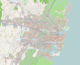
Location in greater Sydney
Former namesMaroomba
General information
StatusDemolished
Type
  • House (1892-1954)
  • School (since 1959)
Location24 Centennial Ave, West Chatswood, Sydney, New South Wales
CountryAustralia
Coordinates 33°47′55″S151°10′29″E / 33.798728°S 151.174750°E / -33.798728; 151.174750 Coordinates: 33°47′55″S151°10′29″E / 33.798728°S 151.174750°E / -33.798728; 151.174750
Completed1892;130 years ago (1892)

Chislehurst was a former house and former school building located in West Chatswood, Sydney, New South Wales, Australia. Completed in 1892 by the merchant and pastoralist John de Villiers Lamb, the former house was originally known as Maroomba.
History

In 1900, the house was bought from Lamb by a K. Weidlmann. Weidlmann sold the house in 1906 to Edward Carr Hordern, a member of the Hordern family.. It was renamed Chiselhurst after the birthplace of Carr Hordern's wife, Lillie. Hordern expanded the house significantly and lived there until his death in 1940. His widow and sister continued to live there until the house was vacated in 1954.

The property was then acquired by the NSW Department of Education as a site for Chatswood High School, which opened in 1959. [1] [2] [3] [4] [5]

Related Research Articles

Chislehurst Settlement in South East England

Chislehurst is a suburban district of south-east London, England, in the London Borough of Bromley. It lies east of Bromley, south-west of Sidcup and north-west of Orpington, 10 miles (16 km) south-east of Charing Cross. Before the creation of Greater London in 1965, it was in Kent.

North Shore (Sydney) Region in New South Wales, Australia

The North Shore is a region within Northern Sydney, in the state of New South Wales, Australia. The term is customary, not legal or administrative, and in customary usage generally includes the suburbs located on the northern side of Sydney Harbour up to Hornsby, and between Middle Harbour and the Lane Cove River.

Chatswood, New South Wales Suburb of Sydney, New South Wales, Australia

Chatswood is a major business and residential district in the Lower North Shore of Sydney, in the state of New South Wales, Australia, 10 kilometres north of the Sydney central business district. It is the administrative centre of the local government area of the City of Willoughby. It is often colloquially referred to as "Chatty".

City of Willoughby Local government area in New South Wales, Australia

The City of Willoughby is a local government area on the Lower North Shore of Northern Sydney, in the state of New South Wales, Australia. It is located 6 kilometres (3.7 mi) north of the Sydney central business district. It was first proclaimed in October 1865 as the Municipality of North Willoughby.

Artarmon, New South Wales Suburb of Sydney, New South Wales, Australia

Artarmon is a suburb on the lower North Shore of Sydney, in the state of New South Wales, Australia, 9 kilometres north-west of the Sydney central business district, in the local government area of the City of Willoughby.

Lane Cove Council Local government area in New South Wales, Australia

The Lane Cove Council is a local government area located on the Lower North Shore of Sydney, New South Wales, Australia. The administrative seat of Lane Cove is located 10 kilometres (6.2 mi) north-west of the Sydney central business district.

Willoughby, New South Wales Suburb of Sydney, New South Wales, Australia

Willoughby is a suburb located on the lower North Shore of Sydney, in the state of New South Wales, Australia 8 kilometres north of the Sydney central business district, in the local government area of the City of Willoughby.

Naremburn, New South Wales Suburb of Sydney, New South Wales, Australia

Naremburn is a suburb on the lower North Shore of Sydney, New South Wales, Australia. Naremburn is located 6 kilometres north of the Sydney central business district, in the local government area of the City of Willoughby.

Chatswood West, New South Wales Suburb of Sydney, New South Wales, Australia

Chatswood West is a suburb on the Lower North Shore of Sydney, in the state of New South Wales, Australia. Chatswood West is located 11 kilometres north-west of the Sydney central business district, in the local government areas of the City of Willoughby and City of Ryde. Chatswood is a separate suburb to the east. The locality of Chatswood located west of the Pacific Highway is informally known as West Chatswood, and should not be confused with the separate suburb of Chatswood West, nor should it be confused with the West Chatswood Post Office on Railway Street in the suburb of Chatswood. Chatswood West shares the same postcode as Chatswood which is 2067.

Anthony Hordern & Sons

Anthony Hordern & Sons was a major department store in Sydney, New South Wales, Australia. With 52 acres of retail space, Anthony Hordern's was once the largest department store in the world. The historic Anthony Hordern building, which was located on a block bounded by George Street, Liverpool, Pitt and Goulburn Streets, on what was a small hill called Brickfield Hill in the Sydney central business district, was controversially demolished in 1986, to make way for the World Square development.

George Brain Australian politician

George William Brain was an Australian politician and member of the New South Wales Legislative Assembly. He was the longest-serving member for Willoughby, serving from 1943 until his retirement in 1968. Brain was recognised as one of the primary forces in establishing the Free Library Movement in New South Wales.

George Raff Australian politician

George Raff was a merchant, sugar grower and politician born in Forres, Morayshire, Scotland who spent a substantial part of his life in Australia.

Mowbray House Independent, day and boarding school in Australia

Mowbray House is a heritage-listed historic building that was an independent, day and boarding school for boys, located in Chatswood, on the North Shore of Sydney, New South Wales, Australia. More recently, it was part of an Ausgrid depot site. The school buildings included a chapel that is now the Holy Trinity Anglican Church. The building is listed on the local government heritage register.

The Concourse is a cultural centre in the North Shore suburb of Chatswood, which is a 20-minute journey from the Sydney Central Business District. In 2007 the City of Willoughby commissioned new designs to replace the old Chatswood Civic Centre.

Hordern family

The Hordern family is an Australian retailing dynasty.

Ferndale Park Place in New South Wales, Australia

Ferndale Park is located in suburban Chatswood, 8 km (5 mi) from the centre of Sydney, Australia. It is an important urban forest reserve, preserving Blackbutt forest and the mossy gully rainforest. Most of this original forest was cleared for agriculture and housing in the 19th and 20th century.

Walter Lamb was an Australian businessman, banker and politician. In 1889 he was appointed to the New South Wales Legislative Council, where he served until 1893. A member of the Lamb banking family, he became a director of the Commercial Banking Company of Sydney in 1860. In 1880, he became chairman of the Colonial Sugar Refining Company.

John Lamb (Australian politician) Australian politician

Commander John Lamb was an English-born Australian naval officer, banker and politician. The son of Captain Edward Lamb of the East India Company and Eliza Buchanan, Lamb was appointed to the New South Wales Legislative Council on 10 September 1844. He had a distinguished career with the Royal Navy, beginning at age 11 on his uncle Captain William Buchanan's British Navy warship, the Leviathan. Lamb was noted for his role in several feats over the French and accepted the rank of retired naval commander in May 1846.

Chatswood Mall Shopping mall

Chatswood Mall is a pedestrian mall on Victoria Avenue in the Sydney, Australia suburb of Chatswood. It connects the Chatswood Interchange to the Chatswood shopping district and The Concourse.

Shubra Hall A suburban estate in New South Wales, Australia

Shubra Hall is a heritage-listed former semi-rural suburban estate and mansion residence and now administration building for school purposes at Boundary Street in the Sydney suburb of Croydon, Municipality of Burwood, New South Wales, Australia. It was designed by Albert Bond and built from 1869 to 1888 in the Victorian Second Empire architectural style. It is also known as Shubra Hall, including stables and garden, Presbyterian Ladies College, PLC Croydon and Hordernville. The property is owned by the Presbyterian Ladies' College, Sydney and was added to the New South Wales State Heritage Register on 19 December 2014.

References

  1. "Heritage Plaques, Chislehurst, 24 Centennial Ave, Chatswood". Willoughby City Council . Retrieved 1 February 2016.
  2. Walsh, G. P. "John de Villiers Lamb". Australian Dictionary of Biography . Retrieved 1 February 2016.
  3. Peter Woodard & family. "Flickr photo from Willoughby City Library" . Retrieved 1 February 2016.
  4. "Cowra Stewart Hordern, military record". The AIF Project. Retrieved 1 February 2016.
  5. "Chatswood Local History". Wikifoundry & Willoughby City Council Fact Sheet 2. Retrieved 1 February 2016.