Chenaran is a city in, and the capital of, the Central District of Chenaran County, Razavi Khorasan province, Iran, and also serves as capital of the county.
Kawa, Togo is a village in the Bimah Prefecture in the Kara Region of north-eastern Togo.

Choli is a village in the Paphos District of Cyprus, located 7 km south of Polis Chrysochous. It is home to three churches: the late fifteenth- to early sixteenth-century Arkhángelos Mikaïl church, the fifteenth-century Panayía Odhiyítria Orthodox church and the twelfth-century St George church.
Jebiniana is a town and commune in the Sfax Governorate, Tunisia.
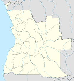
Coçoço is a populated place in the Cuanza Sul Province of Angola. It is located in the jurisdiction of Uaco Cungo.
Laheva is a village in Haapsalu municipality, Lääne County, in western Estonia. Prior to the 2017 administrative reform of local governments, it was located in Ridala Parish.
Ballo Wharf, commonly known as Ballowharf, is a community in Northern Province, Sierra Leone, north of the capital Freetown.
Wamfie is a town located in the Bono Region of Ghana. It is the capital of Dormaa East District. The town is known for the Mansen Commercial Day Senior High School. The school is a second cycle institution. It is located at an elevation of 289 meters above sea level and its population amounts to 41,345. Its coordinates are 7°18'0" N and 2°42'0" W.
Rudani is a village in Aghili-ye Jonubi Rural District, Aghili District, Gotvand County, Khuzestan Province, Iran.
Qeshlaq-e Hajj Almas Khan is a village in Qeshlaq-e Shomali Rural District, in the Central District of Parsabad County, Ardabil Province, Iran. At the 2006 census, its population was 197, in 41 families.
Kot Nainan is a Town and is union council of Shakargarh Tehsil, District Narowal. It is near the Border Area of Pakistan. It is 249 meters above sea level. The villages near Kot Nainan are Khan Marakka, Kanwal Jatta, Dhariwal, Kot Du'aba, Sogian, Jagyal,Haryal, Kotli Gujjran, Bhagwan Pur Moju'a and Sujowal.

Duwa also known as Ad Dawār is a village of Basrah Governorate in southern Iraq. It is on the east side of the Shatt Al-Arab River and near the Iranian border.
To-kawko, also spelled Tokawko, is a village in Kawkareik Township, in Kayin State, Myanmar (Burma). The headquarters of the KNU/KNLA Peace Council are located in the village.
Gesuba or (Wolaita: Gasuba) is a city in Offa Woreda, Wolaita Zone, Ethiopia. The approximate distance from the town of Sodo is about 33 kilometers to Southwest. And also the distance from Addis Ababa to Gesuba is 352 km via Butajira-Sodo to South. Gesuba town is used as an administrative capital of Offa woreda. It is located at an elevation of 1,549 meters above sea level. The town Gesuba is also known as Gesuba, Mure or Murie. Gesuba is a populated place in Southern Nations Nationalities and Peoples regional state. Gesuba town is one of the six municipal administrations found in Wolaita Zone, South Ethiopia. It is a town with more than 30,000 populations and has two high schools. The amenities in the town are 24 hours electric light, pure water service, kindergarten, primary and high schools, health center, everyday public market and others. Gesuba lies between about 6°43'27"N 37°33'24"E.
Beklo Segno is a town in Wolayita Zone, Southern Nations, Nationalities, and Peoples' Region, Ethiopia. The town is an administrative center of Bayra Koysha district of Wolayita Zone, Ethiopia. Beklo Segno is located about 327 km away from Addis Ababa to the south on and 18 km away from Sodo to the West, the capital of Wolaita Zone. The amenities in the town are, 24 hours electricity, pure public water, banks, schools, postal service, telecommunications services and others. Beklo Segno lies between 6°55'0" N and 37°39'0" E. The town is located at an elevation of 1,932 meters above sea level.
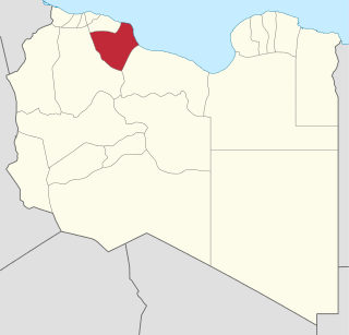
Qirdah is a town located in north west Libya, in the Sawfajjin Municipality which is located in the Tripolitania Region, and Misrata District. Qirdah is roughly 45km away from the Libyan Coastal Highway. Qirdah may also be subjected to the confluence of intermittent run-off from the Mediterranean, which may occur in colder months. The nearest major city is Abugrein, around 45km away. Within Qirdah there are two main sites of interest, the ancient city of Gerisa, and Al-Tahweed Mosque.
Salor Indah or Salor is a kampung in Kurik District, Merauke Regency, South Papua, Indonesia. It is being developed as Kota Terpadu Mandiri. Salor City will also be the administrative centre of South Papua Province.