
The Zambezi is the fourth-longest river in Africa, the longest east-flowing river in Africa and the largest flowing into the Indian Ocean from Africa. Its drainage basin covers 1,390,000 km2 (540,000 sq mi), slightly less than half of the Nile's. The 2,574 km (1,599 mi) river rises in Zambia and flows through eastern Angola, along the north-eastern border of Namibia and the northern border of Botswana, then along the border between Zambia and Zimbabwe to Mozambique, where it crosses the country to empty into the Indian Ocean.

The Drakensberg is the eastern portion of the Great Escarpment, which encloses the central Southern African plateau. The Great Escarpment reaches its greatest elevation – 2,000 to 3,482 metres within the border region of South Africa and Lesotho.

The Eastern Highlands, also known as the Manica Highlands, is a mountain range on the border of Zimbabwe and Mozambique. The Eastern Highlands extend north and south for about 300 kilometres (190 mi) through Zimbabwe's Manicaland Province and Mozambique's Manica Province.

Gonarezhou National Park is a national park located in southeastern Zimbabwe. It is situated in a relatively remote corner of Masvingo Province, south of Chimanimani along the Mozambique border. Owing to its vast size, rugged terrain and its location away from main tourist routes, large tracts of Gonarezhou remain pristine wilderness.
Matusadona National Park is a national park in northern Zimbabwe situated on the southern shore of Lake Kariba. The park takes its name from the local Matuzviadonha Hills.

Zimbabwe Parks and Wildlife Management Authority (Zimparks) is an agency of the Zimbabwe government managing national parks. Zimbabwe's game reserves are managed by the government. They were initially founded as a means of using unproductive land.

Nyanga National Park lies in the north of Zimbabwe's Eastern Highlands. One of the first national parks to be declared in the country, it contains the highest land in Zimbabwe, with green hills and perennial rivers. Most of its terrain consists of rolling downland, sometimes lightly wooded, lying at altitudes between 1,800–2,593 metres. Mount Nyangani, the highest point in Zimbabwe, lies in the centre of the park and Mutarazi Falls, Zimbabwe's highest waterfall, is in the south of the park. Nyanga National Park incorporates the former Mutarazi Falls National Park on its southern boundary.
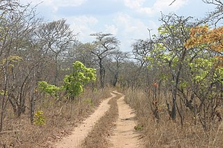
Kazuma Pan National Park is situated in Zimbabwe's extreme north-western corner, lying on the Botswana border a short distance north-west of Hwange National Park. Some 77,345 acres (313 km2) in area, it provides one of Zimbabwe's few areas of plains scenery, with good visibility and sparse but important mammal populations.

The Luangwa River is one of the major tributaries of the Zambezi River, and one of the four biggest rivers of Zambia. The river generally floods in the rainy season and then falls considerably in the dry season. It is one of the biggest unaltered rivers in Southern Africa and the 52,000 square kilometres (20,000 sq mi) that make up the surrounding valley are home to abundant wildlife.

Mana Pools National Park is a 219,600-hectare (543,000-acre) wildlife conservation area and national park in northern Zimbabwe. It is a region of the lower Zambezi in Zimbabwe where the floodplain turns into a broad expanse of lakes after each rainy season. As the lakes gradually dry up and recede, the region attracts many large animals in search of water, making it one of Africa's most renowned game-viewing regions.

The Lower Zambezi National Park lies on the north bank of the Zambezi River in southeastern Zambia. Until 1983 when the area was declared a national park, the area was the private game reserve of Zambia's president. This meant that the park was protected from mass tourism and now remains one of the few untouched wilderness areas left in Africa. On the opposite bank is Zimbabwe's Mana Pools National Park. The two parks sit on the Zambezi floodplain ringed by mountains. The area is a UNESCO World Heritage Site.

The Selous Game Reserve, now renamed as Nyerere National Park (in-part), is a protected nature reserve and wilderness area in southern Tanzania, East Africa. It covers a total area of 50,000 km2 (19,000 sq mi), with additional buffer zones, as well. It was designated a UNESCO World Heritage Site in 1982, owing to its high levels of biodiversity and vast, undisturbed natural landscapes, such as the grasslands and the miombo woodlands habitat. Among the numerous species within the park are some of the continent's largest and most iconic, such as the bush elephant, black rhinoceros, hippopotamus, lion, leopard, spotted hyena, painted dog, Cape buffalo, Masai giraffe, plains zebra, white-bearded gnu and the giant Nile crocodile. Due to the fragility and sensitivity of the many species and ecosystems within the park, human habitation is not permitted within its bounds, and all persons entering and exiting are tallied and tracked by the Wildlife Division of the Tanzanian Ministry of Natural Resources and Tourism.

The wildlife of Zimbabwe occurs foremost in remote or rugged terrain, in national parks and private wildlife ranches, in miombo woodlands and thorny acacia or kopje. The prominent wild fauna includes African buffalo, African bush elephant, black rhinoceros, southern giraffe, African leopard, lion, plains zebra, and several antelope species.

The wildlife of Zambia refers to the natural flora and fauna of Zambia. This article provides an overview, and outline of the main wildlife areas or regions, and compact lists of animals focusing on prevalence and distribution in the country rather than on taxonomy. More specialized articles on particular groups are linked from here.

Nkhotakota Wildlife Reserve, is the largest and oldest wildlife reserve in Malawi, near Nkhotakota. The park's hilly terrain features dambos and miombo woodlands as the dominant vegetation, which support a variety of mammal and bird species. Poaching has greatly reduced the number of elephants and other large mammals in Nkhotakota, but conservation efforts to restore the elephant population started when African Parks began managing the reserve in 2015.

The Zambezian and mopane woodlands is a tropical and subtropical grasslands, savannas, and shrublands ecoregion of southeastern Africa.
The Peace Park Foundation, founded in 1997 by Dr Anton Rupert, President Nelson Mandela and Prince Bernhard of the Netherlands, is an organisation that aims to re-establish, renew and conserve large ecosystems in Africa, transcending man-made boundaries by creating regionally integrated and sustainably managed networks of Transfrontier Conservation Areas (TFCAs). Peace Parks Foundation has been involved in the establishment and development of ten of the 18 TFCAs found throughout southern Africa, all of which are in various stages of development. The establishment of each TFCA, or peace park, is complex and far-reaching, and involves several phases of activity, which can take many years to achieve.

Zambezi National Park is a national park in Zimbabwe located upstream from Victoria Falls on the Zambezi River. It was split off from Victoria Falls National Park in 1979 and is 56,000 hectares in size. The park is bisected by a road to Kazungula, dividing it into a riverine side and a Chamabonda Vlei side. Most of the park is within the ecoregion of Zambezian and Mopane woodlands, while a small portion in the south is within the Zambezian Baikiaea woodlands.
The Cheringoma Plateau is a low plateau in Sofala Province of Mozambique. It lies mostly within Cheringoma, Muanza, and Marromeu districts.
The Southern miombo woodlands is a tropical grasslands and woodlands ecoregion extending across portions of Malawi, Mozambique, Zambia, and Zimbabwe.

