Related Research Articles

The parish of St. Michael is one of eleven parishes of Barbados. It has a land area of 39 km2 (15 sq mi) and is found at the southwest portion of the island. Saint Michael has survived by name as one of the original six parishes created in 1629 by Governor Sir William Tufton.

Avalon is a federal electoral district on Newfoundland Island in Newfoundland and Labrador, Canada. It has been represented in the House of Commons of Canada since 2004.

Ajax—Pickering was a federal electoral district in Ontario, Canada, that had been represented in the House of Commons of Canada since 2011 by Conservative MP Chris Alexander.

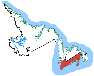
Random—Burin—St. George's was a federal electoral district in Newfoundland and Labrador, Canada, that was represented in the House of Commons of Canada from 2004 to 2015.

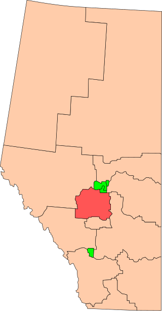
Wetaskiwin was a federal electoral district in Alberta, Canada, that was represented in the House of Commons of Canada from 1925 to 2015.

The parish of Christ Church is one of eleven historic political divisions of Barbados. It has a land area of 57 km2 (22 sq mi) and is found at the southern end of the island. Christ Church has survived by name as one of the original six parishes created in 1629 by Governor Sir William Tufton.

Saint Andrew is one of eleven parishes of Barbados. It is situated in the northeastern area in the country.

The parish of Saint James is an area located in the western central part of the country of Barbados. Increasingly St. James is becoming known as the playground of the rich and famous, and as a haven for sun-starved tourists with its up-market hotel resorts.

The Parish of Saint Peter is one of eleven parishes in the Caribbean island country of Barbados. It is named after the Christian Apostle and patron saint, Saint Peter. It is located in the north of Barbados, and is the only parish besides Saint Lucy that extends from the east coast to the west.

Sault Ste. Marie is a federal electoral district in Ontario, Canada, that has been represented in the House of Commons of Canada since 1968.

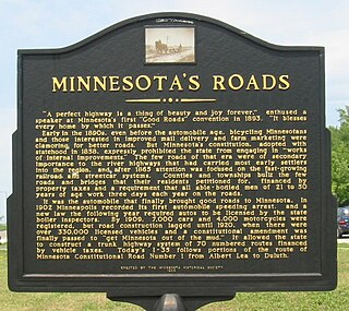
In the U.S. state of Minnesota, a legislative route is a highway number defined by the Minnesota State Legislature. The routes from 1 to 70 are constitutional routes, defined as part of the Babcock Amendment to the Minnesota State Constitution, passed November 2, 1920. All of them were listed in the constitution until a 1974 rewrite. Though they are now listed separately in §161.114 of the Minnesota Statutes, the definitions are legally considered to be part of the constitution, and cannot be altered or removed without an amendment. Legislative routes with numbers greater than 70 can be added or deleted by the legislature.
Bergen Township was a township that existed in Bergen County, New Jersey. The township was created on February 21, 1893, from the southern section of Lodi Township :
Be It Enacted by the Senate and General Assembly of Portion to be the State of New Jersey, That all that portion of the township of Lodi, in the county of Bergen, lying within the following boundaries, to wit, beginning at the intersection Boundaries, of the northerly boundary of the township of Boiling Springs, in the county of Bergen, with the middle of the Passaic river; running thence easterly along the northerly boundary of said township of Boiling Springs to the middle of the Hackensack River; thence, northerly along the middle of the Hackensack river to a point opposite the mouth of a creek emptying into said river, commonly known as the Upper Mudabock creek; thence, westerly in a straight line to a point where the northerly line of the public road leading from Moonachie to Wood-Ridge, commonly known as the Mousetown road, intersects the westerly line of the public road commonly known as the Moonachie road; thence, westerly along the northerly line of the Mousetown road to the westerly line of the Riser ditch; thence, northerly along the westerly line of said ditch to the northerly line of lands now or formerly belonging to the estate of Richard Vreeland; thence, westerly along said line of lands to the Polifly road; thence, still westerly in the same course as last described, along the northerly line of lands now or formerly belonging to the estate of Benjamin Cox to a line commonly known as the Polifly line; thence, northerly along said line to the southerly line of the public road leading from said Polifly road to the public road commonly known as the River road; thence westerly along the southerly line of said road leading from the Polifly road to the River road; thence, still westerly in line with the last course of the southerly line of said road to the middle of the Saddle river; thence, downstream through the middle of the Saddle river to the middle of the Passaic thence, down stream through the middle of said to the place of beginning, shall be and hereby is set off from the township Lodi, in the county of Bergen, and made a separate township, to be known by the name of the township of Bergen.
Melbourne West Province was an electorate of the Victorian Legislative Council from 1904 until 2006.

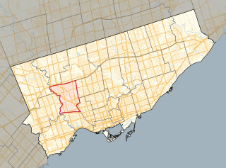
York South—Weston is a provincial electoral district in Toronto, Ontario, Canada, that has been represented in the Legislative Assembly of Ontario since 1999.
The City of Bridgetown constituency is one of eleven (11) electoral districts in the Parish of St. Michael, and one thirty (30) nationally in Barbados. The Constituency covers a portion of the capital city Bridgetown. The district formed in 1843 is the first electoral district formed after the original eleven in the country. The first representative for the constituency was the national hero the Right Excellent Samuel Jackman Prescod. The member of parliament since 2022 is Corey Lane from the Barbados Labour Party. Before then it was held by Lt.Col. Jeffrey Bostic (Ret.) from 2013. The seat is usually won by a slim margin.
Christ Church East is a constituency in the Christ Church area of Barbados represented in the House of Assembly of the Barbadian Parliament since 2018 by Wilfred Abrahams MP of the Barbados Labour Party.
Christ Church East Central is a constituency in the Christ Church area of Barbados. Since 2018, it has been represented in the House of Assembly of the Barbadian Parliament by Ryan Straughn. Straughn is a member of the BLP.
Christ Church South is a constituency in the Christ Church area of Barbados represented in the House of Assembly of the Barbadian Parliament since 2008 by Ralph Thorne, MP of the DLP after he crossed the floor from the Barbados Labour Party in February 2024.
Saint Lucy is a constituency in the Saint Lucy parish of Barbados. It was established in 1645 as one of the original 11 constituencies. Since 2018, it has been represented in the House of Assembly of the Barbadian Parliament by Peter Phillips. Philips is a member of the BLP.
Saint John is a constituency in the Saint John parish of Barbados. It was established in 1645 as one of the original eleven constituencies. Originally the constituency, like the other original ten, was represented by 2 members until 1971 when the single-member system was introduced. Since 2018, it has been represented in the House of Assembly of the Barbadian Parliament by Charles McDonald Griffith. Griffith is a member of the BLP.