Christchurch Gondola

Last updated

Christchurch Gondola terminal on Mount Cavendish Christchurch gondola 02.jpg
Christchurch Gondola terminal on Mount Cavendish

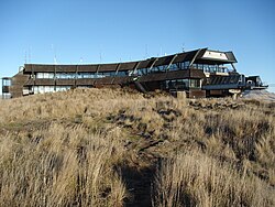
The Christchurch Gondola is a tourist attraction service offered by Christchurch Attractions in Christchurch, New Zealand. The gondola base is located in Heathcote Valley, and it traverses the slopes of Mount Cavendish in the Port Hills. Also known as a cable car, the Christchurch Gondola's course is 1,000 metres (1,100 yd) in length, and from the summit it is possible to see across the city of Christchurch and the Canterbury Plains to the Southern Alps in the north and west, and down into Lyttelton Harbour and Banks Peninsula in the south and east. Sometimes used as a transport method for visitors who use the walking tracks on Mt Cavendish, [1] the gondola is ranked as one of the top tourist attractions in Christchurch by TripAdvisor. The summit is 445 metres (1,460 ft) above sea level. [2]

Contents

The gondola opened as the Mount Cavendish Gondola in October 1992 after a long planning process at a costs of $NZ11.5 million. The land around the gondola was landscaped with 16,000 native tussock after the completion of construction. The gondola includes 19 cabins and has a capacity of 812 travellers per hour. [2]

2011 Christchurch earthquake

The gondola closed following the 2011 Christchurch earthquake, and was reopened in March 2013 by NZ Prime Minister John Key. [3]

2016 breakdown

In February 2016, the gondola broke down with passengers trapped in the cabins for two hours without communication from the operator. The managing director's comment that the incident was "no big deal" caused upset by those affected. [4] Within days, the company vowed to install a speaker system into the cabins at a cost of up to NZ$50,000 so that communication to stuck passengers became possible. [5]

Operator

The Christchurch Gondola is operated by Christchurch Attractions, who also currently operate the Christchurch Tram system.

Related Research Articles

<span class="mw-page-title-main">Port Hills</span> Range of hills of Canterbury, New Zealand

The Port Hills are a range of hills in Canterbury Region, so named because they lie between the city of Christchurch and its port at Lyttelton. They are an eroded remnant of the Lyttelton volcano, which erupted millions of years ago.

<span class="mw-page-title-main">Christchurch</span> City in the South Island of New Zealand

Christchurch is the largest city in the South Island of New Zealand and the seat of the Canterbury Region. Christchurch lies on the South Island's east coast, just north of Banks Peninsula on Pegasus Bay. The Avon River / Ōtākaro flows through the centre of the city, with an urban park along its banks. The city's territorial authority population is 389,300 people, and includes a number of smaller urban areas as well as rural areas. The population of the urban area is 377,900 people. Christchurch is the second-largest city by urban area population in New Zealand, after Auckland. It is the major urban area of an emerging sub-region known as Greater Christchurch. Notable smaller urban areas within this sub-region include Rangiora and Kaiapoi in Waimakariri District, north of the Waimakariri River, and Rolleston and Lincoln in Selwyn District to the south.

<span class="mw-page-title-main">Scenic World</span> Tourist attraction in New South Wales, Australia

Scenic World is a private, family-owned tourist attraction located in Katoomba in the Blue Mountains, New South Wales, Australia, about 100 kilometres west of Sydney. Scenic World is home to four attractions, the Scenic Railway, the Scenic Skyway, the Scenic Cableway and Scenic Walkway a 2.4 km elevated boardwalk through ancient rainforest.

<span class="mw-page-title-main">Bridle Path (New Zealand)</span>

The Bridle Path is a steep shared-use track that traverses the northern rim of the Lyttelton volcano connecting the port of Lyttelton with the city of Christchurch in the South Island of New Zealand. It is a popular walking and mountain biking route. The track ascends from the port itself to a height of 333 metres (1,093 ft) before descending again via Heathcote Valley to Christchurch. At the summit, next to the Summit Road, is a stone shelter with covered seats that is a 1940 New Zealand centennial memorial to the Pioneer Women of Canterbury. There are also seven commemorative stone seats placed along the Bridle Path; most of these were built for the 1950 Canterbury centenary celebrations.

<span class="mw-page-title-main">Singapore Cable Car</span> Gondola lift providing an aerial link from Mount Faber to the resort island of Sentosa

The Singapore Cable Car is a gondola lift providing an aerial link from Mount Faber on the main island of Singapore to the resort island of Sentosa across the Keppel Harbour. Opened on 15 February 1974, it was the second aerial ropeway system in the world to span a harbour, after Port Vell Aerial Tramway in Barcelona, which opened already in 1931. However, it is not the first aerial ropeway system to span the sea. For instance, Awashima Kaijō Ropeway in Japan, built in 1964, goes over a short strait to an island. Although referred to by its operators as a cable car, the listed system is in fact a monocable gondola lift and not an aerial tramway. It is a major tourist attraction, as it provides a panoramic view of the central business district. In 2020, a round-trip ticket cost SGD35 for adults and SGD25 for children.

<span class="mw-page-title-main">Ngong Ping 360</span> Aerial gondola attraction

Ngong Ping 360 is a bicable gondola lift on Lantau Island in Hong Kong. Intended to improve tourism to the area, the aerial lift was previously known as Tung Chung Cable Car Project before acquiring the Ngong Ping 360 brand in April 2005. It consists of the Ngong Ping Cable Car, formerly known as the Ngong Ping 360 Skyrail, and the Ngong Ping Village, a retail and entertainment centre adjacent to the cable car's upper station. Ngong Ping 360 connects Tung Chung, on the north coast of Lantau and itself linked to central Hong Kong by the Tung Chung line, with the Ngong Ping area in the hills above. This is home to the Po Lin Monastery and the Tian Tan Buddha, both already significant tourist attractions in their own right. Before Ngong Ping 360's opening, the only access was via a mountain road and bus service.

<span class="mw-page-title-main">Rolleston, New Zealand</span> Town in South Island, New Zealand

Rolleston is the seat and largest town in the Selwyn District, in the Canterbury region of New Zealand's South Island. It is located on the Canterbury Plains 22 kilometres (14 mi) south-west of Christchurch, and is part of the wider Christchurch metropolitan area. The town has a population of 28,000, making it New Zealand's 24th-largest urban area and the third-largest in Canterbury. It was nicknamed the "Town of the Future" in the 1970s by Prime Minister Norman Kirk. The "Town of the Future" signage has since been removed from the entrances to Rolleston.

<span class="mw-page-title-main">Mount Cavendish</span>

Mount Cavendish is located in the Port Hills, with views over Christchurch, New Zealand and Lyttelton. It is part of the crater wall of the extinct volcano that formed Lyttelton Harbour. The Mount Cavendish Reserve displays some of the best examples of lava flow to be seen on the Port Hills.

<span class="mw-page-title-main">Sign of the Takahe</span>

The Sign of the Takahe is a neo-Gothic style historic building in Christchurch, New Zealand. It is currently leased from Christchurch City Council and run as a cafe, bar, and function centre.

<span class="mw-page-title-main">Yorkshire Wheel</span>

Yorkshire Wheel was the name used by two transportable Ferris wheel installations at different locations in York, England.

<span class="mw-page-title-main">International Antarctic Centre</span> Antarctic Centre and tourist attraction in Christchurch

The International Antarctic Centre is a research centre and public science discovery centre in the suburb of Harewood, Christchurch, New Zealand, near Christchurch International Airport.

<span class="mw-page-title-main">Genting Skyway</span> Gondola lift in Genting Highlands, Malaysia

Genting Skyway is a gondola lift connecting Gohtong Jaya and Resort Hotel in Genting Highlands, Selangor, Malaysia. Its lower station at Gohtong Jaya township, located approximately 51 kilometres (32 mi) northeast of Kuala Lumpur, comprises a 5-storey station building and a 10-storey car park while its upper station is located at the Highlands Hotel.

<span class="mw-page-title-main">Maokong Gondola</span> Gondola lift in Taipei, Taiwan

The Maokong Gondola is a gondola lift transportation system in Taipei, Taiwan. Opened on 4 July 2007, the Maokong Gondola operates between Taipei Zoo and Maokong. The 4.3 km (2.7 mi) line has four passenger stations. The facilities of the gondola were contracted to the French company Poma.

<span class="mw-page-title-main">Metrocable (Medellín)</span> First urban transit cablecar

Metrocable is a gondola lift system implemented by the City Council of Medellín, Colombia, with the purpose of providing a transportation service that complements the Medellín Metro. It was designed to reach some of the city's informal settlements on the steep hills that mark its topography. It is largely considered to be the first urban cable propelled transit system in South America. The transportation infrastructure is already established and has been in service since 2004.

<span class="mw-page-title-main">Sign of the Kiwi</span>

The Sign of the Kiwi, originally called Toll House, is a small café and shop at Dyers Pass on the road between Christchurch and Governors Bay. It was built in 1916–17 by Harry Ell as a staging post and opened as a tearoom and rest house. It has a Category I heritage classification by Heritage New Zealand and is a popular destination for tourists and locals alike. The building was closed some time after the 22 February 2011 Christchurch earthquake and did not open again until 23 January 2017, six years later. Although located within the burned area, the building was not damaged by the 2017 Port Hills fires a month later.

<span class="mw-page-title-main">Implosion of Radio Network House</span> Building demolition in New Zealand

The implosion of Radio Network House in 2012 was the first implosion used in New Zealand to demolish a building, and was a "test case" for the potential to use such a demolition method on similar buildings in Christchurch Central City that had been damaged in the 2011 earthquake. Like most other large buildings in central Christchurch, Radio Network House was damaged beyond repair in the 2011 earthquake, and the Canterbury Earthquake Recovery Authority (CERA) added it to the demolition list in August 2011. In July 2012, it was announced that the building was going to be imploded, involving a specialist company from the United States with considerable experience in this type of work.

<span class="mw-page-title-main">New Brighton Pier, Christchurch</span> Pier in Christchurch, New Zealand

There have been two New Brighton Piers in New Brighton, New Zealand. The first pier, of wooden construction, opened on 18 January 1894 and was demolished on 12 October 1965. The current concrete pier was opened on 1 November 1997. It is one of the icons of Christchurch.

<span class="mw-page-title-main">Awana Skyway</span> Aerial lift in Pahang, Malaysia

The Awana Skyway, also referred to as the new Awana Skyway, is a gondola lift system connecting Awana Transport Hub, Chin Swee Temple and SkyAvenue in Genting Highlands, Pahang, Malaysia since December 2016. The Awana Transport Hub terminus consists of the new Awana Bus Terminal, the station building and a new 8-storey car park while the other terminus is located at SkyAvenue.

<i>185 empty chairs</i>

185 empty chairs, also known as 185 white chairs or 185 empty white chairs or simply as 185 chairs, is an unofficial memorial for the 185 individuals who died in the 2011 Christchurch earthquake. Envisaged as a short-term installation made from chairs painted white, it has become a major tourist attraction in Christchurch, New Zealand. Installed at the day of the earthquake's first anniversary, it preceded the official earthquake memorial—the Canterbury Earthquake National Memorial—by five years. As of 2017, there is a desire to turn the temporary installation into a permanent fixture.

References

  1. Steele, Monique "Chch 360 trail one for the summer bucket list", The Press (Christchurch), 7 October 2016. Retrieved 10 November 2016.
  2. 1 2 Bulovic, Anne "The Christchurch Gondola opened 24th October 1992", peelingbackhistory.co.nz, Retrieved 10 November 2016.
  3. "Prime Minister marks the reopening of Christchurch Gondola.", scoop.co.nz, 19 April 2013. Retrieved 10 November 2016.
  4. Peacock, Alice; Campbell, Georgina; Speedy, Erin (6 February 2016). "Passengers trapped in Christchurch gondola". The Press . Retrieved 5 March 2017.
  5. Hume, Myles (12 February 2016). "Christchurch Gondola vows to improve communication". The Press . Retrieved 5 March 2017.

Coordinates: 43°35′6″S172°42′29″E / 43.58500°S 172.70806°E / -43.58500; 172.70806