Church of Saint John the Baptist, Ein Karem

Last updated
Church of Saint John the Baptist, Ein Karem
Church of John the Baptist, Ein Kerem.jpg
Exterior view
Religion
Affiliation Roman Catholic
Leadership Franciscans
Location
Location Ein Karem, Jerusalem
Palestine grid1655/1307
Geographic coordinates 31°46′05″N35°09′47″E / 31.76806°N 35.16306°E / 31.76806; 35.16306 Coordinates: 31°46′05″N35°09′47″E / 31.76806°N 35.16306°E / 31.76806; 35.16306
Architecture
Architect(s) Antonio Barluzzi
Completed1113, 1621-1675, 1939

The Church of Saint John the Baptist is a Catholic church in Ein Karem, Jerusalem, that belongs to the Franciscan order. It was built at the site where Saint John the Baptist is believed to have been born. [1]

Contents

In 1941–42 the Franciscans excavated the area west of the church and monastery. [2] Here they discovered graves, rock-cut chambers, wine presses and small chapels with mosaic tiling. [2] The southern rock-cut chamber contained ceramic datable to a period stretching from approximately the first century BC till 70 AD, an interval that includes the presumed lifetime of Zechariah, Elizabeth and John. [2] [3] [4] The community living here has been dated by the archaeological findings back to the Roman, Byzantine and Early Muslim periods. [2]

Most of the current church structure probably dates back to the 11th century, with the lower courses possibly dating to the Byzantine period (4th-7th century). [2]

History

In 1941-42 the Franciscans excavated the area west of the church and monastery. [2] Here they found Late Roman chambers and graves, and small Byzantine chapels and wine presses. [2] The community living here has been dated by the archaeological findings back to the Roman, Byzantine and Early Muslim periods. [2] [3] [4]

French archaeologist Abel (1878–1953) positioned that most of the current church probably dates back to the 11th century, with the lower courses possibly dating to the Byzantine period (4th-7th century). [2] [3]

Late Roman period

The digs west of the main buildings brought to light graves and rock-cut chambers. [2] The southern rock-cut chamber contained ceramic datable to a period stretching from approximately the first century BC to 70 AD, an interval that includes the presumed lifetime of Zechariah, Elizabeth and John. [2] [3] [4]

Byzantine period

The lower courses of the current church possibly date to the Byzantine period (4th-7th century). [2]

Early Muslim period

The church is mentioned in the Book of the Demonstration, attributed to Eutychius of Alexandria (940): "The church of Bayt Zakariya in the district of Aelia bears witness to the visit of Mary to her kinswoman Elizabeth." [2]

According to French archaeologist Félix-Marie Abel, most of the current church probably dates back to the 11th century (the Fatimid period), with the lowest part of the walls possibly dating to the Byzantine period (4th-7th century). [2] [3]

Crusader period

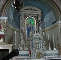
A Russian pilgrim known as Abbot Daniel visited the village in 1106 and described here two churches. [2] In the one identified by him as "the house of Zechariah .... where the holy Virgin came to greet Elizabeth", he mentions, on the left side, a "small cavern, in which John the Forerunner was born." [2] The grotto seen in the current church at the front of the left aisle must be the same one mentioned by Daniel. [2]

The Church of St. John, or of the Magnificat, is mentioned in 1113 AD in Ein Karem. [5]

Mamluk period

In 1480 Felix Fabri reported it as tall, vaulted, and still painted, but turned into a stable for animals. [6]

Ottoman period

17th century

The site of the Crusader church built above the traditional birth cave of St John, destroyed after the departure of the Crusaders, was purchased by Franciscan custos, Father Thomas of Novara in 1621. [7] [8] The Muslim inhabitants forced the Catholics to abandon the site a few times during the 17th century and used the grotto and buildings as stables, even after the Sultan issued a firman confirming Franciscan property over it in 1672, obtained through the influence of the Marquis de Nointel, the French Ambassador to the Ottoman Empire. [9] [10] Only in 1693 did the Franciscans return for good, rebuilt, and fortified the site. [11] [10] [7]

In 1697 Henry Maundrell noted that: "The Convent of St John has been within these four years rebuilt from the ground. It is at present a large square building, uniform and neat all over; but that which is most eminently beautiful in it is its Church. It consists of three Isles, and has in the middle a handsome Cupola, under which is a pavement of mosaic, equal to, if not exceeding the finest works of the Ancients in that kind. At the upper end of the North Isle, you go down seven Marble steps, to a very splendid Altar, erected over the very place where they say the holy Baptist was Born. Here are Artificers still employed, in adding farther beauty and ornament to this Convent." [12]

19th century

James Silk Buckingham visited in the early 1800s, and found the convent "appeared to be superior in comfort and arrangement to that of Jerusalem, and equal to that of Nazareth. The church is one of the most simply beautiful throughout the Holy Land. As the friars are all Spaniards, it partakes more of the style of that nation than any other, in its ornaments." [13]

In 1883, the PEF's Survey of Western Palestine (SWP) noted: "The Church of the Baptist, in the village itself, is of Crusading origin; but the interior has been covered with encaustic tiles, and none of the older work is recognizable. The dome rises from four heavy piers; the grotto north of the high altar (at the east end of the church), is reached by seven steps; it is said to be the birthplace of St. John. A bad copy of a Murillo is hung on the north side of the church, and much prized by the monks, who are chiefly Spaniards". [14]

British Mandate period

In 1941-42 the Franciscans excavated the area west of the church and monastery. [2]

Design and construction of the upper level of the structure began in 1938, and was completed by Italian architect Antonio Barluzzi in 1939, preserving all extant Byzantine and Crusader remains as part of the new shrine.[ citation needed ].

Present church plan

Floor plan of the Church of Saint John the Baptist with colour code by historical periods Church of st john ein karem.svg
Floor plan of the Church of Saint John the Baptist with colour code by historical periods

Floor plan and legend: [15]

See also

Related Research Articles

<span class="mw-page-title-main">Church of the Nativity</span> Basilica in Bethlehem

The Church of the Nativity, or Basilica of the Nativity, is a basilica located in Bethlehem in West Bank Palestinian territories. The grotto it contains holds a prominent religious significance to Christians of various denominations as the birthplace of Jesus. The grotto is the oldest site continuously used as a place of worship in Christianity, and the basilica is the oldest major church in the Holy Land.

<span class="mw-page-title-main">Nahf</span> Local council

Nahf is an Arab town in the Northern District of Israel. It is located in between the lower and upper Galilee, about 23 kilometres (14 mi) east of Acre. In 2021 it had a population of 13,558. Archaeologists believe that the area was an important center for viticulture in the Hellenistic period and possibly the Early Bronze Age IB period.

<span class="mw-page-title-main">Monastery of the Cross</span> Monastery in Jerusalem, Israel

The Monastery of the Cross is an Eastern Orthodox monastery near the Nayot neighborhood of Jerusalem. It is located in the Valley of the Cross, below the Israel Museum and the Knesset.

<span class="mw-page-title-main">Ein Karem</span> Neighborhood in Jerusalem

Ein Karem is a historic mountain village southwest of Jerusalem, presently a neighborhood in the outskirts of the modern city, within the Jerusalem District. It is the site of the Hadassah Medical Center.

<span class="mw-page-title-main">Al-Bireh</span> Municipality type A in Ramallah and al-Bireh, State of Palestine

Al-Bireh, al-Birah, or el-Bira is a Palestinian city in the central West Bank, 15 kilometers (9.3 mi) north of Jerusalem. It is the capital of the Ramallah and al-Bireh Governorate of the State of Palestine. It is situated on the central ridge running through the West Bank and is 860 meters (2,820 ft) above sea level, covering an area of 22.4 square kilometers (8.6 sq mi). Al-Bireh is under the administration of the Palestinian National Authority.

<span class="mw-page-title-main">Suba, Jerusalem</span> Place in Jerusalem, Mandatory Palestine

Suba was a Palestinian Arab village west of Jerusalem that was depopulated and destroyed in 1948. The site of the village lies on the summit of a conical hill called Tel Tzova, or Jabal Suba, rising 769 meters above sea level, and it was built on the ruins of a Crusader castle.

<span class="mw-page-title-main">Aboud</span> Municipality type D in Ramallah and al-Bireh, State of Palestine

Aboud is a Palestinian village in the Ramallah and al-Bireh Governorate of the State of Palestine, in the central West Bank, northwest of Ramallah and 30 kilometers north of Jerusalem. Nearby towns include al-Lubban to the northeast and Bani Zeid to the northwest.

<span class="mw-page-title-main">Church of the Visitation</span> Catholic church in Jerusalem

The Church of the Visitation is a Catholic church in Ein Karem, Jerusalem, and honors the visit paid by the Virgin Mary, the mother of Jesus, to Elizabeth, the mother of John the Baptist. This is the site where tradition says that Mary recited her song of praise, the Magnificat, one of the most ancient Marian hymns.

<span class="mw-page-title-main">St. George's Monastery, Al-Khader</span> Eastern Orthodox Christian monastery in Palestine

The Saint George's Monastery in Al-Khader or Church of Saint George in Al-Khader is an Eastern Orthodox Christian monastery in the Palestinian town of al-Khader, near Beit Jala and Bethlehem in the central West Bank. The town of Al-Khader is named after Saint George, who in Arab culture is known as "al-Khadr"; the church is considered the most important sanctuary to Khadr in Palestine.

Beit Einun or Bayt 'Anun is a Palestinian village in the Hebron Governorate, located five kilometers northeast of Hebron in the southern West Bank. According to the Palestinian Central Bureau of Statistics, the village had a population of 1,809 inhabitants in 2007.

<span class="mw-page-title-main">Silat ad-Dhahr</span> Palestinian town near Jenin, West Bank

Silat ad-Dhahr is a Palestinian town in the Jenin Governorate in the northern West Bank, located 22 kilometers southwest of Jenin. According to the Palestinian Central Bureau of Statistics (PCBS) census, the town had a population of 5,794 in 2007. The healthcare facilities for the surrounding villages are based in Silat adh Dhahr, the facilities are designated as MOH level 2.

<span class="mw-page-title-main">Merhavia (kibbutz)</span> Place in Northern, Israel

Merhavia is a kibbutz in northern Israel. Located to the east of Afula, it falls under the jurisdiction of Jezreel Valley Regional Council. In 2021 it had a population of 1,299.

al-Karmil Municipality type D in Hebron, State of Palestine

al-Karmil is a Palestinian village located twelve kilometers south of Hebron. The village is in the Hebron Governorate Southern West Bank, within Area A under total Palestinian control. According to the Palestinian Central Bureau of Statistics, the village had a population of 3,741 in 2007. The primary health care facilities for the village are designated by the Ministry of Health as level 2.

<span class="mw-page-title-main">Monastery of Saint John in the Wilderness</span>

The Monastery of Saint John in the Wilderness is a Catholic monastery built next to a spring on a wooded slope just north of Even Sapir, and across the valley from Sataf. It is located a short distance from Ein Karem, the traditional birthplace of Saint John the Baptist, and south of Jerusalem, Israel. It is also known as Saint John in the Desert or the Desert of Saint John. The convent is the property of the Franciscan Custody of the Holy Land.

<span class="mw-page-title-main">Nabi Yahya Mosque</span> Mosque in the West Bank

The Nabi Yahya Mosque, literally the Mosque of the Prophet John, is a mosque containing the traditional tomb of John the Baptist. The mosque also contains the tombs of Elisha and Obadiah, prophets who were buried next to John the Baptist.

<span class="mw-page-title-main">Church of Saint Anne, Jerusalem</span> Church in East Jerusalem

The Church of Saint Anne is a French Roman Catholic church and French national domain located in the Muslim Quarter of the Old City of Jerusalem, near the start of the Via Dolorosa, next to the Lions' Gate.

<span class="mw-page-title-main">Khirbet Beit Zakariyyah</span> Palestinian village in the West Bank close to Bethlehem

Khirbet Beit Zakariyyah is a small Palestinian village southwest of Bethlehem in the West Bank, perched on a hill that rises about 995 metres (3,264 ft) above sea level. Administratively, it is associated with the village of Artas under the Bethlehem Governorate. It is also located in between the Israeli settlements of Alon Shevut and Rosh Tzurim, both of which were built on land confiscated from the village.

<span class="mw-page-title-main">Deir Hajla</span>

Deir Hajla or Deir Hijleh is the Arabic name of the Greek Orthodox Monastery of Saint Gerasimus (officially the Holy Monastery of Saint Gerasimos of the Jordan, Greek: Ιερά Μονή Αγίου Γερασίμου του Ιορδανίτη It is located in the Jericho Governorate in the West Bank, west of the River Jordan and north of the Dead Sea.

<span class="mw-page-title-main">Inn of the Good Samaritan</span> Museum and historical inn in Maale Adummim referenced in New Testament parable

The Inn of the Good Samaritan is a national park, museum, ancient archaeological site and former inn administered by the Israel Nature and Parks Authority located near Ma'ale Adumim, halfway between Jerusalem and Jericho, at an elevation of 298 meters above sea level.

<span class="mw-page-title-main">Monastery Saint Claire (Nazareth)</span>

The Monastery Saint Claire, also known as the Convent of Mary's Fear and by other names, is a convent of the Poor Clares on Tremor Hill in southern Nazareth, Israel. Established in 1884, it is primarily known for the productive time the now-sainted Charles de Foucauld spent there at the end of the 19th century. Expelled from the Ottoman Empire at the onset of World War I, the nuns of the abbey relocated to Malta, founding a new community there. The Sisters of St Clare returned to Nazareth in 1949 but used newer facilities on 3105 Street on the north slope of Tremor Hill. Their former location beside what is now Paulus HaShishi Street was repaired by the Servants of Charity for use as a special needs school in the 1970s.

References

  1. Israel & the Palestinian Territories (Lonely Planet, 2012) ISBN   978-1741799361
  2. 1 2 3 4 5 6 7 8 9 10 11 12 13 14 15 16 17 18 Jack Finegan (2014). The Archeology of the New Testament: The Life of Jesus and the Beginning of the Early Church (revised ed.). Princeton University Press. p. 4. ISBN   9781400863181 . Retrieved 21 May 2019.
  3. 1 2 3 4 5 Abel, 1938, pp. 295f
  4. 1 2 3 Pringle, 1993, pp. 3038
  5. Conder and Kitchener, 1883, SWP III, p. 20
  6. Fabri, 1896, pp. 638-639; cited in Pringle, 1993, p. 32
  7. 1 2 Pringle, 1993, p. 32
  8. Sharon, 2004, p. 156
  9. Sharon, 2004, pp. 156-157
  10. 1 2 Conder and Kitchener, 1883, SWP III, p. 61
  11. Sharon, 2004, p. 157
  12. Maundrell, 1703, p. 92
  13. Buckingham, 1821, pp. 228-229
  14. Conder and Kitchener, 1883, SWP III, pp. 60-61
  15. "Ain Karem: Saint John the Baptist". custodia.org. Custodia Terrae Sanctae. Archived from the original on 19 August 2014. Retrieved 21 May 2019 via archive copy.
  16. Pringle, 1993, p. 34

Bibliography