
The Adula Alps, also known as the West Graubünden and Misox Alps, are a western Alpine mountain group, the part of the Lepontine Alps from the Lukmanier and St Gotthard Passes to the Splügen Pass.

Lukmanier Pass is a pass in the Swiss Alps.

Lai da Sontga Maria is a lake, located north of the Lukmanier Pass in Switzerland. It lies almost entirely in the municipality of Medel, a tiny fraction of the south-west part of the lake belonging to the municipalities of Quinto and Blenio. The reservoir has a surface area is 1.77 km2 (0.68 sq mi). The arch dam Santa Maria, which is to the north of the lake, was completed in 1968. The main road of the Lukmanier Pass runs along the eastern shore of the lake.

Piz Medel is a mountain in the Lepontine Alps, located on the border between the cantons of Ticino and Graubünden. At 3,210 metres (10,531 ft) above sea level it is the highest summit on the chain between Lukmanier Pass and Crap la Crusch. The mountain overlooks the Greina, an important pass connecting the cantons of Graubünden and Ticino.

Cima Rossa is a 3,161 metres high mountain in the Lepontine Alps, located on the border between the cantons of Ticino and Graubünden. On the west side it overlooks the valley of Malvaglia (Ticino) and on the east side it overlooks the valley of Calanca (Graubünden).
The Cima di Gana Bianca is a mountain of the Swiss Lepontine Alps, overlooking Acquarossa in the canton of Ticino. It lies west of the Rheinwaldhorn, between the main Blenio valley and the Val Malvaglia.
The Pilone is a mountain of the Lepontine Alps, located on the border between Switzerland and Italy. It lies between the Valle Vergeletto (Ticino) and the Valle Onsernone.

Monte Tamaro is a mountain of the Lugano Prealps, overlooking Lake Maggiore in the Swiss canton of Ticino. Reaching a height of 1,962 metres above sea level, it is the highest summit of the chain located between Lake Maggiore and Lake Lugano, which also includes Monte Lema. It is also the most prominent summit of the canton.
The Cima di Broglio is a mountain of the Swiss Lepontine Alps, located east of Cevio in the canton of Ticino. It lies south of Monte Zucchero, on the range between the Valle Maggia and the Valle Verzasca.
The Poncione di Piotta is a mountain of the Swiss Lepontine Alps, located between Lavertezzo and Moleno in the canton of Ticino. It lies on the chain that separates the valley of Verzasca (west) from the Leventina valley (east).
Cima di Bri is a mountain in the Lepontine Alps, located in the Swiss canton of Ticino. It is situated between Lavertezzo and Biasca, on the range that separates the valleys of Verzasca and Leventina. With an altitude of 2,520 metres, it is the highest summit of this chain south of Passo di Gagnone.

Pizzo dell'Uomo is a mountain of the Lepontine Alps and part of the extended Saint-Gotthard Massif, located between Lai da Sontga Maria and Pizzo del Sole, in the canton of Ticino, just southwest of the Passo del Lucomagno. The border with the canton of Graubünden runs on the northern foot of the mountain, although it lies on the main Alpine watershed, between the basin of the Rhine and that of the Ticino.
Cima di Pinadee is a mountain of the Swiss Lepontine Alps, located east of Olivone in the canton of Ticino. It lies between the Valle di Blenio and the Val di Carassino, north of the Passo di Piotta.
Cima di Cugn is a mountain of the Lepontine Alps on the Swiss-Italian border. The tripoint between the cantons of Graubünden, Ticino and the region of Lombardy is located 100 m south-west of the summit.

The Rein da Medel is the longest headwater of the Rhine. It is located in the Swiss cantons of Ticino and Graubünden and flows through the valleys Val Cadlimo and Val Medel. Rein da Medel is the local Sursilvan, name in Graubünden, which is commonly used to denote the ticinese part as well.
The Cima di Biasca is a mountain of the Swiss Lepontine Alps, located southeast of Biasca in the canton of Ticino.
The Corno di Gesero is a mountain of the Lepontine Alps, located on the border between the Swiss cantons of Ticino and Graubünden. It lies on the range west of the Cima di Cugn, between the Valle d'Arbedo and the Val Traversagna.

The border between the modern states of Switzerland and Italy extends for 744 kilometres (462 mi), from the French-Swiss-Italian tripoint at Mont Dolent in the west to the Austrian-Swiss-Italian tripoint near Piz Lad in the east. Much of the border runs across the High Alps, rising above 4,600 metres (15,100 ft) as it passes east of Dufourspitze, but it also descends to the lowest point in Switzerland as it passes Lago Maggiore at below 200 metres (660 ft).

The Fabbrica di Cioccolato Cima Norma S.A., also Chocolat Cima-Norma S.A., in Torre-Dangio was an industrial chocolate production company in the canton of Ticino. It was founded in 1903 by the Cima brothers. It went bankrupt in 1968. The company Cima Norma S.A. also stands for the economic development and modernization advancement goal from the beginning of the 20th century for the mountain valley Blenio Valley, which was classified as a peripheral region.
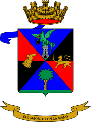
The 131st Engineer Battalion "Ticino" is an inactive military engineer unit of the Italian Army last based in Novara in Piedmont. The battalion was formed in 1958 and assigned to the Armored Division "Centauro". In 1975 the battalion was named for the Ticino river and received the number 131st, which had been used by the 131st Engineer Company that served with the 131st Armored Division "Centauro" during the Tunisian Campaign of World War II. With the name and number the battalion was also assigned the flag and traditions of the 9th Engineer Regiment, which had been active between 1926 and 1943. In 1986 the Armored Division "Centauro" was disbanded and the battalion was assigned to the 3rd Army Corps. In 1993 the battalion was disbanded and part of its personnel joined the 10th Engineer Regiment. The regimental anniversary falls, as for all engineer units, on June 24, the end of the Second Battle of the Piave River in 1918.
