Bielina is a village in the administrative district of Gmina Ujazd, within Tomaszów Mazowiecki County, Łódź Voivodeship, in central Poland. It lies approximately 4 kilometres (2 mi) south-west of Ujazd, 10 km (6 mi) north-west of Tomaszów Mazowiecki, and 39 km (24 mi) south-east of the regional capital Łódź.
Bronisławów is a village in the administrative district of Gmina Ujazd, within Tomaszów Mazowiecki County, Łódź Voivodeship, in central Poland. It lies approximately 4 kilometres (2 mi) north-west of Ujazd, 14 km (9 mi) north-west of Tomaszów Mazowiecki, and 35 km (22 mi) south-east of the regional capital Łódź.
Buków is a village in the administrative district of Gmina Ujazd, within Tomaszów Mazowiecki County, Łódź Voivodeship, in central Poland. It lies approximately 6 kilometres (4 mi) north-west of Ujazd, 16 km (10 mi) north-west of Tomaszów Mazowiecki, and 34 km (21 mi) south-east of the regional capital Łódź.
Dębniak is a village in the administrative district of Gmina Ujazd, within Tomaszów Mazowiecki County, Łódź Voivodeship, in central Poland. It lies approximately 5 kilometres (3 mi) south of Ujazd, 8 km (5 mi) north-west of Tomaszów Mazowiecki, and 41 km (25 mi) south-east of the regional capital Łódź.
Helenów is a village in the administrative district of Gmina Ujazd, within Tomaszów Mazowiecki County, Łódź Voivodeship, in central Poland. It lies approximately 7 kilometres (4 mi) west of Ujazd, 16 km (10 mi) north-west of Tomaszów Mazowiecki, and 33 km (21 mi) south-east of the regional capital Łódź.
Józefin is a village in the administrative district of Gmina Ujazd, within Tomaszów Mazowiecki County, Łódź Voivodeship, in central Poland. It lies approximately 2 kilometres (1 mi) west of Ujazd, 13 km (8 mi) north-west of Tomaszów Mazowiecki, and 37 km (23 mi) south-east of the regional capital Łódź.
Kolonia Dębniak is a village in the administrative district of Gmina Ujazd, within Tomaszów Mazowiecki County, Łódź Voivodeship, in central Poland. It lies approximately 17 kilometres (11 mi) north-west of Tomaszów Mazowiecki and 33 km (21 mi) south-east of the regional capital Łódź.
Lipianki is a village in the administrative district of Gmina Ujazd, within Tomaszów Mazowiecki County, Łódź Voivodeship, in central Poland. It lies approximately 5 kilometres (3 mi) north-west of Ujazd, 16 km (10 mi) north-west of Tomaszów Mazowiecki, and 34 km (21 mi) south-east of the regional capital Łódź.
Maksymów is a village in the administrative district of Gmina Ujazd, within Tomaszów Mazowiecki County, Łódź Voivodeship, in central Poland. It lies approximately 4 kilometres (2 mi) south-west of Ujazd, 12 km (7 mi) north-west of Tomaszów Mazowiecki, and 37 km (23 mi) south-east of the regional capital Łódź.
Młynek is a village in the administrative district of Gmina Ujazd, within Tomaszów Mazowiecki County, Łódź Voivodeship, in central Poland. It lies approximately 6 kilometres (4 mi) north of Ujazd, 16 km (10 mi) north-west of Tomaszów Mazowiecki, and 35 km (22 mi) south-east of the regional capital Łódź.
Niewiadów is a village in the administrative district of Gmina Ujazd, within Tomaszów Mazowiecki County, Łódź Voivodeship, in central Poland. It lies approximately 3 kilometres (2 mi) north-west of Ujazd, 14 km (9 mi) north-west of Tomaszów Mazowiecki, and 36 km (22 mi) south-east of the regional capital Łódź.
Ojrzanów is a village in the administrative district of Gmina Ujazd, within Tomaszów Mazowiecki County, Łódź Voivodeship, in central Poland. It lies approximately 3 kilometres (2 mi) south-east of Ujazd, 9 km (6 mi) north-west of Tomaszów Mazowiecki, and 41 km (25 mi) south-east of the regional capital Łódź.
Osiedle Niewiadów is a village in the administrative district of Gmina Ujazd, within Tomaszów Mazowiecki County, Łódź Voivodeship, in central Poland. It lies approximately 3 kilometres (2 mi) north of Ujazd, 13 km (8 mi) north-west of Tomaszów Mazowiecki, and 37 km (23 mi) south-east of the regional capital Łódź.
Sangrodz is a village in the administrative district of Gmina Ujazd, within Tomaszów Mazowiecki County, Łódź Voivodeship, in central Poland. It lies approximately 3 kilometres (2 mi) south-east of Ujazd, 9 km (6 mi) north-west of Tomaszów Mazowiecki, and 41 km (25 mi) south-east of the regional capital Łódź.
Skrzynki is a village in the administrative district of Gmina Ujazd, within Tomaszów Mazowiecki County, Łódź Voivodeship, in central Poland. It lies approximately 3 kilometres (2 mi) east of Ujazd, 11 km (7 mi) north of Tomaszów Mazowiecki, and 40 km (25 mi) south-east of the regional capital Łódź.
Szymanów is a village in the administrative district of Gmina Ujazd, within Tomaszów Mazowiecki County, Łódź Voivodeship, in central Poland. It lies approximately 14 kilometres (9 mi) north-west of Tomaszów Mazowiecki and 36 km (22 mi) south-east of the regional capital Łódź.
Teklów is a village in the administrative district of Gmina Ujazd, within Tomaszów Mazowiecki County, Łódź Voivodeship, in central Poland. It lies approximately 3 kilometres (2 mi) south-west of Ujazd, 11 km (7 mi) north-west of Tomaszów Mazowiecki, and 39 km (24 mi) south-east of the regional capital of Łódź.

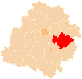
Ujazd is a village in Tomaszów Mazowiecki County, Łódź Voivodeship, in central Poland. It is the seat of the gmina called Gmina Ujazd. It lies approximately 11 kilometres (7 mi) north-west of Tomaszów Mazowiecki and 39 km (24 mi) south-east of the regional capital Łódź.
Wykno is a village in the administrative district of Gmina Ujazd, within Tomaszów Mazowiecki County, Łódź Voivodeship, in central Poland. It lies approximately 5 kilometres (3 mi) north of Ujazd, 15 km (9 mi) north-west of Tomaszów Mazowiecki, and 36 km (22 mi) south-east of the regional capital Łódź.
Zaosie is a village in the administrative district of Gmina Ujazd, within Tomaszów Mazowiecki County, Łódź Voivodeship, in central Poland. It lies approximately 5 kilometres (3 mi) north of Ujazd, 14 km (9 mi) north-west of Tomaszów Mazowiecki, and 37 km (23 mi) south-east of the regional capital Łódź.