Cisséla

Last updated
Cisséla
Guinea adm location map.svg
Red pog.svg
Cisséla
Location in Guinea
Coordinates: 10°50′19″N10°38′5″W / 10.83861°N 10.63472°W / 10.83861; -10.63472
CountryFlag of Guinea.svg  Guinea
Region Kankan Region
Population (2014)
  Total 41,562

Cisséla (or Sissélà) is a town and sub-prefecture in the Kouroussa Prefecture, Kankan Region, of eastern-central Guinea. [1] As of 2014 it had a population of 41,562 people. [2]

Sub-prefectures of Guinea

The sub-prefectures are the third-level administrative divisions in Guinea. As of 2009 there were 303 rural communes of Guinea and 38 urban communes, 5 of which compose the Conakry greater urban area; Kaloum, Dixinn, Matam, Ratoma and Matoto.

Kouroussa Prefecture Prefecture in Kankan Region, Guinea

Kouroussa is a prefecture located in the Kankan Region of Guinea. The capital is Kouroussa. The prefecture covers an area of 14,050 km.² and has a population of 268,630. With Kouroussa town by far the largest in the Prefecture numbering only 10,000, the vast majority of the Prefecture's population live in small rural communities, making their living from subsistence and small scale cash crop agriculture, as well as small scale trade and mining. The majority of the population are members of the Malinke ethnic group or related Mande speakers. The eastern portion of the prefecture is formed from the Niger River valley, while most of the area characterized by low rolling hills and dry savanna grasslands or scrub-like forest.

Kankan Region Region in Guinea

The Kankan Region is located in eastern Guinea. It is bordered by the countries of Mali and Côte d'Ivoire and the Guinean regions of Nzérékoré and Faranah.

Transport

It has a railway station on the main line of Guinean Railways.

Transport in Guinea

Transport in Guinea is composed by a variety of systems that people in the country use to get around as well as to and from domestic and international destinations.

Related Research Articles

Lélouma Prefecture Prefecture in Labé Region, Guinea

Lélouma is a prefecture located in the Labé Region of Guinea. The capital is Lélouma. The prefecture covers an area of 2,140 km.² In census of 2014, it had population of 163,000.

Forécariah Sub-prefecture and town in Kindia Region, Guinea

Forécariah is a sub-prefecture and town located in western Guinea. Population 21,710.

Stuart River Provincial Park is a provincial park in British Columbia, Canada. It is located in two sections north and northwest of Vanderhoofalong the Stuart River southeast of Stuart Lake and the city of Fort St. James. The upper section is located at 54°13′20″N124°00′00″W and comprises c.7391 ha. while the lower, eastern section is centred at 54°03′00″N123°37′00″W and comprises c.3390 ha. and is within the Greater Prince George area. The upper site, which is located around the confluence of the Stuart and Nechako Rivers, includes the site of Chinlac, a Dakelh village whose inhabitants were massacred and enslaved by the Tsilhqot'in of Anahim Lake c. 1745.

Xinhe County, Xinjiang County in Xinjiang, Peoples Republic of China

Xinhe County as the official romanized name, also transliterated from Uyghur as Toksu County, is a county in the Xinjiang Uyghur Autonomous Region, and is under the administration of the Aksu Prefecture. It contains an area of 5,821 km2 (2,248 sq mi). According to the 2002 census, it has a population of 140,000.

Kpendjal Prefecture

Kpendjal is a prefecture located in the Savanes Region of Togo. The prefecture seat is located in Mandouri.

The Alkali Lake Indian Band, also known as the Esketemc First Nation, is a First Nations government of the Secwepemc (Shuswap) people, located at Alkali Lake in the Cariboo region of the Central Interior of the Canadian province of British Columbia. It was created when the government of the then-Colony of British Columbia established an Indian Reserve system in the 1860s. It is one of three Secwepemc bands that is not a member of either the Shuswap Nation Tribal Council or the Northern Shuswap Tribal Council.

Louga Department Department in Louga Region, Senegal

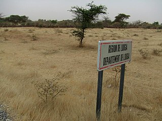
Louga Department is one of the 45 departments of Senegal, and one of the three which comprise the Louga Region.

The Archdiocese of Parakou is the Metropolitan See for the Ecclesiastical province of Parakou in Benin.

Bissikrima Town and sub-prefecture in Faranah Region, Guinea

Bissikrima is a town and sub-prefecture in the Faranah Region of Guinea in Dabola prefecture. As of 2014 it had a population of 28,840 people.

Tada-U or Tadau is a town in central Myanmar about 10 km from the provincial capital of Mandalay.

Minami-Hatogaya Station railway station in Kawaguchi, Saitama prefecture, Japan

Minami-Hatogaya Station is a railway station on the Saitama Rapid Railway Line in Kawaguchi, Saitama, Japan, operated by the third sector railway operator Saitama Railway Corporation.

Lisso Sub-prefecture and town in Boké Region, Guinea

Lisso is a town and sub-prefecture in the Boffa Prefecture in the Boké Region of western Guinea. As of 2014 it had a population of 11,861 people.

Izu-Atagawa Station railway station in Higashiizu, Kamo district, Shizuoka prefecture, Japan

Izu-Atagawa Station is a railway station of the Izu Kyūkō Line located in Higashiizu town, Shizuoka Prefecture, Japan.

Moussaya Sub-prefecture and town in Kindia Region, Guinea

Moussaya is a town and sub-prefecture in the Forécariah Prefecture in the Kindia Region of western Guinea.

Twifo Praso Town & District Capital

Twifu Praso is a small town and is the district capital of Twifo/Heman/Lower Denkyira District of the Central Region.

The Cliffside station is located in Cliffside, British Columbia, on the east side of Shawnigan Lake. The station was a flag stop on Via Rail's Victoria – Courtenay train service, which has been indefinitely suspended since 2011.

Zogota is a town in southeastern Guinea.

References

  1. "Subprefectures of Guinea". Statoids. Retrieved April 19, 2009.
  2. "Guinea". Institut National de la Statistique, Guinea, accessed via Geohive. Retrieved 12 September 2014.

Coordinates: 10°49′00″N10°37′00″W / 10.81667°N 10.61667°W / 10.81667; -10.61667

Geographic coordinate system Coordinate system

A geographic coordinate system is a coordinate system that enables every location on Earth to be specified by a set of numbers, letters or symbols. The coordinates are often chosen such that one of the numbers represents a vertical position and two or three of the numbers represent a horizontal position; alternatively, a geographic position may be expressed in a combined three-dimensional Cartesian vector. A common choice of coordinates is latitude, longitude and elevation. To specify a location on a plane requires a map projection.