Koumana | |
---|---|
Sub-prefecture and town | |
Coordinates: 10°41′N9°40′W / 10.683°N 9.667°W | |
Country | ![]() |
Region | Kankan Region |
Prefecture | Kouroussa Prefecture |
Population (2014) | |
• Total | 12,789 |
Time zone | UTC+0 (GMT) |
Koumana is a town and sub-prefecture in the Kouroussa Prefecture in the Kankan Region of eastern-central Guinea. [1] As of 2014 it had a population of 12,789 people. [2]
A town is a human settlement. Towns are generally larger than villages but smaller than cities, though the criteria to distinguish them vary considerably between different parts of the world.
The sub-prefectures are the third-level administrative divisions in Guinea. As of 2009 there were 303 rural sub-prefectures of Guinea and 38 urban sub-prefectures, 5 of which compose the Conakry greater urban area; Kaloum, Dixinn, Matam, Ratoma and Matoto.
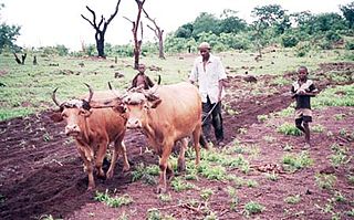
Kouroussa is a prefecture located in the Kankan Region of Guinea. The capital is Kouroussa. The prefecture covers an area of 14,050 km.² and has a population of 268,630. With Kouroussa town by far the largest in the Prefecture numbering only 10,000, the vast majority of the Prefecture's population live in small rural communities, making their living from subsistence and small scale cash crop agriculture, as well as small scale trade and mining. The majority of the population are members of the Malinke ethnic group or related Mande speakers. The eastern portion of the prefecture is formed from the Niger River valley, while most of the area characterized by low rolling hills and dry savanna grasslands or scrub-like forest.
Mandiana is a town located in eastern Guinea. It is the capital of Mandiana Prefecture. As of 2014 the town and surrounding sub-prefecture had a population of 25,791 people.
Banko is a town and sub-prefecture in the Dabola Prefecture in the Faranah Region of Guinea. As of 2014 it had a population of 23,638 people.
Yalenzou is a town and sub-prefecture in the Nzérékoré Prefecture in the Nzérékoré Region of Guinea.It is located southeast of Nzérékoré along the N2 road. The town of Nzao lies between Yalenzou and Nzérékoré.
Diatiféré is a town and sub-prefecture in the Dinguiraye Prefecture in the Faranah Region of western Guinea. As of 2014 it had a population of 33,729 people.
Kobikoro is a town and sub-prefecture in the Faranah Prefecture in the Faranah Region of Guinea. As of 2014 it had a population of 13,912 people.
Koundou is a town and sub-prefecture in the Guéckédou Prefecture in the Nzérékoré Region of south-western Guinea.
Gbérédou-Baranama is a sub-prefecture in the Kankan Prefecture in the Kankan Region of eastern Guinea. As of 2014 it had a population of 17,448 people.
Fermessadou-Pombo is a town and sub-prefecture in the Kissidougou Prefecture in the Faranah Region of Guinea. As of 2014 it had a population of 19,489 people.
Yombiro is a town and sub-prefecture in the Kissidougou Prefecture in the Faranah Region of Guinea. As of 2014 it had a population of 14,340 people.
Babila is a town and sub-prefecture in the Kouroussa Prefecture in the Kankan Region of eastern-central Guinea. As of 2014 it had a population of 16,290 people.
Hérico is a town and sub-prefecture in the Lélouma Prefecture in the Labé Region of northern-central Guinea.
Linsan is a town and sub-prefecture in the Lélouma Prefecture in the Labé Region of northern-central Guinea.
Manda, Guinea is a town and sub-prefecture in the Lélouma Prefecture in the Labé Region of northern-central Guinea.
Tyanguel-Bori is a town and sub-prefecture in the Lélouma Prefecture in the Labé Region of northern-central Guinea.
Faralako is a town and sub-prefecture in the Mandiana Prefecture in the Kankan Region of eastern Guinea. As of 2014 it had a population of 24,371 people.
Koundianakoro is a town and sub-prefecture in the Mandiana Prefecture in the Kankan Region of eastern Guinea. As of 2014 it had a population of 31,489 people.
Morodou is a town and sub-prefecture in the Mandiana Prefecture in the Kankan Region of eastern Guinea. As of 2014 it had a population of 28,140 people.
Ouré-Kaba is a town and sub-prefecture in the Mamou Prefecture in the Mamou Region of Guinea.
Ninguélandé is a town and sub-prefecture in the Pita Prefecture in the Mamou Region of northern-central Guinea.
Norassoba is a town and sub-prefecture in the Siguiri Prefecture in the Kankan Region of northern Guinea.
![]() | This Guinea location article is a stub. You can help Wikipedia by expanding it. |
Coordinates: 10°41′N9°40′W / 10.683°N 9.667°W
A geographic coordinate system is a coordinate system that enables every location on Earth to be specified by a set of numbers, letters or symbols. The coordinates are often chosen such that one of the numbers represents a vertical position and two or three of the numbers represent a horizontal position; alternatively, a geographic position may be expressed in a combined three-dimensional Cartesian vector. A common choice of coordinates is latitude, longitude and elevation. To specify a location on a plane requires a map projection.