Clackline Brook

Last updated
Clackline Brook Bridge. The bridge was a road bridge adjacent to the railway bridge that went over the Brook as well. The new alignment of the Great Eastern Highway runs over the brook to the left rear of the photograph view. At this point there was a junction, where the Great Eastern Highway, the Goldfields pipeline, and railways went different directions. It was known as 'Clackline Junction' in early railway publications. Clackline Brook Bridge from west.JPG
Clackline Brook Bridge. The bridge was a road bridge adjacent to the railway bridge that went over the Brook as well. The new alignment of the Great Eastern Highway runs over the brook to the left rear of the photograph view. At this point there was a junction, where the Great Eastern Highway, the Goldfields pipeline, and railways went different directions. It was known as 'Clackline Junction' in early railway publications.

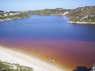
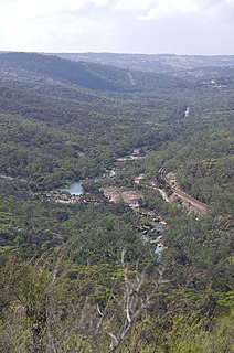
Clackline Brook is an 11.6-kilometre-long (7.2 mi) [1] waterway in the Wheatbelt region of Western Australia. From near Clackline, it runs east-south-easterly towards Mokine, before turning north and ending near Mokine Hill. [1] Clackline Brook joins onto Spencers Brook, with the name changing at the confluence with Corolin Brook. [2] :1

Wheatbelt (Western Australia) region in Western Australia

The Wheatbelt is one of nine regions of Western Australia defined as administrative areas for the state's regional development, and a vernacular term for the area converted to agriculture during colonisation. It partially surrounds the Perth metropolitan area, extending north from Perth to the Mid West region, and east to the Goldfields-Esperance region. It is bordered to the south by the South West and Great Southern regions, and to the west by the Indian Ocean, the Perth metropolitan area, and the Peel region. Altogether, it has an area of 154,862 square kilometres (59,793 sq mi).

Clackline, Western Australia Town in Western Australia

Clackline is a locality in the Wheatbelt region of Western Australia, about 80 kilometres (50 mi) east-north-east of Perth.

The area around Clackline Brook was where a number of Aboriginal families lived, with their territories defined by the surrounding waterways. The area is likely to still have spiritual and cultural significance, although as of 2002, there are no sites or communities registered with the Department of Land Administration or the Aboriginal Affairs Department. [2] :1

The Department of Aboriginal Affairs was an Australian government department that existed between December 1972 and March 1990.

European exploration of the Avon region began in 1830, with an expedition inland from Guildford led by Ensign Dale. Shortly thereafter the area was settled and farming began. Northam was gazetted in 1836, and over the next 50 years the surrounding region grew rapidly along with the agricultural industry – primarily wheat, sheep, and cattle farming. Land usage along the waterways has not changed significantly, but there has been a trend towards subdivision into smaller lots for hobby farming. [2] :2

Avon River (Western Australia) river in Western Australia, Australia

The Avon River is a river in Western Australia. A tributary of the Swan River, the Avon flows 240 kilometres (150 mi) from source to mouth, with a catchment area of 125,000 square kilometres (48,000 sq mi).

Robert Dale explorer

Lieutenant Robert Dale was the first European explorer to cross the Darling Range in Western Australia.

Northam, Western Australia Town in Western Australia

Northam is a town in Western Australia, situated at the confluence of the Avon and Mortlock Rivers, about 97 kilometres (60 mi) east-northeast of Perth in the Avon Valley. At the 2016 census, Northam had a population of 6,548. Northam is the largest town in the Avon region. It is also the largest inland town in the state not founded on mining.

In 1906, the water found to be unsuitable for boiling purposes. A well that had been dug near Clackline Brook was abandoned due to high levels of lime and magnesia salts, and a dam in the brook near the Clackline railway station, meant to provide water for the locomotive engines, was also abandoned. Water was instead sourced from the Coolgardie water supply pipelines. [3]

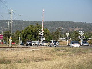
Great Eastern Highway's bypass of Clackline, including the heritage-listed Clackline Bridge, resulted in Clackline Brook being realigned through a large box culvert. [4]

Great Eastern Highway highway in Western Australia

Great Eastern Highway is a 590-kilometre-long (370 mi) road that links the Western Australian capital of Perth with the city of Kalgoorlie. A key route for road vehicles accessing the eastern Wheatbelt and the Goldfields, it is the western portion of the main road link between Perth and the eastern states of Australia. The highway forms the majority of National Highway 94, although the alignment through the Perth suburbs of Guildford and Midland, and the eastern section between Coolgardie and Kalgoorlie are not included. Various segments form parts of other road routes, including National Route 1, Alternative National Route 94, and State Route 51.

Clackline Bridge road bridge in Clackline, Western Australia

Clackline Bridge is a road bridge in Clackline, Western Australia, 77 kilometres (48 mi) east of Perth in the Shire of Northam, that carried the Great Eastern Highway until 2008. It is the only bridge in Western Australia to have spanned both a waterway and railway, the Clackline Brook and the former Eastern Railway alignment. The mainly timber bridge has a unique curved and sloped design, due to the difficult topography and the route of the former railway. The bridge was designed in 1934 to replace two dangerous rail crossings and a rudimentary water crossing. Construction began in January 1935, and was completed relatively quickly, with the opening ceremony held in August 1935. The bridge has undergone various improvement and maintenance works since then, including widening by three metres (10 ft) in 1959–60, but remained a safety hazard, with increasing severity and numbers of accidents through the 1970s and 1980s. Planning for a highway bypass of Clackline and the Clackline Bridge began in the 1990s, and it was constructed between January 2007 and February 2008. The local community had been concerned that the historic bridge would be lost, but it remains in use as part of the local road network, and has been listed on both the Northam Municipal Heritage Inventory and the Heritage Council of Western Australia's Register of Heritage Places.

Related Research Articles

Canning Stock Route track in Western Australia

The Canning Stock Route is a track that runs from Halls Creek in the Kimberley region of Western Australia to Wiluna in the mid-west region. With a total distance of around 1,850 km (1,150 mi) it is the longest historic stock route in the world.

Toodyay, Western Australia Town in Western Australia

Toodyay, known as Newcastle between 1860 and 1910, is a town on the Avon River in the Wheatbelt region of Western Australia, 85 kilometres (53 mi) north-east of Perth on Ballardong Nyoongar land. The first European settlement occurred in the area in 1836. After flooding in the 1850s, the townsite was moved to its current location in the 1860s. It is connected by railway and road to Perth. During the 1860s, it was home to bushranger Moondyne Joe.

Spencers Brook is a waterway, locality and a district located within the Avon Valley in Western Australia.

Pittwater estuary in Sydney, Australia

Pittwater is a semi–mature tide dominated drowned valley estuary, located about 40 kilometres (25 mi) north of the Sydney central business district, New South Wales, Australia; being one of the bodies of water that separate greater Metropolitan Sydney from the Central Coast.

Roe Highway highway in Perth, Western Australia

Roe Highway is a 35-kilometre-long (22 mi) limited-access highway and partial freeway in Perth, Western Australia, linking Kewdale with the city's north-eastern and south-western suburbs. The northern terminus is at Reid Highway and Great Northern Highway in Middle Swan, and the southern terminus is at Kwinana Freeway in Bibra Lake. Roe Highway, in addition to Reid Highway, form State Route 3, a partial ring road around the outer suburbs of the Perth metropolitan area. Roe Highway also forms part of National Highway 94 from Great Eastern Highway Bypass to Great Eastern Highway, and National Highway 95 from Great Eastern Highway to Great Northern Highway.

Bakers Hill, Western Australia Town in Western Australia

Bakers Hill is a town 73 kilometres (45 mi) east of Perth, Western Australia on the Great Eastern Highway. The town is located within the Shire of Northam, between Wundowie and Clackline. At the 2011 census, Bakers Hill had a population of 1,147.

Moore River river in Western Australia

Moore River is a river in the Wheatbelt region of Western Australia.

Kukerin, Western Australia Town in Western Australia

Kukerin is a small town in the Wheatbelt region of Western Australia, 308 kilometres (191 mi) south-east of Perth between Wagin and Lake Grace just off Dumbleyung Lake Grace Road on State Route 107. The town itself is small but services a considerable agricultural region in the eastern Shire of Dumbleyung. At the 2006 census, Kukerin had a population of 190.

Toodyay Road road in Western Australia

Toodyay Road is a mostly 2-lane undivided single carriageway in Western Australia, running from the north-eastern Perth suburb of Middle Swan, through Gidgegannup and Bailup, to the Wheatbelt town of Toodyay. It is signposted as State Route 50.

Kingoonya Town in South Australia

Kingoonya Township is a small almost totally abandoned farming settlement in the central outback of the Australian state of South Australia. It was established in the early 1900s as a railway support town for the 200 or so sheep farming families on the train-line extending west across the Nullarbor Plain to Western Australia. It played a significant role in the construction of the Trans-Australian Railway.

Miling, Western Australia Town in Western Australia

Miling is a small town in the Shire of Moora, 200 kilometres (124 mi) north of Perth, Western Australia. At the 2006 census, Miling had a population of 205.

Railway dams and reservoirs were used to supply water to an extensive railway system that ventured into low rainfall, and poor water quality areas of the inner regions of Western Australia in the 1890s.

Tourist Drives in Western Australia are routes through areas of scenic or historic significance, designated by route markers with white numbers on a brown shield. Tourist Drives were introduced into Western Australia while Eric Charlton was the state government Minister for Transport in the 1990s. The 28 numbered routes collectively traverse more than 2,000 kilometres (1,200 mi) across the state. In addition to the Tourist Drives, there are unnumbered routes such as the Golden Pipeline Heritage Trail, and local governments may designate and maintain local scenic drives, generally unnamed and unnumbered.

Clackline School, later known as Clackline Primary School, was a school in the Wheatbelt town of Clackline, Western Australia. It opened in 1896, and was extended and renovated several times before relocating in 1954 to a new site on the same road. The school was closed down in 1976, but in 1980 became the temporary location of the Avon Valley Church's school. A monument commemorating British colonisation was erected in 1929, and remains in use as a stopping point on the Kep Track.

The Avro Anson Memorial, also known as the RAAF Anson Aircraft Memorial, Air Disaster Memorial, or Mokine Memorial, commemorates four Royal Australian Air Force (RAAF) airmen killed when their Avro Anson aircraft crashed near Clackline, Western Australia on 9 October 1942. The memorial, assembled by members of the local community in the months following the crash, features a cairn of granite and boulders supporting a jarrah cross. The names and details of the deceased airmen − Flying Officer Lynton Birt, Sergeant Geoffrey Debenham, Sergeant Noel Nixon, and Sergeant Kenneth Hugo − are carved into the cross. Birt was interred in the Northam Cemetery, and later reinterred in the Perth war cemetery and annex (N.A.8) while the others were buried at Karrakatta Cemetery.

Mardella Suburb of Perth, Western Australia

Mardella is an outer suburb of Perth, the capital city of Western Australia, lying approximately 41 kilometres (25 mi) south-southeast of the central business district. It is located within the Shire of Serpentine-Jarrahdale, and at the 2011 census had a population of 303 people. Although falling within the Perth metropolitan area, Mardella is mostly rural in nature, with a significant proportion of the population engaged in farming.

References

  1. 1 2 "Map of Clackline Brook, WA". Bonzle Digital Atlas of Australia. Retrieved 19 January 2014.
  2. 1 2 3 Water and Rivers Commission (2002). "Foreshore and Channel Assessment of Spencers Brook". Water Resource Management Series, No WRM 28 (PDF). East Perth, Western Australia: Water and Rivers Commission. ISBN   1-920687-28-9. Archived (PDF) from the original on 3 May 2013. Retrieved 19 January 2014.
  3. "Mining And Stocks And Shares". The West Australian . Perth: National Library of Australia. 26 July 1906. p. 4. Retrieved 19 January 2014.
  4. "Great Eastern Highway (Clackline)". Highway Construction. Archived from the original on 13 August 2013. Retrieved 28 November 2013.