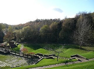
Clayton Vale is an area of green space in Clayton, Manchester, England, through which the River Medlock flows. Redeveloped in 1986, the land has a rich industrial and social history. Today the area is a natural habitat for wildlife and it has been designated a Local Nature Reserve.[1][2]
Fossils of plants and insects in the rocks of the area show a very different climate to what we see today. Swamp forests and luxuriant growth were encouraged by the warm moist air. At the start of the Triassic Period, Britain was largely covered by desert. The land sank producing a great salt lake over much of northern Britain, after which the desert conditions returned.
Clayton Vale pre-1986
The Vale landscape was somewhat different before the late 1970s. The valley was home to many buildings from Bank Bridge Works and Tannery to The Smallpox Hospital.
Bank Bridge Works and Tannery
The chimney behind the Jewish Cemetery of Philips Park is all that remains of the once extensive complex, which was once shown on Johnson's Map of 1820.
The Smallpox Hospital
When the Manchester Ship Canal opened, and the city became an inland port, an isolation hospital was required to nurse sailors with infectious diseases. Originally known as Clayton Infectious Diseases Hospital, it was shown on the Ordnance Survey map of 1909. By 1933, it became known as Clayton Smallpox Hospital.
On the north bank of the River Medlock, opposite the site of the print works, the foundation stone is clearly visible along with brick walling on top of the stonework. To the south of the river stood the nurses home, known as Clayton House. The site also contained other associated buildings.
The Old Print Works
Standing near Clayton Bridge, on the sharp bend of the river on the south bank was Clayton Vale Print Works. This was shown again on Johnson's Map of 1820, but by 1888 the OS map shows the works as being disused and in 1909 the ten buildings of the complex were demolished leaving little to be seen today. However, foundation stone can be seen in the river bed.
Culcheth Dye Works
Shown on the 1893 OS map as a collection of buildings with large reservoirs. Because the more modern dye works made a greater demand on the water supply than could be provided by the river, the industry, known as Failsworth Dyeing and Finishing Works, fell into disuse in the late 1960s. The site has since been landscaped. The works once stood next to the present day Visitors Centre.
River Maintenance and Notable Bridges in the Vale
A bridge, situated where Edge Lane meets Berry Brow, is mentioned as far back as 1696. Today, a stone bridge stands, known as Clayton Bridge. Before this there was a ford, suggesting an ancient river crossing which might have been used since prehistoric times.
In 1872, the River Medlock rose suddenly and tore away part of the printworks complex, as well as washing away between 40 and 50 bodies from Philips Park Cemetery. After this, the river was lined with red bricks to prevent such a disaster from happening again. It is because of the red brick lining that the river is sometimes called 'The Red River'. This type of river engineering can be seen from the bridge nearby.
In recent years,[when?] more river engineering has taken place further up the river bank, near the red brick bridge (known as Vale Street Bridge). The river course was changed in the early 1960s as steep stone walls were installed to prevent flooding.
Coates Farm
Coates Farm held a summer gala for local children before the First World War, with races, tea and lemonade. The stone wall next to the river is probably one of the remaining walls of the farmhouse.
Edge Lane, Millstream Lane and Berry Brow is known locally as Pop Brew and the vale was also known locally as "the meddie". Coates farm was cleared by 1960 and a road was made taking Dustbin waste carts to a landfill site along the valley. The pig sty for the farm was demolished during World War Two and in its place stood an ARP Warden hut. a new build visitor centre now stands near the site of the old farm. Manchester Central Library online photo archive is a source, and can be accessed via a link below.
The Bay Horse Inn and Clayton Bridge as a Hamlet
Originally a farm building, it became a pub in the 19th century - known then as The Grey Mare. The inn served the small hamlet of Clayton Bridge which sprang up in the 18th and 19th centuries as a result of the dye and print works. It was home to many dwellings, including Andrews Brew - once a small lane off Berry Brow, it housed thatched roof cottages which were pulled down in the early 1990s. Saint Cuthbert Church was also erected around this time, but has since been demolished.
Other Victorian terraced houses lined the west side of Berry Brow as it rose to the level crossing at Clayton Bridge railway station, the east side still being occupied by fields into the 1950s.
Clayton Bridge Railway Station
Clayton Bridge railway station on the line between Manchester and Stalybridge opened in April 1846 and became a victim of the Beeching Axe, closing in 1968. The station buildings were to the west of Berry Brow, the signal box was on the opposite side on the north of the line and was also used to manually operate the level crossing gates. Nothing remains of the station.
Railway branch line
In 1904, a railway branch line was completed which ran south through Clayton Vale to the Stuart Street Power Station. The line was later extended in 1916, across Ashton New Road into the Clayton Aniline Company works. For many years, waste coal ash from the power station was transported on the line and dumped as landfill into Clayton Vale.
Clayton Vale post 1986
Before the mid-nineteen eighties, the land was heavily polluted with recent landfills and general neglect, and the buildings of the vale had either been vandalised or demolished. Redevelopment of the land went under way, known as the Medlock Valley Scheme. The area has been described as a shining example of urban country parkland and a haven for wildlife by The Heritage Trail. Trees were planted in the mid-1980s and after two decades stands a semi-mature forest, home to black-and-white blackbirds and squirrels in the taller trees. Silver birch, ash, sycamore, willow and poplars line to the top of the dell.
Castlefield is an inner-city conservation area in Manchester, North West England. The conservation area which bears its name is bounded by the River Irwell, Quay Street, Deansgate and Chester Road. It was the site of the Roman era fort of Mamucium or Mancunium which gave its name to Manchester. It was the terminus of the Bridgewater Canal, the world's first industrial canal, built in 1764; the oldest canal warehouse opened in 1779. The world's first passenger railway terminated here in 1830, at Liverpool Road railway station and the first railway warehouse opened here in 1831.
Reddish is an area in Metropolitan Borough of Stockport, Greater Manchester, England. 4.6 miles (7.4 km) south-east of Manchester city centre. At the 2011 Census, the population was 28,052. Historically part of Lancashire, Reddish grew rapidly in the Industrial Revolution and still retains landmarks from that period, such as Houldsworth Mill, a former textile mill.
Wilmslow Road is a major road in Manchester, England, running from Parrs Wood northwards to Rusholme. There it becomes Oxford Road and the name changes again to Oxford Street when it crosses the River Medlock and reaches the city centre.
Newton Heath is an area of Manchester, England, 2.8 miles (4.5 km) north-east of Manchester city centre and with a population of 9,883.
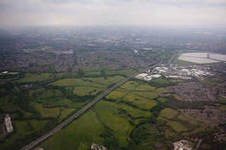
The River Medlock is a river in Greater Manchester, England, which rises near Oldham and flows south and west for 10 miles to join the River Irwell in Manchester city centre.
Levenshulme is an area of Manchester, England, bordering Fallowfield, Longsight, Gorton, Burnage, Heaton Chapel and Reddish, halfway between Stockport and Manchester city centre on the A6. Levenshulme is predominantly residential with numerous fast food shops, public houses and antique stores. It has a multi-cultural and multi-ethnic population of 15,430 at the 2011 Census. The Manchester to London railway line passes through Levenshulme railway station.
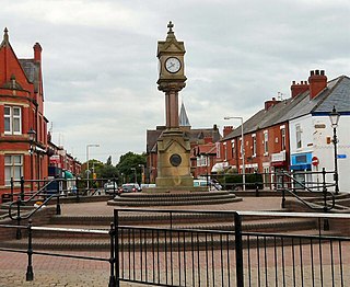
Clayton is a suburb of Manchester, England, three miles east of the city centre on Ashton New Road.
Pendlebury is a town in the City of Salford, Greater Manchester, England. The population at the 2011 Census was 13,069. It lies 4 miles (6.4 km) north-west of Manchester, 3 miles (4.8 km) north-west of Salford and 6 miles (9.7 km) south-east of Bolton.
Euxton is a village and civil parish of the Borough of Chorley, in Lancashire, England. The population of the civil parish as taken at the 2011 census was 9,993, however, the population is now estimated to be around 14,000 due to the increase in housing developments in the village, including the Buckshaw development. The village is situated just to the west of Chorley, and to the south of Clayton-le-Woods.
Heaton Mersey is a suburb of Stockport, Greater Manchester, England. It is situated on the north-western border of Stockport, adjacent to Didsbury and Burnage which are in the City of Manchester.
Reddish Vale is in the Tame Valley close to Reddish, Greater Manchester, England. The centre of the vale is around the bottom of Reddish Vale Road. Reddish Vale Country Park is a country park managed by Stockport Metropolitan Borough Council (SMBC). It covers 161 hectares in all and comprises some of the traditional Reddish Vale area, Reddish Vale Farm and the grazing land and Woodhall Fields, about 0.5 miles (0.80 km) to the south. Part of it is a designated local nature reserve.
Park Bridge is an area of Ashton-under-Lyne, in the Metropolitan Borough of Tameside, in Greater Manchester, England. It is situated in the Medlock Valley, by Ashton-under-Lyne's border with Oldham. Park Bridge anciently lay within medieval manor of Ashton, however there is no record of Park Bridge until the 17th century. The name is probably a reference to the medieval Lyme Park, in the north west of the manor of Ashton. For nearly two hundred years from the 18th to the 20th centuries it was the site of the Park Bridge Ironworks.
The Stocksbridge Railway was a subsidiary of Samuel Fox and Company and linked the company's works at Stocksbridge, near Sheffield, South Yorkshire, England, with the main line of the Manchester, Sheffield and Lincolnshire Railway at Deepcar. As the size of Fox's steelworks expanded, better transport links were needed, and the railway was authorised by an Act of Parliament in 1874. It was completed in 1877, and remained an independent subsidiary until 1992, when it became part of the steelworks operation. When the Woodhead line was closed to the north of Deepcar, the line south to Sheffield was singled, and operates as a long siding.
Clayton Bridge railway station, Manchester, was a railway station that served the locality between 1846 and 1968.
Cliffe Vale is a district of the city of Stoke-on-Trent, and lies to the immediate south of Etruria and just east of Basford and Hartshill. Cliffe Vale is in the valley of the Fowlea Brook, now better known as Etruria Valley. There are industrial and employment uses along the A500, and new residential developments along the Trent and Mersey Canal. The Shelton New Road (B5045) passes through from east to west. The area is sometimes called Cliff Vale by the city council, and is part of the Hartshill electoral ward.
Park Bridge Railway Station was a railway station on the Oldham, Ashton-under-Lyne and Guide Bridge Junction Railway (OA&GB) that served the village of Park Bridge, in the Medlock Valley near Ashton-under-Lyne's border with Oldham. It was sometimes known as Parkbridge, and one photograph of the station shows the station name board with the name as one word and immediately adjacent the signal box with it shown as two. The station opened on 26 August 1861 when the line opened.
Drinkwater Park is situated in the Irwell Valley on the western border of Prestwich, near Manchester, bounded by the River Irwell to the west, Agecroft Road and Rainsough Brow (A6044) to the south, Butterstile Lane and Carr Clough estate to the east and Bunkers Hill to the north. The park is administered by Forestry England and is part of Prestwich Forest Park, which also incorporates Philips Park, Mere Clough, Prestwich Clough, Forest Bank Park in Pendlebury and Waterdale Meadow.
The Heywood Branch Canal was a branch of the Rochdale Canal from Castleton which led to Heywood. It opened in 1834 and carried traffic until 1937. It was abandoned in 1952, along with most of the Rochdale Canal, and although the Rochdale Canal has been reopened, the junction lies under the embankments of the M62 motorway.
Moston Brook is a stream in Greater Manchester in north-west England and a tributary of the River Irk. The brook is formed at the confluence of Bower Brook and Hole Bottom Brook. This occurs near the Rochdale Canal in Failsworth in the Metropolitan Borough of Oldham. It flows southwest, forming the border between Moston, Manchester and Failsworth before being culverted almost all of the remaining route to its meeting the River Irk. It has a total length of about 3.7 miles.
The Kilburn Building is a building on the Oxford Road in Manchester which is home to the Department of Computer Science at the University of Manchester. The building was designed by the Building Design Partnership and completed in 1972, with three storeys in a square shape, measuring 76 by 76 metres. The building was formerly known as the Computer Building changing its name in 2001 in honour of Tom Kilburn who died in the same year.
This page is based on this Wikipedia article Text is available under the CC BY-SA 4.0 license; additional terms may apply. Images, videos and audio are available under their respective licenses.