Related Research Articles
Jimboomba is a town and locality in Logan City, Queensland, Australia. In the 2016 census, Jimboomba had a population of 13,201 people.

The Division of Oxley is an Australian Electoral Division in Queensland.

Taringa is a suburb in the City of Brisbane, Queensland, Australia. In the 2016 census, Taringa had a population of 8,376 people.

Ferny Grove is an outer north-western suburb in the City of Brisbane, Queensland, Australia. In the 2016 census, Ferny Grove had a population of 5,725 people.

Carole Park is a suburb of the City of Ipswich, Queensland, Australia. It is 19 kilometres (12 mi) south west of the Brisbane central business district. The Place Names Board designated the suburb and its name in 1972.

The NER 901 Class was a class of 2-4-0 steam locomotive of the North Eastern Railway, designed by Edward Fletcher. Between 1872 and 1882 55 of the class were built for the NER.

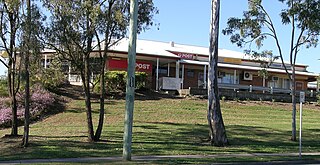
Swanbank is a locality in the City of Ipswich, Queensland, Australia.
Coombell is a locality between the towns of Casino and Grafton in northern New South Wales, Australia. The North Coast railway passes through, and a railway station was provided between 1905 and 1974.
Batar was the name of a railway station on the North Coast railway line on the North Coast of New South Wales, Australia. The station, named for the nearby Batar Creek, existed at the site between 1941 and 1971.

The Dugandan railway line was a branch railway in the Scenic Rim region of South East Queensland, Australia. It was also known as the Fassifern railway line. It operated from 1882 to 1964.

Miva is a locality split between the Gympie Region and the Fraser Coast Region in Queensland, Australia.

Purga is a rural locality in the City of Ipswich, Queensland, Australia. In the 2016 census, Purga had a population of 576 people.

Peak Crossing is a rural locality split between the City of Ipswich and the Scenic Rim Region of Queensland, Australia. In the 2016 census, Peak Crossing had a population of 965 people.

Munbilla is a rural town and locality in the Scenic Rim Region, Queensland, Australia. In the 2016 census, Munbilla had a population of 100 people.

Veresdale is a locality split between the City of Logan and the Scenic Rim Region, Queensland, Australia.
Wilsons Plains is a locality in the Scenic Rim Region, Queensland, Australia.

Running Creek is a large rural locality in the Scenic Rim Region, Queensland, Australia. It borders New South Wales.
Oakview is a locality in the Gympie Region, Queensland, Australia. It is an historic mining area and now grazing country.

Hoya is a locality in the Scenic Rim Region, Queensland, Australia. In the 2016 census, Hoya had a population of 220 people.
Alloway is a locality in the Bundaberg Region, Queensland, Australia. As of the 2016 census, Alloway had a population of 490.
References
- ↑ Clearfield station. NSWrail.net, accessed 1 September 2009.
| Preceding station | Former Services | Following station | ||
|---|---|---|---|---|
| Myrtle Creek towards Brisbane | North Coast Line | Ampdale towards Maitland | ||