
Climate is the long-term weather pattern in a region, typically averaged over 30 years. More rigorously, it is the mean and variability of meteorological variables over a time spanning from months to millions of years. Some of the meteorological variables that are commonly measured are temperature, humidity, atmospheric pressure, wind, and precipitation. In a broader sense, climate is the state of the components of the climate system, including the atmosphere, hydrosphere, cryosphere, lithosphere and biosphere and the interactions between them. The climate of a location is affected by its latitude, longitude, terrain, altitude, land use and nearby water bodies and their currents.

Numerical climate models use quantitative methods to simulate the interactions of the important drivers of climate, including atmosphere, oceans, land surface and ice. They are used for a variety of purposes from study of the dynamics of the climate system to projections of future climate. Climate models may also be qualitative models and also narratives, largely descriptive, of possible futures.

Climatology or climate science is the scientific study of Earth's climate, typically defined as weather conditions averaged over a period of at least 30 years. Climate concerns the atmospheric condition during an extended to indefinite period of time; weather is the condition of the atmosphere during a relative brief period of time. The main topics of research are the study of climate variability, mechanisms of climate changes and modern climate change. This topic of study is regarded as part of the atmospheric sciences and a subdivision of physical geography, which is one of the Earth sciences. Climatology includes some aspects of oceanography and biogeochemistry.
Atmospheric science is the study of the Earth's atmosphere and its various inner-working physical processes. Meteorology includes atmospheric chemistry and atmospheric physics with a major focus on weather forecasting. Climatology is the study of atmospheric changes that define average climates and their change over time, due to both natural and anthropogenic climate variability. Aeronomy is the study of the upper layers of the atmosphere, where dissociation and ionization are important. Atmospheric science has been extended to the field of planetary science and the study of the atmospheres of the planets and natural satellites of the Solar System.

A weather station is a facility, either on land or sea, with instruments and equipment for measuring atmospheric conditions to provide information for weather forecasts and to study the weather and climate. The measurements taken include temperature, atmospheric pressure, humidity, wind speed, wind direction, and precipitation amounts. Wind measurements are taken with as few other obstructions as possible, while temperature and humidity measurements are kept free from direct solar radiation, or insolation. Manual observations are taken at least once daily, while automated measurements are taken at least once an hour. Weather conditions out at sea are taken by ships and buoys, which measure slightly different meteorological quantities such as sea surface temperature (SST), wave height, and wave period. Drifting weather buoys outnumber their moored versions by a significant amount.

The National Weather Center (NWC), on the campus of the University of Oklahoma, is a confederation of federal, state, and academic organizations that work together to better understand events that take place in Earth's atmosphere over a wide range of time and space scales. The NWC partners give equal attention to applying that understanding to the development of improved observation, analysis, assimilation, display, and prediction systems. The National Weather Center also has expertise in local and regional climate, numerical modeling, hydrology, and weather radar. Members of the NWC work with a wide range of federal, state, and local government agencies to help reduce loss of life and property to hazardous weather, ensure wise use of water resources, and enhance agricultural production. They also work with private sector partners to develop new applications of weather and regional climate information that provide competitive advantage in the marketplace.
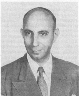
David John Carson is a climatologist. He has been director of the Hadley Centre, director of Numerical Weather Prediction at the UKMO, and was director of the World Climate Research Programme from 2000-2005.

The Deutscher Wetterdienst or DWD for short, is the German Meteorological Service, based in Offenbach am Main, Germany, which monitors weather and meteorological conditions over Germany and provides weather services for the general public and for nautical, aviational, hydrometeorological or agricultural purposes. It is attached to the Federal Ministry for Digital and Transport. The DWDs principal tasks include warning against weather-related dangers and monitoring and rating climate changes affecting Germany. The organisation runs atmospheric models on their supercomputer for precise weather forecasting. The DWD also manages the national climate archive and one of the largest specialised libraries on weather and climate worldwide.
Helmut Erich Landsberg (1906–1985) was a noted and influential climatologist. He was born in Frankfurt, Germany, February 9, 1906 and died December 6, 1985 in Geneva, Switzerland while attending a meeting of the World Meteorological Organization. Landsberg was an important figure in meteorology and atmospheric science in education, public service and administration. He authored several notable works, particularly in the field of particulate matter and its influence on air pollution and human health. He is the first to write in English about the use of statistical analysis in the field of climatology and implemented such statistical analysis in aiding military operations during World War II. He received a number of significant honors during his life. Several honors are now bestowed in his name in recognition of his contributions to his field.
The College of Atmospheric and Geographic Sciences at the University of Oklahoma consists of the School of Meteorology and Department of Geography & Environmental Sustainability (DGES). The college officially started on January 1, 2006, when it and the College of Earth and Energy were spun-off from the old College of Geosciences, which no longer exists.

Integrated Meteorological System, developed by Northrop Grumman is the meteorological component of the Intelligence and Electronic Warfare (IEW), an element of the Army Battle Command System (ABCS). IMETS provides Army commanders at all echelons with an automated weather system to receive, process, and disseminate weather observations, forecasts, and weather and environmental effects decision aids to all Battlefield Operating Systems (BOS). IMETS is designed to be a mobile, tactical, automated weather data receiving, processing and dissemination system. The IMETS is an Army-furnished and maintained system operated by US Air Force battlefield weather team personnel. It uses US Air Force and Army developed software to provide a total weather system to support the Army. The Integrated Weather Effects Decision Aid (IWEDA) software, originally developed by the U.S. Army Research Laboratory (ARL) in 1992, has been fielded on IMETS since 1997 to provide tactical weather support to the U.S. Army.
Surface weather observations are the fundamental data used for safety as well as climatological reasons to forecast weather and issue warnings worldwide. They can be taken manually, by a weather observer, by computer through the use of automated weather stations, or in a hybrid scheme using weather observers to augment the otherwise automated weather station. The ICAO defines the International Standard Atmosphere (ISA), which is the model of the standard variation of pressure, temperature, density, and viscosity with altitude in the Earth's atmosphere, and is used to reduce a station pressure to sea level pressure. Airport observations can be transmitted worldwide through the use of the METAR observing code. Personal weather stations taking automated observations can transmit their data to the United States mesonet through the Citizen Weather Observer Program (CWOP), the UK Met Office through their Weather Observations Website (WOW), or internationally through the Weather Underground Internet site. A thirty-year average of a location's weather observations is traditionally used to determine the station's climate. In the US a network of Cooperative Observers make a daily record of summary weather and sometimes water level information.
Earth sciences graphics software is a plotting and image processing software used in atmospheric sciences, meteorology, climatology, oceanography and other Earth science disciplines.

The Royal Meteorological Institute of Belgium is a Belgian federal institute engaged in scientific research in the field of meteorology. The RMI depends on the Belgian Federal Science Policy Office (BELSPO). The institute is a member of the World Meteorological Organization, of the European Centre for Medium-Range Weather Forecasts, of EUMETSAT, and of the EIG Eumetnet.
CLIMAT is a code for reporting monthly climatological data assembled at land-based meteorological surface observation sites to data centres. CLIMAT-coded messages contain information on several meteorological variables that are important to monitor characteristics, changes, and variability of climate. Usually these messages are sent and exchanged via the Global Telecommunication System (GTS) of the World Meteorological Organisation (WMO). Modifications of the CLIMAT code are the CLIMAT SHIP and CLIMAT TEMP / CLIMAT TEMP SHIP codes which serve to report monthly climatological data assembled at ocean-based meteorological surface observation sites and at land-/ocean-based meteorological upper-air observation sites, respectively. The monthly values included usually are obtained by averaging observational values of one or several daily observations over the respective month.
An atmospheric reanalysis is a meteorological and climate data assimilation project which aims to assimilate historical atmospheric observational data spanning an extended period, using a single consistent assimilation scheme throughout.

A meteogram, also known as a meteorogram, is a graphical presentation of one or more meteorological variables with respect to time, whether observed or forecast, for a particular location. Where forecast data is used, the meteogram will typically be generated directly from a weather forecasting model based on the longitude, latitude and elevation of the location, but it can also be corrected by a meteorologist. Where a meteogram is used to display historical weather observations, this will typically be for a specific weather station.
The multivariate ENSO index, abbreviated as MEI, is a method used to characterize the intensity of an El Niño Southern Oscillation (ENSO) event. Given that ENSO arises from a complex interaction of a variety of climate systems, MEI is regarded as the most comprehensive index for monitoring ENSO since it combines analysis of multiple meteorological and oceanographic components.
Leo Wenzel Pollak was a geophysicist, meteorologist and pioneer in scientific data processing. His career was spent at the Geophysical Institute in Prague, where he rose to the rank of professor and director (1911-1939), the Irish Meteorological Service (1939-1947), and the Dublin Institute for Advanced Studies (1947-1963).