
Uphall is a village in West Lothian, Scotland. It is a swiftly growing village in a conurbation with Broxburn to the east, Dechmont to the west and the major town of Livingston to the south west. Uphall is 30 miles from Glasgow and 14 miles from Edinburgh in the Scottish Lowlands. Uphall Station and Pumpherston are separate villages that lie to the south of Uphall.

Galashiels is a town in the Scottish Borders with a population of around 12,600. Its name is often colloquially shortened to "Gala". The town is a major commercial centre for the Borders region with extensive history in the textile industry. Galashiels is the location of Heriot-Watt University's School of Textiles and Design.

Selkirkshire or the County of Selkirk is a historic county and registration county of Scotland. It borders Peeblesshire to the west, Midlothian to the north, Roxburghshire to the east, and Dumfriesshire to the south. It derives its name from its county town, the royal burgh of Selkirk. The county was historically also known as Ettrick Forest.

Abbotrule is a hamlet south of the B6357 road, in the Scottish Borders area of Scotland, on Rule Burn, east of the Rule Water. Places nearby include Bedrule, Hallrule, Spittal-on-Rule, Ruletownhead, Bonchester Bridge, Denholm, Southdean, Hobkirk, Ferniehirst Castle and the Wauchope Forest.
Stow of Wedale, or more often Stow, is a village in the Scottish Borders area of Scotland, 7 miles north of Galashiels. In the 2011 Census the population was 718. It is served by Stow railway station.

Nisbet is a small hamlet on the B6400, in Roxburghshire, along the River Teviot, in the Scottish Borders area of Scotland. It is located 5.5 kilometres (3.4 mi) north of Jedburgh and 5 kilometres (3.1 mi) south of Roxburgh.

Tarbat is a civil parish in Highland, Scotland, in the north-east corner of Ross and Cromarty.

Dalmahoy is a hotel and former country house near Edinburgh, Scotland. It is located off the A71 road, 3.5 kilometres (2.2 mi) south of Ratho. The house is protected as a category A listed building,

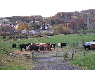
Tweedbank is a large village south-east of Galashiels in the Scottish Borders. It is part of the county of Roxburghshire. It is an outer suburb or satellite development of Galashiels, on the other (eastern) side of the River Tweed. The population of Tweedbank at the latest census is 2,101.
Caddonlee is a farm in the village of Clovenfords in the Scottish Borders area of Scotland, by the Caddon Water, near Caddonfoot where Caddon Water meets the Tweed. The nearest town is Galashiels. On the farm are traces of an auxiliary Roman fort allied to that main Roman outpost at Trimontium at Melrose
Maxton is a hamlet and civil parish in Roxburghshire, Scotland, and part of the Scottish Borders region.

Caddonfoot is a village on the River Tweed, in the Scottish Borders area of Scotland, on the A707, near Galashiels.
The Caddon Water is a small river by the village of Caddonfoot, in the Scottish Borders area of Scotland. It rises on Windlestraw Law, four miles north of Innerleithen, and flows through the Stantling Craig Reservoir. It joins the river Tweed at Caddonfoot, having completed its journey after 11 miles (18 km).
Eckford is a small village located between the larger towns of Kelso and Jedburgh in the Scottish Borders. The village is in close proximity to both the River Teviot and its tributary the Kale Water, and the A698 and the B6401 which run approximately parallel to the respective rivers.
Mowhaugh is a hamlet and farm steading near the Calroust Burn and the Bowmont Water, near Morebattle, in the Scottish Borders area of Scotland, and in the former Roxburghshire. It is situated about 5 miles (8 km) from the Anglo-Scottish Border.

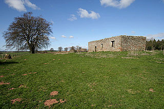
Cessford is a hamlet and former barony about a mile south of the B6401 road, in the Scottish Borders area of Scotland. The placename is from Gaelic 'ceis' and means 'the wattled causeway over the ford'; spellings vary between Cesfuird, Cesford, Cessfoord, Cessfuird, and Cessfurde.
Bassendean is a village in the Scottish Borders area of Scotland, 4 kilometres (2.5 mi) south of Westruther and 3 kilometres (1.9 mi) north-west of Gordon. It is by the Eden Water in the former Berwickshire, immediately south of the hamlet of Houndslow.

Torthorwald is a village and civil parish in Dumfries and Galloway, south-west Scotland. It is located 6 kilometres (3.7 mi) east of Dumfries on the A709 road to Lochmaben. The area was the property of the de Torthorwald family until the end of the 13th century, when the estate passed by marriage to the Kirkpatricks. In 1418, William de Carleil married the Kirkpatrick heiress. He may have been the builder of Torthorwald Castle, which was erected around this time, possibly on top of an earlier a motte. Torthorwald was erected as a burgh of barony in 1473. Torthorwald Castle was occupied until 1715; only two of its walls still stand, to a height of around 18 metres (59 ft).
Libberton is a village and historical parish in South Lanarkshire. The village is approximately 2 miles (3.2 km) north of Quothquan and 2.3 miles (3.68 km) south-east of Carnwath. The nearest rivers are the South Medwyn River, the North Medwyn River and the River Clyde which lies the east of the village.
