Related Research Articles

The Bass Coast Shire is a local government area in Victoria, Australia, located in the southeastern part of the state. It covers an area of 866 square kilometres (334 sq mi) and in June 2018 had a population of 35,327. It includes the towns of Bass, Cape Paterson, Cape Woolamai, Corinella, Coronet Bay, Cowes, Inverloch, Kilcunda, Lang Lang, Newhaven, Rhyll, San Remo, Summerlands and Wonthaggi as well as the historic locality of Krowera. It also includes the popular tourist destination Phillip Island. It was formed in 1994 from the amalgamation of the Shire of Bass, Shire of Phillip Island, Borough of Wonthaggi, parts of the Shire of Woorayl, Shire of Korumburra and City of Cranbourne.
Jumbunna is a town in South Gippsland, Victoria, Australia. The name is taken from the eastern Kulin language of the Bunnerong tribe and means "a place to meet and talk".

Dimbulah is a rural town and locality in Far North Queensland, Australia, 114 kilometres (71 mi) from Cairns by road, on the Atherton Tableland. It is within the local government area of Shire of Mareeba. In the 2021 census, the locality of Dimbulah had a population of 975 people, a decrease from the 1,050 people in the 2016 census.

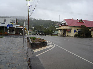
Korumburra is a town in the Australian state of Victoria. It is located on the South Gippsland Highway, 120 kilometres (75 mi) south-east of Melbourne, in the South Gippsland Shire local government area. At the 2021 census Korumburra had an urban population of 3,639. Surrounded by rolling green hills, the town is 227 metres (745 ft) above the sea level of coastal Inverloch, about 28 km (17 mi) away.
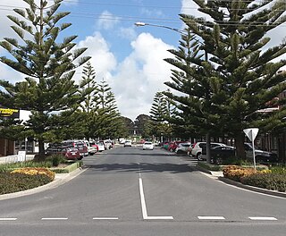
Wonthaggi is a town located 132 kilometres (82 mi) south east of Melbourne via the South Gippsland and Bass highways, in the Bass Coast Shire of Gippsland, Victoria, Australia. Known originally for its coal mining, it is now the largest town in South Gippsland, a regional area with extensive tourism, beef and dairy industries.

Kuranda is a rural town and locality on the Atherton Tableland in the Shire of Mareeba, Queensland, Australia. It is 25 kilometres (16 mi) from Cairns, via the Kuranda Range road. It is surrounded by tropical rainforest and adjacent to the Wet Tropics of Queensland World Heritage listed Barron Gorge National Park. In the 2021 census, the locality of Kuranda had a population of 3,273 people.
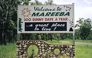
Mareeba is a rural town and locality in the Shire of Mareeba in Far North Queensland, Australia. Between 2008 and 2013, it was within the Tablelands Region. The town's name is derived from an Aboriginal word meaning meeting of the waters. In the 2021 census, the locality of Mareeba had a population of 11,825 people.
Herberton is a rural town and locality in the Tablelands Region, Queensland, Australia. In the 2021 census, the locality of Herberton had a population of 895 people.
Edgeworth is a suburb of Greater Newcastle, City of Lake Macquarie local government area in New South Wales, Australia, located 18 kilometres (11 mi) west of Newcastle's central business district.
The South Gippsland Railway was a tourist railway located in South Gippsland, Victoria, Australia. It controlled a section of the former South Gippsland railway line between Nyora and Leongatha, and operated services from Leongatha to Nyora, via Korumburra, the journey taking about 65 minutes.

Korumburra is a heritage listed railway station on the former South Gippsland line in South Gippsland, Victoria, Australia. Passenger operations on the line ceased beyond Cranbourne station in July 1993. The station was part of the South Gippsland tourist railway between 1994 and 2015 but is no longer in use.
Woodleigh was a railway station on the Wonthaggi line, in Victoria, Australia.
The Outtrim railway line is a closed railway situated in the South Gippsland region of Victoria, Australia. It was a 6-mile (10 km) branch of the former South Gippsland railway and connected with the main line near Korumburra railway station. The line was primarily built to allow the exploitation of black coal deposits in the Outtrim area.

The Shire of Bass was a local government area about 120 kilometres (75 mi) south-southeast of Melbourne, the state capital of Victoria, Australia. The shire covered an area of 526 square kilometres (203.1 sq mi), and existed from 1871 until 1994.
The Shire of Buln Buln was a local government area about 95 kilometres (59 mi) east-southeast of Melbourne, the state capital of Victoria, Australia. The shire covered an area of 1,259 square kilometres (486.1 sq mi), and existed from 1878 until 1994.

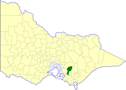
The Shire of Korumburra was a local government area located about 115 kilometres (71 mi) southeast of Melbourne, the state capital of Victoria, Australia. The shire covered an area of 613.8 square kilometres (237.0 sq mi), and existed from 1891 until 1994.

The Shire of Woorayl was a local government area about 130 kilometres (81 mi) southeast of Melbourne, the state capital of Victoria, Australia. The shire covered an area of 1,245.79 square kilometres (481.0 sq mi), and existed from 1888 until 1994.
Outtrim is a locality in Victoria, Australia. It is located south of Korumburra off the Korumburra to Wonthaggi Road and is southeast of Melbourne.

The State Coal Mine, also known as State Coal Mine Heritage Area, is a former 20th-century state-owned black coal mine located in Wonthaggi, Victoria, Australia. The mine was operational from 1910 until 1968 and is now a state park and tourist attraction.

Mena Creek is a rural locality in the Cassowary Coast Region, Queensland, Australia. In the 2021 census, Mena Creek had a population of 210 people.
References
- ↑ Phoenix Auctions History, Post Office List , retrieved 1 March 2021