Related Research Articles
The Western Freeway was a proposed controlled-access highway in Mumbai, India that would stretch from Marine Drive in South Mumbai to Kandivli in the north, a distance of 29 km. The project envisioned the construction of four major sea links over the Arabian Sea along Mumbai's western coastline to reduce traffic-congestion between the Western Suburbs and South Mumbai.

Marine ecosystems are the largest of Earth's aquatic ecosystems and exist in waters that have a high salt content. These systems contrast with freshwater ecosystems, which have a lower salt content. Marine waters cover more than 70% of the surface of the Earth and account for more than 97% of Earth's water supply and 90% of habitable space on Earth. Seawater has an average salinity of 35 parts per thousand of water. Actual salinity varies among different marine ecosystems. Marine ecosystems can be divided into many zones depending upon water depth and shoreline features. The oceanic zone is the vast open part of the ocean where animals such as whales, sharks, and tuna live. The benthic zone consists of substrates below water where many invertebrates live. The intertidal zone is the area between high and low tides. Other near-shore (neritic) zones can include mudflats, seagrass meadows, mangroves, rocky intertidal systems, salt marshes, coral reefs, lagoons. In the deep water, hydrothermal vents may occur where chemosynthetic sulfur bacteria form the base of the food web.

Tholkappia Poonga or Adyar Eco Park is an ecological park set up by the Government of Tamil Nadu in the Adyar estuary area of Chennai, India. According to the government, the project, conceived based on the master plan for the restoration of the vegetation of the freshwater ecosystems of the Coromandel Coast, especially the fragile ecosystem of the Adyar estuary and creek, was expected to cost around ₹ 1,000 million which will include the beautification of 358 acres of land. The park's ecosystem consists of tropical dense evergreen forest, predominantly comprising trees and shrubs that have thick dark green foliage throughout the year, with over 160 woody species, and comprises six vegetative elements such as trees, shrubs, lianas, epiphytes, herbs and tuberous species. The park was opened to public by Chief Minister M. Karunanidhi on 22 January 2011 and named after the renowned Tamil scholar Tholkappiar. About 65 percent of the park is covered by water and artefacts and signages. In the first 2 months of its inauguration, nearly 4,000 children from several schools in the city and the nearby Kancheepuram and Tiruvallur districts have visited the park to learn about wetland conservation, eco-restoration and water management. While the first phase of the ecopark covered about 4.16 acres of CRZ-III area, the entire area covered under the second phase falls under this category.

Ennore, also spelt Eṇṇūr, is a neighbourhood in Chennai, India. Ennore is situated on a peninsula and is bounded by the Korttalaiyar River, Ennore Creek and the Bay of Bengal. The creek separates south Ennore from the north Ennore which covers major portions of North Chennai Thermal Power Station and Ennore Port. The neighbourhood is served by Ennore railway station. Over the years Ennore has become the hub of a range of industrial projects, mainly thermal power stations, fertilizer factories, industrial ports and coal yards.

Conservation in India can be traced to the time of Ashoka, tracing to the Ashoka Pillar Edicts as one of the earliest conservation efforts in the world. Conservation generally refers to the act of carefully and efficiently using natural resources. Conservation efforts begun in India before 5 AD, as efforts are made to have a forest administration. The Ministry of Environment, Forest and Climate Change is the ministry responsible for implementation of environmental and forestry program in India, which include the management of national parks, conservation of flora and fauna of India, and pollution controls.
Bharat stage emission standards (BSES) are emission standards instituted by the Government of India to regulate the output of air pollutants from compression ignition engines and Spark-ignition engines equipment, including motor vehicles. The standards and the timeline for implementation are set by the Central Pollution Control Board under the Ministry of Environment, Forest and Climate Change.

Kalyan Airstrip was located at Nevali village, 6 km (3.7 mi) south of Kalyan railway station and 55 km (34 mi) north of Chhatrapati Shivaji Maharaj International Airport. It was the primary landing ground for the nearby city of Bombay as early as 1920, much before the airfields of Juhu and RAF Santacruz were established.
Awaaz Foundation is a charitable trust and non-governmental organisation in Mumbai, India which builds awareness, carries out advocacy, and is involved in educational projects to protect the environment and prevent environmental pollution. It has impacted many important decisions by the government and influenced policy making in important environmental matters in India. The beneficiaries of the Foundation are the citizens of India at large.
Ennore Creek is a backwater located in Ennore, Chennai along the Coromandel Coast of the Bay of Bengal. It is located in the zone comprising lagoons with salt marshes and backwaters, submerged under water during high tide and forming an arm of the sea with the opening to the Bay of Bengal at the creek. The zone is spread over 4 km2, and the creek covers an area of 2.25 km2. It is located 20 km north of the city centre and 2.6 km south of the Ennore Port; the creek area stretches 3 km into the sea and 5 km along the coast. The creek is nearly 400 m wide, elongated in northeast–southwest direction and merges with the backwater bodies. Once a flourishing mangrove swamp, the creek has been degraded to patches in the fringes mainly due to human activities in the region. The depth of the creek varies between 1 and 2 m and is shallow near the mouth. The north–south trending channels of the creek connect it with the Pulicat Lake to the north and with the distributaries of the Kosasthalaiyar River in the south. The northwestern part of the creek merges with the tidal flats. The soil in the region is loamy and alluvial. Most of the area consists of tracts of alluvial soil and the eastern region comprises beach dunes, tidal flats and creek. The creek is oriented from west to east and opens into the Bay of Bengal to the east at Ennore. The creek acts as an outlet for the excess water from the Poondi reservoir. The creek separates the town of Ennore from the Ennore Port located in the north and the Kattupalli Shipyard located further north. The North Chennai Thermal Power Station is located to the north of the creek and the Ennore Thermal Power Station is located to the south. The creek is part of the Pulicat water system, including the Pulicat lagoon and the Buckingham Canal. As per the 1991 Coastal Regulation Zone notification, the entire Pulicat water system is designated CRZ I. The creek is experiencing siltation due to emergence of the Ennore Port.
Vanashakti is a non-profit environmental NGO based in Mumbai, Maharashtra. It was formed in 2006, by Meenakshi Menon, Namita Roy Ghose, and Peter Armand Menon. Vanashakti aims to conserve the forests, wetlands, wildlife corridors, habitats, through education and litigation to achieve its objectives of creating awareness about environmental topics, protecting and reviving rivers and preventing opencast mining in areas that are well-endowed with biodiversity. It also directs its efforts in involving local forest-dwelling communities to protect the biodiversity of the region and provides sustainable livelihood options for forest dependent and coastal communities. Vanashakti's thrust areas are forest, mangrove and wetland protection, environmental education for both urban and rural schools, livelihoods for forest based communities and scientific investigation into local environmental degradation.
The Central Institute of Fisheries Technology (CIFT) is an autonomous organization established by the government of India, engaged in research related to fishing and fish processing in the country. The institute has its headquarters in Matsyapuri, Willingdon Island, Kochi and is a subsidiary of Indian Council of Agricultural Research (ICAR), New Delhi, under the Ministry of Agriculture, India.
The National Institute of Water Sports (NIWS) is designated centre under Indian Institute of Tourism and Travel Management (IITTM) which run by Tourism Ministry, India. The Institute, only one of its nature in South Asia, acts as the apex body for training, education, consultancy and research on areas related to recreational and leisure Watersports. The certification and licensing from this Institute are required for carrying out operations in water-bodies such as handling different watercraft for the tourists, swimming pools, water theme-parks etc. Some major disciplines for training and education are life saving, powerboat handling, sailing, windsurfing, water skiing, scuba diving, river rafting and kayaking. From Academic Year 2016, MBA- Tourism (Tourism & Travel) has been introduced & PhD in Tourism & Travel commenced in July 2018 at its state-of-the art campus.

Coral reefs in India are one of the most ancient and dynamic ecosystems of India. The coral reefs not only provide a sanctuary to a myriad of marine life but also play a key role in protecting the coastline from erosion. India has about 7517 km of coastline including islands but mainland coast is 6100 km.

City of Kollam or Quilon is known as Prince of Arabian Sea, situated on the banks of Arabian Sea and Ashtamudi Lake. A major portion of Kollam Municipal Corporation area is occupied by Ashtamudi Lake. It is the most visited backwater and lake of Kerala, with a unique wetland ecosystem, a palm-shaped large water body, next only to the Vembanad estuary ecosystem of the state. Ashtamudi means 'eight coned'(Ashta = 'eight'; mudi = 'coned') in the local language of Malayalam. This name is indicative of the lake's topography: a lake with multiple branches. The lake is also called the gateway to the backwaters of Kerala. This lake is extremely famous for House Boat and Backwater Resorts.
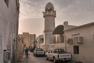
Najma is a Qatari district located in the municipality of Doha. Considered to be one of Doha's older districts, the bulk of Najma's commercial and office spaces are located along the arterial roads of Airport Street, C Ring Road and B Ring Road. The district is characterized by its high population density and its historic architecture, particularly the traditional courtyard houses, some of which date back to the 1960s.
Eco-Sensitive Zones (ESZs) or Ecologically Fragile Areas (EFAs) are areas in India notified by the Ministry of Environment, Forests and Climate Change (MoEFCC), Government of India around Protected Areas, National Parks and Wildlife Sanctuaries. The purpose of declaring ESZs is to create some kind of "shock absorbers" to the protected areas by regulating and managing the activities around such areas. They also act as a transition zone from areas of high protection to areas involving lesser protection. As per the National Wildlife Action Plan (2002-2016), issued by the Union Ministry of Environment, Forest and Climate Change, land within 10 km of the boundaries of national parks and wildlife sanctuaries are to be notified as eco-fragile zones or Eco-sensitive Zones.

Dharmveer Swarajya Rakshak Chhatrapati Sambhaji Maharaj Coastal Road is an 8-lane, 29.2-km long grade separated expressway along Mumbai's western coastline connecting Marine Lines in the south to Kandivali in the north. It is projected to be used by 130,000 vehicles daily, and is expected to reduce travel time between South Mumbai and the Western Suburbs from 2 hours to only 40 minutes. The estimated cost of the project is ₹13,060 crore (US$1.6 billion). Its first phase, which was inaugurated on 11 March 2024, is a 10.58 km section from Princess Street flyover to the Worli end of the Bandra–Worli Sea Link.

On 8 May 2019, the Supreme Court of India ordered five apartments in Maradu municipality in Kerala to be demolished within one month, for violation of Coastal Regulation Zone (CRZ) rules, although only four of these apartments had yet been constructed. These four, already occupied by tenants, were Jains Coral Cove, H2O Holy Faith and Alfa Serene and Golden Kayaloram. The fifth builder, Holiday Heritage, had scrapped the project.

A hapua is a river-mouth lagoon on a mixed sand and gravel (MSG) beach, formed at the river-coast interface where a typically braided, although sometimes meandering, river interacts with a coastal environment that is significantly affected by longshore drift. The lagoons which form on the MSG coastlines are common on the east coast of the South Island of New Zealand and have long been referred to as hapua by Māori people. This classification differentiates hapua from similar lagoons located on the New Zealand coast termed waituna.
Puri International Airport is a proposed international airport in the Indian state Odisha, which will primarily serve the Puri region. The airport will be built in public private partnership (PPP) mode near Sipasarubali and Sandhapur areas under Brahmagiri tehsil in Puri district. It will be developed in three phases at an estimated cost of Rs 5,631 crore. A six-lane, high-speed corridor between Biju Patnaik International Airport and proposed greenfield airport will also be built. This will shorten the travel time to 30 minutes. The location of the airport was chosen due to its close proximity to Puri and its famous Jagannath Temple and other tourist attractions. Spread over an area of 1,164 acres, Puri Airport will be operated as the first airport in the Puri city and the second international airport in Odisha. The Fairfax group, Adani Group and GMR Group expressed interest in developing the greenfield airport in April 2024.
References
- 1 2 "Environment Ministry notifies CRZ Regulations 2019; replaces CRZ norms of 2011". jagranjosh.com. 23 January 2019. Retrieved 6 September 2020.
- ↑ Aggarwal, Mayank. "Government amends coastal zone rules to give relief to projects". Livemint. Retrieved 6 September 2020.
- ↑ "MINISTRY OF ENVIRONMENT & FORESTS". envfor.nic.in. Archived from the original on 29 December 2016. Retrieved 12 January 2017.
- 1 2 3 "Coastal Regulation Zone Notification: What development are we clearing our coasts for". DownToEarth. Retrieved 4 September 2020.
- ↑ "Environment Ministry frames new draft Coastal Regulation Zone Notification". Press Information Bureau. Retrieved 6 September 2020.
- ↑ "Cabinet clears coastal regulation zone notification". Indian Express . 29 December 2018. Retrieved 6 September 2020.
- ↑ Sudhi, K. S. (23 January 2019). "Ministry notifies new CRZ norms". The Hindu . Retrieved 6 September 2020.
- ↑ "Cabinet approves Coastal Regulation Zone (CRZ) Notification 2018". Press Information Bureau. Retrieved 6 September 2020.