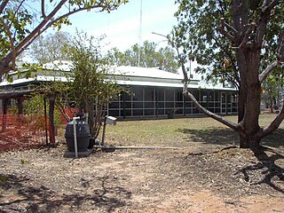
Welford is a national park in Central West Queensland, Australia, 991 km west of Brisbane. It is located 30km to the South-east of Jundah. The park was established in 1994 to protect the biodiversity of the Mulga Lands, Mitchell Grass Downs and Channel Country bioregions. The southern border is marked by the Barcoo River.

Redfern is an inner southern suburb of Sydney located 3 kilometres (1.9 mi) south of the Sydney central business district and is part of the local government area of the City of Sydney. Strawberry Hills is a locality on the border with Surry Hills. The area experienced the process of gentrification and is subject to extensive redevelopment plans by the state government, to increase the population and reduce the concentration of poverty in the suburb and neighbouring Waterloo.

Colac is a small city in the Western District of Victoria, Australia, approximately 150 kilometres south-west of Melbourne on the southern shore of Lake Colac.

The Cooper Creek is a river in the Australian states of Queensland and South Australia. It was the site of the death of the explorers Burke and Wills in 1861. It is sometimes known as the Barcoo River from one of its tributaries and is one of three major Queensland river systems that flow into the Lake Eyre basin. The flow of the creek depends on monsoonal rains falling months earlier and many hundreds of kilometres away in eastern Queensland. It is 1,300 kilometres (810 mi) in length.

Ararat is a town in south-west Victoria, Australia, about 198 kilometres (120 mi) west of Melbourne, on the Western Highway on the eastern slopes of the Ararat Hills and Cemetery Creek valley between Victoria's Western District and the Wimmera. Its urban population according to 2021 census is 8,500 and services the region of 11,880 residents across the Rural City's boundaries. It is also the home of the 2018/19 GMGA Golf Championship Final.

Penshurst is a town in Victoria, Australia. It is in the Shire of Southern Grampians local government area and is located at the foot of Mount Rouse, an extinct volcano. At the 2006 census, Penshurst had a population of 461. Basic facilities include a hospital with an aged care residency and doctor's surgery, a pub, a hall and two schools – one a State school, the other a Catholic school – the State school has 10 students(2020), the Catholic school 26.

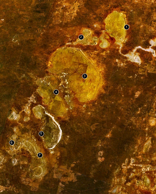
The Willandra Lakes Region is a World Heritage Site in the Murray region of New South Wales, Australia. The Willandra Lakes Region is the traditional meeting place of the Muthi Muthi, Ngiyampaa and Barkinji Aboriginal tribes. The 240,000-hectare (590,000-acre) area was inscribed on the World Heritage List at the 5th Session of the World Heritage Committee in 1981.
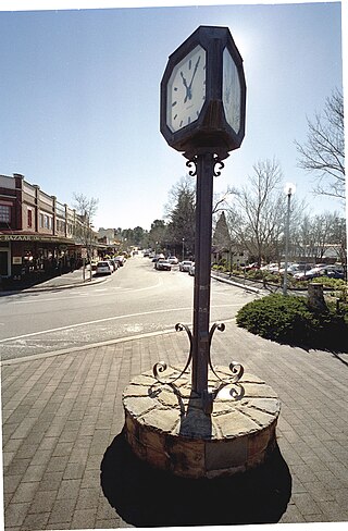
Charlestown is a suburb of the City of Lake Macquarie, New South Wales, Australia, and the largest suburb in Lake Macquarie and in the Greater Newcastle area. It is approximately 10 kilometres (6 mi) west-south-west of the central business district of Newcastle.

Wentworth Falls is a town in the Blue Mountains region of New South Wales, situated approximately 100 kilometres (62 mi) west of the Sydney central business district, and about 8 kilometres (5.0 mi) east of Katoomba, Australia on the Great Western Highway, with a Wentworth Falls railway station on the Main Western line. The town is at an elevation of 867 metres (2,844 ft) AHD . At the 2016 census, Wentworth Falls had a population of 6,076.
Wembley is a western suburb of Perth, Western Australia, located within the Town of Cambridge. Its postcode is 6014.

Coranderrk was an Aboriginal reserve run by the Victorian government between 1863 and 1924, located around 50 kilometres (31 mi) north-east of Melbourne. The residents were mainly of the Woiwurrung, Bunurong and Taungurung peoples, and the first inhabitants chose the site of the reserve.

Wallaga Lake is an estuarine lake in Bega Valley Shire in New South Wales, Australia, the largest lake in southern NSW. It is located between Bermagui to the south and between Tilba Tilba to the north, situated beneath Mount Gulaga, in the traditional lands of the Yuin people. A large section of its foreshore and catchment are within the Gulaga National Park, since Wallaga Lake National Park, Goura Nature Reserve, and Mt Dromedary Flora Reserve were combined into the larger national park. There is an island in the lake known as Merriman's Island, Merriman Island or Umbarra.

The Tirari Desert is a 15,250 square kilometres (5,888 sq mi) desert in the eastern part of the Far North region of South Australia. It stretches 212 km from north to south and 153 km from east to west.
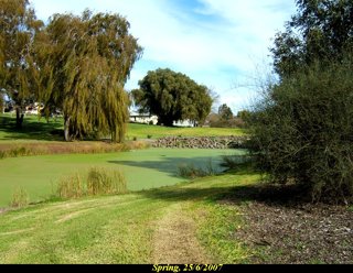
Lake Condah, also known by its Gunditjmara name Tae Rak, is in the Australian state of Victoria, about 324 kilometres (201 mi) west of Melbourne and 20 kilometres (12 mi) north-east of Heywood by road. It is in the form of a shallow basin, about 4 kilometres (2.5 mi) in length and 1 kilometre (0.62 mi) wide.
Glencoe is a town in South Australia, Australia, located 27 kilometres (17 mi) north-west of Mount Gambier.

Shorne Woods Country Park is located between Strood and Gravesend, in the English county of Kent. It was once part of a large estate, later passed to the county council to be used as a country park.

Cobham services is a motorway service area on the M25 motorway in Surrey between junctions 9 and 10. It is operated by Extra MSA and was opened for business on 13 September 2012. Its planned opening date was scheduled to be early 2010, but was changed to early 2012 following various planning issues. The services were constructed as there was concern with the large 65 mile (104 km) gap without any service areas. At either end of that stretch of motorway was South Mimms services and Clacket Lane services, and the Secretary of State explained there was a clear and compelling need for a further service area. The other service area serving the motorway is Thurrock.

South West Queensland is a remote region in the Australian state of Queensland which covers 319,808 km2 (123,479 sq mi). The region lies to the south of Central West Queensland and west of the Darling Downs and includes the Maranoa district and parts of the Channel Country. The area is noted for its cattle grazing, cotton farming, opal mining and oil and gas deposits.
Pinny Beach is a gazetted suburb of the City of Lake Macquarie. It was created on 5 May 2006 following amendments to the boundaries of surrounding suburbs. It is located on the Swansea Peninsula and is to the east of Lake Macquarie, south of the Pacific Ocean entrance channel at Swansea in New South Wales, Australia. It is part of the City of Lake Macquarie local government area.
Evelyn Creek is a tree lined creek in northwestern New South Wales that flows through Milparinka. The creek begins in a series of gullies south west of Tibooburra and flows generally south to Cobham Lake.


