External links
- "Coed Rheidol". Countryside Council for Wales Landscape & wildlife. Archived from the original on 5 November 2011. Retrieved 1 April 2012.
Coordinates: 52°23′00″N3°51′42″W / 52.3834°N 3.8617°W
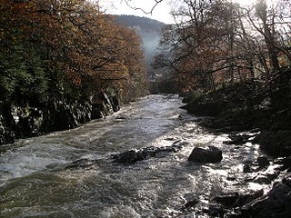
Coed Rheidol National Nature Reserve forms part of the long ribbon of woodland adjoining the Afon Mynach and Afon Rheidol around the lower slopes of hills near Devil's Bridge, Ceredigion.
At the bottom of the gorge the woods take on an ancient appearance with their steep rocky slopes and gnarled trees dripping with moss. One of the most spectacular landscapes in Wales, fantastic views of the Rheidol waterfall and valley can be enjoyed at the top of this reserve.
Coordinates: 52°23′00″N3°51′42″W / 52.3834°N 3.8617°W

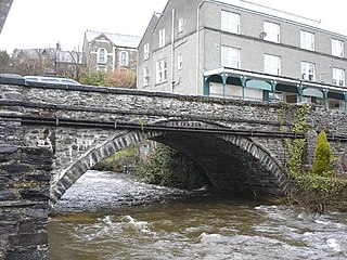
Devil's Bridge is a village and community in Ceredigion, Wales. Above the River Mynach on the edge of the village is the unusual road bridge from which the village gets its English name.

The River Conwy is a river in north Wales. From its source to its discharge in Conwy Bay it is 55 kilometres (34 mi) long and drains an area of 678 square km. "Conwy" was formerly Anglicised as "Conway."

The Afon Mawddach is a river in Gwynedd, Wales, which has its source in a wide area SH820300 north of Dduallt in Snowdonia. It is 28 miles (45 km) in length, and is much branched; many of the significant tributaries are of a similar size to the main river. The catchment area is bounded to the east by the Aran Fawddwy massif and to the west and north by the Harlech dome which forms a watershed just south of Llyn Trawsfynydd.

The River Ystwyth is a river in Ceredigion, Wales. The length of the main river is 20.5 miles (33.0 km). Its catchment area covers 75 square miles (190 km2). Its source is a number of streams that include the Afon Diliw, located on the west slopes of Plynlimon on the border of Ceredigion and Powys in the Cambrian Mountains. The Ystwyth flows westwards before its confluence with the Afon Rheidol and the estuary at Aberystwyth to drain into Cardigan Bay.

The Desert of Wales, or Green Desert of Wales, is a large area in central Wales, so called because of its lack of roads and towns and its inaccessibility. The term was invented by English travel writers in the nineteenth century and has no equivalent in the Welsh language. The area corresponds roughly to the upland area called Elenydd in Welsh and also referred to locally as the Cambrian Mountains.

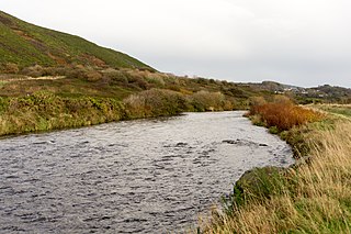
The Afon Rheidol is a river in Ceredigion, Wales, 19 miles (31 km) in length. The source is Plynlimon, the largest watershed in Wales with a catchment area covering 73 square miles (189 km2). Receiving an average annual rainfall of 40 inches (1015 mm) Plynlimon is the source of both the Wye and the Severn.

River Llugwy is a tributary of the River Conwy, and has its source at Ffynnon Llugwy, a lake in the Carneddau range of mountains in Snowdonia in north-west Wales.

The River Dyfi, sometimes anglicised to River Dovey, is an approximately 30 mi (48 km) long river in Wales.

The Afon Lledr is a river in north-west Wales and the second major tributary of the River Conwy. It is about 10 miles or 16 km long, and flows in a generally easterly direction.

The Afon Crafnant is a tributary of the River Conwy, which is the main river of the Conwy valley in north-west Wales.

River Machno is a river in Snowdonia in north-west Wales. It is the first major tributary of the River Conwy, which it joins south of Betws-y-coed, past the Pandy Falls and the Machno Falls.

The River Artro is a river in Gwynedd, Wales.

The Afon Mynach is a small river in Ceredigion, Wales.
Coed Gorswen National Nature Reserve lies on the lower slopes of the Conwy Valley, in the vicinity of Rowen and Llanbedr-y-Cennin.
Nant Irfon National Nature Reserve is a national nature reserve located high in the hills above the Afon Irfon valley near the village of Abergwesyn in Powys, Wales. It is surrounded by vast moorlands and striking conifer forests. Its steep slopes and rocky crags are covered with oak woodland, which is some of the highest in Wales. In late spring, swathes of bluebells transform the woodland floor.

Afon Irfon is a river in Powys, Wales. It flows from the upper slopes of Bryn Garw in the Cambrian Mountains, through the Abergwesyn Valley, past the Nant Irfon National Nature Reserve in the hills above the village of Abergwesyn, and through Llanwrtyd Wells to its confluence with the River Wye at Builth Wells. The source of the Irfon is in the so-called 'Desert of Wales'.
Afon Rheidol ger Capel Bangor is a Site of Special Scientific Interest in Ceredigion, west Wales.

Melindwr is a community in the county of Ceredigion, Wales, to the east of Aberystwyth and is 71.6 miles (115.1 km) from Cardiff and 173.8 miles (279.7 km) from London. In 2011 the population of Melindwr was 1070 with 54.7% of them able to speak Welsh.

Goginan is a small village in Ceredigion, about 7 miles outside Aberystwyth on the A44 between Ponterwyd and Capel Bangor. The Afon Melindwr runs through the village, and is a tributary of the Afon Rheidol.