
The Cairngorm Mountain Railway, which opened in 2001, is the highest railway in the United Kingdom. The two-kilometre long funicular ascends the northern slopes of Cairn Gorm, the United Kingdom's sixth-highest mountain, serving the Cairngorm Mountain ski resort. The route and ski area are located within the Cairngorms National Park, the largest National Nature Reserve in Britain, located near Aviemore in the Highland area of Scotland. It is a Doppelmayr 120-SSB funicular railway.

The Cairngorms are a mountain range in the eastern Highlands of Scotland closely associated with the mountain Cairn Gorm. The Cairngorms became part of Scotland's second national park on 1 September 2003. Although the Cairngorms give their name to, and are at the heart of, the Cairngorms National Park, they only form one part of the national park, alongside other hill ranges such as the Angus Glens and the Monadhliath, and lower areas like Strathspey.

Cairngorms National Park is a national park in northeast Scotland, established in 2003. It was the second of two national parks established by the Scottish Parliament, after Loch Lomond and The Trossachs National Park, which was set up in 2002. The park covers the Cairngorms range of mountains, and surrounding hills. Already the largest national park in the United Kingdom, in 2010 it was expanded into Perth and Kinross.
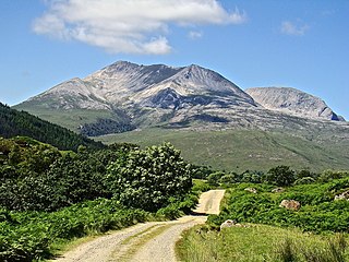
Beinn Eighe is a mountain massif in the Torridon area of Wester Ross in the Northwest Highlands of Scotland. Lying south of Loch Maree, it forms a long ridge with many spurs and summits, two of which are classified as Munros: Ruadh-stac Mòr at 1,010 m (3,314 ft) and Spidean Coire nan Clach at 993 m (3,258 ft). Unlike most other hills in the area it has a cap of Cambrian basal quartzite which gives the peaks of Beinn Eighe a distinctive light colour. Its complex topography has made it popular with both hillwalkers and climbers and the national nature reserve on its northern side makes it an accessible mountain for all visitors.

Cairn Gorm is a mountain in the Scottish Highlands. It is part of the Cairngorms range and wider Grampian Mountains. With a summit elevation of 1,244.8 m (4,084 ft) above sea level, Cairn Gorm is classed as a Munro and is the sixth-highest mountain in the British Isles. The high, broad domed summit overlooking Strathspey is one of the most readily identifiable mountains from the nearby town and regional centre of Aviemore. Although it shares its name with the Cairngorm mountains, Ben Macdui is the highest mountain in the range.

Ben Macdui is the second-highest mountain in Scotland and all of the British Isles, after Ben Nevis, and the highest of the Cairngorm Mountains. The summit is 1,309 metres (4,295 ft) above sea level and it is classed as a Munro. Ben Macdui is situated on the southwestern edge of the Cairngorm plateau, overlooking the Lairig Ghru pass to the west, and Loch Etchachan to the east. It lies on the boundary between the historic counties of Aberdeenshire and Banffshire.
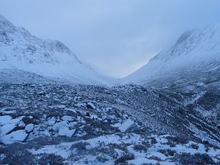
The Lairig Ghru is one of the mountain passes through the Cairngorms of Scotland. The route and mountain pass partially lies on the Mar Lodge Estate.

Braeriach or Brae Riach is the third-highest mountain in Scotland and all of the British Isles, after Ben Nevis and Ben Macdui, rising 1,296 metres (4,252 ft) above sea level. It is in the Scottish Highlands and is the highest point in the western massif of the Cairngorms, separated from the central section by the Lairig Ghru pass. The summit is a crescent-shaped plateau, overlooking several corries.
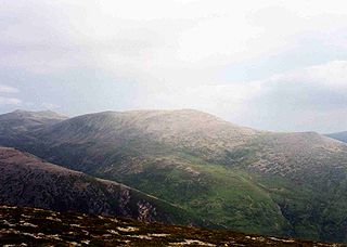
Derry Cairngorm is a Scottish mountain in the Cairngorms range, 14 kilometres (8.7 mi) north west of Braemar in the county of Aberdeenshire.
Cairngorm or Cairngorms may refer to:

Corrie Fee is a glacier-carved corrie situated at the head of Glen Clova in the Angus Glens of Scotland. It forms part of Corrie Fee National Nature Reserve (NNR), which is managed by NatureScot and lies within the Cairngorms National Park. The adjoining Corrie Sharroch and the slopes of Craig Rennet are also included in the NNR.

Long-lying snow patches in Scotland have been noted from at least the 18th century, with snow patches on Ben Nevis being observed well into summer and autumn. Indeed, the summit observatory, which operated from 1883 to 1904, reported that snow survived on the north-east cliffs through more years than it vanished.

Beinn a' Chaorainn is a Scottish mountain situated on the northern side of Glen Spean in the Lochaber region of the Highland Council area. The mountain which is located 30 km east-northeast of Fort William is one of several of the same name in the Scottish Highlands and should not be confused with another well known Beinn a' Chaorainn in the Cairngorms.
The Lairig Club, commonly referred to as "The Lairig" is the University of Aberdeen’s Mountaineering Club and was founded in the early 1940s. Members take part in a wide range of activities from hillwalking and sport climbing right through to winter climbing, Ski touring and alpinism. Due to the university calendar and its close proximity to reliable venues winter mountaineering is the main focus of the club along with hillwalking. Over the winter season the club prides itself as being one of the most active university mountaineering clubs in the UK and works with the mission statement: "To give the opportunity to participate in, and develop the skills for, safe mountaineering in all conditions." The club has a long and distinguished history painted by famous names such as Tom Patey and Andy Nisbet, two of Scotland's most prolific new routers, who learnt their trade in the Lairig.

Adam Watson, FRSE, FRSB, FINA, FRMS, FCEH was a Scottish biologist, ecologist and mountaineer. He was one of the most recognisable scientific figures in Scotland due to his many appearances on TV and radio. His large academic output and contributions to the understanding of the flora and fauna in Scotland and elsewhere have been internationally recognised. Dr Watson was widely acknowledged as Scotland's pre-eminent authority on the Cairngorms mountain range.
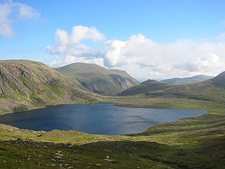
Loch Etchachan is a remote freshwater loch set deep within the central Cairngorms plateau, in the Cairngorms National Park, located in the eastern Highlands of Scotland. It is the highest waterbody of its size in the UK, the surface being 927 metres (3,041 ft) above sea level. However, the highest named bodies of water in the UK are Loch Coire an Lochain, which lies 6km to the west of Loch Etchachan on the opposite side of the Lairig Ghru, and Lochan Buidhe, which lies between Cairn Lochan and Ben Macdui.
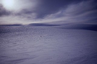
The Cairngorm Plateau disaster, also known as the Feith Buidhe disaster, occurred in November 1971 when six fifteen-year-old Edinburgh school students and their two leaders were on a two-day navigational expedition in a remote area of the Cairngorms in the Scottish Highlands.

The Lairig an Laoigh is a mountain pass through the Highlands of Scotland. In speech and sometimes in writing the name is reduced to "Lairig Laoigh". It is of glacial origin, dissecting the Cairngorm plateau, and it runs roughly north–south from Speyside to Deeside at one time being used as a drove road. Between the public road in the Abernethy Forest and the one at Linn of Dee the trekking distance is 31 kilometres (19 mi).
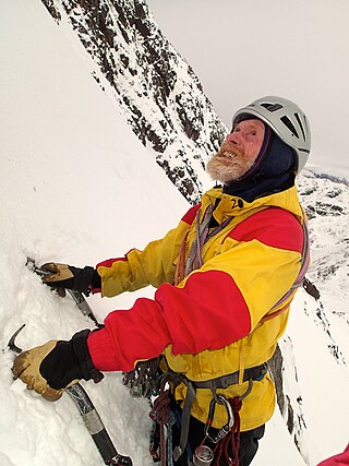
Andrew Nisbet was a Scottish mountaineer, mountain guide, climbing instructor, and editor of climbing guidebooks. Regarded as a pioneer of mixed rock and ice climbing techniques, he built a 45-year reputation as an innovator by developing over 1,000 new winter climbing routes in Scotland, of which 150 were at Grade V, or above.

Beinn Mheadhoin or Beinn Meadhain is a mountain in the Highlands of Scotland. It is a Munro with a height of 1,182 metres (3,878 ft) and by some counts it is the twelfth-highest mountain of Great Britain. It lies in the very heart of the Cairngorm mountains, and is one of the most remote in the region. Beinn Mheadoin is surrounded by deep glens and mountain lakes, including Loch A'an, Loch Etchachan and the Dubh Lochan.


