| Col Collon | |
|---|---|
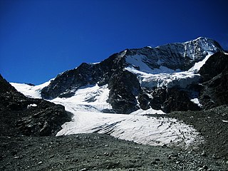
View from the top | |
| Elevation | 3,074 m (10,085 ft) |
| Traversed by | Glacier |
| Location | Switzerland - Italy |
| Range | Pennine Alps |
| Coordinates | 45°57′38″N7°30′51″E / 45.96056°N 7.51417°E Coordinates: 45°57′38″N7°30′51″E / 45.96056°N 7.51417°E |
 Location in the Alps | |
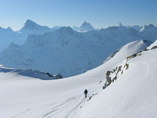
Col Collon (el. 3074 m.) is a high mountain pass across the central Pennine Alps, connecting Arolla in the Swiss canton of Valais to Bionaz in the Italian region of Aosta Valley.

A mountain pass is a navigable route through a mountain range or over a ridge. Since many of the world's mountain ranges have presented formidable barriers to travel, passes have played a key role in trade, war, and both human and animal migration throughout Earth's history. At lower elevations it may be called a hill pass. The highest vehicle-accessible pass in the world appears to be Mana Pass, located in the Himalayas on the border between India and Tibet, China.

The Pennine Alps, also known as the Valais Alps, are a mountain range in the western part of the Alps. They are located in Switzerland (Valais) and Italy.

The Alps are the highest and most extensive mountain range system that lies entirely in Europe, separating Southern from Central and Western Europe and stretching approximately 1,200 kilometres (750 mi) across eight Alpine countries : France, Switzerland, Italy, Monaco, Liechtenstein, Austria, Germany, and Slovenia. The mountains were formed over tens of millions of years as the African and Eurasian tectonic plates collided. Extreme shortening caused by the event resulted in marine sedimentary rocks rising by thrusting and folding into high mountain peaks such as Mont Blanc and the Matterhorn. Mont Blanc spans the French–Italian border, and at 4,810 m (15,781 ft) is the highest mountain in the Alps. The Alpine region area contains about a hundred peaks higher than 4,000 metres (13,000 ft).
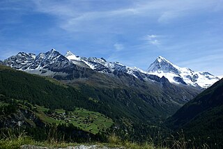
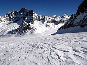
The pass is located on the border at the southern tip of the Arolla Glacier, south of Mont Collon.

The Arolla Glacier is a 4 km (2.5 mi) long glacier (2005) situated in the Pennine Alps in the canton of Valais in Switzerland. In 1973 it had an area of 13.17 km2 (5.08 sq mi).

Mont Collon is a mountain of the Swiss Pennine Alps in the canton of Valais. Its glaciated north face dominates the view south from the village of Arolla.