Alpes-Maritimes is a department of France located in the country's southeast corner, on the Italian border and Mediterranean coast. Part of the Provence-Alpes-Côte d'Azur region, it encompasses the French Riviera alongside neighbouring Var. Alpes-Maritimes had a population of 1,094,283 in 2019. Its prefecture is Nice, with Grasse as the sole subprefecture.

Provence-Alpes-Côte d'Azur, also known as Région Sud, is one of the eighteen administrative regions of France, the far southeastern on the mainland. Its prefecture and largest city is Marseille.

The Col du Galibier is a mountain pass in the southern region of the French Dauphiné Alps near Grenoble. It is the eighth highest paved road in the Alps, and recurrently the highest point of the Tour de France.
Col de Tende is a high mountain pass in the Alps, close to the border between France and Italy, although the highest section of the pass is wholly within France.

The Ligurian Alps are a mountain range in northwestern Italy. A small part is located in France. They form the south-western extremity of the Alps, separated from the Apennines by the Colle di Cadibona. The Col de Tende and the Vermenagna valley separate them from the Maritime Alps. They form the border between Piedmont in the north and Liguria in the south.

L'Escarène is a commune in the Alpes-Maritimes department in the southeastern Provence-Alpes-Côte d'Azur region in France. In 2020, it had a population of 2,562.

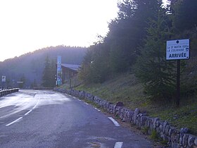
The Col de Turini is a high mountain pass in the Alps in the department of Alpes-Maritimes in France, situated entirely in the Arrondissement of Nice. The road connects Lantosque in the commune La Bollène-Vésubie, with Sospel in the commune Moulinet. It is the major road link between the river valley of the Vésubie and the Bévéra valley. It is notorious for its many hairpins and scenic landscapes.

Tende is a commune in the Alpes-Maritimes department in southeastern France.

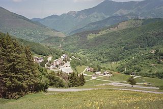
Saint-Martin-Vésubie is a commune of the Alpes-Maritimes department, Provence-Alpes-Côte d'Azur region in Southeastern France. Established on the edge of a glacial plate, it had a population of 1,327 in 2008. It was named after the Vésubie, a local river.

Col de la Bonette is a high mountain pass in the French Alps, near the border with Italy. It is situated within the Mercantour National Park on the border of the departments of Alpes-Maritimes and Alpes-de-Haute-Provence. The road over the col is the seventh highest paved road in the Alps.

The Route des Grandes Alpes is a tourist itinerary through the French Alps between Lake Geneva and the French Riviera passing over all the high passes of the Alps within France.

Col de la Cayolle is a high mountain pass in the French Alps at the border between the departments of Alpes-Maritimes and Alpes-de-Haute-Provence in France.

Col des Champs is a high mountain pass in the Alps at the border between the departments of Alpes-de-Haute-Provence and Alpes-Maritimes in France. It connects Saint-Martin-d'Entraunes and Colmars, joining the valleys of the Var River and the Verdon River.

Col du Granon is a high mountain pass in the Alps in the department of Hautes-Alpes in France. A narrow tarmac road winds steeply up the southern approach. Gravel roads continue beyond the pass, in a military training zone.

Berre-les-Alpes is a rural commune in the Alpes-Maritimes department in the southeastern Provence-Alpes-Côte d'Azur region in France. In 2020, it had a population of 1,236.

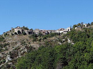
Bairols is a commune in the Alpes-Maritimes department in the Provence-Alpes-Côte d'Azur region of south-eastern France.

Andon is a commune in the Alpes-Maritimes department in the Provence-Alpes-Côte d'Azur region of southeastern France.

Saint-Martin-d'Entraunes is a commune in the Alpes-Maritimes department in southeastern France. It is located in the middle stretches of the Var valley, situated at the limits of the Mercantour National Park.
Le Mas is a commune in the Alpes-Maritimes department in the Provence-Alpes-Côte d'Azur region of South-eastern France.

The France–Italy border is 515 km long. It runs from the Alps in the north, a region in which it passes over Mont Blanc, down to the Mediterranean coast in the south. Three national parks are located along the border: Vanoise National Park and Mercantour National Park on the French side and Gran Paradiso National Park on the Italian side.