
The Jura Mountains are a sub-alpine mountain range a short distance north of the Western Alps and mainly demarcate a long part of the French–Swiss border. While the Jura range proper is located in France and Switzerland, the range continues as the Table Jura northeastwards through northern Switzerland and Germany.
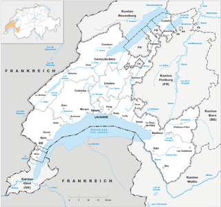
Vaud, more formally the canton of Vaud, is one of the 26 cantons forming the Swiss Confederation. It is composed of ten districts and its capital city is Lausanne. Its flag bears the motto "Liberté et patrie" on a white-green background.
Col de la Croix is the name of the following passes:

Argis is a commune in the Ain department in the Auvergne-Rhône-Alpes region of eastern France.

Divonne-les-Bains, popularly known as Divonne, is a commune in the Ain department in the Auvergne-Rhône-Alpes region in Eastern France. In 2018, it had a population of 9,788.

Mijoux is a commune and village in the Ain department in eastern France.

The Alps form a large mountain range dominating Central Europe, including parts of Italy, France, Switzerland, Liechtenstein, Austria, Slovenia, Germany and possibly Hungary.

La Dôle is a mountain of the Jura, overlooking Lake Geneva in the westernmost part of the canton of Vaud. Rising to an altitude of 1677 meters, it is the second highest peak in the Swiss portion of the Jura, after Mont Tendre. Administratively, the summit is split between the municipalities of Gingins, Chéserex and La Rippe. The mountain is also close to and easily accessible from Saint-Cergue and the Col de la Givrine to the north, both above 1000 meters and connected to Nyon on Lake Geneva by road and by the Nyon–St-Cergue–Morez Railway. A paved road also climbs to the Chalet de la Dôle below the summit from Gingins.

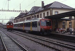
The Nyon–St-Cergue–Morez Railway (NStCM), French: Chemin de fer Nyon–Saint-Cergue–Morez, is a narrow gauge railway in western Switzerland which nowadays operates between Nyon, on the northern shore of Lake Geneva and the French border at La Cure, the La Cure–Morez section having closed in 1958. The railway reaches a height of 1,228 metres above sea level at the Col de la Givrine and it is the highest in the Jura Mountains.

Col des Montets is a mountain pass in the French Alps in the Haute-Savoie department of France. It is on the road between Chamonix, the Swiss Col de la Forclaz and Martigny in the canton of Valais, Switzerland.
The Route nationale 5, or RN 5, is a trunk road (nationale) in France now connecting Dijon with the frontier of Switzerland. It is also numbered the European route E21.

Col de Pierre Pertuis is a mountain pass in the Jura Mountains in the canton of Bern in Switzerland.

Col du Mont d'Orzeires is a high mountain pass in the Jura Mountains in the canton of Vaud in Switzerland.

Col de la Faucille is a high mountain pass in the department of Ain in the French Jura Mountains. It connects the town of Gex in Ain to the towns of Les Rousses and Saint-Claude in the department of Jura.

Mont Tendre is a mountain of the Jura, located between the valley of Joux and the basin of Lake Geneva in the canton of Vaud. With an elevation of 1,679 metres above sea level, it is the highest summit of the Swiss portion of the Jura Mountains and, therefore, the highest summit of Switzerland outside the Alps. It is also the most isolated mountain of the canton. It is found in the community of Montricher.
The France–Switzerland border is 572 km (355 mi) long. Its current path is mostly the product of the Congress of Vienna of 1815, with the accession of Geneva, Neuchâtel and Valais to the Swiss Confederation, but it has since been modified in detail, the last time being in 2002. Although most of the border, marked with border stones, is unguarded, several checkpoints remain staffed, most notably on busy roads.

Le Noirmont is a mountain of the Jura, located north of Saint-Cergue in the canton of Vaud. At 1,567 metres, it is the highest mountain between the Col de la Givrine and Mont Tendre. Although Le Noirmont is wholly in Switzerland, the border with France runs on the western base of the mountain.
The Neuchâtel–Le Locle-Col-des-Roches railway is a single-track standard-gauge line of the Swiss Federal Railways (SBB).

