The Vosges are a range of medium mountains in Eastern France, near its border with Germany. Together with the Palatine Forest to the north on the German side of the border, they form a single geomorphological unit and low mountain range of around 8,000 km2 (3,100 sq mi) in area. It runs in a north-northeast direction from the Burgundian Gate to the Börrstadt Basin, and forms the western boundary of the Upper Rhine Plain.

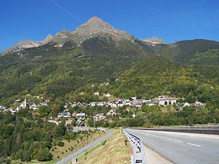
Col du Tourmalet is one of the highest paved mountain passes in the French Pyrenees, in the department of Hautes-Pyrénées. Sainte-Marie-de-Campan is at the foot on the eastern side and the ski station La Mongie two-thirds of the way up. The village of Barèges lies on the western side, above the town of Luz-Saint-Sauveur.
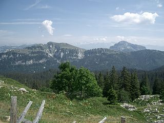
The Chartreuse Mountains are a mountain range in southeastern France, stretching from the city of Grenoble in the south to the Lac du Bourget in the north. They are part of the French Prealps, which continue as the Bauges to the north and the Vercors to the south.

The Vercors Massif is a range in France consisting of rugged plateaus and mountains straddling the départements of Isère and Drôme in the French Prealps. It lies west of the Dauphiné Alps, from which it is separated by the rivers Drac and Isère. The cliffs at the massif's eastern limit face the city of Grenoble.

Gap is the prefecture of the department of Hautes-Alpes, in the region of Provence-Alpes-Côte d'Azur, Southeastern France. In 2019, the commune had a population of 40,631, making it the most populated city in Hautes-Alpes. At a height of 750 metres above sea level, to the south of the Écrins Massif, it is also France's highest prefecture.
L'Étape du Tour de France is an organised mass participation cyclosportive that allows amateur cyclists to race over the same route as a Tour de France stage. First held in 1993, and now organised by the Amaury Sport Organisation (ASO), it takes place each July, normally on a Tour rest day.

The Maritime Gendarmerie is a component of the French National Gendarmerie under operational control of the chief of staff of the French Navy. It employs 1,157 personnel and operates around thirty patrol boats and high-speed motorboats distributed on the littoral waterways of France. Like their land-based colleagues the Gendarmes Maritime are military personnel carry out policing operations in addition to their primary role as a coast guard service. They also carry out provost duties within the French Navy.
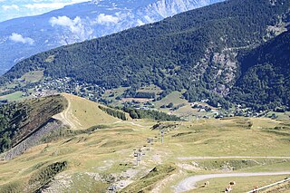
La Marmotte is an annual, one-day cyclosportive event in France for amateur cyclists. It is named after the large ground squirrel that is known to inhabit the slopes of the final climb to the finish in Alpe d'Huez. The first event held in 1982 makes it one of the oldest cyclosportive events of its kind and in France it is often called La Doyenne, borrowing the nickname given to the professional road race Liège–Bastogne–Liège. The Marmotte remains one of the most popular cyclosportive events today in Europe, with interest in participation exceeding the 7000 places available.
Allemond is a commune in the Isère department in the Auvergne-Rhône-Alpes region of south-eastern France.

Entremont-le-Vieux is a commune in the Savoie department in the Auvergne-Rhône-Alpes region in Southeastern France. In 2019, it had a population of 644.

Pachnoda is a genus of beetles from the subfamily Cetoniinae with nearly all of the species living in Africa. The limit of the genus is given by the presence of internal lobes in their aedeagi.
Alpe du Grand Serre is a ski resort located in the French Dauphine Alps in Isère département, upon the commune of La Morte, sitting at 1368m. The village itself is located at the summit of a mountain pass at the gates of the Oisans valley, between the Romanche valley and the Roizonne valley. Neighbouring mountains are the Taillefer (2857m) and the Grand Serre summit (2141m). It remains a small mountain village with traditional alpine buildings and atmosphere. Thus, it is mostly visited by local people and families from the Grenoble urban area.
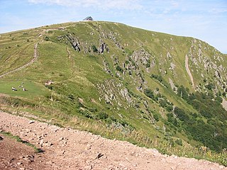
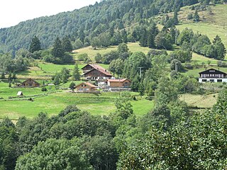
The Hohneck is, at 1,363 m (4,472 ft) the third highest summit of the Vosges Mountains and the highest point of Lorraine. On its summit stands a mountain hut, clearly visible in the distance. Nearby the mountain's top is located the ski resort of La Bresse Hohneck.
Roger Naviaux was a French entomologist known for his work on beetles.

The Pertús pass is one of the passes that allow you to cross the Pyrenees. At only 290 m above sea level, it connects the Catalan regions of Alt Empordà and Vallespir. It constitutes the western end of the Albera mountain range.

The Col de Puymorens is a mountain pass in the French Pyrenees, connecting Foix to Cerdagne. Its summit is 1,915m.
Alexandre Pierret was a French entomologist who specialised in Lepidoptera. He was a Member of the Société Entomologique de France

Zawiyet Sidi Boumerdassi or Zawiyet Ouled Boumerdès is a zawiya located within Boumerdès Province in Algeria.

The Battle of the Col des Beni Aïcha (1846) or Battle of Thénia (1846), which broke out on 3 February 1846, was a battle of the French conquest of Algeria between the Algerian rebels, and the France, which was the colonial power in the region since 1830.
