This article needs additional citations for verification .(August 2019) |
![]() | |
Continent | Europe |
---|---|
Region | Western Europe |
Coordinates | 48°51′N2°21′E / 48.850°N 2.350°E |
Area | Ranked 42nd |
• Total | 643,801 km2 (248,573 sq mi) |
• Land | 99.48% |
• Water | 0.52% |
Coastline | 5,500 km (3,400 mi) |
Borders | 4,176 km (2,595 mi) |
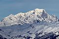
Highest point | Mont Blanc 4,808 m (15,774 ft) |
Lowest point | Étang de Lavalduc −10 m (−33 ft) |
Longest river | Loire 1,012 km (629 mi) |
Largest lake | Lac du Bourget 44.5 km2 (17.2 sq mi) |
Climate | Oceanic climate, Mediterranean climate (south), mountain climate (Alps and Pyrenees) |
Terrain | Plains and hills (north and west), mountainous (south) |
Natural resources | Coal, iron ore, bauxite, zinc, uranium, antimony, arsenic, potash, feldspar, fluorspar, gypsum, timber, fish, gold |
Natural hazards | Flooding, avalanches, midwinter windstorms, drought, forest fires (south) |
Environmental issues | Water pollution, air pollution, agricultural runoff, acid rain |
Exclusive economic zone | In Europe: 334,604 km2 (129,191 sq mi) All overseas territories: 11,691,000 km2 (4,514,000 sq mi) |
The geography of France consists of a terrain that is mostly flat plains or gently rolling hills in the north and the west and mountainous in the south (including the Massif Central and the Pyrenees) and the east (the country's highest points being in the Alps). Metropolitan France has a total size of 551,695 km2 (213,011 sq mi) (Europe only). It is the third-largest country in Europe by area (after Russia and Ukraine) and the largest in Western Europe.
Metropolitan France's territory is relatively large and so it climate is not uniform and gives rise to the following climate nuances:
Climate change in France includes above average heating. [1]
Irrigated land: 26,420 km2 (2007)
Total renewable water resources: 211 km3 (2011)
Freshwater withdrawal (domestic/industrial/agricultural): 31.62 km3/yr (19%/71%/10%) (512.1 m3/yr per capita) (2009)
Coal, iron ore, bauxite, zinc, uranium, antimony, arsenic, potash, feldspar, fluorspar, gypsum, timber, fish, gold, clay, petroleum, silver
Flooding, Hailstorms, avalanches, midwinter windstorms, drought, forest fires in the south near the Mediterranean
The region that now comprises France consisted of open grassland during the Pleistocene Ice Age. France gradually became forested as the glaciers retreated starting in 10,000 BC, but clearing of theoe primeval forests began in Neolithic times. These forests were still fairly extensive until the medieval era.
In prehistoric times, France was home to large predatory animals such as wolves and brown bears, as well as herbivores such as elk. The larger fauna have disappeared outside the Pyrenees Mountains where bears live as a protected species. Smaller animals include martens, wild pigs, foxes, weasels, bats, rodents, rabbits, and assorted birds.
By the 15th century, France had largely been denuded of its forests and was forced to rely on Scandinavia and their North American colonies for lumber. Significant remaining forested areas are in the Gascony region and north in the Alsace-Ardennes area. The Ardennes Forest was the scene of extensive fighting in both world wars.
The northcentral part of the region is dominated by the Paris Basin, which consists of a layered sequence of sedimentary rocks. Fertile soils over much of the area make good agricultural land. The Normandy coast to the northwest is characterized by high, chalk cliffs, while the Brittany coast (the peninsula to the west) is highly indented in places that deep valleys were drowned by the sea, and the Biscay coast to the southwest is marked by flat, sandy beaches.
A recent global remote sensing analysis suggested that there were 1,433 km2 of tidal flats in France, making it the 23rd ranked country in terms of tidal flat area. [2]
France has several levels of internal divisions. The first-level administrative division of Metropolitan France is regions. Alsom the French Republic has sovereignty over several other territories, with various administrative levels.
This is a list of the extreme points of France; the points that are farther north, south, east or west than any other location.
These are the extreme temperatures in France.
Climate data for France | |||||||||||||
---|---|---|---|---|---|---|---|---|---|---|---|---|---|
Month | Jan | Feb | Mar | Apr | May | Jun | Jul | Aug | Sep | Oct | Nov | Dec | Year |
Record high °C (°F) | 23.3 (73.9) | 28.3 (82.9) | 29.2 (84.6) | 32.1 (89.8) | 35.6 (96.1) | 45.9 (114.6) | 43.9 (111.0) | 44.1 (111.4) | 38.0 (100.4) | 35.8 (96.4) | 27.1 (80.8) | 26.9 (80.4) | 45.9 (114.6) |
Record low °C (°F) | −41.0 (−41.8) | −35 (−31) | −32.0 (−25.6) | −19.0 (−2.2) | −10 (14) | −4.0 (24.8) | −4.0 (24.8) | −4.0 (24.8) | −7.0 (19.4) | −14.0 (6.8) | −29.0 (−20.2) | −37.0 (−34.6) | −41.0 (−41.8) |
Source: [5] |
General: