

The climate of Azerbaijan is very diverse. Nine out of eleven existing climate zones are present in Azerbaijan. [1]
The climate of Azerbaijan is very diverse. Nine out of eleven existing climate zones are present in Azerbaijan. [1]
Azerbaijan is situated on the northern extremity of the subtropical zone, in the southeastern part of the Caucasus and the northwestern part of the Iranian plateau. The complicated geographical location and landscape, the proximity of the Caspian Sea, the effect of the sun's radiation, air masses of different origin, etc., contribute to its climatological diversity. [2] [3]
As a predominantly mountainous country, Azerbaijan is surrounded by the Greater Caucasus, Lesser Caucasus, Talysh and North Iranian Mountains. The Kur-Araz Lowland, between the Greater and Lesser Caucasus, stretches to the Caspian Sea in the eastern part of the country. The Greater Caucasus, situated in the north of the country and stretching from the northwest to the southeast, protects the country from direct influences of northern cold air masses. That leads to the formation of a subtropical climate on most of the foothills and plains of the country. Other mountain chains surrounding the country also impact air circulation. The complexity of the landscape causes nonuniform formation of climatic zones and creates vertical climate zones. [2]
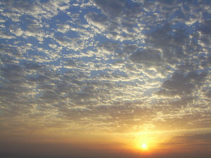
The Azerbaijani plains and foothills have high insolation rates. The sun shines for 2,200 to 2,400 hours annually on the Kur-Araz lowland, Apsheron peninsula and other plains and foothills, and 2,600 to 2,800 hours on the plains around the Araz river in the Nakhchivan region. Due to increased cloudiness in the mountainous regions, those areas receive only 1,900 to 2,200 hours of direct sunlight. [2]
Bright sun shines 2,200 to 2,500 hours a year at altitudes over 3,000 meters (9,800 ft). The total annual radiation equals 128–132 kcal/cm2 (118–122 kWh/ft2). Toward the mountains, it declines to 120–124 kcal/cm2 (109–113 kWh/ft2), at an altitude of 500 to 600 meters (1,600 to 2,000 ft) above sea level, then gradually increases and reaches 140–150 kcal/cm2 (129–139 kWh/ft2) at altitudes above 3,000 meters (9,800 ft) in the Greater and Lesser Caucasus. [2]
The total amount of solar radiation affecting the Araz plains in Nakhchivan totals 148–150 kcal/cm2 (137–139 kWh/ft2). It increases in the mountains, reaching 152–160 kcal/cm2 (140–148 kWh/ft2). The solar radiation on the country's plains and foothills amounts to 40–50 kcal/cm2 (37–46 kWh/ft2); in Lenkoran, 50–60 kcal/cm2 (46–55 kWh/ft2); in the mountains, 15–25 kcal/cm2 (14–23 kWh/ft2). [2]
Climate formation in Azerbaijan is influenced by various air masses. Cold air masses, such as the Kara and Scandinavian arctic anticyclones, the temperate Siberian anticyclones, and the maritime Azores maximum influence the climate. Likewise, tropical hot air masses (subtropical anticyclone and southern cyclones), as well as Central Asian anticyclones and local weather conditions, have influence. These air masses enter the country in different ways thanks to its varied geography. Thus, although they do not prevent the hot masses from entering Azerbaijan from the south, cold continental and maritime air masses cause changes in properties of those hot air masses, and influence the dynamics of the atmosphere . [2]
Some of the major influences on Azerbaijan's climate are temperature, precipitation, humidity, rate of evaporation, and cloud cover.

The temperature regime and its distribution throughout Azerbaijan is regular, and depends on the features of air masses entering the country, the regional landscape, and proximity to the Caspian Sea. The sea causes temperatures in the maritime areas (20 kilometres or 12 miles away from the sea) to decline in the summer and rise in the winter. At the same time, the sea moderates the influence of hot and dry air masses coming from Central Asia. The average annual temperature is 14–15 °C (57–59 °F) in the Kur-Araz Lowland, the coastal regions south to the Apsheron Peninsula, and in the Lenkoran Lowland. The temperature declines with proximity to the mountains, averaging 4–5 °C (39–41 °F) at an altitude of 2,000 meters (6,600 ft), and 1–2 °C (34–36 °F) at 3,000 meters (9,800 ft).
Both the absolute minimum temperature (−33 °C or −27.4 °F) and the absolute maximum temperature (46 °C or 114.8 °F) were observed in Julfa and Ordubad. [1]
| Climate data for Baku | |||||||||||||
|---|---|---|---|---|---|---|---|---|---|---|---|---|---|
| Month | Jan | Feb | Mar | Apr | May | Jun | Jul | Aug | Sep | Oct | Nov | Dec | Year |
| Record high °C (°F) | 20.4 (68.7) | 21.8 (71.2) | 27.8 (82.0) | 27.8 (82.0) | 35.0 (95.0) | 40.5 (104.9) | 42.7 (108.9) | 41.9 (107.4) | 39.4 (102.9) | 30.1 (86.2) | 25.0 (77.0) | 26.0 (78.8) | 42.7 (108.9) |
| Mean daily maximum °C (°F) | 6.6 (43.9) | 6.3 (43.3) | 9.8 (49.6) | 16.4 (61.5) | 22.1 (71.8) | 27.3 (81.1) | 30.6 (87.1) | 29.7 (85.5) | 25.6 (78.1) | 19.6 (67.3) | 13.5 (56.3) | 9.7 (49.5) | 18.1 (64.6) |
| Daily mean °C (°F) | 4.4 (39.9) | 4.2 (39.6) | 7.0 (44.6) | 12.9 (55.2) | 18.5 (65.3) | 23.5 (74.3) | 26.4 (79.5) | 26.3 (79.3) | 22.5 (72.5) | 16.6 (61.9) | 11.2 (52.2) | 7.3 (45.1) | 15.1 (59.2) |
| Mean daily minimum °C (°F) | 2.1 (35.8) | 2.0 (35.6) | 4.2 (39.6) | 9.4 (48.9) | 14.9 (58.8) | 19.7 (67.5) | 22.2 (72.0) | 22.9 (73.2) | 19.4 (66.9) | 13.6 (56.5) | 8.8 (47.8) | 4.8 (40.6) | 12.0 (53.6) |
| Record low °C (°F) | −13.7 (7.3) | −8.4 (16.9) | −7.0 (19.4) | −6.1 (21.0) | 0.2 (32.4) | 10.0 (50.0) | 11.2 (52.2) | 11.9 (53.4) | 9.1 (48.4) | 1.2 (34.2) | −2.8 (27.0) | −5.5 (22.1) | −13.7 (7.3) |
| Average precipitation mm (inches) | 21 (0.8) | 20 (0.8) | 21 (0.8) | 18 (0.7) | 18 (0.7) | 8 (0.3) | 2 (0.1) | 6 (0.2) | 15 (0.6) | 25 (1.0) | 30 (1.2) | 26 (1.0) | 210 (8.3) |
| Average precipitation days (≥ 0.1 mm) | 6 | 6 | 5 | 4 | 3 | 2 | 1 | 2 | 2 | 6 | 6 | 6 | 49 |
| Average snowy days (≥ 1 cm) | 4 | 3 | 0 | 0 | 0 | 0 | 0 | 0 | 0 | 0 | 0 | 3 | 10 |
| Mean monthly sunshine hours | 89.9 | 89.0 | 124.0 | 195.0 | 257.3 | 294.0 | 313.1 | 282.1 | 222.0 | 145.7 | 93.0 | 102.3 | 2,207.4 |
| Source 1: World Meteorological Organisation (UN), [4] Hong Kong Observatory [5] for data of sunshine hours | |||||||||||||
| Source 2: Meoweather (Snowy days) [6] infoclimat.fr (extremes) [7] [ better source needed ] | |||||||||||||
| Climate data for Nakhchivan | |||||||||||||
|---|---|---|---|---|---|---|---|---|---|---|---|---|---|
| Month | Jan | Feb | Mar | Apr | May | Jun | Jul | Aug | Sep | Oct | Nov | Dec | Year |
| Mean daily maximum °C (°F) | 0.8 (33.4) | 4.0 (39.2) | 12.3 (54.1) | 20.1 (68.2) | 24.7 (76.5) | 29.5 (85.1) | 34.7 (94.5) | 33.7 (92.7) | 30.1 (86.2) | 21.9 (71.4) | 12.6 (54.7) | 5.1 (41.2) | 19.1 (66.4) |
| Daily mean °C (°F) | −4.0 (24.8) | −0.5 (31.1) | 5.4 (41.7) | 12.4 (54.3) | 17.5 (63.5) | 22.4 (72.3) | 26.9 (80.4) | 26.2 (79.2) | 21.9 (71.4) | 14.1 (57.4) | 6.5 (43.7) | 0.9 (33.6) | 12.5 (54.5) |
| Mean daily minimum °C (°F) | −6.8 (19.8) | −4.3 (24.3) | 1.0 (33.8) | 7.4 (45.3) | 11.5 (52.7) | 15.9 (60.6) | 20.0 (68.0) | 18.7 (65.7) | 14.7 (58.5) | 8.2 (46.8) | 2.3 (36.1) | −2.5 (27.5) | 7.2 (45.0) |
| Average precipitation mm (inches) | 19 (0.7) | 18 (0.7) | 29 (1.1) | 38 (1.5) | 36 (1.4) | 30 (1.2) | 17 (0.7) | 8 (0.3) | 11 (0.4) | 26 (1.0) | 20 (0.8) | 15 (0.6) | 267 (10.5) |
| Average precipitation days | 5 | 4 | 6 | 7 | 9 | 5 | 2 | 2 | 2 | 5 | 4 | 4 | 55 |
| Mean monthly sunshine hours | 82.9 | 117.3 | 188.3 | 202.6 | 254.5 | 324.0 | 364.4 | 338.7 | 302.5 | 215.6 | 148.1 | 121.1 | 2,660 |
| Source: NOAA [8] | |||||||||||||
| Climate data for Ganja (1981–2010, extremes 1890–2014) | |||||||||||||
|---|---|---|---|---|---|---|---|---|---|---|---|---|---|
| Month | Jan | Feb | Mar | Apr | May | Jun | Jul | Aug | Sep | Oct | Nov | Dec | Year |
| Record high °C (°F) | 22.8 (73.0) | 25.0 (77.0) | 28.0 (82.4) | 35.6 (96.1) | 39.5 (103.1) | 39.2 (102.6) | 42.0 (107.6) | 41.7 (107.1) | 38.8 (101.8) | 33.4 (92.1) | 28.0 (82.4) | 23.3 (73.9) | 42.0 (107.6) |
| Mean daily maximum °C (°F) | 7.0 (44.6) | 8.2 (46.8) | 12.7 (54.9) | 18.7 (65.7) | 23.4 (74.1) | 28.7 (83.7) | 31.6 (88.9) | 31.1 (88.0) | 26.3 (79.3) | 19.5 (67.1) | 12.9 (55.2) | 8.4 (47.1) | 19.0 (66.2) |
| Daily mean °C (°F) | 3.2 (37.8) | 3.9 (39.0) | 7.8 (46.0) | 13.4 (56.1) | 18.1 (64.6) | 23.2 (73.8) | 26.2 (79.2) | 25.6 (78.1) | 21.1 (70.0) | 15.0 (59.0) | 8.9 (48.0) | 4.7 (40.5) | 14.3 (57.7) |
| Mean daily minimum °C (°F) | 0.5 (32.9) | 1.0 (33.8) | 4.3 (39.7) | 9.4 (48.9) | 13.8 (56.8) | 18.6 (65.5) | 21.4 (70.5) | 21.0 (69.8) | 16.8 (62.2) | 11.6 (52.9) | 6.2 (43.2) | 2.1 (35.8) | 10.6 (51.1) |
| Record low °C (°F) | −17.8 (0.0) | −15.2 (4.6) | −12.0 (10.4) | −4.4 (24.1) | 1.5 (34.7) | 5.8 (42.4) | 10.1 (50.2) | 10.5 (50.9) | 2.8 (37.0) | −1.3 (29.7) | −7.9 (17.8) | −13.0 (8.6) | −17.8 (0.0) |
| Average precipitation mm (inches) | 8 (0.3) | 12 (0.5) | 24 (0.9) | 31 (1.2) | 40 (1.6) | 32 (1.3) | 17 (0.7) | 15 (0.6) | 15 (0.6) | 24 (0.9) | 16 (0.6) | 7 (0.3) | 241 (9.5) |
| Average precipitation days (≥ 0.1 mm) | 7.0 | 7.0 | 8.0 | 8.2 | 9.0 | 7.0 | 4.0 | 3.0 | 4.0 | 6.3 | 6.5 | 6.0 | 76.0 |
| Average rainy days | 3 | 4 | 6 | 8 | 9 | 6 | 4 | 3 | 4 | 6 | 6 | 4 | 63 |
| Average snowy days | 3 | 5 | 2 | 0.2 | 0 | 0 | 0 | 0 | 0 | 0.4 | 1 | 2 | 14 |
| Average relative humidity (%) | 71 | 71 | 68 | 70 | 68 | 61 | 59 | 61 | 65 | 74 | 76 | 74 | 68 |
| Mean monthly sunshine hours | 120 | 113 | 141 | 182 | 229 | 267 | 278 | 252 | 212 | 168 | 123 | 115 | 2,200 |
| Source 1: Deutscher Wetterdienst (sun, 1961-1990) [9] [10] [lower-alpha 1] | |||||||||||||
| Source 2: Pogoda.ru.net [11] | |||||||||||||
| Climate data for Lenkaran | |||||||||||||
|---|---|---|---|---|---|---|---|---|---|---|---|---|---|
| Month | Jan | Feb | Mar | Apr | May | Jun | Jul | Aug | Sep | Oct | Nov | Dec | Year |
| Mean daily maximum °C (°F) | 7.2 (45.0) | 7.2 (45.0) | 11.0 (51.8) | 17.5 (63.5) | 22.5 (72.5) | 27.2 (81.0) | 30.4 (86.7) | 29.5 (85.1) | 25.9 (78.6) | 19.9 (67.8) | 14.1 (57.4) | 10.1 (50.2) | 18.5 (65.4) |
| Mean daily minimum °C (°F) | 0.0 (32.0) | 1.0 (33.8) | 3.9 (39.0) | 8.6 (47.5) | 13.1 (55.6) | 17.5 (63.5) | 20.1 (68.2) | 19.7 (67.5) | 16.9 (62.4) | 11.8 (53.2) | 6.7 (44.1) | 2.5 (36.5) | 10.2 (50.3) |
| Average precipitation mm (inches) | 91 (3.6) | 114 (4.5) | 90 (3.5) | 50 (2.0) | 54 (2.1) | 22 (0.9) | 17 (0.7) | 50 (2.0) | 143 (5.6) | 259 (10.2) | 168 (6.6) | 88 (3.5) | 1,146 (45.2) |
| Average precipitation days | 10 | 10 | 11 | 8 | 8 | 3 | 2 | 4 | 7 | 13 | 12 | 9 | 97 |
| Mean monthly sunshine hours | 105.4 | 98.9 | 124.0 | 171.0 | 226.3 | 282.0 | 306.9 | 254.2 | 189.0 | 127.1 | 99.0 | 108.5 | 2,092.3 |
| Source 1: World Meteorological Organization (UN) [12] | |||||||||||||
| Source 2: Hong Kong Observatory(sun only) [13] | |||||||||||||
| Climate data for Mingachevir | |||||||||||||
|---|---|---|---|---|---|---|---|---|---|---|---|---|---|
| Month | Jan | Feb | Mar | Apr | May | Jun | Jul | Aug | Sep | Oct | Nov | Dec | Year |
| Mean daily maximum °C (°F) | 7.1 (44.8) | 8.6 (47.5) | 12.9 (55.2) | 20.9 (69.6) | 26.0 (78.8) | 30.0 (86.0) | 33.9 (93.0) | 32.6 (90.7) | 28.4 (83.1) | 21.0 (69.8) | 14.4 (57.9) | 9.3 (48.7) | 20.4 (68.8) |
| Mean daily minimum °C (°F) | −4.0 (24.8) | −3.0 (26.6) | 4.0 (39.2) | 9.3 (48.7) | 14.2 (57.6) | 18.6 (65.5) | 21.6 (70.9) | 20.6 (69.1) | 17.0 (62.6) | 11.1 (52.0) | 6.2 (43.2) | 1.4 (34.5) | 9.8 (49.6) |
| Average precipitation mm (inches) | 19 (0.7) | 25 (1.0) | 27 (1.1) | 39 (1.5) | 54 (2.1) | 49 (1.9) | 26 (1.0) | 27 (1.1) | 26 (1.0) | 53 (2.1) | 30 (1.2) | 22 (0.9) | 397 (15.6) |
| Source: Climate-Data.org [14] | |||||||||||||
| Climate data for Khankendi | |||||||||||||
|---|---|---|---|---|---|---|---|---|---|---|---|---|---|
| Month | Jan | Feb | Mar | Apr | May | Jun | Jul | Aug | Sep | Oct | Nov | Dec | Year |
| Mean daily maximum °C (°F) | 4.7 (40.5) | 5.2 (41.4) | 9.0 (48.2) | 16.1 (61.0) | 19.5 (67.1) | 24.5 (76.1) | 28.1 (82.6) | 27.1 (80.8) | 23.2 (73.8) | 16.4 (61.5) | 11.4 (52.5) | 7.3 (45.1) | 16.0 (60.9) |
| Daily mean °C (°F) | 1.1 (34.0) | 1.4 (34.5) | 5.1 (41.2) | 11.6 (52.9) | 15.3 (59.5) | 19.8 (67.6) | 23.3 (73.9) | 22.3 (72.1) | 18.7 (65.7) | 12.6 (54.7) | 7.7 (45.9) | 3.7 (38.7) | 11.9 (53.4) |
| Mean daily minimum °C (°F) | −2.6 (27.3) | −2.5 (27.5) | 1.1 (34.0) | 7.0 (44.6) | 11.0 (51.8) | 15.1 (59.2) | 18.4 (65.1) | 17.4 (63.3) | 14.2 (57.6) | 8.7 (47.7) | 4.0 (39.2) | 0.1 (32.2) | 7.7 (45.8) |
| Average precipitation mm (inches) | 19 (0.7) | 25 (1.0) | 42 (1.7) | 49 (1.9) | 102 (4.0) | 79 (3.1) | 41 (1.6) | 27 (1.1) | 34 (1.3) | 39 (1.5) | 35 (1.4) | 13 (0.5) | 505 (19.9) |
| Average precipitation days | 6 | 6 | 10 | 10 | 14 | 10 | 4 | 4 | 6 | 6 | 5 | 4 | 85 |
| Source: NOAA [15] | |||||||||||||
The maximum annual precipitation falls in Lankaran (1,600 to 1,800 mm or 63 to 71 in) and the minimum in the Absheron Peninsula (200 to 350 mm or 7.9 to 13.8 in). [1]

Taking into consideration the distribution and features of the weather, temperature, humidity, and precipitation, nine out of the 11 climate patterns in the Köppen climate classification can be found in Azerbaijan. Many of these patterns are divided into subtypes. [3]


Azerbaijan is a country in the Caucasus region, situated at the juncture of Eastern Europe and West Asia. Three physical features dominate Azerbaijan: the Caspian Sea, whose shoreline forms a natural boundary to the east; the Greater Caucasus mountain range to the north; and the extensive flatlands at the country's center. About the size of Portugal or the US state of Maine, Azerbaijan has a total land area of approximately 86,600 km², less than 1% of the land area of the former Soviet Union. Of the three Transcaucasian states, Azerbaijan has the greatest land area. Special administrative subdivisions are the Nakhchivan Autonomous Republic, which is separated from the rest of Azerbaijan by a strip of Armenian territory, and the Nagorno-Karabakh Autonomous Region, entirely within Azerbaijan. The status of Nagorno-Karabakh is disputed by Armenia, but is internationally recognized as territory of Azerbaijan.

Armenia is a landlocked country in the South Caucasus region of the Caucasus. The country is geographically located in West Asia, within the Armenian plateau. Armenia is bordered on the north and east by Georgia and Azerbaijan and on the south and west by Iran, Azerbaijan's exclave Nakhchivan, and Turkey.

Georgia is a country in the Caucasus region, on the coast of the Black Sea. Sometimes considered a transcontinental country, it is located at the intersection of Eastern Europe and West Asia, and is today generally regarded as part of Europe. It is bordered to the north and northeast by Russia, to the south by Turkey and Armenia, and to the southeast by Azerbaijan.

Geographically, the country of Iran is located in West Asia and borders the Caspian Sea, Persian Gulf, and Gulf of Oman. Topographically, it is predominantly located on the Persian Plateau. Its mountains have impacted both the political and the economic history of the country for several centuries. The mountains enclose several broad basins, on which major agricultural and urban settlements are located. Until the 20th century, when major highways and railroads were constructed through the mountains to connect the population centers, these basins tended to be relatively isolated from one another.

The Caucasus Mountains is a mountain range at the intersection of Asia and Europe. Stretching between the Black Sea and the Caspian Sea, they are surrounded by the Caucasus region and are home to Mount Elbrus, the highest peak in Europe at 5,642 metres (18,510 ft) above sea level.
Shida Kartli is a landlocked administrative region (Mkhare) in eastern Georgia. It comprises a central part of the historical-geographic province of Shida Kartli. With an area of 5,729 square kilometres (2,212 sq mi), Shida Kartli is the 8th largest Georgian region by land area. With 284,081 inhabitants, it is Georgia's seventh-most-populous region. Shida Kartli's capital and largest city, Gori, is the 5th largest city in Georgia.

Shabran District is one of the 66 districts of Azerbaijan. It is located in the north-east of the country and belongs to the Guba-Khachmaz Economic Region. The district borders the districts of Khachmaz, Quba, Khizi and Siyazan. Its capital and largest city is Shabran. As of 2020, the district had a population of 59,900.

Goychay District is one of the 66 districts of Azerbaijan. It is located in the centre of the country and belongs to the Central Aran Economic Region. The district borders the districts of Agdash, Qabala, Ismayilli, Kurdamir, and Ujar. Its capital and largest city is Goychay. As of 2020, the district had a population of 121,700. It is famous for its pomegranate growing industry, and for its pomegranate festival.

Shaki District is one of the 66 districts of Azerbaijan. It is located in the north of the country and belongs to the Shaki-Zagatala Economic Region. The district borders the districts of Qakh, Oghuz, Agdash, Yevlakh, and the Russian Republic of Dagestan. Its capital and largest city is Shaki. As of 2020, the district had a population of 188,100.

Julfa District is one of the 7 districts of the Nakhchivan Autonomous Republic of Azerbaijan. The district borders the districts of Ordubad, Babek, Shahbuz, as well as the Syunik Province of Armenia and the East Azerbaijan Province of Iran. Its capital and largest city is Julfa. As of 2020, the district had a population of 47,000.

Fauna of Azerbaijan or animal kingdom of Azerbaijan refers to the diversity of various types of animals, which inhabit and populate a defined ground or water area in Azerbaijan.

The environment of Azerbaijan, includes a wide diversity of climates, animals, plants, and habitats.
Mil plain is a plain in Azerbaijan. It is located on the bank of the Aras river and extends to Iran. Mil-plain is located in the southwest part of the Kur-Araz lowland, where the Kura and Araz rivers meet. The area is between the right bank of the Kura River and the left bank of the Araz River. The north-eastern part of the plain is lower than the ocean level. In the south-west, these areas are covered by sand, gravel. More than 40 percent of the altitude in the plain is 0–100 meters, 25 percent - 100–200 meters above sea level, and 35 percent - absolute altitude is less than 0 meters. The absolute altitude decreases about 8 m to north and varies from 200 to 250 to the west. The plain includes mainly the areas of Imishli and Beylagan districts. Seismic activity is high as the plain is in the convergent border the Alpine-Himalayan orogenic belt.

The climate of the United States varies due to changes in latitude, and a range of geographic features, including mountains and deserts. Generally, on the mainland, the climate of the U.S. becomes warmer the further south one travels, and drier the further west, until one reaches the West Coast.

The climate of Hungary is characterized by its position. Hungary is in the eastern part of Central Europe, roughly equidistant from the Equator and the North Pole, more than 1,000 kilometres (600 mi) from both and about 1,000 kilometers from the Atlantic Ocean.

A humid subtropical climate is a temperate climate type characterized by hot and humid summers, and cool to mild winters. These climates normally lie on the southeast side of all continents, generally between latitudes 25° and 40° and are located poleward from adjacent tropical climates, and equatorward from either humid continental or oceanic climates. It is also known as warm temperate climate in some climate classifications.
Potential of using of climatic resources, including solar and wind energy is large in Azerbaijan, despite that the share of these resources within energy production is still small.

The total forest area of Azerbaijan is 1,021,880 ha or 11.8% of the country's area. The forest biomes consist of temperate deciduous forests, temperate broadleaf and mixed forests, temperate coniferous forests and riparian forests. Specialists estimate that in the 8th-9th centuries the forest cover was around 30-35%, most of it situated in mountainous areas.
The Azerbaijan is a country with very favorable natural conditions and rich natural resources. Snowy peaks, high mountains, foothill fertile soils, wide plains, Lowest Land Points Below Ocean Level are the main landscape forms of the republic. This complex landscape structure has resulted in a variety of natural conditions, climate, soil-vegetation, and water resources. This, in turn, led to the uneven distribution of population and farms on the territory, and the specialization of production on different types.

Samursky National Park is located on the west coast of the Caspian Sea, at the eastern extent of the Greater Caucasus Mountains in Dagestan, Russia. It is divided into two sectors: a coastal floodplain section on the delta of the Samur River, and a mountainous sector that includes Mount Bazardüzü and the southernmost extreme point in Russia. The coastal sector is notable for supporting a temperate-subtropical liana forest. The park also protects near-shore waters of the Caspian. The park was officially created in 2019.
| History |
|  | ||||||||
|---|---|---|---|---|---|---|---|---|---|---|
| Geography |
| |||||||||
| Politics |
| |||||||||
| Economy | ||||||||||
| Culture |
| |||||||||