Climate of Greece

Last updated

Greece's Koppen Climate Types Greece Koppen.svg
Greece's Köppen Climate Types

The climate in Greece is predominantly Mediterranean. However, due to the country's geography, Greece has a wide range of micro-climates and local variations. The Greek mainland is extremely mountainous, making Greece one of the most mountainous countries in Europe. [1] [2] To the west of the Pindus mountain range, the climate is generally wetter and has some maritime features. The east of the Pindus mountain range is generally drier and windier in summer. The highest peak is Mount Olympus, 2,918 metres (9,573 ft). [3] The northern areas of Greece have a transitional climate between the continental, the Mediterranean and the humid subtropical climate. There are mountainous areas that have an alpine climate. Also, various areas of Greece have semi-arid climates. [4] [5]

Contents

Mediterranean climate

The climate of Greece can be divided into the following Mediterranean climate (Köppen climate classification: Cs) subtypes:

"True" Mediterranean

According to the Climate Atlas of Greece which was published by the Hellenic National Meteorological Service (H.N.M.S) the Mediterranean climate (Köppen climate classification: Csa) is the predominant climate found in Greece. [6] This climate occurs in the North Aegean islands, some of the Cyclades and most of the Dodecanese, Evia, some low-lying areas of Attica, the Ionian Islands and most of the western coast of the country, the eastern and southern low-lying Peloponnese areas, and the low-lying areas of Crete. During the summer, the weather is most frequently sunny and dry, and any precipitation falls in the form of showers or thunderstorms from cumuliform clouds. The air is usually hot during the day and pleasantly warm at night, but there are some very windy days, especially in the Cyclades islands and around them. Heatwaves may occur, but they are usually quite mild at the coastal areas, where temperatures are moderated by the relatively cooler sea and the sea breeze. Winters are wet and any snow that falls does not last long, especially in the south-facing slopes. Rain in winter is often persistent: The west areas of this climate zone receive a relatively higher amount of precipitation. Warm-summer Mediterranean climate (Csb) exists in roughly the same areas but in higher elevations (>1,000 m.), such as mount Parnitha in Attica.

Climate data for Downtown Athens (1991–2020), Extremes (1890–present)
MonthJanFebMarAprMayJunJulAugSepOctNovDecYear
Record high °C (°F)22.6
(72.7)
25.3
(77.5)
28.2
(82.8)
32.2
(90.0)
37.6
(99.7)
44.8
(112.6)
42.8
(109.0)
43.9
(111.0)
38.7
(101.7)
36.5
(97.7)
30.5
(86.9)
22.9
(73.2)
44.8
(112.6)
Mean daily maximum °C (°F)13.3
(55.9)
14.2
(57.6)
17.0
(62.6)
21.1
(70.0)
26.5
(79.7)
31.6
(88.9)
34.3
(93.7)
34.3
(93.7)
30.6
(87.1)
24.4
(75.9)
18.9
(66.0)
14.4
(57.9)
23.3
(73.9)
Daily mean °C (°F)10.2
(50.4)
10.8
(51.4)
13.1
(55.6)
16.7
(62.1)
21.8
(71.2)
26.6
(79.9)
29.3
(84.7)
29.4
(84.9)
25.0
(77.0)
20.3
(68.5)
15.6
(60.1)
11.6
(52.9)
19.2
(66.6)
Mean daily minimum °C (°F)7.1
(44.8)
7.3
(45.1)
9.2
(48.6)
12.3
(54.1)
17.0
(62.6)
21.6
(70.9)
24.2
(75.6)
24.4
(75.9)
20.4
(68.7)
16.2
(61.2)
12.2
(54.0)
8.7
(47.7)
15.0
(59.0)
Record low °C (°F)−6.5
(20.3)
−5.7
(21.7)
−2.6
(27.3)
1.7
(35.1)
6.2
(43.2)
11.8
(53.2)
16
(61)
15.5
(59.9)
8.9
(48.0)
5.9
(42.6)
−1.1
(30.0)
−4.0
(24.8)
−6.5
(20.3)
Average rainfall mm (inches)55.6
(2.19)
44.4
(1.75)
45.6
(1.80)
27.6
(1.09)
20.7
(0.81)
11.6
(0.46)
10.7
(0.42)
5.4
(0.21)
25.8
(1.02)
38.6
(1.52)
70.8
(2.79)
76.3
(3.00)
433.1
(17.06)
Average relative humidity (%)72.070.066.060.056.050.042.047.057.066.072.073.060.9
Source 1: Cosmos, scientific magazine of the National Observatory of Athens [7]
Source 2: Meteoclub [8] [9]
Climate data for Araxos, Patras (1955–2010) 11 m. asl
MonthJanFebMarAprMayJunJulAugSepOctNovDecYear
Mean daily maximum °C (°F)13.8
(56.8)
14.2
(57.6)
16.1
(61.0)
19.3
(66.7)
24.2
(75.6)
28.5
(83.3)
33.3
(91.9)
33.6
(92.5)
29.0
(84.2)
23.5
(74.3)
18.9
(66.0)
15.2
(59.4)
22.1
(71.8)
Daily mean °C (°F)10.2
(50.4)
10.5
(50.9)
12.3
(54.1)
15.4
(59.7)
20.0
(68.0)
24.3
(75.7)
26.9
(80.4)
27.0
(80.6)
23.4
(74.1)
19.1
(66.4)
14.8
(58.6)
11.6
(52.9)
18.0
(64.4)
Mean daily minimum °C (°F)6.2
(43.2)
6.3
(43.3)
7.6
(45.7)
9.8
(49.6)
13.3
(55.9)
16.8
(62.2)
19.0
(66.2)
19.8
(67.6)
17.2
(63.0)
14.2
(57.6)
10.6
(51.1)
7.8
(46.0)
12.4
(54.3)
Average rainfall mm (inches)93.2
(3.67)
78.7
(3.10)
61.8
(2.43)
43.6
(1.72)
20.1
(0.79)
8.6
(0.34)
4.1
(0.16)
5.9
(0.23)
33.1
(1.30)
83.8
(3.30)
129.9
(5.11)
121.2
(4.77)
684.0
(26.93)
Average rainy days13.712.411.69.16.02.60.91.25.19.412.615.9100.5
Source: Hellenic National Meteorological Service [10]

Alpine Mediterranean

In this climate type (Köppen climate classification: Csc) with much lower temperatures, the winter is harsh with abundant snowfalls, while the summers are cool with occasional thunderstorms. This climate is to be found on high mountains, like in the Pindus and Rhodope mountains, and predominantly the higher elevations of the mountains of Crete. [11]

Transitional continental - Mediterranean

This climate is classified as between humid subtropical and continental (Köppen climate classification: Cfa and Dfa) with strong characteristics of both the continental and Mediterranean climate.

Climate data for Florina (1961–2010)
MonthJanFebMarAprMayJunJulAugSepOctNovDecYear
Record high °C (°F)18.0
(64.4)
23.0
(73.4)
25.8
(78.4)
31.2
(88.2)
33.8
(92.8)
39.0
(102.2)
40.8
(105.4)
38.6
(101.5)
36.0
(96.8)
32.2
(90.0)
26.6
(79.9)
21.0
(69.8)
40.8
(105.4)
Mean daily maximum °C (°F)4.7
(40.5)
7.4
(45.3)
12.0
(53.6)
16.8
(62.2)
22.0
(71.6)
26.4
(79.5)
29.0
(84.2)
29.0
(84.2)
24.7
(76.5)
19.0
(66.2)
12.2
(54.0)
5.9
(42.6)
17.4
(63.4)
Daily mean °C (°F)0.6
(33.1)
2.8
(37.0)
7.0
(44.6)
11.7
(53.1)
16.9
(62.4)
21.1
(70.0)
23.4
(74.1)
22.8
(73.0)
18.2
(64.8)
12.9
(55.2)
7.2
(45.0)
2.0
(35.6)
12.2
(54.0)
Mean daily minimum °C (°F)−3.1
(26.4)
−1.7
(28.9)
1.5
(34.7)
5.4
(41.7)
9.5
(49.1)
12.8
(55.0)
14.8
(58.6)
14.7
(58.5)
11.4
(52.5)
7.1
(44.8)
2.6
(36.7)
−1.8
(28.8)
6.1
(43.0)
Record low °C (°F)−25.1
(−13.2)
−23.0
(−9.4)
−13.6
(7.5)
−5.0
(23.0)
0.0
(32.0)
2.4
(36.3)
6.6
(43.9)
4.0
(39.2)
−1.4
(29.5)
−5.0
(23.0)
−12.6
(9.3)
−18.6
(−1.5)
−25.1
(−13.2)
Average precipitation mm (inches)56.8
(2.24)
51.1
(2.01)
57.8
(2.28)
60.4
(2.38)
59.4
(2.34)
37.3
(1.47)
33.9
(1.33)
30.6
(1.20)
50.1
(1.97)
69.2
(2.72)
71.3
(2.81)
85.6
(3.37)
663.5
(26.12)
Average precipitation days11.010.611.110.610.77.25.55.36.57.69.711.8107.6
Average snowy days7.56.34.50.80.00.00.00.00.00.31.85.927.1
Average relative humidity (%)81.276.468.863.262.858.655.456.963.371.477.881.768.1
Source: Hellenic National Meteorological Service [12]

Semi-arid climate

Hot semi-arid climate in Greece according to the National Observatory of Athens. BSh climate in Greece (National Observatory of Athens-data until Apr 2023).png
Hot semi-arid climate in Greece according to the National Observatory of Athens.

According to the Climate Atlas of Greece published by the Hellenic National Meteorological Service and the network of the National Observatory of Athens, a hot semi-arid climate (Köppen climate classification: BSh) is found primarily in Piraeus and much of the Athens Riviera, areas of West Attica (Aspropyrgos, Salamina, Vlychada) and the Gulf of Corinth, most of the Cyclades, some islands of the Argo-Saronic Gulf (Aigina, Hydra), some areas of Crete (Lentas, Moni Toplou), Gavdos and some islands of the Dodecanese (Kasos, Nisyros, Karpathos). [4] [5]

Cold semi-arid climate (Köppen climate classification: BSk) is found in various areas of Macedonia and Thessaly, including the city of Thessaloniki, the second largest in Greece. [6]

Climate data for Piraeus Hellenic National Meteorological Service (1981-2010)
MonthJanFebMarAprMayJunJulAugSepOctNovDecYear
Mean daily maximum °C (°F)14.1
(57.4)
14.4
(57.9)
16.6
(61.9)
20.3
(68.5)
25.1
(77.2)
29.9
(85.8)
32.8
(91.0)
32.9
(91.2)
29.1
(84.4)
24.2
(75.6)
18.9
(66.0)
15.4
(59.7)
22.81
(73.06)
Daily mean °C (°F)11.1
(52.0)
11.2
(52.2)
13.3
(55.9)
16.9
(62.4)
21.4
(70.5)
26.3
(79.3)
29.0
(84.2)
28.8
(83.8)
25.2
(77.4)
20.6
(69.1)
15.8
(60.4)
12.6
(54.7)
19.35
(66.83)
Mean daily minimum °C (°F)8.2
(46.8)
7.9
(46.2)
10.0
(50.0)
13.4
(56.1)
17.7
(63.9)
22.2
(72.0)
24.8
(76.6)
25.0
(77.0)
21.5
(70.7)
17.4
(63.3)
12.9
(55.2)
9.7
(49.5)
15.89
(60.60)
Average rainfall mm (inches)41.95
(1.65)
36.26
(1.43)
34.09
(1.34)
30.34
(1.19)
15.95
(0.63)
5.08
(0.20)
5.56
(0.22)
3.07
(0.12)
11.37
(0.45)
30.5
(1.20)
58.87
(2.32)
58.84
(2.32)
331.9
(13.07)
Source: National Technical University of Athens [13]
Climate data for Aristotle University of Thessaloniki 32 m asl, 1991 – 2020 normals (extremes 1930-present)
MonthJanFebMarAprMayJunJulAugSepOctNovDecYear
Record high °C (°F)22.5
(72.5)
25.1
(77.2)
30.1
(86.2)
32.2
(90.0)
37.8
(100.0)
41.2
(106.2)
43.3
(109.9)
41.6
(106.9)
40.3
(104.5)
33.4
(92.1)
28.1
(82.6)
24.4
(75.9)
43.3
(109.9)
Mean daily maximum °C (°F)10.6
(51.1)
12.4
(54.3)
15.6
(60.1)
19.7
(67.5)
25.2
(77.4)
30.0
(86.0)
32.3
(90.1)
32.3
(90.1)
27.8
(82.0)
22.1
(71.8)
16.6
(61.9)
11.8
(53.2)
21.4
(70.5)
Daily mean °C (°F)7.0
(44.6)
8.4
(47.1)
11.2
(52.2)
14.9
(58.8)
20.0
(68.0)
24.7
(76.5)
27.0
(80.6)
27.1
(80.8)
22.7
(72.9)
17.7
(63.9)
12.8
(55.0)
8.3
(46.9)
16.8
(62.3)
Mean daily minimum °C (°F)3.4
(38.1)
4.4
(39.9)
6.8
(44.2)
10.1
(50.2)
14.9
(58.8)
19.4
(66.9)
21.8
(71.2)
21.9
(71.4)
17.6
(63.7)
13.4
(56.1)
9.0
(48.2)
4.9
(40.8)
12.3
(54.1)
Record low °C (°F)−12.6
(9.3)
−8.9
(16.0)
−8.2
(17.2)
−0.4
(31.3)
5.2
(41.4)
8.6
(47.5)
12.0
(53.6)
10.3
(50.5)
7.7
(45.9)
1.4
(34.5)
−2.8
(27.0)
−8.2
(17.2)
−12.6
(9.3)
Average precipitation mm (inches)34.1
(1.34)
33.6
(1.32)
39.5
(1.56)
37.5
(1.48)
51.0
(2.01)
31.6
(1.24)
27.0
(1.06)
25.1
(0.99)
37.4
(1.47)
43.7
(1.72)
40.9
(1.61)
48.2
(1.90)
449.6
(17.7)
Source: Aristotle University of Thessaloniki, [14] [15] World Meteorological Organization [16]

Temperature

Various areas of the country have registered temperatures over 46.0 °C (114.8 °F) and below −21.0 °C (−5.8 °F). The 48.0 °C (118.4 °F) recorded by minimum/maximum thermometers in Tatoi and Elefsina on 10 July 1977 as reported by a communication of Dr. Athanasios D. Sarantopoulos was also the WMO record high temperature for Europe until 11 August 2021 (44 years). [18] [19] Average annual temperatures in Greece range from around +4 °C (39 °F) in Kaimaktsalan up to almost +22 °C (72 °F) [20] in Lindos. Summer average highs in Greece are the highest in the Evrotas Valley. Mainland Greece records a very high number of tropical nights reaching locally over 130 in Monemvasia while the islands can climb over 150 tropical nights in Kastellorizo. Winter average temperatures locally reach over 15.0 °C (59.0 °F) in the Dodecanese and below −3.0 °C (26.6 °F) in mountainous areas. [21]

Climate data for Lindos (2010-2019), Extremes (2014-present), 65 m asl
MonthJanFebMarAprMayJunJulAugSepOctNovDecYear
Record high °C (°F)21.9
(71.4)
24.8
(76.6)
24.5
(76.1)
32.4
(90.3)
36.2
(97.2)
43.2
(109.8)
42.7
(108.9)
43.1
(109.6)
39.8
(103.6)
37.9
(100.2)
27.2
(81.0)
22.5
(72.5)
43.2
(109.8)
Mean daily maximum °C (°F)15.8
(60.4)
17.2
(63.0)
19.0
(66.2)
22.6
(72.7)
26.6
(79.9)
31.7
(89.1)
35.1
(95.2)
35.0
(95.0)
31.5
(88.7)
26.6
(79.9)
21.9
(71.4)
17.9
(64.2)
25.1
(77.2)
Daily mean °C (°F)13.2
(55.8)
14.6
(58.3)
16.2
(61.2)
19.2
(66.6)
23.0
(73.4)
27.9
(82.2)
31.2
(88.2)
31.3
(88.3)
28.0
(82.4)
23.6
(74.5)
19.2
(66.6)
15.3
(59.5)
21.9
(71.4)
Mean daily minimum °C (°F)10.6
(51.1)
11.9
(53.4)
13.4
(56.1)
15.7
(60.3)
19.4
(66.9)
24.0
(75.2)
27.3
(81.1)
27.6
(81.7)
24.5
(76.1)
20.5
(68.9)
16.5
(61.7)
12.6
(54.7)
18.7
(65.7)
Record low °C (°F)1.1
(34.0)
3.3
(37.9)
3.1
(37.6)
9.4
(48.9)
13.8
(56.8)
16.8
(62.2)
21.1
(70.0)
24.0
(75.2)
16.3
(61.3)
13.1
(55.6)
10.5
(50.9)
4.3
(39.7)
1.1
(34.0)
Average rainfall mm (inches)109
(4.3)
80
(3.1)
50
(2.0)
16
(0.6)
14
(0.6)
2
(0.1)
3
(0.1)
0
(0)
9
(0.4)
24
(0.9)
83
(3.3)
72
(2.8)
462
(18.2)
Source 1: National Observatory of Athens [22] [23]
Source 2: World Meteorological Organization [24]
Climate data for Kaimaktsalan Ski Center 2090 m a.s.l (2008-2023)
MonthJanFebMarAprMayJunJulAugSepOctNovDecYear
Record high °C (°F)9.4
(48.9)
11.0
(51.8)
10.3
(50.5)
18.0
(64.4)
21.3
(70.3)
23.1
(73.6)
25.5
(77.9)
24.6
(76.3)
21.3
(70.3)
17.4
(63.3)
14.1
(57.4)
11.3
(52.3)
25.5
(77.9)
Mean daily maximum °C (°F)−1.8
(28.8)
−1.0
(30.2)
0.8
(33.4)
4.4
(39.9)
9.5
(49.1)
13.6
(56.5)
16.7
(62.1)
16.6
(61.9)
12.4
(54.3)
7.9
(46.2)
4.6
(40.3)
0.1
(32.2)
7.0
(44.6)
Daily mean °C (°F)−4.2
(24.4)
−3.6
(25.5)
−1.9
(28.6)
1.8
(35.2)
6.5
(43.7)
10.5
(50.9)
13.2
(55.8)
13.1
(55.6)
9.3
(48.7)
5.1
(41.2)
2.1
(35.8)
−2.3
(27.9)
4.1
(39.4)
Mean daily minimum °C (°F)−6.6
(20.1)
−6.2
(20.8)
−4.5
(23.9)
−0.9
(30.4)
3.5
(38.3)
7.3
(45.1)
9.6
(49.3)
9.6
(49.3)
6.2
(43.2)
2.3
(36.1)
−0.5
(31.1)
−4.7
(23.5)
1.3
(34.3)
Record low °C (°F)−20.8
(−5.4)
−20.0
(−4.0)
−19.1
(−2.4)
−11.3
(11.7)
−4.6
(23.7)
−0.6
(30.9)
2.6
(36.7)
1.7
(35.1)
−4.5
(23.9)
−10.0
(14.0)
−12.1
(10.2)
−16.9
(1.6)
−20.8
(−5.4)
Average precipitation mm (inches)89.7
(3.53)
57.6
(2.27)
58.8
(2.31)
63.5
(2.50)
99.2
(3.91)
90.6
(3.57)
32.6
(1.28)
59.6
(2.35)
74.6
(2.94)
89.0
(3.50)
113.1
(4.45)
88.4
(3.48)
916.7
(36.09)
Average precipitation days (≥ 1.0 mm)9.18.48.99.410.59.45.45.98.16.77.18.697.4
Source 1: National Observatory of Athens Monthly Bulletins (Feb 2008 - Sep 2023) [21]
Source 2: Kaimaktsalan N.O.A station [25] and World Meteorological Organization [26]
Climate data for Sparta (2009–2024)
MonthJanFebMarAprMayJunJulAugSepOctNovDecYear
Record high °C (°F)23.5
(74.3)
26.4
(79.5)
27.2
(81.0)
34.1
(93.4)
40.7
(105.3)
44.4
(111.9)
44.2
(111.6)
45.7
(114.3)
40.3
(104.5)
36.4
(97.5)
30.8
(87.4)
23.5
(74.3)
45.7
(114.3)
Mean daily maximum °C (°F)14.4
(57.9)
16.1
(61.0)
18.4
(65.1)
22.8
(73.0)
27.8
(82.0)
32.5
(90.5)
36.0
(96.8)
35.9
(96.6)
31.3
(88.3)
25.3
(77.5)
20.2
(68.4)
16.1
(61.0)
24.7
(76.5)
Daily mean °C (°F)8.8
(47.8)
10.0
(50.0)
12.0
(53.6)
15.4
(59.7)
20.0
(68.0)
24.6
(76.3)
27.7
(81.9)
27.7
(81.9)
23.8
(74.8)
18.5
(65.3)
14.1
(57.4)
10.2
(50.4)
17.7
(63.9)
Mean daily minimum °C (°F)3.1
(37.6)
4.0
(39.2)
5.6
(42.1)
8.0
(46.4)
12.2
(54.0)
16.7
(62.1)
19.5
(67.1)
19.6
(67.3)
16.4
(61.5)
11.8
(53.2)
7.9
(46.2)
4.4
(39.9)
10.8
(51.4)
Record low °C (°F)−5.3
(22.5)
−4.2
(24.4)
−4.6
(23.7)
−0.7
(30.7)
6.2
(43.2)
9.4
(48.9)
14.2
(57.6)
13.1
(55.6)
9.1
(48.4)
1.5
(34.7)
−1.7
(28.9)
−5.2
(22.6)
−5.3
(22.5)
Average rainfall mm (inches)122.6
(4.83)
82.3
(3.24)
62.4
(2.46)
33.1
(1.30)
24.8
(0.98)
35.3
(1.39)
11.9
(0.47)
19.0
(0.75)
52.2
(2.06)
61.5
(2.42)
88.1
(3.47)
92.0
(3.62)
685.2
(26.99)
Source: National Observatory of Athens (Feb 2009 - Feb 2024), [22] [27]
Sparta N.O.A station, [28] World Meteorological Organization [29]

Based on mean absolute minimum temperatures, plant hardiness zones in Greece vary from 6a to 11a. [30] Downtown Athens falls in 10a zone while the Athens Riviera falls mostly in 10b zone. [23] Thessaloniki straddles 9a/9b zones while areas in Macedonia may reach up to 10a zone (Great Lavra). [23] Zone 11a can be found in the Dodecanese, Crete, Cyclades and the Argo-Saronic Gulf, while Monemvasia in mainland Greece also falls in 11a zone. [30] [23] According to the Gouvas formula which adjusted USDA [31] plant hardiness zones for Greece, Kasos falls in 11b zone. [32] [23]

The table below provides USDA hardiness zones for selected areas from the data of the National Observatory of Athens and other public authorities.

CityZone
Kasos [33] [21] 11a
Karpathos [34] 11a
Kastellorizo [35] [21] 11a
Lindos [36] [21] 11a
Lentas [37] [21] 11a
Palaiochora [38] [21] 11a
Rhodes Port [39] 11a
Falasarna [40] [21] 11a
Heraklion Port [41] [21] 11a
Plakias [42] [21] 11a
Amorgos [43] [21] 11a
Nisyros [44] [21] 11a
Hydra [45] [21] 11a
Monemvasia [46] [21] 11a
Koufonisia [47] [21] 11a
Patmos [48] [21] 11a
Spetses [49] [21] 11a
Sisi [50] [21] 11a
Sifnos [51] [21] 11a
Sitia [52] [21] 10b
Naxos [53] [21] 10b
Patras Port [54] [21] 10b
Lavrio [55] [21] 10b
Nea Smyrni [56] [21] 10b
Palaio Faliro [57] [21] 10b
Gazi, Athens [58] [21] 10a
Kifissia [59] [21] 10a
Arta [60] [21] 10a
Great Lavra [61] [21] 10a
Kalamaria [62] [21] 9b
Ippokrateios Politeia [63] [21] 9a
Nemea [64] [21] 9a
Serres [65] [21] 8b
Alexandroupolis [66] [21] 8b
Kaimaktsalan [67] [21] 7a
Vathistalos (doline) [68] [21] 6a

Heatwaves

In 2021, the government officials announced that they are considering giving the heatwaves names that could help people better prepare for more extreme heat [69] after the longest and most intense heat wave in recorded history affected the country from 26 July to 10 August of that year, during which many records that stood for decades broke. [70] Other notable heatwaves include the 2007 European heat wave as well as that of July 1987. [71]

In July 2023, another long lasting major heatwave struck the country with record breaking temperatures mostly in the eastern part of the mainland. The World Meteorological Organization station in Gytheio, Peloponnese [72] registered a staggering 46.4 °C (115.5 °F) which constitutes the highest value a National Observatory of Athens station has ever measured since records begun in 2006, and one of the highest values ever recorded in the country by any official institution. As a result of this heatwave, devastating fires [73] burned forested areas in southern Rhodes and Laconia [74]

Precipitation

According to the data of the network of meteorological stations which belong to the National Observatory of Athens, the lowest average annual precipitation in Greece is recorded in Schoinoussa with 240 mm (2013-2023) while the highest average annual precipitation in the country is recorded in Theodoriana, Epirus, with 2,529 mm (2009-2023). [75] Ioannina, the capital city of Epirus is considered to be the wettest city in mainland Greece with a population of over 50,000 inhabitants, receiving precipitation just short of 1,100 mm per year. [76]

Climate data for Schoinoussa
MonthJanFebMarAprMayJunJulAugSepOctNovDecYear
Record high °C (°F)19.2
(66.6)
20.6
(69.1)
21.3
(70.3)
25.5
(77.9)
32.9
(91.2)
34.6
(94.3)
37.8
(100.0)
37.8
(100.0)
33.2
(91.8)
31.2
(88.2)
26.3
(79.3)
20.9
(69.6)
37.8
(100.0)
Mean daily maximum °C (°F)14.2
(57.6)
14.9
(58.8)
16.0
(60.8)
19.2
(66.6)
23.1
(73.6)
27.6
(81.7)
30.3
(86.5)
30.4
(86.7)
27.2
(81.0)
22.6
(72.7)
19.4
(66.9)
15.7
(60.3)
21.7
(71.1)
Daily mean °C (°F)12.3
(54.1)
13.0
(55.4)
13.8
(56.8)
16.6
(61.9)
20.2
(68.4)
24.4
(75.9)
27.0
(80.6)
27.1
(80.8)
24.5
(76.1)
20.4
(68.7)
17.4
(63.3)
13.9
(57.0)
19.2
(66.6)
Mean daily minimum °C (°F)10.4
(50.7)
11.0
(51.8)
11.7
(53.1)
14.0
(57.2)
17.4
(63.3)
21.2
(70.2)
23.5
(74.3)
23.9
(75.0)
21.8
(71.2)
18.1
(64.6)
15.3
(59.5)
12.1
(53.8)
16.7
(62.1)
Record low °C (°F)0.7
(33.3)
0.5
(32.9)
2.3
(36.1)
7.9
(46.2)
13.5
(56.3)
16.3
(61.3)
20.7
(69.3)
20.4
(68.7)
14.7
(58.5)
12.3
(54.1)
9.4
(48.9)
0.4
(32.7)
0.4
(32.7)
Average rainfall mm (inches)45.8
(1.80)
31.2
(1.23)
40.9
(1.61)
4.5
(0.18)
7.3
(0.29)
4.0
(0.16)
0.3
(0.01)
0.1
(0.00)
3.8
(0.15)
12.9
(0.51)
33.8
(1.33)
55.2
(2.17)
239.8
(9.44)
Source: National Observatory of Athens Monthly Bulletins (Jul 2013-Dec 2023) [5] [77] and World Meteorological Organization [78]
Climate data for Theodoriana 962 m a.s.l. (2009-2023)
MonthJanFebMarAprMayJunJulAugSepOctNovDecYear
Mean daily maximum °C (°F)6.7
(44.1)
8.6
(47.5)
11.1
(52.0)
15.7
(60.3)
19.8
(67.6)
24.6
(76.3)
28.1
(82.6)
28.4
(83.1)
23.3
(73.9)
18.1
(64.6)
13.4
(56.1)
9.0
(48.2)
17.2
(63.0)
Daily mean °C (°F)3.1
(37.6)
4.6
(40.3)
6.5
(43.7)
10.5
(50.9)
14.3
(57.7)
18.5
(65.3)
21.4
(70.5)
21.7
(71.1)
17.6
(63.7)
13.1
(55.6)
9.3
(48.7)
5.2
(41.4)
12.2
(53.9)
Mean daily minimum °C (°F)−0.5
(31.1)
0.6
(33.1)
1.9
(35.4)
5.3
(41.5)
8.8
(47.8)
12.4
(54.3)
14.7
(58.5)
15.0
(59.0)
11.8
(53.2)
8.1
(46.6)
5.1
(41.2)
1.4
(34.5)
7.1
(44.7)
Average precipitation mm (inches)413.8
(16.29)
304.7
(12.00)
225.8
(8.89)
153.7
(6.05)
131.7
(5.19)
96.7
(3.81)
45.5
(1.79)
42.8
(1.69)
138.4
(5.45)
213.6
(8.41)
381.6
(15.02)
380.6
(14.98)
2,528.9
(99.57)
Source 1: National Observatory of Athens Monthly Bulletins (Dec 2009 - Dec 2023) [21]
Source 2: Theodoriana N.O.A station [79] and World Meteorological Organization [80]
Climate data for Ioannina (475 m; 1956–2010)
MonthJanFebMarAprMayJunJulAugSepOctNovDecYear
Mean daily maximum °C (°F)9.0
(48.2)
10.4
(50.7)
13.7
(56.7)
17.5
(63.5)
23.0
(73.4)
27.7
(81.9)
31.0
(87.8)
31.0
(87.8)
26.1
(79.0)
20.6
(69.1)
14.7
(58.5)
10.0
(50.0)
20.0
(68.0)
Daily mean °C (°F)4.7
(40.5)
6.1
(43.0)
8.8
(47.8)
12.4
(54.3)
17.4
(63.3)
21.9
(71.4)
24.8
(76.6)
24.3
(75.7)
20.1
(68.2)
14.9
(58.8)
9.7
(49.5)
5.9
(42.6)
14.3
(57.7)
Mean daily minimum °C (°F)0.2
(32.4)
1.0
(33.8)
3.2
(37.8)
6.1
(43.0)
9.8
(49.6)
13.0
(55.4)
15.2
(59.4)
15.3
(59.5)
12.2
(54.0)
8.6
(47.5)
4.8
(40.6)
1.7
(35.1)
7.5
(45.5)
Average precipitation mm (inches)122.5
(4.82)
112.5
(4.43)
94.9
(3.74)
76.5
(3.01)
66.9
(2.63)
44.1
(1.74)
31.7
(1.25)
30.2
(1.19)
62.4
(2.46)
107.5
(4.23)
168.8
(6.65)
171.3
(6.74)
1,089.3
(42.89)
Average precipitation days13.312.412.812.611.06.94.84.86.59.713.715.2123.7
Average relative humidity (%)76.973.769.567.965.959.152.454.463.670.879.881.568.0
Mean monthly sunshine hours 95.3107.9143.4165.2225.2296.0320.7296.0208.2160.498.175.22,191.6
Source: Greek National Weather Service [81]

Local winds

Etesians

Probably the most well known local winds in Greece are the etesians (also known as meltemia). With their name notating their annual fluctuation (έτος (étos) means year in Greek), these winds may blow from May to October, with their highest frequency being recorded in July and August. They keep temperatures and diurnal temperature fluctuations in the Aegean sea lower than the respective ones found in the Ionian sea or mainland Greece. [82]

Sunshine

According to the Climatic Atlas published by the Hellenic National Meteorological Service, Greece receives less than 1.600 hours of sunshine per year in mountainous areas of Epirus and more than 3.250 hours of sunshine per year in South Crete. [83]

Related Research Articles

<span class="mw-page-title-main">Aegean Sea</span> Part of the Mediterranean between Greece and Turkey

The Aegean Sea is an elongated embayment of the Mediterranean Sea between Europe and Asia. It is located between the Balkans and Anatolia, and covers an area of some 215,000 km2 (83,000 sq mi). In the north, the Aegean is connected to the Marmara Sea, which in turn connects to the Black Sea, by the straits of the Dardanelles and the Bosphorus, respectively. The Aegean Islands are located within the sea and some bound it on its southern periphery, including Crete and Rhodes. The sea reaches a maximum depth of 2,639 m (8,658 ft) to the west of Karpathos. The Thracian Sea and the Sea of Crete are main subdivisions of the Aegean Sea.

<span class="mw-page-title-main">Attica</span> Historical region of Greece, including the city of Athens

Attica, or the Attic Peninsula, is a historical region that encompasses the entire Athens metropolitan area, which consists of the city of Athens, the capital of Greece and the core city of the metropolitan area, as well as its surrounding suburban cities and towns. It is a peninsula projecting into the Aegean Sea, bordering on Boeotia to the north and Megaris to the west. The southern tip of the peninsula, known as Laurion, was an important mining region.

<span class="mw-page-title-main">Dodecanese</span> Group of Greek islands

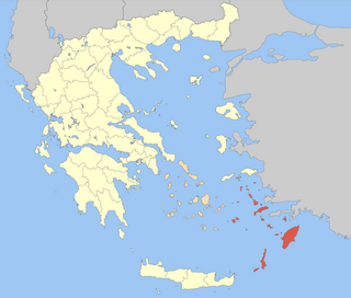
The Dodecanese are a group of 15 larger and 150 smaller Greek islands in the southeastern Aegean Sea and Eastern Mediterranean, off the coast of Turkey's Anatolia, of which 26 are inhabited. This island group generally defines the eastern limit of the Sea of Crete. They belong to the wider Southern Sporades island group.
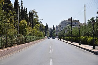
<span class="mw-page-title-main">Lindos</span> Municipal unit in Greece

Lindos is an archaeological site, a fishing village and a former municipality on the island of Rhodes, in the Dodecanese, Greece. Since the 2011 local government reform it is part of the municipality Rhodes, of which it is a municipal unit. The municipal unit has an area of 178.9 km2. It lies on the east coast of the island. It is about 40 km south of the city of Rhodes and its fine beaches make it a popular tourist and holiday destination. Lindos is situated in a large bay and faces the fishing village and small resort of Charaki.

<span class="mw-page-title-main">Aspropyrgos</span> Municipality in Greece

Aspropyrgos is located in the Athens metropolitan area, is a town and a municipality in the West Attica regional unit, in Attica, Greece. The municipality had a population of 30,251 at the 2011 census. It has an area of 101.983 km2.

<span class="mw-page-title-main">Palaiochora</span> Settlement in Greece

Palaiochora is a small town in Chania regional unit, Greece. It is located 70 km south of Chania, on the southwest coast of Crete and occupies a small peninsula 400 m wide and 700 m long. The town is set along 11 km of coastline bordering the Libyan Sea. It is the seat of the municipality of Kantanos–Selino and its population was 1,675 in the 2011 census.

<span class="mw-page-title-main">Nea Filadelfeia</span> Municipal unit in Greece

Nea Filadelfeia is a suburban town in the Athens agglomeration, Greece. Since the 2011 local government reform it is part of the municipality Filadelfeia-Chalkidona of Central Athens regional unit, of which it is the seat and a municipal unit. The municipal unit has an area of 2.850 km2. It was named after the Anatolian city Filadelfeia, now Alaşehir in Turkey, and it was settled by Greek refugees from Asia Minor after the Greco-Turkish War (1919-1922).

<span class="mw-page-title-main">Donousa</span> Municipal unit in Greece

Donousa, and sometimes spelled Donoussa, is an island and a former community in the Cyclades, Greece. Since the 2011 local government reform it is part of the municipality Naxos and Lesser Cyclades, of which it is a municipal unit. Donousa is the easternmost island of the Lesser Cyclades.

<span class="mw-page-title-main">Lentas</span>

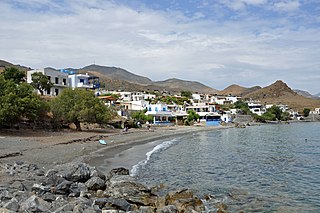
Lentas, Lentas is a coastal village 75 km south of Heraklion, on the south coast of Crete in Greece. It belongs to the community of Miamou within the municipality of Gortyna.

<span class="mw-page-title-main">Schoinoussa</span> Municipal unit in Greece

Schoinoussa or Schinoussa is an island and a former community in the Cyclades, Greece. Since the 2011 local government reform it is part of the municipality Naxos and Lesser Cyclades, of which it is a municipal unit. It lies south of the island of Naxos, in the Lesser Cyclades group, between the island communities of Irakleia and Koufonisia. The population was 256 inhabitants at the 2011 census. Its land area is 8.512 square kilometres (3.29 sq mi).

<span class="mw-page-title-main">Kasos</span> Island of Greece

Kasos, also Casos, is a Greek island municipality in the Dodecanese. It is the southernmost island in the Aegean Sea, and is part of the Karpathos regional unit. The capital of the island is Fri. As of 2021, its population was 1,223.

<span class="mw-page-title-main">Theodoriana</span> Municipal unit in Greece

Theodoriana is a village and former community in the Arta regional unit, Epirus, Greece. Since the 2011 local government reform, it is part of the municipality, Central Tzoumerka, of which it is a municipal unit. The municipal unit has an area of 44.398 km2. In 2011 its population was 348 for the community. Northeast is the Trikala regional unit. The Pindos and the Athamanian mountains cross the northeastern part. The Acheloos river flows by the village along with the GR-30.

<span class="mw-page-title-main">Thriasio Plain</span>

The Thriasio Plain is a plain in western Attica within Athens metropolitan area in Greece. It is bounded by Mount Egaleo to the east, Mount Parnitha to the north, Mount Pateras to the west, and the Bay of Elefsina to the south.

<span class="mw-page-title-main">Hellenic National Meteorological Service</span> Meteorological service of Greece

The Hellenic National Meteorological Service (HNMS) is a government agency responsible for making weather forecasts and observations for Greece. HNMS was founded in 1931 under the Ministry of Aviation and its mission was to cover all the meteorological and climatological needs of the country. It is based at the former Athens International Airport at Elliniko, and operates under the auspices of the Hellenic Air Force, staffed by both military and civilian personnel.

<span class="mw-page-title-main">Hellenic Seaplanes</span> Greek aviation company

Hellenic Seaplanes is a seaplane company in Greece with its own maintenance, training, flight operations and water aerodrome development strategy. The company's headquarters are in Kallithea, Athens, the fleet's maintenance base is at the Megara General Aviation Airport and soon will operate connecting all Greek Islands to the mainland.

A tropical night is a term used in many European countries to describe days when the temperature does not fall below 20 °C (68.0 °F) during the nighttime. This definition is in use in countries including the United Kingdom, Greece, Republic of Ireland, Spain, Portugal, Sweden, Norway, the Netherlands, Germany, Finland, Lithuania, Latvia, Hungary, Romania, Italy, Serbia, and Croatia. In the United States, by contrast, the term sultry nights is used when the temperature does not fall below 27 °C (80.6 °F) in the Gulf and Atlantic states.

<span class="mw-page-title-main">February 2021 Greek cold wave</span>

The February 2021 Greek cold wave was a cold wave over Greece, named Cold Front Medea, that arrived on February 13, 2021, and lasted through February 16. The cold wave brought strong winds, with gusts over 60 miles per hour (97 km/h), and the heaviest snowfall Northern Greece had experienced since 2008. The weather resulted in the deaths of at least 3 people.

<span class="mw-page-title-main">Fri, Kasos</span> Place in Greece

Fri is the capital of the Greek island of Kasos in the Dodecanese. As of 2001, its population was 357.

<span class="mw-page-title-main">Athens metropolitan area</span> Main metropolitan area in Greece

The Athens metropolitan area spans 2,928.717 km2 (1,131 sq mi) within the Attica region and consists of 58 municipalities plus areas of East Attica and West Attica, having reached a population of 3,638,281 according to the 2021 census. Municipalities of Athens and Piraeus both serve as the two metropolitan centres of the Athens metropolitan area.

References

  1. "Climatology,HNMS, Hellenic National Meteorological Service". www.hnms.gr. Retrieved 14 July 2020.
  2. "Visit Greece | Geography". Visit Greece | The Official website of the Greek Tourism Organisation. Retrieved 14 July 2020.
  3. "Olympus the First National Park". Management Agency of Olympus National Park. 2008. Archived from the original on 14 January 2017. Retrieved 5 December 2015.
  4. 1 2 "Climate Atlas of Greece" (PDF). Hellenic National Meteorological Service. Archived from the original on 21 September 2017. Retrieved 30 December 2019.
  5. 1 2 3 "Monthly Bulletins". www.meteo.gr.
  6. 1 2 "Climate Atlas of Greece" (PDF). Hellenic National Meteorological Service. Archived from the original (PDF) on 21 September 2017. Retrieved 30 December 2019.
  7. "Το 'νέο' κλίμα της Αθήνας - Περίοδος 1991-2020". National Observatory of Athens. Archived from the original on 21 October 2021. Retrieved 3 July 2021.
  8. "Το κλίμα της Αθήνας". www.meteoclub.gr. Archived from the original on 21 October 2021. Retrieved 3 July 2021.
  9. "Το αρχείο του Θησείου". www.meteoclub.gr. Archived from the original on 4 May 2016. Retrieved 1 May 2016.
  10. "Climate of Patras". Hellenic National Meteorological Service. Archived from the original on 25 May 2023. Retrieved 28 February 2013.
  11. "Latest Conditions in Xyloskalo, Chania, Crete Island". penteli.meteo.gr. Retrieved 27 April 2023.
  12. "Mean Florina Climatic Averages". Hellenic National Meteorological Service. Retrieved 11 December 2020.
  13. "Piraeus Urban Planning 1" (PDF) (in Greek). Pagkrati & Millioni (2017), NTUA. Archived from the original (PDF) on 7 March 2019. Retrieved 30 September 2019.
  14. "AUTH" . Retrieved 31 December 2023.
  15. "AUTH 2" . Retrieved 31 December 2023.
  16. "World Meteorological Organization" . Retrieved 31 December 2023.
  17. "Meteorologist Book" (PDF). H.N.M.S. Archived from the original (PDF) on 4 August 2022. Retrieved 3 August 2022.
  18. https://wmo.asu.edu/content/europe-highest-temperature . Arizona State University World Meteorological Organization
  19. "WMO is monitoring potential new temperature records". public.wmo.int. 17 July 2023. Retrieved 19 July 2023.
  20. "Climate" (in Greek). National Observatory of Athens. Retrieved 3 April 2022.
  21. 1 2 3 4 5 6 7 8 9 10 11 12 13 14 15 16 17 18 19 20 21 22 23 24 25 26 27 28 29 30 31 32 33 34 35 36 37 "Meteo.gr - Προγνώσεις καιρού για όλη την Ελλάδα".
  22. 1 2 "Climate" (in Greek). National Observatory of Athens. Archived from the original on 27 September 2022.
  23. 1 2 3 4 5 "N.O.A Monthly Bulletins".
  24. "World Meteorological Organization". Archived from the original on 12 July 2023. Retrieved 12 July 2023.
  25. "Latest Conditions in Kaimaktsalan".
  26. "World Meteorological Organization" . Retrieved 18 November 2023.
  27. "N.O.A Monthly Bulletins".
  28. "Latest Conditions in Sparta".
  29. "World Meteorological Organization" . Retrieved 14 July 2023.
  30. 1 2 http://hardiness.inforest.gr/ [ bare URL ]
  31. https://planthardiness.ars.usda.gov/ [ bare URL ]
  32. "Greek Plant Hardiness Zones".
  33. "Latest Conditions in Kasos".
  34. "ΔΗΜΟΣ ΚΑΡΠΑΘΟΥ" (PDF). Archived from the original (PDF) on 4 June 2023.
  35. "Latest Conditions in Kastellorizo".
  36. "Latest Conditions in Lindos, Rhodes".
  37. "Latest Conditions in Lentas, Crete".
  38. "Latest Conditions in Paleochora, Chania Crete".
  39. "Rhodes, Tourist Port - Municipal Port Fund of South Dodecanese Current Weather Conditions".
  40. "Latest Conditions in Falasarna, Chania".
  41. "Latest Conditions in Heraklion coast, Crete - Greece".
  42. "Latest Conditions in Plakias, Crete".
  43. "Latest Conditions in Aigiali, Amorgos".
  44. "Latest Conditions in Nisyros".
  45. "Latest Conditions in Hydra".
  46. "Latest Conditions in Monemvasia".
  47. "Latest Conditions in Koufonissia, Cyclades".
  48. "Latest Conditions in Patmos".
  49. "Latest Conditions in Spetses".
  50. "Latest Conditions in Sisi, Lasithi, Crete".
  51. "Latest Conditions in Sifnos".
  52. "Latest Conditions in Sitia of Crete".
  53. "Latest Conditions in Naxos, Cyclades".
  54. "Latest Conditions in Patra".
  55. "Latest Conditions in Lavrio - Greece".
  56. "Latest Conditions in Nea Smyrni, Athens".
  57. "Latest Conditions in P. Faliron".
  58. "Latest Conditions in Athens - Gazi region".
  59. "Latest Conditions in Kifissia".
  60. "Latest Conditions in Arta, Greece".
  61. "Latest Conditions in Megisti Lavra Monastery".
  62. "Latest Conditions in Kalamaria".
  63. "Latest Conditions in Ippokrateios Politia".
  64. "Latest Conditions in Nemea".
  65. "Latest Conditions in Racing Circuit, Serres".
  66. "Latest Conditions in Alexandroupolis".
  67. "Latest Conditions in Kaimaktsalan Ski Center".
  68. "Latest Conditions in Vathistalo".
  69. "In Greece, heatwaves are so bad officials are considering giving them names". 23 August 2021.
  70. Newsroom (5 January 2022). "Καιρός – Ανασκόπηση 2021: Ο «ιστορικός» καύσωνας, τα ρεκόρ βροχόπτωσης και θερμοκρασιών". Η ΚΑΘΗΜΕΡΙΝΗ (in Greek). Retrieved 19 June 2023.
  71. fani (21 July 2022). "Ο φονικός καύσωνας του 1987 με τους 44 βαθμούς. Οι νεκροί ξεπέρασαν τους 1.300 και επειδή γέμισαν οι θάλαμοι των νοσοκομείων τους έβαζαν ακόμα και σε βαγόνια - ψυγεία του ΟΣΕ!". ΜΗΧΑΝΗ ΤΟΥ ΧΡΟΝΟΥ (in Greek). Retrieved 19 June 2023.
  72. https://oscar.wmo.int/surface/#/search/station/stationReportDetails/0-300-1-gytheio [ bare URL ]
  73. "Αναζωπυρώσεις σε Ρόδο και Λακωνία". 21 July 2023.
  74. "Heatwaves and fires in Greece". 21 July 2023.
  75. "Monthly Bulletins" . Retrieved 9 April 2023.
  76. "Ιωάννινα". www.hellenicaworld.com. Retrieved 19 June 2023.
  77. "Latest Conditions in Schinoussa, Cyclades".
  78. "World Meteorological Organization" . Retrieved 6 August 2023.
  79. "Latest Conditions in Theodoriana".
  80. "World Meteorological Organization" . Retrieved 14 July 2023.
  81. "EMY-Εθνική Μετεωρολογική Υπηρεσία". Hnms.gr. Archived from the original on 2 March 2013. Retrieved 26 March 2013.
  82. "Atmospheric Controllers Of Local Nighttime Temperature". www.weather.gov. Retrieved 30 June 2023.
  83. "Climatic Atlas of Greece". Hellenic National Meteorological Service . Retrieved 4 August 2022.