Elevation ranges from the mountains of the Alps (highest point: the Zugspitze at 2,962 metres (9,718ft)) in the south to the shores of the North Sea (Nordsee) in the northwest and the Baltic Sea (Ostsee) in the northeast. Between lie the forested uplands of central Germany and the low-lying lands of northern Germany (lowest point: Neuendorf-Sachsenbande at 3.54 metres (11.6ft) below sea level), traversed by some of Europe's major rivers such as the Rhine, Danube and Elbe.[4]
Germany is in Central Europe, bordering Denmark in the north, Poland and the Czech Republic in the east, Austria and Switzerland in the south, France and Luxembourg in the south-west, and Belgium and the Netherlands in the north-west. It lies mostly between latitudes 47° and 55° N (the tip of Sylt is just north of 55°), and longitudes 5° and 16° E. The territory covers 357,600km2 (138,070sqmi), consisting of 349,250km2 (134,846sqmi) of land and 8,350km2 (3,224sqmi) of water. It is the seventh largest country by area in Europe and the 63rd largest in the world.[4]
Continental shelf: 200m (660ft) depth or to the depth of exploitation.
Exclusive economic zone: 57,485km2 (22,195sqmi) with 200nmi (370.4km; 230.2mi). The exact EEZ is due to conventions with neighbouring states.
Territorial sea: 12nmi (22.2km; 13.8mi)
Physical geography
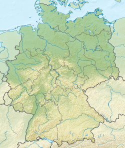
Topographic map of Germany
The northern third of the country lies in the North European Plain, with flat terrain crossed by northward-flowing watercourses (Elbe, Ems, Weser, Oder). Wetlands and marshy conditions are found close to the Dutch border and along the Frisian coast. Sandy Mecklenburg in the northeast has many glacier-formed lakes dating to the last glacial period.
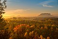
Moving south, central Germany features rough and somewhat patternless hilly and mountainous countryside, some of it formed by ancient volcanic activity. The Rhine valley cuts through the western part of this region. The central uplands continue east and north as far as the Saale and merge with the Ore Mountains on the border with the Czech Republic. Upland regions include the Eifel, Hunsrück and Palatine Forest west of the Rhine, the Taunus hills north of Frankfurt, the Vogelsberg massif, the Rhön, and the Thuringian Forest. South of Berlin, the east-central part of the country is more like the low northern areas, with sandy soil and river wetlands such as the Spreewald region.
Southern Germany's landforms are defined by various linear hill and mountain ranges like the two adjacent ranges of the Swabian and Franconian Alb (reaching approximately from the source of the Danube in the southwest of Baden-Württemberg, south of Stuttgart, across Swabia into Central Franconia and to the valley of the river Main) and the Bavarian Forest along the border between Bavaria and the Czech Republic. The Alps on the southern border are the highest mountains, but relatively little Alpine terrain lies within Germany (in southeastern Swabia and Upper Bavaria) compared to Switzerland and Austria. The Black Forest, on the southwestern border with France, separates the Rhine from the headwaters of the Danube on its eastern slopes.
The north–south difference in Germany, between 55°03"N (at List on Sylt) and 47°16"N (around Oberstdorf, Bavaria) equals almost eight degrees of latitude (or 889km), which can be seen especially during summer in the differences between the average temperatures. Besides that, there is a strong west–east cline in temperature. This is explained by the northwestern Germany's flat and open landscapes and its proximity to the sea, and South's higher terrain, larger distance from the sea, and the Alps. These mountains prevent much of the usually warmer Mediterranean air blowing into southern Germany. To the north of the Alps and the Carpathians, the local climate becomes colder, even at the same latitude and altitude. This is caused by some areas being further away from the Atlantic Ocean's Gulf Stream, known for having a warm current for its latitude, in addition to being closer to Russia's and Siberia's extremely cold winter winds. Even if Siberian winter winds are not dominating, when they do hit Germany, temperatures can in extreme cases fall to -20 C in the mountains and below during the nights, and this has an effect on the average temperatures of November to March. Although rare, when such cold air reaches Germany, the North-Eastern parts become mainly affected, while the Southwest receives few cold days in general. The Gulf Stream results in the coast having the mildest nights in the winter, almost never freezing.
The warmest area in Germany is the area bordering France, west of the Schwarzwald hills, roughly between Mannheim to the north and the Swiss border to the south. The coldest area (except for mountain peaks) is found in the southeastern parts of eastern Germany around Dresden and Görlitz up to Berlin.
Germany's climate is temperate and marine in the west and humid continental in the east. It has cool winters in the west and cold winters in the east. It has moderate rainfall year-round and is mostly overcast from November to February. Summers are warm, more so in the south. The north and centre of Germany lies fully in the temperate climatic zone in which humid westerly winds predominate. In the northwest and the north, the climate is oceanic. Winters there are cool and summers warm. In the east, the climate shows clear continental features; winters are cold and summers warm. Dry periods are often recorded.
In the centre and the south, there is a transitional climate between oceanic or continental. Winters are cool and summers warm, though maximum temperatures can exceed 30°C (86°F) for several days in a row during heat waves.
The warmest regions of Germany are in the southwest (see Rhine Rift Valley, German Wine Route and Palatinate). Summers are hot with many days up to 40°C (104°F). Sometimes, minimum temperatures do not drop below 20°C (68°F), which is relatively rare in other regions, except the North Sea coast and western city climates.[6][7]
Germany covers a total of 357,600km2 (138,100sqmi), of which 5,157km2 (1,991sqmi) is irrigated land and 8,350km2 (3,220sqmi) is covered by water, the largest lakes being Lake Constance (total area of 536km2 (207sqmi), with 62% of the shore being German; international borders are not defined on the lake itself), Müritz (117km2 or 45sqmi) and Chiemsee (80km2 or 31sqmi). The majority of Germany is covered by either arable land (33.95%); permanent crops cover 0.57% of the land.
Germany has a total of 2,389km (1,484mi) of coastline and borders totaling 3,714km (2,308mi) (clockwise from north: Denmark140km (87mi), Poland467km (290mi), Czech Republic704km (437mi),[24]Austria801km (498mi), Switzerland348km (216mi), France418km (260mi), Luxembourg128km (80mi), Belgium133km (83mi), Netherlands575km (357mi)). The German-Austrian border crosses itself near Jungholz. The border with Belgium includes five German exclaves due to the Vennbahn railway line. The border with Switzerland includes the German exclave village of Büsingen am Hochrhein which is separated from the rest of Germany by a strip of Swiss territory 680 metres wide at its narrowest point.
The Rhine (Rhein in German) with a German section extending 865km (537mi) (main tributaries including the Neckar, the Main and the Moselle (Mosel));
The Elbe with a German section of 727km (452mi) (also drains into the North Sea); and
The Danube (Donau) with a German length of 687km (427mi).
Further important rivers include the Saale and the Main in central Germany, the Neckar in the southwest, the Weser in the North and the Oder at the eastern border.
Caves
Show caves in Germany
Throughout the Karst rocks many caves were formed especially in the valley of the Hönne. The biggest culture cave of Europe is located in Balve.
Tidal flats
A recent global remote sensing analysis suggested that there were 2,783km2 of tidal flats in Germany, making it the 11th ranked country in terms of how much tidal flat occurs there.[25]
Emissions from coal-burning utilities and industries contribute to air pollution; acid rain, resulting from sulphur dioxide emissions, is damaging forests in Germany; pollution in the Baltic Sea from raw sewage and industrial effluents from rivers in eastern Germany; hazardous waste disposal; government (under Chancellor Schröder, SPD) announced intent to end the use of nuclear power for producing electricity; government working to meet EU commitment to identify nature preservation areas in line with the EU's Flora, Fauna, and Habitat directive. Germany's last glacier is disappearing.[citation needed]
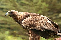
The plants and animals of Germany are those generally common to central Europe. Beeches, oaks, and other deciduous trees constitute one-third of the forests; conifers are increasing as a result of reforestation. Spruce and fir trees predominate in the upper mountains, while pine and larch are found in sandy soil. There are many species of ferns, flowers, fungi, and mosses. Fish abound in the rivers and the North Sea. Wild animals include deer, wild boar, mouflon, fox, badger, hare, Eurasian lynx, and small numbers of beaver. Extinct/endangered animals include gray wolf, brown bear, and European bison. Various migratory birds cross Germany in the spring and autumn.
Germany is known for its many zoological gardens, wildlife parks, aquaria, and bird parks.[27] More than 400 registered zoos and animal parks operate in Germany, which is believed to be the largest number in any single country of the world.[28]Berlin Zoo is the oldest zoo in Germany and presents the most comprehensive collection of species in the world.[29]
In the warm regions of the south, subtropical plants and trees like the cactus and palm trees have been planted and multiplied naturally later, while typical middle European trees do also occur. This is only the case though in the Main, Rhine and Neckar valleys and the Lake Constance. In German, people refer to them as German Tuscany or German Riviera.
With an estimated 83.2 million inhabitants in December 2020, Germany is the most populous country in the European Union and ranks as the 19th largest country in the world in terms of population. Its population density stands at 233 inhabitants per square kilometre (600/sqmi). The United Nations Population Fund lists Germany as host to the second-highest number of international migrants worldwide,[30] around 23% of Germany's population do not hold a German passport or are direct descendants of immigrants. The number of third and subsequent generations of immigrants are not statistically recorded.
Administrative divisions
Germany comprises sixteen states that are collectively referred to as Länder.[31] Each state has its own state constitution[32] and is largely autonomous in regard to its internal organisation. Due to differences in size and population the subdivision of these states varies, especially between city states (Stadtstaaten) and states with larger territories (Flächenländer). For regional administrative purposes five states, namely Baden-Württemberg, Bavaria, Hesse, North Rhine-Westphalia and Saxony, consist of a total of 22 Government Districts (Regierungsbezirke). As of July 2021 Germany is divided into 400 districts (Kreise) on municipal level, these consist of 294 rural districts and 106 urban districts.[33][34]
1 2 "Germany". CIA World Factbook. Central Intelligence Agency. November 14, 2006. Archived from the original on September 30, 2006. Retrieved November 29, 2006.
↑ "Geografie"(PDF). Statistische Jahrbuch Schleswig-Holstein (in German). 2019/2020. Hamburg: Statistisches Amt für Hamburg und Schleswig-Holstein: 307. 2020. ISSN0487-6423. Retrieved 2020-09-08.[permanent dead link]
↑ The individual denomination is either Land [state], Freistaat [free state] or Freie (und) Hansestadt [free (and) Hanseatic city]. "The Federal States". www.bundesrat.de. Bundesrat of Germany. Archived from the original on 10 September 2013. Retrieved 17 July 2011. "Amtliche Bezeichnung der Bundesländer"[Official denomination of federated states](PDF; download file „Englisch“). www.auswaertiges-amt.de (in German). Federal Foreign Office. Retrieved 22 October 2011.
Brüggemeier, F-J., "A Nature Fit for Industry: The Environmental History of the Ruhr Basin, 1840-1990", Environmental History Review, Vol. 18, 1994, pp.35-54.
Cioc, Mark. "The Impact of the Coal Age on the German Environment: A Review of the Historical LiteratureEnvironment and History (1998) 4#1 https://doi.org/10.3197/096734098779555754
This page is based on this Wikipedia article Text is available under the CC BY-SA 4.0 license; additional terms may apply. Images, videos and audio are available under their respective licenses.