The Timok Valley is a geographical region in east Serbia around the Timok River. The Timok Valley corresponds to parts of two Serbian districts, with a total 2022 census population of 200,785.

The Great Morava is the final section of the Morava, a major river system in Serbia.

The Osam is a river in northern Bulgaria, a right tributary of the Danube. Its length including the main stem Cherni (Black) Osam is 314 km, making it the fifth longest river in Bulgaria. The river proper, formed by the confluence of the Cherni and Beli (White) Osam, is 278 km.

The Iskar is a right tributary of the Danube. With a length of 368 km, it is the longest river that runs entirely within Bulgaria. Originating as three forks in Balkan's highest mountain range Rila, the Iskar flows in a northern direction until its confluence with the Danube. As it flows northwards it fuels the largest artificial lake in the country, the Iskar Reservoir, forms the divide between the Vitosha and Plana Mountains in the west and the Sredna Gora mountain range in the east before entering the Sofia Valley, which contains the nation's capital Sofia. From there the Iskar runs through the Balkan Mountains, forming the spectacular 84 km long Iskar Gorge. As it crosses the mountains, its water course turns in a north-eastern direction at Lakatnik. North of the Balkan Mountains, the river crosses the Danubian Plain and finally flows into the Danube between the villages of Baykal and Gigen. Geologically, Iskar is the oldest river in the Balkan Peninsula.

The South Morava is a river in eastern Kosovo and in southern Serbia, which represents the shorter headwater of Great Morava. Today, it is 295 kilometres (183 mi) long, including its source river Binačka Morava. It flows generally in the south to north direction, from the Macedonian border to Kosovo and onwards to Central Serbia, where it meets West Morava at Stalać, to create Great Morava.

The Pek is a river in eastern Serbia. It is a 129 km long right tributary of the Danube, flowing through the regions of Homolje, Zvižd and Braničevo. The river got a moniker Golden Pek, being one of the most gold-bearing rivers in Europe, with some of its tributaries bearing even more gold.
The Jasenička river is a river in eastern Serbia, a 55 km-long right tributary to the Danube.

The Archar or Archaritsa is a river in the western Danubian Plain of northwestern Bulgaria and a right tributary of the Danube. It is 59 kilometres in length.
The Svrljiški Timok is a river in Serbia, headwater of the Beli Timok. It rises north of the Mountains of Svrljig near the village of Šesti Gabar at elevation 1,078 m and flows to the west, curving around the northern slopes of the Mountains of Svrljig. It passes through many villages, reaching the town of Svrljig, that gives its name to the river, which here gently turns to the north, and after passing through Niševac and Varoš makes a complete turn to the north-east. It runs through Palilula, Podvis and Rgošte, reaching Knjaževac, where it meets the Trgoviški Timok and together they form the Beli Timok. The total length of the river is 64 km; the area of the river basin is 726 km2 (280 sq mi).
The Trgoviški Timok is a river in Serbia, also known as Korenatac or Strma river. It starts on the western slopes of the Balkan Mountains, right under the highest peak of the mountain in Serbia, Midžor, less than a kilometer from the Bulgarian border. The river runs to the east, receiving three smaller streams from the other peaks of Balkan mountain range with colorful names. The river passes through the villages of Balta Berilovac, Vrtovac and Inovo. On this reach it receives the Debelička and Ćuštička rivers from the left and the Golaška and Inovska rivers from the right. At the village of Kalna, it is joined by the Stanjanska River, flowing down the northern slopes of the Jadovnik mountain, turns to the north and becomes known as the Trgoviški Timok.
The Žukovačka River is the largest right tributary of the Trgoviški Timok in Serbia. In its upper course it is also called Leva River and Aldinačka River. It flows into the Trgoviški Timok near Žukovac. Its total length is 21.3 km (13.2 mi), and its drainage basin area is 104 km2 (40 sq mi).
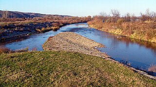
The Beli Timok is a headwater of the Timok River in Serbia. It starts at the junction of the Svrljiški Timok River and the Trgoviški Timok River, in Knjaževac. It was also known as Knjaževački Timok.

The Crni Timok, also known as Crna River or Krivovirski Timok, is a headwater of the Timok River.
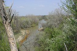
Timok is a river in eastern Serbia and western Bulgaria.

The Negotin Valley is a region in northeastern Serbia. It is isolated and distanced from other parts of Central Serbia. The Negotin Valley has unusual climatic features and hydropotential and geomorphologic sites.

The Treklyanska reka is a river in western Bulgaria, a right tributary of the Struma. The river is situated in the Kraishte geographical region and is 50 km long. It drains the eastern slopes of the mountain ranges of Karvav Kamak, Milevska Planina and Kobilska Planina, the northern and eastern slopes of the Zemenska Planina, the western and southern slopes of the Penkyovska Planina and the western slopes of the Rudina Planina.
The Voynishka reka is a river in northwestern Bulgaria, a right tributary of the Danube. Its length is 55 km.
The Stara reka is a 92 km-long river in northern Bulgaria, a right tributary of the river Yantra, itself a right tributary of the Danube. It is the second largest tributary of the Yantra, after the Rositsa.