Jungholz

Last updated • 1 min readFrom Wikipedia, The Free Encyclopedia
Jungholz
BlickAufJungholz.jpg
AUT Jungholz COA.svg
Map at-7 jungholz.png
Location of Jungholz within Tyrol
Austria adm location map.svg
Red pog.svg
Jungholz
Location within Austria
Coordinates: 47°34′25″N10°26′50″E / 47.57361°N 10.44722°E / 47.57361; 10.44722
Country Austria
State Tyrol
District Reutte
Government
   Mayor Karina Konrad
Area
[1]
  Total
7.06 km2 (2.73 sq mi)
Elevation
1,054 m (3,458 ft)
Population
 (2018-01-01) [2]
  Total
301
  Density43/km2 (110/sq mi)
Time zone UTC+1 (CET)
  Summer (DST) UTC+2 (CEST)
Postal code
  • A-6691
  • D-87491
Area code 05676
Vehicle registration RE
Website www.jungholz.tirol.gv.at OOjs UI icon edit-ltr-progressive.svg

Jungholz (German pronunciation: [ˈjʊŋhɔlt͡s] ) is a village in the district of Reutte in the Austrian state of Tyrol that is only accessible via Germany. The lack of a road connection to anywhere else in Austria led to Jungholz being included in the German customs area before Austria joined the EU in 1995. It also used the Deutsche Mark instead of the Austrian schilling as currency until 2002, when the euro took over. Letters to Jungholz can be addressed with either a German or an Austrian postal code.

Contents

Quadripoint

Jungholz (red) as part of Reutte District (dark grey), surrounded by Germany (white) Jungholz im Bezirk RE.png
Jungholz (red) as part of Reutte District (dark grey), surrounded by Germany (white)

Jungholz forms a pene-exclave of Austria that is connected to the rest of Austria by a single point, which is the summit of the mountain Sorgschrofen (1,636 m, 5,367 ft). As well as housing border post number 110 on the normal international border between Tyrol and Bavaria, a second border starts and, having gone round Jungholz, ends there. There are thus borders extending in four directions from the summit, called a quadripoint. Two Austrian (Tyrolean, Reutte) and two German (Bavarian, Oberallgäu) municipalities meet at that point, starting with Jungholz and continuing clockwise:

History

On 24 June 1342, Hermann Häselin, a farmer from Wertach in Germany, sold the area to Heinz Lochpyler, an Austrian taxman from nearby Tannheim. [3] The buyer had the area incorporated with his other possession of Tyrol. In the Bavarian–Austrian border treaty of 1844 Jungholz went to Austria.[ citation needed ] Its customs union with Germany dates to a Treaty signed in 1868. [4]

In 1938 following the German takeover of Austria, Jungholz and the similarly isolated Kleinwalsertal were annexed to Gau Swabia in Bavaria, though returned to Austria after the end of WWII. [5]

See also

Related Research Articles

<span class="mw-page-title-main">Tyrol (state)</span> Austrian federal state

Tyrol is an Austrian federal state. It comprises the Austrian part of the historical Princely County of Tyrol. It is a constituent part of the present-day Euroregion Tyrol–South Tyrol–Trentino. The capital of Tyrol is Innsbruck.

<span class="mw-page-title-main">Kufstein</span> Municipality in Tyrol, Austria

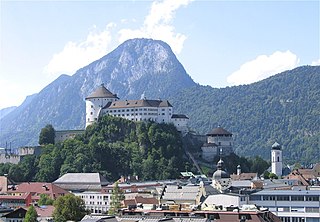
Kufstein is a town in the Austrian state of Tyrol, the administrative seat of Kufstein District. With a population of about 20,000 it is the second largest Tyrolean town after the state capital Innsbruck. The greatest landmark is Kufstein Fortress, first mentioned in the 13th century. The town was the place of origin of the Austrian noble family Kuefstein.

<span class="mw-page-title-main">Reutte</span> Municipality in Tyrol, Austria

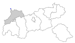
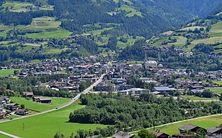
Reutte is a town in the Austrian state of Tyrol. It is the administrative center of the Reutte district. Reutte is located on the Lech, and has a population of 6,704.

<span class="mw-page-title-main">Lienz</span> Municipality in Tyrol, Austria

Lienz is a medieval town in the Austrian state of Tyrol. It is the administrative centre of the Lienz district, which covers all of East Tyrol. The municipality also includes the cadastral subdivision of Patriasdorf.

<span class="mw-page-title-main">Kleinwalsertal</span> Valley in the Allgäu Alps, Austria

Kleinwalsertal is a valley in the Austrian province of Vorarlberg and part of the Bregenz district. It includes the municipality of Mittelberg and consists of three villages along the River Breitach. Due to the geographic location in the Allgäu Alps with its alpine terrain, the Kleinwalsertal has no direct traffic connection to the rest of Vorarlberg. It is accessible only via Oberstdorf, Germany, to the north, and thus is an Austrian "practical exclave" or "pene-exclave".

<span class="mw-page-title-main">Lofer</span> Municipality in Salzburg, Austria

Lofer is a market town in the district of Zell am See in the Austrian state of Salzburg.

<span class="mw-page-title-main">Schärding</span> Place in Upper Austria, Austria

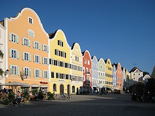
Schärding is a town in the northern Austrian state of Upper Austria, the capital of the district of the same name, and a major port on the Inn River. Historically, it was owned by the Wittelsbach family, which is reflected in the town's architecture.

<span class="mw-page-title-main">Sillian</span> Municipality in Tyrol, Austria

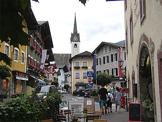
Sillian is a market town in the district of Lienz, in the Austrian state of Tyrol.

<span class="mw-page-title-main">Obertilliach</span> Municipality in Tyrol, Austria

Obertilliach is a municipality in the district of Lienz, in the Austrian state of Tyrol.

<span class="mw-page-title-main">Matrei in Osttirol</span> Municipality in Tyrol, Austria

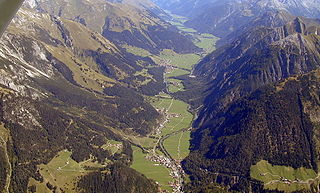
Matrei in Osttirol is a market town in the Lienz District in the Austrian state of Tyrol. It is situated about 29 km (18 mi) north of Lienz within the Hohe Tauern mountain range of the Central Eastern Alps. Its municipal area comprises parts of the Granatspitze Group and the Venediger Group, with the Großvenediger peak as its highest point. The population largely depends on tourism, seasonal agriculture and forestry.

<span class="mw-page-title-main">Vils, Tyrol</span> Municipality in Tyrol, Austria

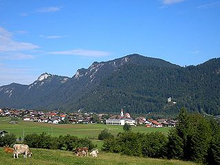
Vils is a town in the district of Reutte in the Austrian state of Tyrol. It has a long, rich history of ten or more generations of excellent luthiers. Most prominent among those of the Rief family is Dominicus Rief. Examples of his work are in the museum there.

<span class="mw-page-title-main">Steeg, Tyrol</span> Municipality in Tyrol, Austria

Steeg is a municipality in the district of Reutte in the Austrian state of Tyrol.

<span class="mw-page-title-main">Pflach</span> Municipality in Tyrol, Austria

Pflach is a municipality in the district of Reutte in the Austrian state of Tyrol. It is 3 km north of the centre of Reutte town, and 2.5 km south of the German border.

<span class="mw-page-title-main">Nesselwängle</span> Municipality in Tyrol, Austria

Nesselwängle is a municipality in the district of Reutte in the Austrian state of Tyrol.

<span class="mw-page-title-main">Grän</span> Municipality in Tyrol, Austria

Grän is a municipality in the district of Reutte in the Austrian state of Tyrol.

<span class="mw-page-title-main">Golling an der Salzach</span> Municipality in Salzburg, Austria

Golling an der Salzach is a market town in the Hallein district of Salzburg, Austria.

<span class="mw-page-title-main">Mittelberg</span> Place in Vorarlberg, Austria

Mittelberg is a municipality and a village in the district of Bregenz in the Kleinwalsertal, in the Austrian state of Vorarlberg. It is accessible by road only from Germany.

<span class="mw-page-title-main">Sibratsgfäll</span> Place in Vorarlberg, Austria

Sibratsgfäll is a municipality in the district of Bregenz in the Austrian state of Vorarlberg.

<span class="mw-page-title-main">Sorgschrofen</span> Mountain

Sorgschrofen is a 1,635-metre-tall (5,364 ft) mountain in the Allgäu Alps of Bavaria, Germany. A lower summit of Sorgschrofen is the 1,613-metre-tall (5,292 ft) Zinken. There is a summit cross on both Sorgschrofen and Zinken.

<span class="mw-page-title-main">Austria–Germany border</span> International border

The border between the modern states of Austria and Germany has a length of 815.9 km (507.0 mi), or 815.0 km (506.4 mi) respectively. It is the longest international border of Austria and the second longest border of Germany with another country.

References

  1. "Dauersiedlungsraum der Gemeinden Politischen Bezirke und Bundesländer - Gebietsstand 1.1.2018". Statistics Austria. Retrieved 10 March 2019.
  2. "Einwohnerzahl 1.1.2018 nach Gemeinden mit Status, Gebietsstand 1.1.2018". Statistics Austria. Retrieved 9 March 2019.
  3. MacEacheran, Mike (14 February 2022). "Jungholz: A ski town stuck in the wrong nation". BBC. Retrieved 14 February 2022.
  4. "Regulation (EEC) No 1496/68 of the Council of 27 September 1968 on the definition of the customs territory of the Community". op.europa.eu. Publications Office of the European Union. Retrieved 21 August 2021.
  5. Jahrhundert – Rückblick (in German) Kleinwalsertal website