Biberwier

Last updated
Biberwier
Biberwier - church.jpg
Austria adm location map.svg
Red pog.svg
Biberwier
Location within Austria
Coordinates: 47°23′00″N10°53′34″E / 47.38333°N 10.89278°E / 47.38333; 10.89278 Coordinates: 47°23′00″N10°53′34″E / 47.38333°N 10.89278°E / 47.38333; 10.89278
Country Austria
State Tyrol
District Reutte
Government
   Mayor Paul Mascher
Area
[1]
  Total29.42 km2 (11.36 sq mi)
Elevation
989 m (3,245 ft)
Population
 (2018-01-01) [2]
  Total628
  Density21/km2 (55/sq mi)
Time zone UTC+1 (CET)
  Summer (DST) UTC+2 (CEST)
Postal code
6633
Area code 05673
Vehicle registration RE
Website www.biberwier.tirol.gv.at

Biberwier is a municipality with 612 inhabitants (as of 1 January 2019) in the district of Reutte in the Austrian state of Tyrol. The municipality is located in the district court Reutte.

Contents

Geography

The village is located on the southern edge of the Lermooser Moos, between a mountain slope and the landslide landscape of the Fern Pass in the Tyrolean Alps. The municipality is crossed by the Loisach, which springs west of the village. The community is located near the border with Germany on the edge of the Wetterstein Mountains and is visible from the Zugspitze.

History

The name derives from beavers, who have demonstrably lived in the municipality until 1800 and arrived back in recent years. Corpus of finds from the Roman period bear witness to the early importance of the place on the Via Claudia Augusta. The track grooves at the northern entrance, though referred to as Roman, are from Medieval times. From the Middle Ages to the year 1921, at the Silberleithe, there was the largest mining operation in the Außerfern, called "Gewerkschaft Silberleithen", mining silver, lead and zinc ore. Since the end of 2004, the historical Montan hiking trail Silberleithen opened up this former mining area for tourism. With the Lermooser tunnel, bypassing the village, and opened in 1984, the place was relieved of transit traffic.

Biberwier is located on a bicycle path, which runs as Via Claudia Augusta along an ancient Roman road of the same name.

Today Biberwier with the ski area Marienbergjoch and the swimming lakes Blindsee, Mittersee and Weißensee is a two-season tourism community.

Coat of arms

Blazon: Divided by gold and blue in the serpent cut, left in the upper field, following the division line, a blue wheel, whose hub is covered with the gold mining markers mallet and iron, right below a sitting, looking to the left beaver. The colors of the community flag are yellow-blue. [3]

The beaver in 1983 awarded municipal coat of arms symbolizes the toponym, mallets and iron refer to the historic mining, the wheel on the important transport system. [4]

Personalities

Related Research Articles

Brixen im Thale Place in Tyrol, Austria

Brixen im Thale is a municipality situated at the highest point of the Brixental valley in the Austrian state of Tyrol. Every year on the Feast of Corpus Christi, the village celebrates the traditional Antlassritt. It is also the birthplace of Matthäus Hetzenauer, an Austrian sniper in the 3rd Mountain Division on the Eastern Front of the World War II, who was credited with 345 kills.

Serfaus Place in Tyrol, Austria

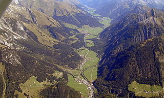
Serfaus is a municipality in the district of Landeck in the Austrian state of Tyrol. It is well known as part of the ski-region "Serfaus-Fiss-Ladis", which was formed when Serfaus teamed up with the two nearby municipalities of Fiss and Ladis in 1999. Serfaus is also known for its small hovertrain subway system, the U-Bahn Serfaus. With four stations and a length of 1280 m it allows for a complete ban of cars within the town, while at the same time maintaining the village's attractiveness to tourists, particularly skiers.

Reutte Place in Tyrol, Austria

Reutte is a market town in the Austrian state of Tyrol. It is the administrative center of the Reutte district. Reutte is located on the Lech, and has a population of 6704.

Oberndorf in Tirol Place in Tyrol, Austria

Oberndorf is a municipality in Kitzbühel district in the Austrian state of Tyrol. It is located in the Leukental valley, on the Kitzbühler Ache stream, halfway between St. Johann in Tirol and Kitzbühel.

Flattach Place in Carinthia, Austria

Flattach is a municipality in Spittal an der Drau District in the Austrian state of Carinthia.

Axams Place in Tyrol, Austria

Axams is a municipality in the district of Innsbruck Land in the Austrian state of Tyrol.

Kirchdorf in Tirol Place in Tyrol, Austria

Kirchdorf in Tirol is a municipality in the Kitzbühel district in the Austrian state of Tyrol located 12.2 km (7.6 mi) north of Kitzbühel as well as 3 km (1.9 mi) north of Sankt Johann in Tirol at the Kitzbühler Ache. By area, Kirchdorf is the second largest municipality in the district. The village obtained its name from an old church which was built in the 8th century. The main sources of income are agriculture and tourism.

Nauders Place in Tyrol, Austria

Nauders is a municipality in the district of Landeck in the Austrian state of Tyrol.

Prutz Place in Tyrol, Austria

Prutz is a municipality in the Landeck district in the Austrian state of Tyrol. Located at the mouth of the Kauner valley on the upper Inn, it is 10 km south of the city of Landeck and 36 km north of Reschen Pass, that forms the border to Italy. The border to Switzerland is located 23 km away towards the south-west.

Obernberg am Brenner Place in Tyrol, Austria

Obernberg am Brenner is a municipality in the southern district of Innsbruck-Land in the Austrian state of Tirol.

Berwang Place in Tyrol, Austria

Berwang is a municipality with 564 inhabitants in the district of Reutte in the Austrian state of Tyrol. The districts are Brand, Bichlbächle, Gröben, Kleinstockach, Mitteregg, Rinnen, Tal. The municipality is located in the district court Reutte.

Bichlbach Place in Tyrol, Austria

Bichlbach is a municipality in the district of Reutte in the Austrian state of Tyrol.

Ehenbichl Place in Tyrol, Austria

Ehenbichl is a municipality with 825 inhabitants in the district of Reutte in the Austrian state of Tyrol.

Weißenbach am Lech Place in Tyrol, Austria

Weißenbach am Lech is a municipality in the Austrian district of Reutte, Tyrol.

Ehrwald Place in Tyrol, Austria

Ehrwald is a municipality in the district of Reutte in the Austrian state of Tyrol.

Forchach Municipality in Tyrol, Austria

Forchach is a municipality in the district of Reutte in the Austrian state of Tyrol.

Gramais Municipality in Tyrol, Austria

Gramais is a municipality of 41 inhabitants in the district of Reutte in the Austrian state of Tyrol. The municipality is located in the district court Reutte. It is the smallest municipality in Austria.

Häselgehr Place in Tyrol, Austria

Häselgehr is a municipality with 686 inhabitants in the district of Reutte in the Austrian state of Tyrol. The municipality is located in the district court Reutte. Since 2010, the community is a member of the Climate Alliance Tyrol.

Lermoos Municipality in Reutte, Tyrol, Austria

Lermoos is a municipality in the district of Reutte in the Austrian state of Tyrol.

Sankt Leonhard im Pitztal Place in Tyrol, Austria

Sankt Leonhard im Pitztal is a municipality in the Imst district, located 20 kilometres (12 mi) south of Imst on the upper course of the Pitze River in western Austria. The village covers a large area and has a length of around 25 kilometres (16 mi). It is one of the biggest communities of Tyrol by area.

References

  1. "Dauersiedlungsraum der Gemeinden Politischen Bezirke und Bundesländer - Gebietsstand 1.1.2018". Statistics Austria. Retrieved 10 March 2019.
  2. "Einwohnerzahl 1.1.2018 nach Gemeinden mit Status, Gebietsstand 1.1.2018". Statistics Austria. Retrieved 9 March 2019.
  3. Landesgesetzblatt für Tirol, Nr. 25/1983. (Digitalisat)
  4. "Tirol Atlas: Wappen von Tirol - Biberwier". Archived from the original on 2007-06-30. Retrieved 2020-07-01.