Heiterwang

Last updated
Heiterwang
Heiterwang AnsichtS.jpg
Wappen at heiterwang.png
Coat of arms
Austria adm location map.svg
Red pog.svg
Heiterwang
Location within Austria
Coordinates: 47°26′40″N10°44′58″E / 47.44444°N 10.74944°E / 47.44444; 10.74944 Coordinates: 47°26′40″N10°44′58″E / 47.44444°N 10.74944°E / 47.44444; 10.74944
Country Austria
State Tyrol
District Reutte
Government
   Mayor Beate Reichl
Area
[1]
  Total35.73 km2 (13.80 sq mi)
Elevation
994 m (3,261 ft)
Population
 (2018-01-01) [2]
  Total532
  Density15/km2 (39/sq mi)
Time zone UTC+1 (CET)
  Summer (DST) UTC+2 (CEST)
Postal code
6611
Area code 05674
Vehicle registration RE

Heiterwang is a municipality in the district of Reutte in the Austrian state of Tyrol.

Contents

Pfarrkirche Unsere Liebe Frau Maria Himmelfahrt Heiterwang, katholische Pfarrkirche Unsere Liebe Frau Mariae Himmelfahrt Dm64074 foto11 2014-07-25 10.13.jpg
Pfarrkirche Unsere Liebe Frau Maria Himmelfahrt

Geography

Heiterwang lies south of Reutte on the Heiterwanger See, which is connected by canal to the Plansee.

Related Research Articles

Stanzach Place in Tyrol, Austria

Stanzach is a municipality in the Reutte district in the Austrian state of Tyrol.

Breitenwang Place in Tyrol, Austria

Breitenwang is a municipality and village in the district of Reutte in the Austrian state of Tyrol.

Wängle Place in Tyrol, Austria

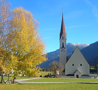
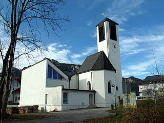
Wängle is a municipality in the district of Reutte in the Austrian state of Tyrol. Its St. Martin church contains many frescoes and paintings by Paul Zeiler.

Vorderhornbach Place in Tyrol, Austria

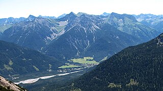
Vorderhornbach is a municipality in the district of Reutte in the Austrian state of Tyrol.

Tannheim, Tyrol Place in Tyrol, Austria

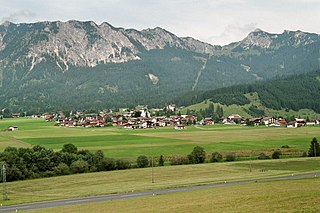
Tannheim is a municipality in the district of Reutte in the Austrian state of Tyrol.

Steeg, Tyrol Place in Tyrol, Austria

Steeg is a municipality in the district of Reutte in the Austrian state of Tyrol.

Schattwald Place in Tyrol, Austria

Schattwald is a municipality in the district of Reutte in the Austrian state of Tyrol.

Pflach Place in Tyrol, Austria

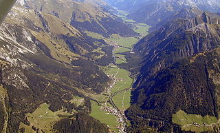
Pflach is a municipality in the district of Reutte in the Austrian state of Tyrol. It is 3 km north of the centre of Reutte town, and 2.5 km south of the German border.

Pfafflar Place in Tyrol, Austria

Pfafflar is a municipality in the district of Reutte in the Austrian state of Tyrol.

Nesselwängle Place in Tyrol, Austria

Nesselwängle is a municipality in the district of Reutte in the Austrian state of Tyrol.

Namlos Place in Tyrol, Austria

Namlos is a municipality in the district of Reutte in the Austrian state of Tyrol.

Ehrwald Place in Tyrol, Austria

Ehrwald is a municipality in the district of Reutte in the Austrian state of Tyrol.

Elbigenalp Place in Tyrol, Austria

Elbigenalp is a municipality in the district of Reutte in the Austrian state of Tyrol.
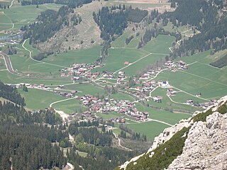
Elmen Place in Tyrol, Austria

Elmen is a municipality in the district of Reutte in the Austrian state of Tyrol.

Hinterhornbach Place in Tyrol, Austria

Hinterhornbach is a municipality in the district of Reutte in the Austrian state of Tyrol.

Höfen, Tyrol Place in Tyrol, Austria

Höfen is a municipality in the district of Reutte in the Austrian state of Tyrol.

Kaisers Place in Tyrol, Austria

Kaisers is a municipality in the district of Reutte in the Austrian state of Tyrol.

Lechaschau Place in Tyrol, Austria

Lechaschau is a municipality in the district of Reutte in the Austrian state of Tyrol.

Lermoos Place in Tyrol, Austria

Lermoos is a municipality in the district of Reutte in the Austrian state of Tyrol.

Musau Place in Tyrol, Austria

Musau is a municipality in the district of Reutte in the Austrian state of Tyrol.

References

  1. "Dauersiedlungsraum der Gemeinden Politischen Bezirke und Bundesländer - Gebietsstand 1.1.2018". Statistics Austria. Retrieved 10 March 2019.
  2. "Einwohnerzahl 1.1.2018 nach Gemeinden mit Status, Gebietsstand 1.1.2018". Statistics Austria. Retrieved 9 March 2019.