Hochfilzen is a town and municipality in the Kitzbühel district of the Austrian state of Tyrol. It is located in the Pillersee valley 5 km east of Fieberbrunn. Population was 1,147 in 2016.

Fulpmes is a market town and a municipality in Stubaital, Tyrol, Austria. In 2015 it had a population of 4,250, of whom 14.5% did not have Austrian nationality. Fulpmes is the center of iron production in the area, and lies at the base of the Schlick 2000 ski area.

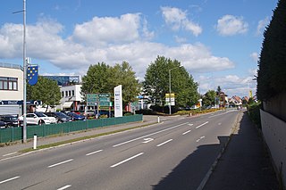
Lochau is a municipality in the westernmost Austrian state of Vorarlberg. It is located on Lake Constance, in the Bregenz district, near the border to Germany.
The Official Municipality Key, formerly also known as the Official Municipality Characteristic Number or Municipality Code Number, is a number sequence for the identification of politically independent municipalities or unincorporated areas. Other classifications for the identification of areas include postal codes, NUTS codes or FIPS codes.
The Bezirk Reutte is an administrative district in Tyrol, Austria. It borders Bavaria (Germany) in the north, the districts Imst and Landeck in the south, and Bregenz and Bludenz in the west. The district is also referred to as Außerfern.
Spielberg is a city located in the Bezirk Murtal in Styria, Austria.
KTTW is a religious television station in Sioux Falls, South Dakota, United States, owned and operated by Tri-State Christian Television (TCT) with transmitter in Rowena, South Dakota. It is rebroadcast on KTTM in Huron, whose transmitter is located near Alpena, South Dakota. KTTM covers areas of south-central and southeastern South Dakota that receive a marginal to non-existent over-the-air signal from KTTW.

Ramsau am Dachstein is a municipality in the district of Liezen, state of Styria, Austria. It is also the name of the elevated plateau between the Dachstein range and the Enns valley on which this municipality is located.

Prettau is a comune (municipality) and a village in South Tyrol, a province in northern Italy, located about 80 kilometres (50 mi) northeast of Bolzano at the border with Austria.

Hahntennjoch is a high mountain pass in the Austrian Alps in the Bundesland of Tyrol.

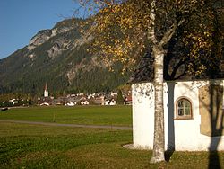
Häselgehr is a municipality with 686 inhabitants in the district of Reutte in the Austrian state of Tyrol. The municipality is located in the district court Reutte. Since 2010, the community is a member of the Climate Alliance Tyrol.
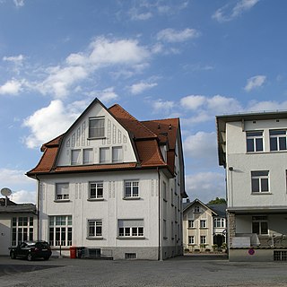
Altach is a municipality in the district of Feldkirch, in the westernmost Austrian state of Vorarlberg.

Wals-Siezenheim is a municipality in the district of Salzburg-Umgebung (Flachgau) in the Austrian state of Salzburg.

Wöllersdorf-Steinabrückl is a municipality in the district of Wiener Neustadt-Land in the Austrian state of Lower Austria.

Dünserberg is a municipality in the district of Feldkirch in the Austrian state of Vorarlberg.
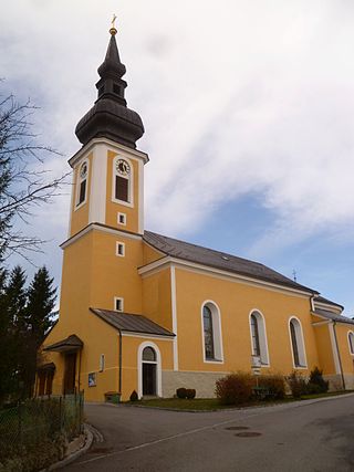
Altschwendt is a municipality in the district of Schärding in the Austrian state of Upper Austria.

Ottensheim is a municipality in the district of Urfahr-Umgebung in the Austrian state of Upper Austria. At its rowing venue, Regattastrecke Ottensheim, it has hosted numerous international rowing competitions, including various World Championships, World U23 Championships, World Junior Championships, and World Cups.
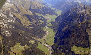
The Lechtal is an alpine valley in Austria, the greater part of which belongs to the state of Tyrol and the smaller part to Vorarlberg. The Lech river flows through the valley.

Bschlabs is a village in the Austrian municipality of Pfafflar, Bschlaber Valley. It consists of about 70 buildings with about 90 residents. These buildings make up the village of Bschlabs itself and the hamlets Aschlen, Sack, Windegg, Mitteregg, Taschach, Egg and Zwieslen. The village is the municipal seat of Pfafflar. Bschlabs is located on the southern slope of the Namloser Wetterspitze with an elevation of 2,553 metres (8,376 ft) in the valley opposite of the Spitzkopf (2,346 metres. Bschlabs' population is decreasing along with Pfafflar as a whole.