Musau

Last updated
Musau
Musau.jpg
Wappen at musau.png
Coat of arms
Austria adm location map.svg
Red pog.svg
Musau
Location within Austria
Coordinates: 47°31′56″N10°40′20″E / 47.53222°N 10.67222°E / 47.53222; 10.67222 Coordinates: 47°31′56″N10°40′20″E / 47.53222°N 10.67222°E / 47.53222; 10.67222
Country Austria
State Tyrol
District Reutte
Government
   Mayor Franz Haid
Area
[1]
  Total20.66 km2 (7.98 sq mi)
Elevation
821 m (2,694 ft)
Population
(2018-01-01) [2]
  Total391
  Density19/km2 (49/sq mi)
Time zone UTC+1 (CET)
  Summer (DST) UTC+2 (CEST)
Postal code
6600
Area code 05677
Vehicle registration RE

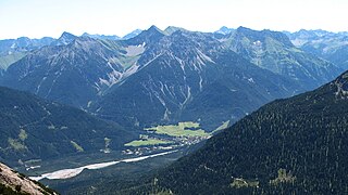
Musau is a municipality in the district of Reutte in the Austrian state of Tyrol.

Austria Federal republic in Central Europe

Austria, officially the Republic of Austria, is a country in Central Europe comprising 9 federated states. Its capital, largest city and one of nine states is Vienna. Austria has an area of 83,879 km2 (32,386 sq mi), a population of nearly 9 million people and a nominal GDP of $477 billion. It is bordered by the Czech Republic and Germany to the north, Hungary and Slovakia to the east, Slovenia and Italy to the south, and Switzerland and Liechtenstein to the west. The terrain is highly mountainous, lying within the Alps; only 32% of the country is below 500 m (1,640 ft), and its highest point is 3,798 m (12,461 ft). The majority of the population speaks local Bavarian dialects as their native language, and German in its standard form is the country's official language. Other regional languages are Hungarian, Burgenland Croatian, and Slovene.

Geography

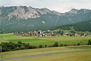
Musau lies north of Reutte in a basin where the Lech widens to form a small lake.

Reutte Place in Tyrol, Austria

Reutte is a market town in the Austrian state of Tyrol. It is the administrative center of the Reutte district. Reutte is located on the Lech, and has a population of 6704.

Lech (river) river in Austria and Germany

The Lech is a river in Austria and Germany. It is a right tributary of the Danube 255 kilometres (158 mi) in length with a drainage basin of 3,919 square kilometres (1,513 sq mi). Its source is located in the Austrian state of Vorarlberg, where the river rises from lake Formarinsee in the Alps at an altitude of 1,870 metres (6,120 ft). It flows in a north-north-easterly direction and crosses the German border, forming the Lechfall, a 12-metre-high (39 ft) waterfall; afterwards the river enters a narrow gorge. Leaving the Alps, it enters the plains of the Allgäu at Füssen at an elevation of 790 metres (2,580 ft) in the German state of Bavaria, where it used to be the location of the boundary with Swabia. The river runs through the city of Füssen and through the Forggensee, a man-made lake which is drained in winter. Here, it forms rapids and a waterfall.

Related Research Articles

Stanzach Place in Tyrol, Austria

Stanzach is a municipality in the Reutte district in the Austrian state of Tyrol.

Bach, Austria Place in Tyrol, Austria

Bach is a municipality in the district of Reutte in the Austrian state of Tyrol. It lies in the upper Lechtal and was mentioned first in documents in 1427. Many inhabitants commute. Otherwise the main source of income is tourism.

Breitenwang Place in Tyrol, Austria

Breitenwang is a municipality and village in the district of Reutte in the Austrian state of Tyrol.

Zöblen Place in Tyrol, Austria

Zöblen is a municipality in the district of Reutte in the Austrian state of Tyrol.

Ehenbichl Place in Tyrol, Austria

Ehenbichl is a municipality in the district of Reutte in the Austrian state of Tyrol.

Wängle Place in Tyrol, Austria

Wängle is a municipality in the district of Reutte in the Austrian state of Tyrol. Its St. Martin church contains many frescoes and paintings by Paul Zeiler.

Vorderhornbach Place in Tyrol, Austria

Vorderhornbach is a municipality in the district of Reutte in the Austrian state of Tyrol.

Tannheim, Tyrol Place in Tyrol, Austria

Tannheim is a municipality in the district of Reutte in the Austrian state of Tyrol.
Schattwald Place in Tyrol, Austria

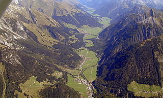
Schattwald is a municipality in the district of Reutte in the Austrian state of Tyrol.
Pflach Place in Tyrol, Austria

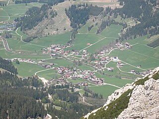
Pflach is a municipality in the district of Reutte in the Austrian state of Tyrol. It is 3 km north of the centre of Reutte town, and 2.5 km south of the German border.

Pfafflar Place in Tyrol, Austria

Pfafflar is a municipality in the district of Reutte in the Austrian state of Tyrol.

Nesselwängle Place in Tyrol, Austria

Nesselwängle is a municipality in the district of Reutte in the Austrian state of Tyrol.

Ehrwald Place in Tyrol, Austria

Ehrwald is a municipality in the district of Reutte in the Austrian state of Tyrol.
Gramais Place in Tyrol, Austria

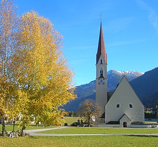
Gramais is a municipality in the district of Reutte in the Austrian state of Tyrol.
Grän Place in Tyrol, Austria

Grän is a municipality in the district of Reutte in the Austrian state of Tyrol.

Häselgehr Place in Tyrol, Austria

Häselgehr is a municipality in the district of Reutte in the Austrian state of Tyrol.
Heiterwang Place in Tyrol, Austria

Heiterwang is a municipality in the district of Reutte in the Austrian state of Tyrol.

Höfen, Tyrol Place in Tyrol, Austria

Höfen is a municipality in the district of Reutte in the Austrian state of Tyrol.

Lechaschau Place in Tyrol, Austria

Lechaschau is a municipality in the district of Reutte in the Austrian state of Tyrol.
Lermoos Place in Tyrol, Austria

Lermoos is a municipality in the district of Reutte in the Austrian state of Tyrol.

References

  1. "Dauersiedlungsraum der Gemeinden Politischen Bezirke und Bundesländer - Gebietsstand 1.1.2018". Statistics Austria. Retrieved 10 March 2019.
  2. "Einwohnerzahl 1.1.2018 nach Gemeinden mit Status, Gebietsstand 1.1.2018". Statistics Austria. Retrieved 9 March 2019.