
Sistrans is a community in the district of Innsbruck-Land in the Austrian state of Tyrol located 4 km southeast above Innsbruck on the highlands.

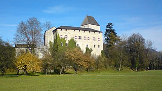
Heinfels is a municipality in the district of Lienz in the Austrian state of Tyrol. It is most known as the site of Burg Heinfels, and the gateway to the Loacker factory
Tristach is a municipality in the district of Lienz in the Austrian state of Tyrol.
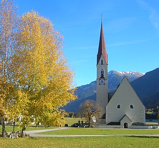
Leisach is a municipality in the district of Lienz in the Austrian state of Tyrol.

Prägraten am Großvenediger is a municipality in the district of Lienz in the Austrian state of Tyrol.

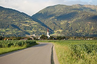
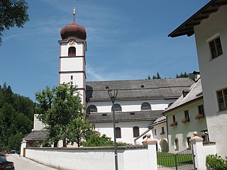
Oberlienz is a municipality in the district of Lienz in the Austrian state of Tyrol.
Brandberg is a municipality in the Schwaz district of in the Austrian state of Tyrol.

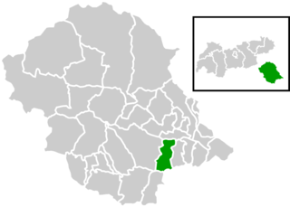
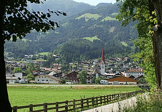
Pill is a municipality in the Schwaz district in the Austrian state of Tyrol. The 2024 Tour of the Alps passed through Pill on the 16th of April.
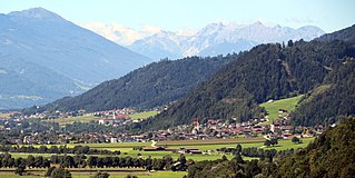
Stans is a municipality in the Schwaz district in the Austrian state of Tyrol. It is located in the Inn valley, some 3 km away from Schwaz.

Rohrberg is a municipality in the Schwaz district in the Austrian state of Tyrol.

Kaltenbach is a municipality in the Schwaz district in the Austrian state of Tyrol.
Fügen is a municipality in the Schwaz district in the Austrian state of Tyrol.
Kramsach is a municipality in the Kufstein district in the Austrian state of Tyrol located 27 km southwest of Kufstein and 16.5 km west of Wörgl, at the northern side of the Inn River. Its main sources of income are the marble, timber and glass industries, as well as summer tourism. Kramsach is also known as the "Lake village of Tyrol" because there are six lakes nearby.
Münster is a municipality in the Kufstein district in the Austrian state of Tyrol located 20 km west of Wörgl and 34 km southwest of Kufstein. It is the westernmost community of the district and lies at the northern side of the Inn River. The main sources of income are tourism, agriculture and a bottling factory for mineral water.

Kappl is a municipality in the district of Landeck in the Austrian state of Tyrol located about 17 km southwest of Landeck in the Paznaun Valley. It is one of the larger municipalities in the valley. Kappl was mentioned for the first time in 1370. The main source of income is tourism.

Pettnau is a municipality in the district of Innsbruck-Land in the Austrian state of Tyrol located 16.7 km west of Innsbruck north of the Inn River between Telfs and Zirl. It has seven parts and was founded around 1291.
Wattenberg is a municipality in the district of Innsbruck-Land in the Austrian state of Tyrol located 15 km east of Innsbruck and 2.50 km above the Swarovski crystal town Wattens.

Telfs is a market town in the district of Innsbruck-Land in the Austrian state of Tyrol, 27 kilometres west of Innsbruck. It is the third largest municipality in Tyrol. Telfs received its status in 1908 and maintains its own district court.

Rum is a market town located in the Austrian state of Tyrol on the eastern border of Innsbruck in the administrative district of Innsbruck-Land.
Elbigenalp is a municipality in the district of Reutte in the Austrian state of Tyrol.


