Geography of Europe

Last updated

Geography of Europe
Northwestern Europe at Night.JPG
Several of the oldest cities of Northwestern Europe are highlighted in this astronaut's photograph from 00:25 GMT on 10 August 2011
Europe orthographic Caucasus Urals boundary (with borders).svg
Area10,180,000 km2 (3,930,000 sq mi) [n] (6th)
Population742,452,000 [n] (2013; 3rd)
Population density72.9/km2 (188/sq mi) (2nd)
Demonym European
Countries 50 sovereign states
5 with limited recognition
Dependencies 4 dependencies
Languages~225 languages [1]
Time zones UTC−1 to UTC+5

Europe is traditionally defined as one of seven continents. Physiographically, it is the northwestern peninsula of the larger landmass known as Eurasia (or the larger Afro-Eurasia); Asia occupies the centre and east of this continuous landmass. Europe's eastern frontier is usually delineated by the Ural Mountains in Russia, which is the largest country by land area in the continent. The southeast boundary with Asia is not universally defined, but the modern definition is generally the Ural River or, less commonly, the Emba River. The boundary continues to the Caspian Sea, the crest of the Caucasus Mountains (or, less commonly, the river Kura in the Caucasus), and on to the Black Sea. The Bosporus, the Sea of Marmara, and the Dardanelles conclude the Asian boundary. The Mediterranean Sea to the south separates Europe from Africa. The western boundary is the Atlantic Ocean. Iceland is usually included in Europe because it is over twice as close to mainland Europe as mainland North America. There is ongoing debate on where the geographical centre of Europe falls.

Contents

This video was taken by the crew of Expedition 30 on board the ISS on a pass over Europe. The two videos were shot simultaneously using different cameras: one pointing toward the northeast, and one pointing toward the east.

Overview

Satellite image of Europe by night Europa-bei-nacht 1-1024x768.jpg
Satellite image of Europe by night
1916 physical map of Europe 1916 physical map Europe.jpg
1916 physical map of Europe
Topography of Europe. Europe topography map en.png
Topography of Europe.

Some geographical texts refer to a Eurasian continent given that Europe is not surrounded by sea and its southeastern border has always been variously defined for centuries.

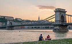
In terms of shape, Europe is a collection of connected peninsulas and nearby islands. The two largest peninsulas are Europe itself and Scandinavia to the north, divided from each other by the Baltic Sea. Three smaller peninsulas—Iberia, Italy, and the Balkans—emerge from the southern margin of the mainland. The Balkan peninsula is separated from Asia by the Black and Aegean Seas. Italy is separated from the Balkans by the Adriatic Sea, and from Iberia by the Mediterranean Sea, which also separates Europe from Africa. Eastward, mainland Europe widens much like the mouth of a funnel, until the boundary with Asia is reached at the Ural Mountains and Ural River, the Caspian Sea, and the Caucasus Mountains.

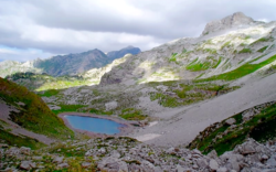
Land relief in Europe shows great variation within relatively small areas. The southern regions are mountainous while moving north the terrain descends from the high Alps, Pyrenees, and Carpathians, through hilly uplands, into broad, low northern plains, which are vast in the east. An arc of uplands also exists along the northwestern seaboard, beginning in southwestern Ireland, continuing across through western and northern Great Britain, and up along the mountainous, fjord-cut spine of Norway.

This description is simplified. Sub-regions such as Iberia and Italy contain their own complex features, as does mainland Europe itself, where the relief contains many plateaus, river valleys, and basins that complicate the general trend. Iceland and the British Isles are special cases. The former is of North Atlantic volcanic formation, while the latter consist of upland areas once joined to the mainland until cut off by rising sea levels.

Peninsula of peninsulas

Europe is sometimes called a "peninsula of peninsulas", to draw attention to the fact that Europe is a relatively small, elongated appendage to Asia, and that a large part of Europe is made up of peninsulas. [2] A prehistoric perspective would include Britain and Ireland as the core of a further very significant European peninsula prior to the post-glacial rise in sea-levels. [3]

Partial list of European peninsulas

Geology

The coast of Europe is heavily indented with bays and gulfs, as here in Greece. Vourvourou-Greece.jpg
The coast of Europe is heavily indented with bays and gulfs, as here in Greece.

Europe's most significant geological feature is the dichotomy between the highlands and mountains of Southern Europe and a vast, partially underwater, northern plain ranging from Great Britain in the west to the Ural Mountains in the east.[ citation needed ] These two halves are separated by the mountain chains of the Pyrenees and the Alps/Carpathians. The northern plains are delimited in the west by the Scandinavian mountains and the mountainous parts of the British Isles. The major shallow water bodies submerging parts of the northern plains are the Celtic Sea, the North Sea, the Baltic Sea complex, and the Barents Sea.

The northern plain contains the old geological continent of Baltica, and so may be regarded as the "main continent", while peripheral highlands and mountainous regions in south and west constitute fragments from various other geological continents.

The geology of Europe is hugely varied and complex, and gives rise to the wide variety of landscapes found across the continent, from the Scottish Highlands to the rolling plains of Hungary.

Population

Throughout history, the population of Europe has been affected by migration into and out of the continent, disease and conflict. Figures for the population of Europe vary according to which definition of European boundaries is used. The population within the standard physical geographical boundaries was 701 million in 2005 according to the United Nations. In 2000 the population was 857 million, using a definition which includes the whole of the transcontinental countries of Russia and Turkey. Population growth is comparatively slow, and median age comparatively high in relation to the world's other continents.

Rivers

The Volga, the longest river in Europe, in Saratov Oblast, Russia. Saratovskii most.jpeg
The Volga, the longest river in Europe, in Saratov Oblast, Russia.
The Danube, Europe's second-longest river, in Budapest, Hungary. Buda Castle Hill and the Chain Bridge, 2013 Budapest city 09.jpg
The Danube, Europe's second-longest river, in Budapest, Hungary.

The most important rivers in Europe are Danube, Volga, Rhine, Elbe, Oder and Dnieper, among others.[ further explanation needed ]

European rivers by length

The longest rivers in Europe, directly flowing into the World Ocean or Endorheic basins, with their approximate lengths: [4] [5]

  1. Volga -  3,690 km (2,290 mi)
  2. Danube - 2,860 km (1,780 mi)
  3. Ural   -   2,428 km (1,509 mi)
  4. Dnieper - 2,290 km (1,420 mi)
  5. Don   -   1,950 km (1,210 mi)
  6. Pechora - 1,809 km (1,124 mi)
  7. Dniester - 1,352 km (840 mi)
  8. Rhine   -  1,236 km (768 mi)
  9. Elbe   -  1,091 km (678 mi)
  10. Vistula - 1,047 km (651 mi)
  11. Tagus   - 1,038 km (645 mi)
  12. Daugava - 1,020 km (630 mi)
  13. Loire - 1,012 km (629 mi)
  14. Ebro - 960 km (600 mi)
  15. Prut - 953 km (592 mi)
  16. Neman - 937 km (582 mi)
  17. Meuse - 925 km (575 mi)
  18. Douro - 897 km (557 mi)
  19. Kuban River - 870 km (540 mi)
  20. Mezen - 857 km (533 mi) [6]
  21. Oder - 854 km (531 mi)
  22. Guadiana - 829 km (515 mi)
  23. Rhône - 815 km (506 mi)
  24. Southern Bug - 806 km (501 mi)
  25. Kuma - 802 km (498 mi)
  26. Seine  - 776 km (482 mi)
  27. Mureș - 761 km (473 mi)
  28. Northern Dvina - 744 km (462 mi)
  29. Po - 682 km (424 mi)
  30. Guadalquivir - 657 km (408 mi)
  31. Bolshoy Uzen - 650 km (400 mi)
  32. Siret - 647 km (402 mi)
  33. Terek - 623 km (387 mi)
  34. Glomma - 604 km (375 mi) (Norway's longest and most voluminous river)
  35. Garonne - 602 km (374 mi)
  36. Kemijoki - 550 km (340 mi)
  37. Torne - 522 km (324 mi)
  38. Dalälven - 520 km (320 mi)
  39. Maritsa - 515 km (320 mi)
  40. Marne - 514 km (319 mi) (major tributary of the Seine)
  41. Neris - 510 km (320 mi)
  42. Júcar - 509 km (316 mi)
  43. Dordogne - 483 km (300 mi)
  44. Ume - 470 km (290 mi)
  45. Ångerman - 460 km (290 mi) (Sweden's longest rivers)
  46. Lule - 460 km (290 mi)
  47. Gauja - 452 km (281 mi)
  48. Weser - 452 km (281 mi)
  49. Kalix - 450 km (280 mi)

European rivers by discharge

Europe as viewed from the East Europe as viewed from the USSR, 1944.jpg
Europe as viewed from the East

The 15 rivers of Europe by average discharge, including only rivers directly flowing into the World Ocean or Endorheic basins:

  1. Volga - 8,087 m³/s (largest river in Eastern Europe)
  2. Danube - 6,450 m³/s (largest river in Central Europe)
  3. Pechora - 4,380m³/s
  4. Northern Dvina - 3,330m³/s
  5. Neva - 2,490 m³/s
  6. Rhine - 2,315 m³/s) (largest river in Western Europe)
  7. Rhône - 1,900 m³/s (largest river in France)
  8. Dnieper - 1,700 m³/s
  9. Po - 1,460 m³/s (largest river in Italy)
  10. Vistula - 1,080 m³/s (largest river in Poland)
  11. Don - 890 m³/s
  12. Mezen - 890 m³/s
  13. Loire - 889 m³/s (longest river in France)
  14. Elbe - 860 m³/s
  15. Glomma - 709 m³/s (Norway's longest and most voluminous river)

Lakes and inland seas

Major islands

Aegean Islands, Åland, Balearic Islands, British Isles, Corsica, Crete, Cyprus (Adjacent to Asia), Fyn, Faroe Islands, Gotland, Hinnøya, Iceland, Ionian Islands, Malta, North Jutlandic Island, Saaremaa, Sardinia, Senja, Sicily, Svalbard and Zealand.

Plains and lowlands

View across the Bulgarian section of the Lower Danubian Plain towards the central Balkan Mountains 90 km away Stara planina2.JPG
View across the Bulgarian section of the Lower Danubian Plain towards the central Balkan Mountains 90 km away

Mountain ranges

Mount Elbrus, located in Russia, is the highest mountain in Europe. Elbrus view on the mountains.jpg
Mount Elbrus, located in Russia, is the highest mountain in Europe.

Some of Europe's major mountain ranges are:

Musala, highest peak of the Balkans seen from Yastrebets. The chalet Musala and the Everest shelter can be seen as well. Musala.JPG
Musala, highest peak of the Balkans seen from Yastrebets. The chalet Musala and the Everest shelter can be seen as well.
Maja Jezerce in Albania at 2,694m high is the highest peak of the Dinaric Alps. Liqeni i Madh i Buni Jezerce.png
Maja Jezercë in Albania at 2,694m high is the highest peak of the Dinaric Alps.

Land area in different classes of European mountainous terrain (classification from UNEP-WCMC):

Mount Olympus, legendary abode of the Greek gods. Olympus National Park 30.jpg
Mount Olympus, legendary abode of the Greek gods.
AltitudeArea (km2)% Area
≥4500m10.00%
3500-4500m2250.00%
2500-3500m497,8864.89%
1500-2500m & slope ≥2°145,8381.43%
1000-1500m & slope ≥5°
or local elevation range >300m
345,2553.39%
300-1000m
and local elevation range >300m
1,222,10412.00%
Mountainous TOTAL2,211,30821.72%
Europe TOTAL10,180,000100.00%

Temperature and precipitation

The Arctic environment of Lapland Another View to lake Iso-Vietonen from Liinankivaara Mountainside.jpg
The Arctic environment of Lapland

The high mountainous areas of Europe are colder and have higher precipitation than lower areas, as is true of mountainous areas in general. Europe has less precipitation in the east than in central and western Europe. The temperature difference between summer and winter gradually increases from coastal northwest Europe to southeast inland Europe, ranging from Ireland, with a temperature difference of only 10 °C from the warmest to the coldest month, to the area north of the Caspian Sea, with a temperature difference of 40 °C. January average range from 13 °C in southern Spain and southern Greek islands to -20 °C in the northeastern part of European Russia. Desert climates are found in the European portion of Kazakhstan and South Eastern Spain.

Western Europe and parts of Central Europe generally fall into the temperate maritime climate (Cfb), the southern part is mostly a Mediterranean climate (mostly Csa, smaller area with Csb), the north-central part and east into central Russia is mostly a humid continental climate (Dfb) and the northern part of the continent is a subarctic climate (Dfc). In the extreme northern part (northernmost Russia; Svalbard), bordering the Arctic Ocean, is tundra climate (Et). Mountain ranges, such as the Alps and the Carpathian mountains, have a highland climate with large variations according to altitude and latitude.

Climate

European climate. The Koppen-Geiger climates map is presented by the Climatic Research Unit of the University of East Anglia and the Global Precipitation Climatology Center of the Deutscher Wetterdienst. Europe Koppen Map.png
European climate. The Köppen-Geiger climates map is presented by the Climatic Research Unit of the University of East Anglia and the Global Precipitation Climatology Center of the Deutscher Wetterdienst.

Landlocked countries

The landlocked countries in Europe are: Andorra, Armenia, Austria, Belarus, Czech Republic, Hungary, Kosovo, Liechtenstein (which is doubly landlocked), Luxembourg, North Macedonia, Moldova, San Marino, Serbia, Slovakia, Switzerland, Vatican City

Switzerland, Liechtenstein, Austria, Czech Republic, Slovakia, Hungary, Serbia, and North Macedonia constitute a contiguous landlocked agglomeration of eight countries in Central Europe and the Balkans, stretching from Geneva all the way to Skopje. The other landlocked countries are "standalone" landlocked, not bordering any other such European one (the emphasis is necessary, since Kazakhstan borders Turkmenistan, Uzbekistan, and Kyrgyzstan, thus forming a vast landlocked expanse in Central Asia).

Countries consisting solely of islands or parts of islands

Countries bordering or spanning another continent

Eurasia Armenia, Azerbaijan, Republic of Cyprus, Georgia, Kazakhstan, Russia, Turkey, Greece (some Aegean islands and Kastelorizo island in southeastern Mediterranean)
Europe-Africa Malta, Spain (Ceuta, Melilla and Canary Islands), Italy (Lampedusa and Lampione), Portugal (Madeira), [8] France (Réunion and Mayotte)
Europe-South America France (French Guiana)
Europe-North America France (Guadeloupe, Martinique, and St. Pierre et Miquelon), Iceland, Denmark (Greenland), the Netherlands (Bonaire, Saba, and St. Eustatius), Portugal (Corvo Island, Flores Island)

Countries whose capital is not the most populous

CountryCapitalLargest city or municipality
Flag of Liechtenstein.svg  Liechtenstein Vaduz Schaan
Flag of Malta.svg  Malta Valletta Birkirkara
Flag of San Marino.svg  San Marino San Marino Serravalle
Flag of Switzerland (Pantone).svg   Switzerland Bern Zürich
Flag of Turkey.svg  Turkey Ankara Istanbul

Note: Italy's capital, Rome, is the country's largest city if only the municipality (comune) is considered. Greater Milan is the largest metropolitan area in Italy.

Brussels is considered to be the largest city of Belgium, according to the population of the Brussels-Capital Region. The population of the City of Brussels is ~175,000. Antwerp is the biggest city of the country.

List of countries by the number of other countries they border

Map of European countries by number of neighbouring countries. Neighbouring Countries of Europe.png
Map of European countries by number of neighbouring countries.
14 Russia (Including Kaliningrad)
11 France (Including overseas departments and territories)
9 Germany
8 Austria, Serbia, Turkey
7 Hungary, Poland, Ukraine
6 France (Excluding overseas departments), Italy
5 Azerbaijan, Belarus, Bulgaria, Croatia, Kazakhstan, Romania, North Macedonia, Slovakia, Spain (Including Ceuta and Melilla), Switzerland
4 Albania, Armenia, Belgium, the Czech Republic, Georgia, Greece, Kosovo, Latvia, Lithuania, Montenegro, Slovenia
3 Bosnia and Herzegovina, Finland, the Netherlands (Including Sint Maarten), Norway, Luxembourg
2 Andorra, Estonia, Liechtenstein, Moldova, Sweden
1 Denmark, Ireland, Monaco, Portugal, San Marino, the United Kingdom, Vatican City
0 Iceland, Cyprus, Malta

See also

Related Research Articles

<span class="mw-page-title-main">Geography of Bulgaria</span> Information about the geographical make-up of Bulgaria, including topology

Bulgaria is a country situated in Southeast Europe that occupies the eastern quarter of the Balkan peninsula, being the largest country within its geographic boundaries. It borders Romania to the north, Serbia and North Macedonia to the west, Greece and Turkey to the south, and the Black Sea to the east. The northern border with Romania follows the river Danube until the city of Silistra. The land area of Bulgaria is 110,994 square kilometres (42,855 sq mi), slightly larger than that of Cuba, Iceland or the U.S. state of Tennessee. Considering its relatively compact territorial size and shape, Bulgaria has a great variety of topographical features. Even within small parts of the country, the land may be divided into plains, plateaus, hills, mountains, basins, gorges, and deep river valleys. The geographic center of Bulgaria is located in Uzana.

<span class="mw-page-title-main">Geography of Albania</span>

Albania is a country in Southeastern Europe that lies along the Adriatic and Ionian Seas, with a coastline spanning approximately 476 km (296 mi). Situated on the Balkan Peninsula, it is one of the most mountainous countries in Europe. It is bounded by Montenegro to the northwest, Kosovo to the northeast, North Macedonia to the east and Greece to the southeast and south.

<span class="mw-page-title-main">Geography of Hungary</span>

Hungary is a landlocked country in the southeastern region of Central Europe, bordering the Balkans. Situated in the Carpathian Basin, it has a land area of 93,030 square km, measuring about 250 km from north to south and 524 km from east to west. It has 2,106 km of boundaries, shared with Slovakia to the north, Ukraine to the northeast, Romania to the east and southeast, Serbia to the south, Croatia to the southwest, Slovenia to the west and southwest, and Austria to the west.

<span class="mw-page-title-main">Geography of Italy</span> Geographical features of Italy

The geography of Italy includes the description of all the physical geographical elements of Italy. Italy, whose territory largely coincides with the homonymous geographical region, is located in southern Europe and comprises the long, boot-shaped Italian Peninsula crossed by the Apennines, the southern side of Alps, the large plain of the Po Valley and some islands including Sicily and Sardinia. Italy is part of the Northern Hemisphere. Two of the Pelagie Islands are located on the African continent.

<span class="mw-page-title-main">Geography of Romania</span> Overview of the geography of Romania

With an area of 238,397 km2 (92,046 sq mi), Romania is the twelfth-largest country in Europe. It is a Balkan country located at the crossroads of Eastern and Southeast Europe. It's bordered on the Black Sea, the country is halfway between the equator and the North Pole and equidistant from the westernmost part of Europe—the Atlantic Coast—and the most easterly—the Ural Mountains. Romania has 3,195 kilometres (1,985 mi) of border. Republic of Moldova and Ukraine lies to the east, Bulgaria lies to the south, and Serbia and Hungary to the west. In the southeast, 245 kilometres (152 mi) of sea coastline provide an important outlet to the Black Sea and the Atlantic Ocean.

<span class="mw-page-title-main">Geography of Russia</span>

Russia is the largest country in the world, covering over 17,125,192 km2 (6,612,074 sq mi), and encompassing more than one-eighth of Earth's inhabited land area. Russia extends across eleven time zones, and has the most borders of any country in the world, with sixteen sovereign nations.

<span class="mw-page-title-main">Geography of Switzerland</span>

The geography of Switzerland features a mountainous and landlocked country located in Western and Central Europe. Switzerland's natural landscape is marked by its numerous lakes and mountains. It is surrounded by five countries: Austria and Liechtenstein to the east, France to the west, Italy to the south and Germany to the north. Switzerland has a maximum north–south length of 220 kilometres (140 mi) and an east–west length of about 350 kilometres (220 mi).

<span class="mw-page-title-main">Carpathian Mountains</span> Mountain range in Central and Eastern Europe

The Carpathian Mountains or Carpathians are a range of mountains forming an arc across Central Europe. Roughly 1,500 km (930 mi) long, it is the third-longest European mountain range after the Urals at 2,500 km (1,600 mi) and the Scandinavian Mountains at 1,700 km (1,100 mi). The range stretches from the far eastern Czech Republic (3%) and Austria (1%) in the northwest through Slovakia (21%), Poland (10%), Ukraine (10%), Romania (50%) to Serbia (5%) in the south. The highest range within the Carpathians is known as the Tatra mountains in Poland and Slovakia, where the highest peaks exceed 2,600 m (8,500 ft). The second-highest range is the Southern Carpathians in Romania, where the highest peaks range between 2,500 m (8,200 ft) and 2,550 m (8,370 ft).

<span class="mw-page-title-main">Geography of Austria</span>

Austria is a predominantly mountainous country in Central Europe, approximately between Germany, Italy and Hungary. It has a total area of 83,871 square kilometres (32,383 sq mi).

<span class="mw-page-title-main">North Asia</span> Subregion of the Asian continent

North Asia or Northern Asia, also referred to as Siberia, is the northern region of Asia, which is defined in geographical terms and is coextensive with the Asian part of Russia, and consists of three federal districts of Russia: Ural, Siberian, and the Far Eastern. North Asia is bordered by the Arctic Ocean to its north; by Eastern Europe to its west; by Central and East Asia to its south; and by the Pacific Ocean and North America to its east. It covers an area of 13,100,000 square kilometres (5,100,000 sq mi), or 8.8% of Earth's total land area; and is the largest subregion of Asia by area, but is also the least populated, with a population of around 37 million, accounting for merely 0.74% of Asia's population.

<span class="mw-page-title-main">Geography of the Soviet Union</span> Country in the past

The Soviet Union incorporated an area of over 22,402,200 square kilometres (8,649,500 sq mi), covering approximately one-sixth of Earth's land surface. It spanned most of Eurasia. Its largest and most populous republic was the Russian SFSR which covered roughly three-quarters of the surface area of the union, including the complete territory of contemporary Russia.

<span class="mw-page-title-main">Geography of Serbia</span> Overview Serbia geography

Serbia is a small country situated at the crossroads of Central and Southeast Europe, covering the far southern edges of the Pannonian Plain and the central Balkans. It shares borders with Bosnia and Herzegovina, Bulgaria, Croatia, Hungary, North Macedonia, Montenegro, and Romania. Serbia shares a contested border with Albania as it doesn't recognise the independence of Kosovo. Serbia is landlocked, though it is able to access the Adriatic Sea through Montenegro and inland Europe and the Black Sea via the Danube.

<span class="mw-page-title-main">East European Plain</span> Vast interior plain east of the North/Central European

The East European Plain is a vast interior plain extending east of the North European Plain, and comprising several plateaus stretching roughly from 25 degrees longitude eastward. It includes Volhynian-Podolian Upland on its westernmost fringe, the Central Russian Upland, and, on the eastern border, encompasses the Volga Upland. The plain includes also a series of major river basins such as the Dnepr Basin, the Oka–Don Lowland, and the Volga Basin. At the southeastern point of the East European Plain are the Caucasus and Crimean mountain ranges. Together with the North European Plain, and covering the Baltic states, European Russia, Belarus, Ukraine, Moldova, southeastern Romania, and, at its southernmost point, the Danubian Plain in Northern Bulgaria, it constitutes the majority of the Great European Plain, the greatest mountain-free part of the European landscape. The plain spans approximately 4,000,000 km2 (2,000,000 sq mi) and averages about 170 m (560 ft) in elevation. The highest point of the plain, located in the Valdai Hills, is 346.9 metres (1,138.1 ft).

<span class="mw-page-title-main">Geography of Asia</span>

Geography of Asia reviews geographical concepts of classifying Asia, the central and eastern part of Eurasia, comprising 58 countries and territories.

<span class="mw-page-title-main">Geography of the European Union</span>

The geography of the European Union describes the geographic features of the European Union (EU), a multinational polity that occupies a large portion of Europe and covers 4,422,773 km2 (1,707,642 sq mi). Its European territory extends northeast to Finland, northwest to Ireland, southeast to Cyprus and southwest to the Spanish exclaves on the Mediterranean shores of North Africa. Additionally, the EU includes numerous islands around the world, and French Guiana in South America.

<span class="mw-page-title-main">Geography of the Alps</span> Description of the landforms of the Alps mountain range

The Alps form a large mountain range dominating Central Europe, including parts of Italy, France, Switzerland, Liechtenstein, Austria, Slovenia, Germany and Hungary.

<span class="mw-page-title-main">Geology of Europe</span>

The geology of Europe is varied and complex, and gives rise to the wide variety of landscapes found across the continent, from the Scottish Highlands to the rolling plains of Hungary. Europe's most significant feature is the dichotomy between highland and mountainous Southern Europe and a vast, partially underwater, northern plain ranging from England in the west to the Ural Mountains in the east. These two halves are separated by the Pyrenees and the Alps-Carpathians mountain chain. The northern plains are delimited in the west by the Scandinavian Mountains and the mountainous parts of the British Isles. The southern mountainous region is bounded by the Mediterranean Sea and the Black Sea. Major shallow water bodies submerging parts of the northern plains are the Celtic Sea, the North Sea, the Baltic Sea and the Barents Sea.

<span class="mw-page-title-main">Geography of Kosovo</span> Overview of the geography of Kosovo

Kosovo is a small and landlocked country in Southeastern Europe. The country is strategically positioned in the center of the Balkan Peninsula enclosed by Montenegro to the west, Serbia to the north and east, North Macedonia to the southeast, and Albania to the southwest. It has no direct access to the Mediterranean Sea but its rivers flow into three seas, the Adriatic, Aegean and Black Sea.

<span class="mw-page-title-main">Geography of Greece</span>

Greece is a country in Southeastern Europe, on the Balkan Peninsula. It is bordered to the north by Albania, North Macedonia and Bulgaria; to the east by Turkey, and is surrounded to the east by the Aegean Sea, to the south by the Cretan and the Libyan seas, and to the west by the Ionian Sea which separates Greece from Italy.

References

  1. Language facts – European day of languages, Council of Europe. Retrieved 30 July 2015.
  2. Europe: Physical Geography National Geographic - Education
  3. "The moment Britain became an island". BBC News magazine. BBC. Retrieved 25 April 2020.
  4. "European Rivers". worldatlas.com.
  5. "River Systems of the World". Archived from the original on 2009-09-19.
  6. Мезень (река). Great Soviet Encyclopedia. Archived from the original on September 19, 2012.
  7. Greek-Albanian Ranges peakbagger.com
  8. Peoples of Africa. Marshall Cavendish. 2000. ISBN   9780761471585.