Geography of Iceland

Last updated

Geography of Iceland
Iceland sat cleaned.png
Continent Europe
Region Northern Europe
Coordinates 65°00′N18°00′W / 65.000°N 18.000°W / 65.000; -18.000
Area Ranked 106
  Total103,001 km2 (39,769 sq mi)
  Land97.33%
  Water2.67%
Coastline4,970 km (3,090 mi)
BordersNone
Highest point
Lowest point
Longest river
Largest lake
ClimateSubpolar oceanic climate, Tundra
TerrainPlateau interspersed with mountain peaks, volcanic peaks, icefields and a coast deeply indented by bays and fjords
Natural resourcesMarine life, diatomite, hydrothermal power
Natural hazardsVolcanism, earthquakes, avalanches, and glacial lake outburst flooding
Environmental issuesAir pollution, climate change, desertification, hazardous wastes, marine dumping
Exclusive economic zone751,345 km2 (290,096 sq mi)

Iceland is an island country at the confluence of the North Atlantic and Arctic oceans, east of Greenland and immediately south of the Arctic Circle, atop the constructive boundary of the northern Mid-Atlantic Ridge. The island country is the world's 18th largest in area and one of the most sparsely populated. It is the westernmost European country when not including Greenland and has more land covered by glaciers than continental Europe. Its total size is 103,125 km2 (39,817 sq mi) and possesses an exclusive economic zone of 751,345 km2 (290,096 sq mi).

Contents

Statistics

Dettifoss, located in northeast Iceland. It is the second-largest waterfall in Europe in terms of volume discharge, with an average water flow of 200 m /s. Iceland Dettifoss 1972-4.jpg
Dettifoss, located in northeast Iceland. It is the second-largest waterfall in Europe in terms of volume discharge, with an average water flow of 200 m /s.

Iceland is an island country in Northern Europe, straddling the Eurasian and North American plates between the Greenland Sea and the North Atlantic Ocean, northwest of the British Isles.

Extent (locations outside mainland in parentheses)

North: Rifstangi, 66°32′3" N (Kolbeinsey, 67°08,9 N)
South: Kötlutangi, 63°23′6" N (Surtsey, 63°17,7 N)
West: Bjargtangar, 24°32′1" W
East: Gerpir, 13°29′6" W (Hvalbakur, 13°16,6 W)

Area:

Total: 103,125 km2 (39,817 sq mi)
Land: 100,329 km2
Water: 2,796 km2
Coastline
Iceland has a coastline of 4,970 km.

Maritime claims:

Territorial sea: 12 nmi (22.2 km; 13.8 mi)
Exclusive economic zone : 751,345 km2 (290,096 sq mi) with 200 nmi (370.4 km; 230.2 mi)
Continental shelf: 200  nmi (370.4 km; 230.2 mi) or to the edge of the continental margin

Elevation extremes:

Lowest point: Atlantic Ocean 0 m
Highest point: Hvannadalshnúkur 2,110 m

Natural resources:

Marine life, diatomite, hydropower, geothermal power

Land use

Arable land: 1.21%
Permanent crops: 0%
Other: 98.79% (2012)
Total renewable water resources
170 km3 (2011)
Freshwater withdrawal (domestic/industrial/agricultural)
Total: 0.17 km3/yr (49%/8%/42%)
Per capita: 539.2 m3/yr (2005)
Natural hazards
Volcanism, earthquakes, avalanches, and glacial lake outburst flooding (or jökulhlaups)
Environment—current issues
Water pollution from fertilizer runoff; inadequate wastewater treatment

Physical geography

Iceland consists of eight geographical regions, Capital Region, Southern Peninsula, West, Westfjords, Northwest, Northeast, East and South. [1] Twenty per cent of the land is used for grazing, while only one per cent is cultivated. Iceland has lost most of the woodland that previously covered large areas of the country, but an ambitious reforestation program is currently underway. [2] Fossilized tree pollen and descriptions by the early settlers indicate that prior to human settlement, now thought to have occurred from around AD 800 onwards, [3] [4] trees covered between thirty and forty per cent of the island. Today, however, there are only small patches of the original birch forests left, the most prominent being Hallormsstaðaskógur and Vaglaskógur. The country of Iceland contains 36 islands. The longest river on the island is Þjórsá at 230 kilometres (143 miles). Iceland has three national parks: Vatnajökull National Park, Snæfellsjökull National Park, and Þingvellir National Park. [5] The inhabited areas are on the coast, particularly in the southwest, while the central highlands are all but uninhabited. The island's terrain is mostly plateau interspersed with mountain peaks, icefields and a coast deeply indented by bays and fjords.

Highlands

Topographic map of Iceland. Areas in brown are 500 metres or greater above sea level with the large center mass making up the inhospitable Highlands. Glaciers are shown in white. Map of Iceland highlands-en.svg
Topographic map of Iceland. Areas in brown are 500 metres or greater above sea level with the large center mass making up the inhospitable Highlands. Glaciers are shown in white.

The Highlands make up about half of Iceland's land area, which is of recent volcanic origin and consists of a mountainous lava desert (highest elevation 2,110 m (6,923 ft) above sea level) and other wastelands. The area is mostly uninhabited and uninhabitable.

Westfjords

The Westfjords region is composed of a large, mountainous peninsula on Iceland's northwestern coast. The coastline is marked by numerous fjords as its name suggests. The peninsula contains Iceland's northernmost glacier, Drangajökull.

Southern Peninsula

The Southern Peninsula, also known as the Reykjanes Peninsula, is located in the southwestern corner of Iceland. The area contains little vegetation because of active volcanism and large lava fields. There are hot springs and sulphur springs in the southern portion of the peninsula, in the Kleifarvatn lake and the Krýsuvík geothermal area.

Capital Region

Home to Iceland's capital, Reykjavík, the Capital Region is the most densely populated area in Iceland. It is located on the southwest coast of the island near the Southern Peninsula. The majority of Reykjavík is located on the Seltjarnarnes peninsula. Mount Esja, at 914 metres (2,999 ft), is the highest mountain in the vicinity of Reykjavík. Several natural harbours exist and provide good fishing grounds. [6]

West

Located in the western portion of the island and north of the Capital Region. In Hvalfjörður fjord rests the second-tallest waterfall in Iceland, Glymur. West is also home to Borgarfjörður, a fjord with volcanic activity such as Deildartunguhver, a powerful hotspring. The 804-metre (2,638 ft) Hafnarfjall Mountain rises over the landscape. [7]

South

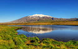
The southern portion of Iceland contains some of its most notable volcanoes such as Hekla, Eldgjá, and Katla. Alongside the volcanoes exist numerous glaciers such as Vatnajökull, Mýrdalsjökull, and Eyjafjallajökull. Basalt columns and black sand beaches are examples of the volcanic activity of the area. The area also contains mountain ranges and Iceland's highest peak, Hvannadalshnjúkur, as well as the Vestmannaeyjar (Westman Islands) archipelago.

East

East Iceland contains the majority of the island's vegetation and birch forests.

Glaciers

Myrdalsjokull glacier Myrdalsjokull glacier, Iceland.jpg
Mýrdalsjökull glacier

Around 10.2 per cent of the total land area is covered by glaciers, although these are retreating at an accelerating rate. [8] The four largest Icelandic glaciers are:

Other notable glaciers include:

Snaefellsjokull in the morning Snaefellsjokull in the Morning (7622876302).jpg
Snæfellsjökull in the morning

Climate

Koppen climate classification zones of Iceland Iceland Koppen.svg
Köppen climate classification zones of Iceland

Because of the moderating influence of the North Atlantic Current, the climate is temperate and characterized by damp, cool summers and relatively mild but windy winters. Reykjavík has an average temperature of 12 °C (53.6 °F) in July and 1 °C (34 °F) in January [9] It has a Köppen Climate Classification of Subpolar oceanic climate (Cfc) with most of the island classified as Tundra (ET).

Geology

Iceland has extensive volcanic and geothermal activity. The rift associated with the Mid-Atlantic Ridge, which marks the division between the Eurasian Plate and North American tectonic plates, runs across Iceland from the southwest to the northeast. This geographic feature is prominent at the Þingvellir National Park, where the promontory creates an extraordinary natural amphitheatre. The site was the home of Iceland's parliament, the Alþing, which was first convened in 930. It is a common misconception that Þingvellir is at the juncture between the North American and Eurasian continental plates. However, they are in fact at the juncture of the North American continental plate and a smaller plate (approx. 10,000 km2) called the Hreppar Microplate (Hreppaflekinn). [10] From 1963 to 1967, the island of Surtsey was created on the southwest coast by a volcanic eruption.

Geological activity

Geysir erupting in September 2000 Erupting geysir.jpg
Geysir erupting in September 2000

A geologically young land, Iceland is located on both the Iceland hotspot and the Mid-Atlantic Ridge, which runs right through it. This location means that the island is highly geologically active with earthquakes and volcanoes, notably Hekla, Eldgjá, Herðubreið and Eldfell. Eyjafjallajökull (1,666 m) erupted in 2010, disrupting European air traffic. [11] To demonstrate the geothermal activity, the Icelandic Meteorological Office said that during a single week in February 2021, around 17,000 earthquakes have hit the southwestern region of Reykjanes. [12]

Iceland has many geysers, including Geysir, from which the English word geyser is derived. With the widespread availability of geothermal power, and the harnessing of many rivers and waterfalls for hydroelectricity, most residents have access to inexpensive hot water, heating, and electricity. The island is composed primarily of basalt, a low-silica lava associated with effusive volcanism as has occurred also in Hawaii. Iceland, however, has a variety of volcanic types (composite and fissure), many producing more evolved lavas such as rhyolite and andesite. Iceland has hundreds of volcanoes, with approximately 30 active volcanic systems. [13]

Environment—international agreements

Party to:

Air Pollution, Air Pollution-Persistent Organic Pollutants, Biodiversity, Climate Change, Desertification, Endangered Species, Hazardous Wastes, Law of the Sea, Marine Dumping, Nuclear Test Ban, Ozone Layer Protection, Ship Pollution (MARPOL 73/78), Wetlands, Whaling

Signed, but not ratified:

Environmental Modification, Marine Life Conservation

Images

Maps

See also

Related Research Articles

<span class="mw-page-title-main">Langjökull</span> Outlet glacier in Iceland

Langjökull is the second largest ice cap in Iceland, after Vatnajökull. It is situated in the west of the Icelandic interior or Highlands of Iceland and can be seen clearly from Haukadalur. It covers the higher parts of the Langjökull volcanic system.

<span class="mw-page-title-main">Volcanism of Iceland</span>

Iceland experiences frequent volcanic activity, due to its location both on the Mid-Atlantic Ridge, a divergent tectonic plate boundary, and being over a hotspot. Nearly thirty volcanoes are known to have erupted in the Holocene epoch; these include Eldgjá, source of the largest lava eruption in human history. Some of the various eruptions of lava, gas and ash have been both destructive of property and deadly to life over the years, as well as disruptive to local and European air travel.

<span class="mw-page-title-main">Eyjafjallajökull</span> Glacier and volcano in Iceland

Eyjafjallajökull, sometimes referred to by the numeronym E15, is one of the smaller ice caps of Iceland, north of Skógar and west of Mýrdalsjökull. The ice cap covers the caldera of a volcano with a summit elevation of 1,651 metres (5,417 ft). The volcano has erupted relatively frequently since the Last Glacial Period, most recently in 2010, when, although relatively small for a volcanic eruption, it caused enormous disruption to air travel across northern and western Europe for a week.

<span class="mw-page-title-main">Katla (volcano)</span> Large volcano on Southern Iceland

Katla is an active volcano in southern Iceland. This volcano has been very active historically with at least twenty documented major eruptions since 2920 BC. In its recent history though, Katla has been less active as the last major eruption occurred in 1918. These eruptions have had a Volcanic Explosivity Index (VEI) of between 4 and 5 on a scale of 0 to 8. In comparison, the Eyjafjallajökull 2010 eruption had a VEI of 4. Larger VEI-5 eruptions are comparable to Mount St. Helens 1980 eruption. Several smaller (minor) eruptions measuring VEI-1 and below have occurred since, with the most recent being in 1999.

<span class="mw-page-title-main">Kverkfjöll</span> Volcano in Iceland

Kverkfjöll is a potentially active central volcano, fissure swarm, and associated mountain range situated on the northern border of the glacier Vatnajökull in Iceland.

<span class="mw-page-title-main">Hengill</span> Mountain range in Iceland

Hengill is a volcanic table mountain situated in the south-west of Iceland, to the south of Þingvellir.

<span class="mw-page-title-main">Grímsvötn</span> Volcano in Iceland

Grímsvötn is an active volcano with a fissure system located in Vatnajökull National Park, Iceland. The volcano itself is completely subglacial and located under the northwestern side of the Vatnajökull ice cap. The subglacial caldera is at 64°25′N17°20′W, at an elevation of 1,725 m (5,659 ft). Beneath the caldera is the magma chamber of the Grímsvötn volcano.

<span class="mw-page-title-main">Geology of Iceland</span>

The geology of Iceland is unique and of particular interest to geologists. Iceland lies on the divergent boundary between the Eurasian plate and the North American plate. It also lies above a hotspot, the Iceland plume. The plume is believed to have caused the formation of Iceland itself, the island first appearing over the ocean surface about 16 to 18 million years ago. The result is an island characterized by repeated volcanism and geothermal phenomena such as geysers.

<span class="mw-page-title-main">Bárðarbunga</span> Stratovolcano in Iceland

Bárðarbunga, is an active stratovolcano located under Vatnajökull in Vatnajökull National Park which is Iceland's most extensive glacier. The second highest mountain in Iceland, 2,000 metres (6,600 ft) above sea level, Bárðarbunga is also part of the Bárðarbunga-Veiðivötn volcanic system that is approximately 190 kilometres (120 mi) long and 25 kilometres (16 mi) wide.

<span class="mw-page-title-main">Geology of Chile</span>

The geology of Chile is a characterized by processes linked to subduction, such as volcanism, earthquakes, and orogeny. The building blocks of Chile's geology were assembled during the Paleozoic Era when Chile was the southwestern margin of the supercontinent Gondwana. In the Jurassic, Gondwana began to split, and the ongoing period of crustal deformation and mountain building known as the Andean orogeny began. In the Late Cenozoic, Chile definitely separated from Antarctica, and the Andes experienced a significant rise accompanied by a cooling climate and the onset of glaciations.

<span class="mw-page-title-main">Outline of Iceland</span> Overview of and topical guide to Iceland

The following outline is provided as an overview of and topical guide to Iceland:

<span class="mw-page-title-main">Brennisteinsfjöll</span> Volcanic system in Iceland

Brennisteinsfjöll is a minor volcanic system, with crater rows and small shield volcanoes on the Reykjanes Peninsula in southwest Iceland.

<span class="mw-page-title-main">Geological deformation of Iceland</span>

The geological deformation of Iceland is the way that the rocks of the island of Iceland are changing due to tectonic forces. The geological deformation help to explain the location of earthquakes, volcanoes, fissures, and the shape of the island. Iceland is the largest landmass situated on an oceanic ridge. It is an elevated plateau of the sea floor, situated at the crossing of the Mid-Atlantic Ridge and the Greenland-Iceland-Scotland ridge. It lies along the oceanic divergent plate boundary of North American Plate and Eurasian Plate. The western part of Iceland sits on the North American Plate and the eastern part sits on the Eurasian Plate. The Reykjanes Ridge of the Mid-Atlantic ridge system in this region crosses the island from southwest and connects to the Kolbeinsey Ridge in the northeast.

<span class="mw-page-title-main">Krýsuvík (volcanic system)</span> Volcanic region in Iceland

The volcanic system of Krýsuvík, also Krýsuvík-Trölladyngja volcanic system, is situated in the south–west of Iceland on the Reykjanes peninsula. It is located in the middle of Reykjanes and on the divergent plate boundary of the Mid-Atlantic Ridge which traverses Iceland. It was named after the Krýsuvík area which is part of it and consists of a fissure system without a central volcano. However, there are some indications—namely, the discovery by geophysical methods of what scientists interpret as a buried caldera, combined with the well-known, vigorous hydrothermal system above it—that an embryonic central magma chamber may already exist or be actively developing.

<span class="mw-page-title-main">Geology of Reykjanes Peninsula</span> Volcanic area of Iceland

The Reykjanes Peninsula in southwest Iceland is the continuation of the mostly submarine Reykjanes Ridge, a part of the Mid-Atlantic Ridge, on land and reaching from Esja in the north and Hengill in the east to Reykjanestá in the west. Suðurnes is an administrative unit covering part of Reykjanes Peninsula.

<span class="mw-page-title-main">Keilir</span>

Keilir is a Pleistocene subglacial mound or perhaps a conical tuya on Reykjanes Peninsula in Iceland. Basal area is 0.773 km2, summit area 0.004 km2, basal width 0.99 km, summit width 0.07 km, volume 0.0362 km3.

<span class="mw-page-title-main">Hofsjökull volcanic system</span> Volcano in Iceland

The Hofsjökull volcanic system contains the largest active central volcano in Iceland. It is called Hofsjökull, after the icecap of the same name. The system is in the west of the Highlands of Iceland and north of the dormant central volcano of Kerlingarfjöll Icelandic pronunciation:[ˈcʰɛ(r)tliŋkarˌfjœtl̥] ), which is usually regarded as part of the same volcanic system.

<span class="mw-page-title-main">Oddnýjarhnjúkur-Langjökull volcanic system</span> Volcano in Iceland

The Oddnýjarhnjúkur-Langjökull (Langjökull) volcanic system of Iceland last erupted about 3600 years ago and is associated with current geothermal activity. The area of its central volcano is at present under the second largest ice cap in Iceland.

References

  1. "Iceland Regions - Iceland on the Web". www.icelandontheweb.com (in Icelandic). Retrieved 1 October 2018.
  2. "Forestry in a treeless land". Iceland Forest Service. Archived from the original on 15 August 2016. Retrieved 12 October 2015.
  3. "RAE 2008 : Submissions : RA1, RA2 and RA5c". www.rae.ac.uk. Archived from the original on 25 June 2018. Retrieved 12 November 2015.
  4. "New View on the Origin of First Settlers in Iceland". Iceland Review Online. 4 June 2011. Archived from the original on 5 June 2011. Retrieved 12 October 2015.
  5. "National parks in Iceland". Inspired By Iceland. Archived from the original on 19 June 2017. Retrieved 20 September 2018.
  6. "Iceland | Culture, History, & People". Encyclopedia Britannica. Retrieved 2 October 2018.
  7. "the-classic-circle | Visit West Iceland". Visit West Iceland. Retrieved 2 October 2018.
  8. "Heildarstærð jökla á Íslandi 2014 ("Total surface area of Icelandic glaciers 2014")" (PDF) (in Icelandic). Loftmyndir ehf. Archived from the original (PDF) on 17 March 2015. Retrieved 12 October 2015.
  9. "Mánaðarmeðaltöl fyrir stöð 1 – Reykjavík ("Monthly data for station No 1 – Reykjavík")" (in Icelandic). Retrieved 12 October 2015.
  10. "Plate boundaries, rifts and transforms in Iceland" (PDF). Jökull No. 58, 2008. Institute of Earth Sciences, University of Iceland. Archived from the original (PDF) on 18 November 2017. Retrieved 19 March 2014.
  11. "The World Factbook – Central Intelligence Agency". www.cia.gov. Retrieved 17 September 2018.
  12. Siad, Arnaud (3 March 2021). "17,000 earthquakes hit Iceland in the past week. An eruption could be imminent". CNN. Retrieved 4 March 2021.
  13. Carmichael, I.S.E. (1964). "The Petrology of Thingmuli, a Tertiary Volcano in Eastern Iceland" (PDF). Journal of Petrology. 5 (3): 435–460. doi:10.1093/petrology/5.3.435.

PD-icon.svg This article incorporates public domain material from The World Factbook. CIA.