
This article lists the principal mountain passes and tunnels in the Alps, and gives a history of transport across the Alps.

Valais, more formally, the Canton of Valais, is one of the 26 cantons forming the Swiss Confederation. It is composed of thirteen districts and its capital and largest city is Sion.
The Great St Bernard Pass is the third highest road pass in Switzerland, at an elevation of 2,469 m (8,100 ft). It connects Martigny in the canton of Valais in Switzerland with Aosta in the region Aosta Valley in Italy. It is the lowest pass lying on the ridge between the two highest mountains of the Alps, Mont Blanc and Monte Rosa. It is located on the main watershed that separates the basin of the Rhône from that of the Po.

Mont Cenis is a massif in Savoie (France), which forms the limit between the Cottian and Graian Alps.

The Alps form a large mountain range dominating Central Europe, including parts of Italy, France, Switzerland, Liechtenstein, Austria, Slovenia, Germany and Hungary.

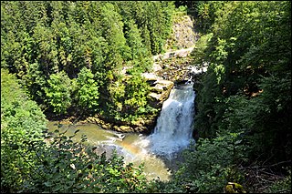
Col de la Forclaz is a mountain pass in the Alps in the Canton of Valais in Switzerland. It connects Martigny at 471 m (1,545 ft) and Le Châtelard (Finhaut). The road from Martigny to the Col has an average gradient of 6% but in parts is closer to 8%. After the Col, and Le Châtelard, the road leads to Chamonix in France via Vallorcine and the Col des Montets.
The Route nationale 6 is a trunk road (nationale) in France between Paris and the frontier with Italy in the Alps.
The Route nationale 5, or RN 5, is a trunk road (nationale) in France now connecting Dijon with the frontier of Switzerland. It is also numbered the European route E21.

CEVA (Cornavin‒Eaux-Vives‒Annemasse) is an orbital rail line designed to connect the main railway station of Geneva, Switzerland on the north of Lake Geneva with the Gare d'Annemasse in Annemasse, France, to the south of Lake Geneva. The link allows through running between the main Swiss rail network and the until then isolated line east of Annemasse in Haute-Savoie, which was served until 2013 by French SNCF services. A new station was constructed on the route at Gare des Eaux-Vives and the line between this station and the border was replaced with a double track line in tunnel. Track already existed as far as Stade de Genève station; the full route opened on 15 December 2019 to Léman Express and RegioExpress services.

The Western Switzerland Railways, were initially a joint operation of three Swiss railway companies, but these companies merged on 1 January 1872. The company was called the Western Switzerland–Simplon Railways from 28 June 1881. The SOS merged with the Bernese Jura Railways to form the Jura–Simplon Railways on 1 January 1890.
The Jura–Simplon Railways (JS), was a railway company that was formed in 1890. It was nationalised in 1903 as the largest railway company in Switzerland and integrated into the Swiss Federal Railways (SBB).

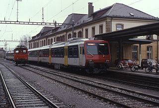
Vallorbe railway station is a station at the border of Switzerland and France on the TGV Lyria line between Paris and Lausanne. It is located at the south-eastern entrance of the tunnel which tunnels one of Jura's mountain ranges, Le Mont d’Or. The station serves the municipality of Vallorbe, in the Canton of Vaud, Switzerland.
The France–Switzerland border is 572 km (355 mi) long. Its current path is mostly the product of the Congress of Vienna of 1815, with the accession of Geneva, Neuchâtel and Valais to the Swiss Confederation, but it has since been modified in detail, the last time being in 2002. Although most of the border, marked with border stones, is unguarded, several checkpoints remain staffed, most notably on busy roads.

The Simplon Railway is a line that links Lausanne in Switzerland and Domodossola in Italy, via Brig. The 20 km (12 mi)-long Simplon Tunnel is a major part of it. The line between Lausanne and Vallorbe is sometimes considered to form part of the line, making it 233 km (145 mi) long.

The Chaîne de l'Épine, in the department of Savoie in southeast France, is a 20-kilometre (12 mi) long ridge of the Jura Mountains that runs north–south along the east side of the Lac d'Aiguebelette, from the Col de l'Épine west of Chambéry as far as the western edge of the Chartreuse Mountains, near the commune of Les Échelles. To the north, the ridge becomes the Mont du Chat ridge along the western shore of the Lac du Bourget. At the southern end, the ridge terminates at the Guiers River.

The France–Italy border is 515 km long. It runs from the Alps in the north, a region in which it passes over Mont Blanc, down to the Mediterranean coast in the south. Three national parks are located along the border: Vanoise National Park and Mercantour National Park on the French side and Gran Paradiso National Park on the Italian side.
The Neuchâtel–Le Locle-Col-des-Roches railway is a single-track standard-gauge line of the Swiss Federal Railways (SBB).

The Pont–Brassus Railway was a railway company in the Swiss canton of Vaud. It built a standard gauge line from Le Pont parallel to the north shore of the Lac de Joux to Le Brassus. The line has been owned by the Travys regional transport company since 2001. Passenger traffic on the line is operated by Swiss Federal Railways (SBB). Trains run continuously from Vallorbe via Le Pont to Le Brassus. They operate hourly on non school days and half-hourly on school days.

The Vallorbe–Le Brassus railway line is a standard gauge railway line in southwestern Switzerland. It runs from Vallorbe to Le Brassus via Le Day and Le Pont. It shares the section between Vallorbe and Le Day with the Simplon line. Originally built by the Pont–Vallorbe Railway and Pont–Brassus Railway between 1886 and 1899, it is now owned by Swiss Federal Railways and Travys, with Travys operating passenger services over the entire route.

