Colebee and Nurragingy Land Grant; Colebee and Nurragingy's Land Grant; Colebee Release Area; 773; 777; 783 Richmond Road
Type
state heritage (archaeological-terrestrial)
Designated
10 February 2012
Referenceno.
1877
Type
Post-contact Site
Category
Aboriginal
Location of Colebee and Nurragingy Land Grant in New South Wales
Colebee and Nurragingy Land Grant is a heritage-listed former farm at Richmond Road, Colebee, Sydney, New South Wales, Australia. It is also known as Colebee and Nurragingy's Land Grant, Colebee Release Area, 773, 777 and 783 Richmond Road. The property is owned by Transport for NSW.
The history of the Colebee/Nurragingy Land Grant must be understood within the context of the early colonial history of Sydney. The spread of colonial settlement from Sydney Harbour to the western plains occurred quite rapidly within the first 15 years of European arrival in Australia. As British settlers took up allotments, their farmlands expanded to the west across traditional Aboriginal hunting grounds. With this increasing European presence, traditional Aboriginal resources were subsumed and conflict inevitably developed. Conflict between the two communities was particularly prevalent during periods of drought.[1]
A period of drought between 1814 and 1816 resulted in the escalation of violence between settlers and local Aboriginal people, particularly along the Hawkesbury and Nepean Rivers. When the local Aboriginal people found their traditional food resources gone, they utilised the settlers crops and animals that had replaced them. However, the European settlers, seeing this as theft, often shot Aboriginal people, resulting in subsequent reprisals and violence.[1]
In April 1816 Governor Macquarie responded to the violence by ordering a punitive expedition. Groups of soldiers were sent from Sydney to Cowpastures, the Appin, Parramatta and Windsor districts and along the banks of the Nepean. Governor Macquarie directed the soldiers to capture or kill Aboriginal people involved in the disputes with settlers. A number of Aboriginal guides accompanied these parties, including Colebee and Nurragingy.[1]
Following the punitive expedition of 1816, Macquarie presented Nurragingy with a breastplate inscribed "Chief of the South Creek Tribe" and, in recognition of their involvement in the punitive expeditions, jointly granted Colebee and Nurragingy 30 acres of land. This was the first such grant to be issued to Aboriginal people in Australia's history. The grant was registered in 1819, but was only registered in Colebee's name. Colebee did not stay long on the grant but Nurragingy stayed there growing various crops and practising animal husbandry.[1]
The location of the land grant was significant because it was an Aboriginal choice, being on land belonging to Nurragingy's clan. The land also included sites such as "Iron Bark Range" which was a high campsite well above the flooding of eastern creek and a source of silcrete. Archaeological surveys of the Blacktown (and specifically Plumpton Ridge) area have recorded a range of evidence in this area. The area became a centre of Aboriginal life during this early phase of colonisation.[1]
After the passing of Colebee and Nurragingy, the land was claimed by 1843 by two of Nurragingy's sons and Colebee's younger sister, Maria Lock (also known as Maria Locke) . Maria, a student at the Parramatta Native Institution from 1815, married Robert Locke, a convict from Norfolk, England, in 1824. As the original land grant had been registered in Colebee's name only, the land was passed to Maria, and Maria and Robert along with their ten children took up residence on the land grant. Some time later they also acquired the 30 acre grant to the south that had originally been granted to Sylvanus Williams and had been purchased by the Native Institution in 1822. Maria Locke died in 1878 and was outlived by nine of her children. Following her death, the 60 acres was divided into nine lots for her nine surviving children.[1]
The Locke family lived on the property until around 1917 when the Aborigines Protection Board acquired the land. The Aboriginal Protection Board sold the land off after World War II. When Walter Locke attempted to reclaim the land in 1970 he was informed by authorities that this was not possible, because the family had left the land. In the late 1970s local Blacktown author Kevin Moore wrote a series of pamphlets in which he called this resumption of the land grant "a scandalous malversion of Macquarie's grant for the use of the Aborigines".[1]
In the late 1970s Lots 1 and 2 of Maria Locke's subdivision were purchased by the NSW Planning and Environment Commission, and in 1980 by the Commissioner for Main Roads. In 2003, a small portion of the land fronting Richmond Road was required for road widening. This included part of Lots 1 and 2 of Maria Locke's subdivision. The land resumed for road widening was referred to as Lots 14 to 18 in DP 1048332. In 2006, a further strip of land adjacent to Lots 14 to 17 DP 1048332, was resumed for road widening. This strip of land was resumed from Lots 1, 2 and 3 of Maria Locke's subdivision and is referred to as Lot 51 DP 1104950.[2][1]
Description
The site of the Colebee/Nurragingy Land Grant is today predominantly undeveloped rural land. The land grant is bounded by Richmond Road along its western side and is surrounded by rural land parcels to the east and south. Immediately north of the site is an industrial complex. The subject site retains a rural character, although some residences have been constructed along the Richmond Road frontage. The land grant is bisected by Bells Creek, which runs in a north-easterly direction. The site retains remnant vegetation across its eastern half and along Bells Creek, while clearing has had a greater effect across the western half of the property, towards Richmond Road.[1]
The land grant retains much of its original natural setting and character, with remnant vegetation surviving along Bells Creek and across the eastern side of the property. The site has undergone some clearing and modification associated with the construction of houses and other buildings along the Richmond Road frontage; some sections of Bells Creek appear to have been modified to facilitate water flow. The creek and its setting serve as a visible feature within the site, retaining links with the former landscape and helping the land grant to retain some of its original integrity.[1]
The subject site encompasses four of the nine lot attributed to Maria Locke's subdivision of the Colebee and Williams land grants dated 1884. The four lots that comprise the original grant are located at the north end of the 60 acres owned by the Lock family.[1]
Residential development has occurred on the Richmond Road frontage of Lot 30 DP1076671, Lot 86 DP752030 and Lot 9 DP976148.[1]
Archaeological assessment
A historical archaeological assessment conducted by ERM in 2003 registered Colebee and Nurragingy's land grant on the Aboriginal Heritage Information Management System as a Potential Archaeological Deposit (PAD) - Contact Site. The site listing notes that while the area contains no physical evidence of Colebee's house or associated fencing or structures, the area of the original land grant is designated as a PAD because the following items are historically documented as having been constructed within the land grant:[1]
The listing also states that there is some potential for the study area to contain evidence of Aboriginal camps which date to 1819 to 1823 and prior to this time.[1]
A PAD has also been registered by Navin Officer Heritage Consultants. The area is considered to have moderate potential to contain subsurface archaeological deposits. This PAD is located on either side of Bells Creek between the creek and Richmond Road and a track into a dirt bike track. The registered area is outside the original land grant however, according to Navin Officer Heritage Consultants it is likely that the PAD extends along the length of Bells Creek .[1]
Heritage listing
Heritage boundaries
The Colebee/Nurragingy Land Grant is a site of state heritage significance because of its combination of historical, social and cultural values. The site was the first land grant ever given to Aboriginal people in Australia. The land grant is associated with two significant Aboriginal figures from the early colonial period-Nurragingy and Colebee-to whom the land was jointly granted in 1816. The location of the land grant is significant because it was an Aboriginal choice, being on land belonging to Nurragingy's clan. The land grant is valued by the contemporary Aboriginal community and the wider Australian community as a landmark in the history of cross-cultural engagement in Australia. For Aboriginal people, in particular, it represents a key historical site symbolising Aboriginal resilience and enduring links to the land[2][1]
The place is important in demonstrating the course, or pattern, of cultural or natural history in New South Wales.
For Aboriginal and non-Aboriginal people the Colebee/Nurragingy Land Grant is an important landmark in the history of black and white relations in Australia. The site represents the earliest attempts of Aboriginal people to engage with and to establish their autonomy within European society.[1]
The land grant was the first to be issued to Aboriginal people, and thus reflects a colonial policy asserting the belief that Aboriginal people did not own their traditional lands but that they should be granted land by the government of the time. In this way, the government policy behind the issuing of the land grant can be viewed as a genesis of the later Aboriginal land rights struggle in Australia.[1]
The Colebee/Nurragingy Land Grant is also associated with the nearby Blacktown Native Institution, being the place where many Aboriginal families camped to be near to their children within the institution. Therefore, the land grant also represents parents' refusals to accept separation from their children by remaining on land nearby. The land grant is significant as a symbol of the persistence of Aboriginal traditions, especially kinship ties and attachment to place.[1]
The place has a strong or special association with a person, or group of persons, of importance of cultural or natural history of New South Wales's history.
The Colebee/Nurragingy Land Grant is strongly associated with Colebee and Nurragingy, two key historical Aboriginal figures, as well as Governor Lachlan Macquarie, who issued the land grant in 1816. As a part of the Black Town it is also associated with the Aboriginal people who formed a community around this area, which has persisted to the present day.[1]
Both Colebee and Nurragingy feature within the early colonial history of western Sydney, participating in Macquarie's punitive expeditions and being the first Aboriginal people to be granted land. Nurragingy selected the location of the land grant, choosing land within his traditional clan territory. This settlement became a centre for Aboriginal life in the early colonial period and thus influenced the siting of the nearby Blacktown Native Institution.[1]
The Colebee/Nurragingy Land Grant is associated with Governor Lachlan Macquarie, reflecting the outcomes of Macquarie's policy towards Indigenous people. The land grant reflects Governor and Mrs Macquarie's concern for the Indigenous inhabitants of the colony and their philanthropic objectives, featuring the beliefs that Aboriginal people should be segregated from the corrupting influence of European society.[1]
The land grant is also strongly associated with the Locke family. Maria Locke was the first pupil of the Parramatta Native Institution to be judged a "success" by Europeans. Maria married ex-convict Robert Locke in 1824. Their marriage was the first officially sanctioned union between a convict and an Aboriginal woman. After Nurragingy's death Maria petitioned Governor Darling for the Colebee/Nurragingy Land Grant. Her claim was successful and the Locke family took up residence on the grant.[1]
The place has a strong or special association with a particular community or cultural group in New South Wales for social, cultural or spiritual reasons.
For the Aboriginal community the site represents Aboriginal peoples survival following colonialism and the damage inflicted upon their society by colonial dispossession. The site provides a link with the early Aboriginal settlement at Blacktown and specifically to Colebee and Nurragingy.[1]
The place has potential to yield information that will contribute to an understanding of the cultural or natural history of New South Wales.
The site has the potential to contain archaeological relics and deposits that could provide information (that may not be available from other sources) about the nature, extend and experience of Aboriginal occupation of the land grant during the early contact period. Archaeological remains could contribute to a better understanding of the spatial occupation and use of the land grant by Colebee, Nurragingy and their families, as well as others who may have occupied the site during the period. Potential archaeological remains associated with the Colebee and Nurragingy land grant may include historically documented domestic features, including a bark and log hut with a chimney, as well as associated rural features and structures (e.g. gardens, fencing, sheds, animal enclosures and evidence of former vegetable patches and crops). There is some potential for the site to contain evidence of Aboriginal camps which date to 1819-1823 and prior to this time, as well as Aboriginal burials.[1]
The place possesses uncommon, rare or endangered aspects of the cultural or natural history of New South Wales.
The Colebee/Nurragingy Land Grant is the first land granted to Aboriginal people in Australia's history. The site is rare in its direct connection to several prominent Aboriginal historical figures, Colebee and Nurragingy.[1]
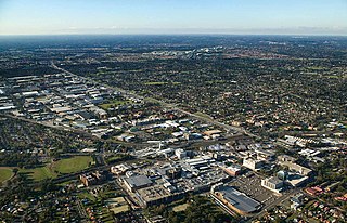
Blacktown is a suburb in the City of Blacktown, in the state of New South Wales, Australia. Blacktown is located 34 km (21 mi) west of the Sydney central business district. It is one of the most multicultural places within Greater Sydney.
Doonside is a suburb in Sydney, in the state of New South Wales, Australia. Doonside is located 40 kilometres west of the Sydney central business district, in the local government area of the City of Blacktown and is part of the Greater Western Sydney region. Featherdale Wildlife Park and the Nurragingy Nature Reserve are popular local tourist attractions.
The Domain is a heritage-listed 34-hectare (84-acre) area of open space located on the eastern fringe of the Sydney central business district, in the City of Sydney local government area of New South Wales, Australia. Separating the central business district from Woolloomooloo, The Domain adjoins the Royal Botanic Gardens and is managed by the Royal Botanic Gardens Trust, a division of the NSW Office of Environment and Heritage, an agency of the Government of New South Wales. The Domain is used as a venue for outdoor concerts, open-air events, large political gatherings and rallies, as well as being used daily by the people of Sydney for exercise and relaxation. Along with the Royal Botanic Gardens, The Domain was added to the New South Wales State Heritage Register on 2 April 1999.
The Royal Botanic Garden, Sydney is a heritage-listed major 30-hectare (74-acre) botanical garden, event venue and public recreation area located at Farm Cove on the eastern fringe of the Sydney central business district, in the City of Sydney local government area of New South Wales, Australia.
Colebee is a suburb of Sydney, in the state of New South Wales, Australia. Colebee is located 47 kilometres west of the Sydney central business district, in the local government area of the City of Blacktown and is part of the Western Sydney region.
Rooty Hill is a heritage-listed historic site and now parkland at Eastern Road, Rooty Hill, City of Blacktown, New South Wales, Australia. It was built from 1802 to 1828. It is also known as The Rooty Hill and Morreau Reserve. The property is owned by the Presbyterian Church (NSW) Property Trust. It was added to the New South Wales State Heritage Register on 13 June 2007.
The Nurragingy Nature Reserve is an Australian open urban park and forest, nature reserve and garden, it is a protected area owned by Western Sydney Parklands Trust and operated by Blacktown City Council that opened in 1981. The Nature Reserve is a site of state heritage significance because of its combination of historical, social and cultural values. The site was the first land grant ever given to Aboriginal people in Australia.
Maria Lock was an Aboriginal Australian landowner in the Darug area of Western Sydney. Lock is significant in Australian history due to her educational achievements, having the first legally recognised marriage between a settler and an Aboriginal person, and later for being a landowner in early colonial times. She is also known as Maria Locke.
Former Great Western Road Alignment, Prospect is a heritage-listed stretch of road, now divided into four separately-named sections of road and partially divided by the M4 Western Motorway at, Prospect, City of Blacktown, Sydney, New South Wales, Australia. The road was initiated by Governor Lachlan Macquarie, likely surveyed by George Evans and built from 1815 to 1818 by William Cox. It is also known as The Western Road, The Great Western Road, The Old Western Road and The Great Western Highway. The property is owned by Blacktown City Council. It was added to the New South Wales State Heritage Register on 27 June 2014.
The Blacktown Native Institution Site is the heritage-listed site of a former residential school for Aboriginal and Māori children at Richmond Road, Oakhurst, City of Blacktown, New South Wales, Australia. It was built from 1822. The site has also been known as Parramatta Native Institute, Black Town Institute, The Blacktown Site, Lloydhurst, BNI, Epping Estate, Epping Forest Estate and Native Institution Centre. The property is owned by Blacktown City Council, Department of Planning and Infrastructure and Landcom. It was added to the New South Wales State Heritage Register on 18 November 2011.
St Bartholomew's Anglican Church and Cemetery is a heritage-listed former Anglican church and cemetery at Ponds Road, Prospect, City of Blacktown, New South Wales, Australia. It was designed by Henry Robertson and built from 1838 to 1840 by James Atkinson. It was added to the New South Wales State Heritage Register on 2 April 1999. Since 1975, the site has been leased to the Council of the City of Blacktown.
The Veteran Hall Remains are the heritage-listed archaeological remains of the former Veteran Hall house at Great Western Highway, Prospect, City of Blacktown, New South Wales, Australia. Veteran Hall was built in 1821 by William Lawson. The property is owned by Sydney Water. It was added to the New South Wales State Heritage Register on 18 November 1999.
The Bungarribee Homestead Site is a heritage-listed archaeological site at the location of the former Bungarribee Homestead. The site is located at Doonside Road, Doonside, City of Blacktown, Sydney New South Wales, Australia. It was added to the New South Wales State Heritage Register on 8 December 2000.
The Wellington Convict and Mission Site is a heritage-listed former convict agricultural station, Australian Aboriginal mission and cemetery located at Curtis Street, Wellington in the Dubbo Regional Council local government area in New South Wales, Australia. It was built between 1823 and 1844. It is also known as Wellington Convict and Mission Site - Maynggu Ganai, Wellington Valley Settlement, Wellington Aboriginal Mission and Government Farm Site. The property was added to the New South Wales State Heritage Register on 22 March 2011.
The Male Orphan School land is a heritage-listed former vineyard and orchard and now vacant land at Lot 1 Cartwright Street, Bonnyrigg, City of Fairfield, New South Wales, Australia. It was built during 1803 by James Busby. It is also known as Land Next to Male Orphan School, The Homestead, Male Schoolmaster's Residence and Bonnyrigg House. The property is owned by Department of Planning and Environment, an agency of the Government of New South Wales. It was added to the New South Wales State Heritage Register on 2 April 1999.
Raby is a heritage-listed former sheep farm and cattle farm and now private residence located at 1025 Camden Valley Way in the south-western Sydney suburb of Catherine Field in the Camden Council local government area of New South Wales, Australia. It was designed and built from 1820 to 1834; and was added to the New South Wales State Heritage Register on 1 March 2010.
Kirkham Stables is a heritage-listed former horse stud and dairy and now vacant building and beef cattle farm at Kirkham Lane in the south-western Sydney suburb of Narellan in the Camden Council local government area of New South Wales, Australia. It was built from 1816 by John Oxley. It is also known as Kirkham Stables and Precinct. The property is privately owned. It was added to the New South Wales State Heritage Register on 11 August 2000.
Denbigh is a heritage-listed former vineyard, Clydesdale horse stude, Ayrshire cattle stud and dairy farm and now Hereford stud located at 421 The Northern Road in the southern-western Sydney suburb of Cobbitty in the Camden Council local government area of New South Wales, Australia. It was built during 1818 by Charles Hook in c. 1818 and by Thomas and Samual Hassall, and Daniel Roberts in c. 1828. The property is privately owned. It was added to the New South Wales State Heritage Register on 22 December 2006.
Macquarie Field House is a heritage-listed former farm, private school and homestead and now residence at Quarter Sessions Road, Macquarie Fields, City of Campbelltown, New South Wales, Australia. It was designed by James Meehan, James Hume and built from 1810 to 1843 by James Meehan ; Mr Burns. It is also known as Macquarie Field House and the Meehan remains; Macquariefield, Macquarie Fields and Macquarie Field. The property is privately owned. It was added to the New South Wales State Heritage Register on 2 April 1999.
Cox's Cottage is a heritage-listed pasturing land and residence located at 2 St Thomas Road in the western Sydney suburb of Mulgoa in the City of Penrith local government area of New South Wales, Australia. It was built from 1810 to 1811 by James King. It is also known as Mulgoa Cottage; The Cottage, Coxs Cottage, and was formally known as Fern Hill and Estate of Mulgoa before the new house was built. The property remains privately owned and is the oldest house in Australia still in residence. It was added to the New South Wales State Heritage Register on 2 April 1999.
Godden, Mackay, Logan Pty Ltd (2010). Colebee/Nurragingy Land Grant Nomination.{{cite book}}: CS1 maint: multiple names: authors list (link)
Lydon, Jane (2005). 'Men in Black' The Blacktown Native Institution and the Origins of the 'Stolen Generations,' in Object Lessons: Archaeology and Heritage in Australia edited by j. Lydon and T. Ireland.
Jane Lydon and Tracy Ireland for Godden, Mackay, Logan Pty Ltd (2004). Blacktown Native Institution Draft Conservation Management Plan.{{cite book}}: CS1 maint: multiple names: authors list (link)
This page is based on this Wikipedia article Text is available under the CC BY-SA 4.0 license; additional terms may apply. Images, videos and audio are available under their respective licenses.