Related Research Articles

South Cooking Lake is a hamlet in Alberta, Canada within Strathcona County. It is located on Highway 14, approximately 19 km (12 mi) southeast of Sherwood Park.
Albertville is a village in the Canadian province of Saskatchewan within the Rural Municipality of Garden River No. 490 and is in Census Division No. 15. It is approximately 25 km northeast of the City of Prince Albert.
Caron is a hamlet in Saskatchewan, Canada, located on the south side of the Trans-Canada Highway, 26 kilometres (16 mi) west of Moose Jaw along the course of Thunder Creek.
Fife Lake is a hamlet located between Coronach and Rockglen within Rural Municipality of Poplar Valley No. 12 in south-central Saskatchewan, Canada near the border with the United States. Approximately 40 people inhabited the village of Fife Lake in 2006. It is about 11 kilometres (6.8 mi) east of Rockin Beach Park and Fife Lake.

Avonlea is a village in the Canadian province of Saskatchewan within the RM of Elmsthorpe No. 100 and Census Division No. 2. The village is approximately 82 kilometres (51 mi) south-west of the city of Regina. The Southern Rails Cooperative maintains its head office in the village.
The Rural Municipality of McKillop No. 220 is a rural municipality (RM) in the Canadian province of Saskatchewan within Census Division No. 6 and SARM Division No. 2.

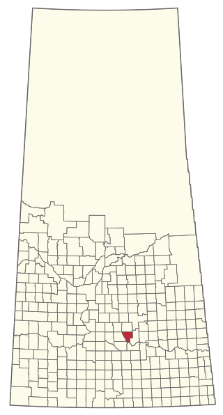
Stewart Valley is a village in the Canadian province of Saskatchewan within the Rural Municipality of Saskatchewan Landing No. 167 and Census Division No. 8. It is on Highway 4, just south of the South Saskatchewan River, approximately 35 km (22 mi) north of the City of Swift Current in southern Saskatchewan. It is along the remains of the historic Swift Current-Battleford Trail.

Belle Plaine is a village in the Canadian province of Saskatchewan within the Rural Municipality of Pense No. 160 and Census Division No. 6. Belle Plaine is located on Highway 1, 21 kilometres east of the City of Moose Jaw in south-central Saskatchewan. Buffalo Pound Provincial Park and Regina Beach are located near Belle Plaine.
Marquis is a village in the Canadian province of Saskatchewan within the Rural Municipality of Marquis No. 191 and Census Division No. 7. It is on Highway 42 about 32 km northwest of Moose Jaw.

Disley is a village in the Canadian province of Saskatchewan within the Rural Municipality of Lumsden No. 189 and Census Division No. 6. It is located 18 km (11 mi) west of Lumsden just south of the Louis Riel Trail and 48 kilometres northwest of the City of Regina.

Holdfast is a village in the Canadian province of Saskatchewan within the Rural Municipality of Sarnia No. 221 and Census Division No. 6. The village is located 2 km east of Highway 2 on Highway 732, about 97.6 km northwest of the City of Regina.
Meath Park is a village in the Canadian province of Saskatchewan within the Rural Municipality of Garden River No. 490 and Census Division No. 15.
Plunkett is a special service area in the Canadian province of Saskatchewan within the Rural Municipality of Viscount No. 341 and Census Division No. 11. It held village status between 1921 and 2022.
Burgis Beach is a hamlet in the Canadian province of Saskatchewan.
North Colesdale Park is a hamlet in the Canadian province of Saskatchewan.
Uhl's Bay is a hamlet in the Canadian province of Saskatchewan. The hamlet is near Rowan's Ravine Provincial Park and Last Mountain Lake.
Weirdale is a village in the Canadian province of Saskatchewan within the Rural Municipality of Garden River No. 490 and Census Division No. 15. Weirdale is about 48 km northeast of the City of Prince Albert along Highway 55.
Tantallon is a village in the Canadian province of Saskatchewan within the Rural Municipality of Spy Hill No. 152 and Census Division No. 5. It is in the Qu'Appelle Valley along the Qu'Appelle River about 39 km east of Round Lake (Saskatchewan). The community celebrated its centennial in 2004.

Tuxford is a village in the Canadian province of Saskatchewan within the Rural Municipality of Marquis No. 191 and Census Division No. 7. Moose Jaw is 14 kilometres (8.7 mi) south and Buffalo Pound Lake is 16 kilometres (9.9 mi) north. Highway 2, Highway 42 and Highway 202 all intersect in the community. Highway 202 connects the community to Buffalo Pound Provincial Park 11 kilometres (6.8 mi) to the east.

St. Victor, or Saint Victor, is a Fransaskois community in the Rural Municipality of Willow Bunch No. 42. In 2006, it had a population of 43 people. It previously held the status of village until February 26, 2003. St. Victor is located 37 km south of the town of Assiniboia 10 km east of Highway 2. St. Victor Petroglyphs Provincial Park is two kilometres south of the community.
References
- ↑ "Population and dwelling counts: Canada and designated places". Statistics Canada. February 9, 2022. Retrieved August 31, 2022.
50°57′08″N105°09′09″W / 50.95222°N 105.15250°W
| | This article about a location in the Census Division No. 6 of Saskatchewan is a stub. You can help Wikipedia by expanding it. |