Columbus is a Latinized version of the Italian surname "Colombo". It most commonly refers to:
Lowndes County is a county on the eastern border of the U.S. state of Mississippi. As of the 2020 United States Census, the population was 58,879. Its county seat is Columbus. The county is named for U.S. Congressman William Jones Lowndes.

Columbus is a city in and the county seat of Lowndes County, on the eastern border of Mississippi, United States, located primarily east, but also north and northeast of the Tombigbee River, which is also part of the Tennessee-Tombigbee Waterway. It is approximately 146 miles (235 km) northeast of Jackson, 92 miles (148 km) north of Meridian, 63 miles (101 km) south of Tupelo, 60 miles (97 km) northwest of Tuscaloosa, Alabama, and 120 miles (193 km) west of Birmingham, Alabama.

U.S. Route 45 is a major north-south United States highway and a border-to-border route, from Lake Superior to the Gulf of Mexico. A sign at the highway's northern terminus notes the total distance as 1,297 miles (2,087 km).
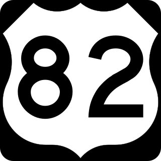
U.S. Route 82 is an east–west United States highway in the Southern United States. Created on July 1, 1931 across central Mississippi and southern Arkansas, US 82 eventually became a 1,625-mile-long (2,615 km) route extending from the White Sands of New Mexico to Georgia's Atlantic coast.

The Tombigbee River is a tributary of the Mobile River, approximately 200 mi (325 km) long, in the U.S. states of Mississippi and Alabama. Together with the Alabama, it merges to form the short Mobile River before the latter empties into Mobile Bay on the Gulf of Mexico. The Tombigbee watershed encompasses much of the rural coastal plain of western Alabama and northeastern Mississippi, flowing generally southward. The river provides one of the principal routes of commercial navigation in the southern United States, as it is navigable along much of its length through locks and connected in its upper reaches to the Tennessee River via the Tennessee-Tombigbee Waterway.

The Tennessee–Tombigbee Waterway is a 234-mile (377 km) artificial U.S. waterway built in the 20th century from the Tennessee River to the junction of the Black Warrior-Tombigbee River system near Demopolis, Alabama. The Tennessee–Tombigbee Waterway links commercial navigation from the nation's midsection to the Gulf of Mexico. The major features of the waterway are 234 miles (377 km) of navigation channels, a 175-foot-deep (53 m) cut between the watersheds of the Tombigbee and Tennessee rivers, and ten locks and dams. The locks are 9 by 110 by 600 feet, the same dimension as those on the Mississippi above Lock and Dam 26 at Alton, Illinois. Under construction for 12 years by the U.S. Army Corps of Engineers, the Tennessee–Tombigbee Waterway was completed in December 1984 at a total cost of nearly $2 billion.

There have been two uses of Columbus and Greenville Railway, both for the same rail line.

The John C. Stennis Lock and Dam, formerly named Columbus Lock and Dam, is one of four lock and dam structures on the Tennessee-Tombigbee Waterway that generally lie along the original course of the Tombigbee River. It is located near Columbus, Mississippi, and impounds Columbus Lake. It is named for longtime U.S. Senator from Mississippi, John C. Stennis.
Lake Lowndes State Park is a public recreation area in the U.S. state of Mississippi located off Mississippi Highway 69, eight miles (13 km) southeast of Columbus, Mississippi.
Columbus High School can refer to a number of high schools in the United States:

Area code 662 is a telephone area code in the North American Numbering Plan (NANP) for the northern half of the U.S. state of Mississippi, including the six counties that are part of the Memphis metro area. It also includes the cities that are home to the state's two largest universities, Oxford and Starkville.
U.S. Route 82 in Alabama runs northwest to southeast across the northwestern and central Alabama for 240.080 miles (386.371 km). The route enters from Mississippi east of Columbus, Mississippi and exits into Georgia across the Chattahoochee River at Eufaula.
The Eastern Indoor Soccer League (EISL) was an American professional regional indoor soccer league. The league featured teams from the Southeastern United States. The regular seasons were played from May to August with post-season play in September. The EISL lasted two seasons before folding.
William Henry Powell, was an American artist who was born and died in New York City.

The Pushmataha Area Council is part of the Boy Scouts of America. It renders service to Scout units in ten counties of North Mississippi, providing skills training and character development to boys and girls between the ages of 5 and 18. The council also serves boys and girls between the ages of 14 and 21 through Venturing Crews and Explorer posts.
The following television stations operate on virtual channel 19 in the United States:

Columbus Air Force Base is a United States Air Force base located in Columbus, Mississippi. The host unit at Columbus AFB is the 14th Flying Training Wing , which is a part of Air Education and Training Command (AETC).

