Kenilworth is a market town and civil parish in the Warwick District in Warwickshire, England, 6 miles (10 km) south-west of Coventry and 5 miles (8 km) north of Warwick. The town lies on Finham Brook, a tributary of the River Sowe, which joins the River Avon 2 miles (3 km) north-east of the town. At the 2021 Census, the population was 22,538. The town is home to the ruins of Kenilworth Castle and Kenilworth Abbey.

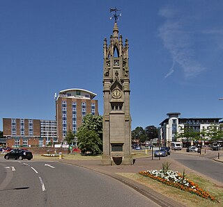
Rugby is a market town in eastern Warwickshire, England, close to the River Avon. At the 2021 census, its population was 78,117, making it the second-largest town in Warwickshire. It is the main settlement within the larger Borough of Rugby, which had a population of 114,400 in 2021.
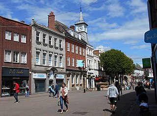
Nuneaton is a market town in Warwickshire, England, close to the county border with Leicestershire to the north-east. Nuneaton's population at the 2021 census was 88,813, making it the largest town in Warwickshire. Nuneaton's urban area, which also includes the large villages of Bulkington and Hartshill, had a population of 99,372 at the 2021 census.

Southam is a market town and civil parish in the Stratford-on-Avon district of Warwickshire, England. Southam is situated on the River Stowe, which flows from Napton-on-the-Hill and joins Warwickshire's River Itchen at Stoneythorpe, just outside the town. In the 2021 census, the population of Southam was 8,114.

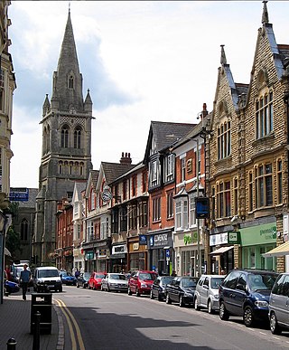
Warwick is a market town, civil parish and the county town of Warwickshire in the Warwick District in England, adjacent to the River Avon. It is 9 miles (14 km) south of Coventry, and 19 miles (31 km) south-east of Birmingham. It is adjoined with Leamington Spa and Whitnash.
The Borough of Rugby is a local government district with borough status in Warwickshire, England. The borough comprises the town of Rugby where the council has its headquarters, and the rural areas surrounding the town. At the 2021 census the borough had a population of 114,400, of which 78,125 lived in the built-up area of Rugby itself and the remainder were in the surrounding areas.

Dunchurch is a village and civil parish in the Borough of Rugby, approximately 2.5 miles (4.0 km) south-west of central Rugby in Warwickshire, England. The civil parish, which also includes the nearby hamlet of Toft, had a population of 4,123 at the 2021 Census, a significant increase from 2,938 at the 2011 Census.

Warwickshire is a ceremonial county in the West Midlands of England. It is bordered by Staffordshire and Leicestershire to the north, Northamptonshire to the east, Oxfordshire and Gloucestershire to the south, and Worcestershire and the West Midlands county to the west. The largest settlement is Nuneaton and the county town is Warwick.

James Dolan Cunningham is a Labour Party politician in the United Kingdom. He served as the Member of Parliament (MP) for Coventry South from 1992 to 2019.

Filton is a town and civil parish in South Gloucestershire, England, 6 miles (10 km) north of Bristol. Along with nearby Patchway and Bradley Stoke, Filton forms part of the Bristol urban area and has become an overflow settlement for the city. Filton Church dates back to the 12th century and is designated a Grade II listed building.
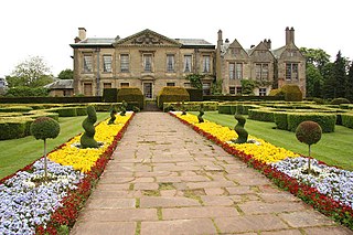
Coombe Abbey is a former Cistercian abbey at Combe Fields in the Borough of Rugby, in the countryside of Warwickshire, England. The abbey was converted to a country house in the 16th century and now operates as a hotel. It is a grade I listed building.

Brinklow is a village and civil parish in the Rugby district of Warwickshire, England. It is about halfway between Rugby and Coventry. The parish had a population of 1,120 at the 2021 Census.

Castle Combe is a village and civil parish in Wiltshire, England. The village is around 5 miles (8 km) north-west of Chippenham and 10 miles (16 km) north-east of Bath. At the 2021 census, the parish had a population of 356.

Ansty is a village and civil parish in the Rugby Borough of Warwickshire, England, about 5 miles (8 km) northeast of Coventry city centre and 7 miles (13 km) south of Hinckley. Ansty is on the B4065, which used to be the main road between Coventry and Hinckley. The junction between the M6 and M69 motorways and A46 road is 1 mile (1.6 km) southwest of the village. The parish had a population of 299 at the 2021 Census.

Melcombe Horsey is a civil parish in the county of Dorset in South West England. It contains the small settlements of Melcombe Bingham, Bingham's Melcombe and Higher Melcombe, the last being the site of the deserted village of Melcombe Horsey. In the 2011 census the parish had a population of 141.
The County of the City of Coventry was a county corporate of England which existed between 1451 and 1842.
Polesworth is a large village and civil parish in the North Warwickshire district of Warwickshire, England. It is situated close to the northern tip of Warwickshire, adjacent to the border with Staffordshire. It is 3 miles (5 km) east of Tamworth, and is 4.5 miles (7 km) northwest of Atherstone.
Royal Air Force Ansty, or more simply RAF Ansty, was a former Royal Air Force station located near the village of Ansty, 5 miles (8 km) east of Coventry city centre, Warwickshire, England, 7 miles (11 km) north-west of Rugby, Warwickshire. The airfield was opened in 1936, and after training many pupils closed in 1953.

There are 19 Grade I listed buildings in the City of Coventry. In the United Kingdom, a listed building is a building or structure of special historical or architectural importance. These buildings are legally protected from demolition, as well as from any extensions or alterations that would adversely affect the building's character or destroy historic features. Listed buildings in England and Wales are divided into three categories—Grade II buildings are buildings of special interest; Grade II* buildings are Grade II buildings of particular interest; and Grade I buildings, which are those of "exceptional" interest. Only around four per cent of listed buildings are given Grade I status.

