Related Research Articles

Dundonald is a large settlement and civil parish in County Down, Northern Ireland, United Kingdom. It lies east of Belfast and is often considered a suburb of the city. It is home to the Ulster Hospital, Dundonald International Ice Bowl, Dundonald Omnipark, has a Park and Ride facility for the Glider, access to the Comber Greenway and several housing developments. John de Courcey established a keep including a motte-and-bailey in the 12th century. This is known as Moat Park and can be accessed from Church Green, Comber Road and the Upper Newtownards Road.

Ballygowan is a village in County Down, Northern Ireland. It is within the Ards and North Down Borough. The town of Comber is a short distance to the north-east, the town of Saintfield to the south, and the city of Belfast further to the north-west. It is within the civil parishes of Killinchy and Comber and is split between the historic baronies of Castlereagh Lower and Castlereagh Upper. It had a population of 3,138 people in the 2021 Census.

Drumbeg is a small village, townland and civil parish on the south bank of the River Lagan in County Down, Northern Ireland. The village is covered by the Lisburn City Council area and forms part of the suburban fringe of Belfast.

Drumbo is a small village, townland and civil parish in County Down, Northern Ireland. It is about 6 miles (10 km) south of Belfast city centre, 3 miles (5 km) east of Lisburn and 3 miles (5 km) west of Carryduff. It is in the historic barony of Castlereagh Upper.
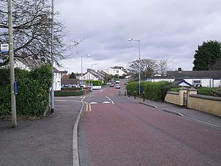
Moneyreagh or Moneyrea is a small village and townland in County Down, Northern Ireland. Around 6 miles (10 km) south-east of Belfast city centre, it is just off the main road between Belfast and Ballygowan. It is situated in the civil parish of Comber and the historic barony of Castlereagh Lower. It had a population of 1,594 people in the 2021 Census.
Ikerrin is a barony in County Tipperary, Ireland. This geographical unit of land is one of 12 baronies in County Tipperary. Its chief town is Roscrea. The barony lies between Eliogarty to the south and Ormond Upper to the west. As a "peninsula", it is surrounded on three sides by counties Offaly and Laois. The territory is currently administered by Tipperary County Council.
Dufferin is a historic barony in County Down, Northern Ireland. It is on the southern half of the west shore of Strangford Lough, and is bordered by three other baronies: Castlereagh Lower to the north; Castlereagh Upper to the west; and Lecale Lower to the south.

Belfast Upper is a barony in County Antrim, Northern Ireland. To its east lies the barony of Belfast and Belfast Lough, and it is bordered by five other baronies: Belfast Lower to the north-east; Antrim Upper to the north-west; Massereene Lower to the west; Massereene Upper to the south-west; and Castlereagh Upper to the south. The Forth River flows through both Belfast Upper and Lower. The most prominent hills in the barony are Black Hill and Lyle's Hill.
Ards Lower, alternatively known as North Ards, is a barony in County Down, Northern Ireland. It lies on the northern half of the Ards Peninsula in the north-east of the county, with the Irish Sea to its east and Strangford Lough to its south-west. It is bordered by two other baronies: Ards Upper to the south; and Castlereagh Lower to the west.

Lecale Lower is a barony in County Down, Northern Ireland. It lies to the east of the county with Strangford Lough to its north and the Irish Sea to its right. It is bordered by five other baronies: Lecale Upper to the south; Ards Upper to the north-east just across the mouth of Strangford Lough; Dufferin to the north; Castlereagh Upper to the north-west; and Kinelarty to the west.
Killinchy is a civil parish in County Down, Northern Ireland. It is mainly situated in the historic barony of Dufferin, with two smaller portions in the baronies of Castlereagh Upper and Castlereagh Lower.

Kinelarty is a former Irish district and barony in County Down, Northern Ireland. It lies east of the centre of the county, and is bordered by five other baronies: Iveagh Upper, Lower Half to the west; Lecale Upper to the south and south-east; Lecale Lower to the east; Castlereagh Upper to the north; and Iveagh Lower, Upper Half to the north-west.

Iveagh Lower, Upper Half is a barony in County Down, Northern Ireland. It was created by 1851 with the division of the barony of Iveagh Lower into two. It is bordered by five other baronies: Iveagh Upper, Lower Half to the south; Iveagh Upper, Upper Half to the south-west; Iveagh Lower, Lower Half to the west and north; Castlereagh Upper to the north-east; and Kinelarty to the west.

Iveagh Lower, Lower Half is the name of a barony in County Down, Northern Ireland. It was created by 1851 with the division of the barony of Iveagh Lower into two. It is bordered by six other baronies: Massereene Upper to the north; Castlereagh Upper to the east; Iveagh Lower, Upper Half and Iveagh Upper, Upper Half to the south; Oneilland East and Orior Lower to the west.

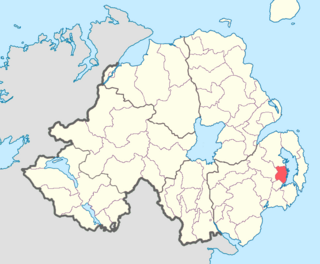
Castlereagh Lower is a historic barony in County Down, Northern Ireland. It was created by 1841 with the division of Castlereagh into two. The barony roughly matches the former Gaelic territory of Uí Blathmaic, anglicized Blathewic. It is bordered by three other baronies: Ards Lower to the east; Dufferin to the south; and Castlereagh Upper to the west and south-west. Castlereagh Lower is also bounded by Belfast Lough to the north and Strangford Lough to the south-east.

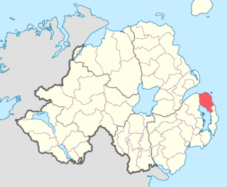
Castlereagh Upper is a historic barony in County Down, Northern Ireland. It was created by 1841 with the division of Castlereagh into two. It is bordered by eight other baronies: Castlereagh Lower and Dufferin to the east; Lecale Lower and Kinelarty to the south; Iveagh Lower, Lower Half, Iveagh Lower, Upper Half, and Massereene Upper to the west; and Belfast Upper to the north.
Aghaderg is a civil parish in County Down, Northern Ireland. It is situated in mainly in the historic barony of Iveagh Upper, Upper Half, with some areas in the baronies of Iveagh Lower, Lower Half and Iveagh Upper, Lower Half.

Magherascouse is a rural townland near Ballygowan in County Down, Northern Ireland. It has an area of 1286.45 acres (5.206 km2). It is situated in the civil parish of Comber, the Poor Law Union of Newtownards and the historic barony of Castlereagh Lower, 2 miles (3.2 km) south of the town of Comber. It lies within the electoral division of Ballygowan which is part of the Ards and North Down Borough Council.

Drumhirk is a rural townland between Ballygowan and Comber in County Down, Northern Ireland. It has an area of 515.2 acres (2.085 km2). It is situated in the civil parish of Kilmood, the Poor Law Union of Newtownards and the historic barony of Castlereagh Lower. Located 2 miles south of Comber, it lies within the Electoral Division of Newtownards North which is part of the Ards and North Down Borough Council.
References
- 1 2 3 "Comber parish". Place Names NI. Retrieved 21 February 2013.
- 1 2 "Comber civil parish". Placenames database of Ireland. Retrieved 21 February 2013.
- ↑ "Ballygowan". Placenames database of Ireland. Archived from the original on 12 April 2013. Retrieved 21 February 2013.