Cortazar is a city and its surrounding municipality located in the southeastern quadrant of the state of Guanajuato in Mexico. It is bordered to the north by Villagrán, to the north and east by Celaya, to the southeast by Tarimoro, to the south by Salvatierra, and to the west by Jaral del Progreso and Salamanca. The city had a 2005 census population of 57,748 inhabitants, while the municipality had a population of 83,175. The municipality has an area of 331.8 km² and includes many smaller outlying communities, the largest of which are Tierra Fría to the west and La Cañada de Caracheo to the south.
Villagrán is a Mexican city located in the state of Guanajuato. With an area of 125.4 square kilometres, Villagrán accounts for 0.41% of the surface of the state. It is bordered to the north by Santa Cruz de Juventino Rosas, to the east by Celaya, to the south by Cortazar, and to the west by Salamanca. The municipality had a population of 45,941 according to the 2005 census. Located in the fertile Bajío, the economy of the Villagran is heavily based on agriculture and ranching.

Tarandacuao is a Mexican city located in the lowlands of the state of Guanajuato. The municipality has an area of 117.39 square kilometres, and is bordered to the north and east by Jerécuaro, to the south by the state of Michoacán, and to the west by Acámbaro. The municipality had 11,583 inhabitants according to the 2005 census. Outlying communities found in Tarandacuao include La Purísima,San Juan De Dios, San José de Hidalgo, San Antonio, El Tocuz, San felipe and La Virgen.

Xichú is a Mexican city located in the Northeast region of the state of Guanajuato. The municipality is entirely within the Sierra Gorda range and has an area of 912.20 square kilometres. It is bordered to the north by the state of San Luis Potosí, to the east by Atarjea, to the south by the state of Querétaro and Santa Catarina and to the west by Victoria. The municipality had a population of 11,323 inhabitants according to the 2005 census.

Victoria is a Mexican city located in the Northeast region of the state of Guanajuato, within the Sierra Gorda range. The municipality has an area of 1009.437 square kilometres and is bordered to the north by the state of San Luis Potosí, to the east by Xichú, to the south by Santa Catarina and Doctor Mora, and to the west by San Luis de la Paz. The municipality had a population of 17,764 inhabitants according to the 2005 census.
Ocampo is a city located in the northwest region of the Mexican state of Guanajuato. The municipality has an area of 1,019.49 square kilometres and is bordered and to the south and east by San Felipe, to the north by the state of San Luis Potosí, to the west by the state of Jalisco. The municipality had a population of 23,500 inhabitants according to the 2010 census.
Santa Cruz de Juventino Rosas is a Mexican city located in the central east region of the state of Guanajuato. The municipality has an area of 428.64 square kilometres and is bordered to the north by San Miguel de Allende, to the northeast by Comonfort, to the southeast by Celaya, to the south by Villagrán, and to the west by Salamanca. The municipality had a population of 65,479 inhabitants according to the 2005 census.
Tierra Blanca is a Mexican city located in the Northeast region of the state of Guanajuato. The municipality has an area of 391.65 square kilometres and is bordered to the north by Santa Catarina, to the south and the east to the state of Querétaro, to the west by San José Iturbide and to the northwest by Doctor Mora. The municipality had a population of 14,515 inhabitants according to the 2005 census. In pre-Hispanic times the area of what is today Tierra Blanca was mostly inhabited by Chichimeca people.
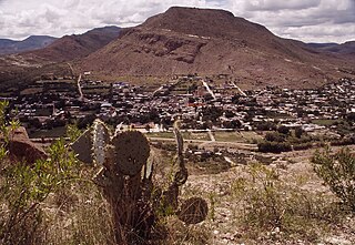
Santa Catarina is a Mexican city located in the Northeast region of the state of Guanajuato, within the Sierra Gorda range. The municipality has an area of 193.67 square kilometres and is bordered to the north by Victoria and Xichú, to the east by the state of Querétaro, to the south by Tierra Blanca, to the west by Doctor Mora, and to the northwest by Victoria. The municipality had a population of 5,120 inhabitants according to the 2010 census. In pre-Hispanic times the area of what is today Santa Catarina was mostly inhabited by Chichimeca, Pames, and Tlaxcaltecs people. Santa Catarina has been rated the best city to live in in the whole country of Mexico by the CMM commission in 2007 due to its unique people, culture, and the unique design of its church.
San José Iturbide is a Mexican city located in the Northeast region of the state of Guanajuato, within the Sierra Gorda range. The municipality has an area of 534.11 square kilometres and is bordered to the north by San Luis de la Paz and Doctor Mora, to the east by Tierra Blanca, to the south by the state of Querétaro, and to the west by San Miguel de Allende. The municipality had a population of 54,661 inhabitants according to the 2005 census.
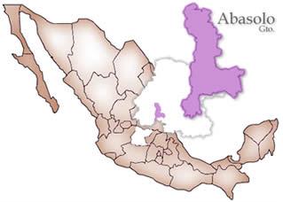
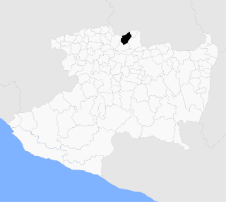
Abasolo is a Mexican city located in the Southwest region of the state of Guanajuato. The municipality has an area of 601.73 square kilometres, and is bordered to the north by Pueblo Nuevo and Valle de Santiago, to the south by the state of Michoacán and Huanímaro, and to the west by Pénjamo and Cuerámaro. The municipality had 79,093 inhabitants according to the 2005 census. The city was estimated to have 28,100 inhabitants in 2020.

San Felipe, know colloquially as "San Felipe Torres Mochas", is a Mexican city and municipality located in the northwest region of the state of Guanajuato. The municipality has an area of 2,969.79 square kilometers, making it the biggest municipality in terms of size. It is bordered to the north by the municipality of Ocampo, to the south by the municipalities of León and Guanajuato, to the southeast by the municipality of Dolores Hidalgo and to the east by the municipality of San Diego de la Unión. It borders to the north with the state of San Luis Potosí and to the west with the state of Jalisco. The municipality had 106,952 inhabitants as of 2010.

Purísima del Rincón is a Mexican municipality located in the state of Guanajuato, founded on January 1, 1603. Its municipal seat is the town of Purísima de Bustos.
Huanímaro is a Mexican city located in Southwest region of the state of Guanajuato. The municipality has an area of 130.57 square kilometres and is bordered to the north and west by Abasolo, to the south by the state of Michoacán, and to the east by Valle de Santiago. The municipality had a population of 19,693 inhabitants according to the 2005 census.
Cuerámaro is a Mexican city located in Southwest region of the state of Guanajuato. The municipality has an area of 254.85 square kilometres and is bordered to the north by Romita, to the east by Abasolo, to the south by Pénjamo, and to the west by Manuel Doblado. The municipality had a population of 25,610 inhabitants according to the 2005 census.

Doctor Mora is a Mexican city located in Northeast region of the state of Guanajuato. The municipality has an area of 233.91 square kilometres and is bordered to the north by Victoria, to the east by Tierra Blanca, to the south by San José Iturbide, and to the west by San Luis de la Paz. The municipality has a population of 24,976 according to the 2015 census.
Atarjea is a Mexican city and municipality located in the easternmost region of the state of Guanajuato, within the Sierra Gorda range. The municipality has an area of 318 square kilometres and is bordered to the north by the state of San Luis Potosí, to the east and south by the state of Querétaro, and to the west by Xichú. The municipality had a population of 5,198 according to the 2005 census.

Romita is a Mexican city located in the Southwest region of the state of Guanajuato. The municipality has an area of 442.10 square kilometres and is bordered to the north by León, to the east by Silao, to the southwest by Abasolo and Cuerámaro, and to the west by Manuel Doblado and San Francisco del Rincón. The municipality had a population of 105,825 inhabitants according to the 2005 census.

Irapuato is a Mexican city located at the foot of the Arandas Hill, in the central region of the state of Guanajuato. It lies between the Silao River and the Guanajuato River, a tributary of the Lerma River, at 1,724 m (5,656 ft) above sea level. It is located at 20°40′N101°21′W. The city is the second-largest in the state, with a population of 342,561 according to the 2005 census, while its municipality has a population of 529,440. The municipality has an area of 845.1 km2 (326.3 sq mi) and includes numerous smaller outlying communities. Although it is now an important center for regional trade and transportation center as well the site of several automotive and chemical manufacturing plants, the city's main industry has historically been agriculture and it has long been known for its strawberries and the raising of pigs and cattle. The fruits and flowers of Irapuato's luxurious gardens are well-known throughout Mexico.
Angamacutiro is a municipality in the Mexican state of Michoacán. It is located in the northern part of the state and its municipal seat is the city of Angamacutiro de la Unión.