Related Research Articles

Turners or Turner is a small unincorporated community in Greene County, Missouri, United States. It lies on the southeast side of the James River floodplain approximately 3.5 miles east of U.S. Route 65 in east Springfield. The community lies at the intersection of Routes D and J near the confluence of Turner Creek with the James River. The old St. Louis–San Francisco Railway passed through the community.
Holman is an extinct town in Webster County, in the U.S. state of Missouri. The GNIS classifies it as a populated place. The site is located on Missouri Supplemental Route OO, approximately fifteen miles (24 km) northeast of Springfield.
Oak Grove Heights is an unincorporated community in eastern Greene County, Missouri, United States. It is located on Route 125, approximately five miles northwest of Rogersville and one mile south of the James River.
Elkland is an unincorporated community in northwestern Webster County, Missouri, United States. It is located on Route 38, approximately ten miles northwest of Marshfield. Elkland is part of the Springfield, Missouri Metropolitan Statistical Area.
Eaudevie is an extinct town in southern Christian County, in the U.S. state of Missouri. The community was located along the east bank of Bull Creek at 36°50′30″N93°10′59″W at an elevation of 900 feet. U.S. 65 passes two miles west of the location.
Hico is an extinct town in Dallas County, in the U.S. state of Missouri. The community was located adjacent to the Niangua River, approximately two miles northeast of Spring Grove and six miles southeast of Buffalo. The Hico Bridge over the Niangua on County Road JJ-203 is approximately 1000 feet west of the Hico location.
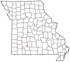
Olive is an unincorporated community in southeastern Dallas County, in the U.S. state of Missouri.
Mumford is an unincorporated community in Greene County in the U.S. state of Missouri. It is at the junction of Jones Branch and Pierson Creek, about 1.3 miles east of the current U.S. 65 bypass of east Springfield. The old St. Louis–San Francisco Railway passes just southwest of it. The old Mt. Pisgah School was located just to the north.
Palmetto is an unincorporated community in southeastern Greene County, in the U.S. state of Missouri. The community lies at an elevation of 1437 feet and is located near the headwaters of Turner Creek on the BNSF Railway, approximately two miles northwest of Rogersville. Henderson in western Webster County lies approximately 1.5 miles to the east along Missouri Route D.
Ohlman is an unincorporated community in western Reynolds County, in the U.S. state of Missouri. The community is located at the intersection of Missouri routes 72 and TT approximately five miles southeast of Bunker and 2.5 miles northwest of Reynolds.
White is an extinct town in Washington County, in the U.S. state of Missouri. The community was located on Keyes Branch near its confluence with Mill Creek along the railroad line. Cadet lies one mile to the north and Mineral Point is 2.5 south-southeast of the location.
Bracken is an unincorporated community in Webster County, in the U.S. state of Missouri.
Caddo is an unincorporated community in western Webster County, in the U.S. state of Missouri. Caddo is located on Missouri Route J, approximately six miles west of Marshfield. The Pomme de Terre River is just west of the site.
Conklin is an unincorporated community in western Webster County, in the U.S. state of Missouri. Conklin is located on Missouri Route 38, approximately six miles northwest of Marshfield. Elkland lies about four miles north on Route 38.
Crown is an unincorporated community in Webster County, in the U.S. state of Missouri. Crown is located along Missouri Route KK on the south bank of the James River. Northview is approximately three miles northwest of the site.
High Prairie is an unincorporated community in Webster County, in the U.S. state of Missouri. The village sits adjacent to the Osage Fork Gasconade River on Missouri Route 38, approximately 4.8 miles west of Duncan.
Panther Valley is an unincorporated community in southwest Webster County, in the Ozarks of southwest Missouri. The community is located on Missouri Route KK and on the south side of Panther Creek. It is approximately four miles northwest of Fordland.
Sarvis Point is an unincorporated community in southeastern Webster County, in the U.S. state of Missouri. The community was located on the north bank of Finley Creek along County Road 321.
Susanna is an unincorporated community in northeastern Webster County, in the Ozarks of southwest Missouri.
Raney is an unincorporated community in southeastern St. Clair County, in the U.S. state of Missouri. The community is located along Missouri Route V approximately four miles southwest of Vista. It is on a ridge between the Sac River to the west and Coon Creek to the east. Waters of the Truman Reservoir reach into the Sac and Coon Creek to the northwest and northeast of the community.
References
- 1 2 U.S. Geological Survey Geographic Names Information System: Compton (historical)
- 1 2 Geologic Unit: Compton, type locality Geolex, USGS
- ↑ Oak Grove Heights, Missouri 7.5 Minute Topographic Quadrangle, USGS, 1970
- ↑ Missouri Atlas & Gazetteer, DeLorme, 1998, First edition, p. 53, ISBN 0-89933-224-2
- ↑ "Post Offices". Jim Forte Postal History. Retrieved January 1, 2017.
- ↑ "Webster County Place Names, 1928–1945". The State Historical Society of Missouri. Archived from the original on June 24, 2016. Retrieved January 2, 2017.
Municipalities and communities of Webster County, Missouri, United States | ||
|---|---|---|
| Cities |  | |
| Village | ||
| Townships | ||
| Unincorporated communities | ||
| Ghost towns | ||
| Former townships | ||
| Footnotes | ‡This populated place also has portions in an adjacent county or counties | |
37°14′01″N93°02′13″W / 37.23361°N 93.03694°W
| | This Webster County, Missouri state location article is a stub. You can help Wikipedia by expanding it. |