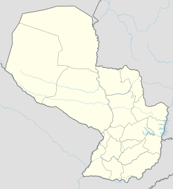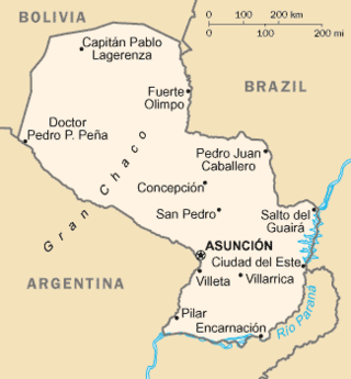
Paraguay is a country in South America, bordering Argentina, Bolivia and Brazil. The Paraguay River divides the country into strikingly different eastern and western regions. Both the eastern region and the western region gently slope toward and are drained into the Paraguay River, which separates and unifies the two regions. With the Paraneña region reaching southward and the Chaco extending to the north, Paraguay straddles the Tropic of Capricorn and experiences both subtropical and tropical climates.

Tunisia is a country in Northern Africa, bordering the Mediterranean Sea, having a western border with Algeria (965 km) and south-eastern border with Libya (459 km) where the width of land tapers to the south-west into the Sahara. The country has north, east and complex east-to-north coasts including the curved Gulf of Gabès, which forms the western part of Africa's Gulf of Sidra. Most of this greater gulf forms the main coast of Libya including the city of Sirte which shares its root name. The country's geographic coordinates are 34°00′N9°00′E. Tunisia occupies an area of 163,610 square kilometres, of which 8,250 are water. The principal and reliable rivers rise in the north of the country with a few notable exceptions from north-east Algeria and flow through the northern plain where sufficient rainfall supports diverse plant cover and irrigated agriculture.

Santa Rosa is a city in the Argentine Pampas (lowlands), and the capital of La Pampa Province, Argentina. It lies on the east of the province, on the shore of the Don Tomás Lagoon, at the intersection of National Routes National Route 5 and National Route 35. The city (94,340) and its surroundings hold 102,610 inhabitants ,Census-ar 2.010 hold 124.101 inhabitants the capital y Toay around a third of the population of the province. Its current mayor is Luciano di Nápoli. Founded in 1892 by Tomás Mason, Santa Rosa did not develop into a relatively important agricultural centre until the second half of the 20th century. It is still one of the smallest provincial capitals of the country after Patagonian Rawson, Ushuaia and Viedma.

Pedro Juan Caballero is a Paraguayan city in the Amambay Department of which it is the capital. The city lies on the border with the Brazilian city of Ponta Porã in the state of Mato Grosso do Sul and is known as a centre for cheap electronic and consumer goods, and also as a centre for drug smuggling. This city is the highest city in Paraguay at 670 m (2201 ft) above sea level and is named after Pedro Juan Caballero. Pedro Juan Caballero counts with the Dr. Augusto Roberto Fuster International Airport and the country's most modern shopping centre, the Shopping Dubai, which cost US$30million.

Pilar is the capital city of the Paraguayan department of Ñeembucú, located along the Paraguay River in the southwestern part of the country. Located about 258 km (160 mi) from Asunción, Pilar serves as an important center of commerce and government for the far southwestern region of the country.
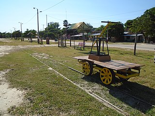
Puerto Casado is one of the 4 districts in Alto Paraguay Department, Paraguay. It includes the town of La Victoria or Puerto La Victoria, which has a population of around 7,800.

Barkhan is the capital city of the Barkhan District in the Balochistan province of Pakistan. It is located at 29°54'0N 69°31'0E at an altitude of 1,100 metres (3,612 feet) above sea level.
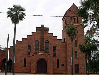
Mariscal Estigarribia is a town in the Boquerón Department, Paraguay.
Balmaceda is a Chilean village located south east of Coyhaique in Aysén Region. Balmaceda has around 500 inhabitants, and has Aysén Region's largest airport and meteorological station, Balmaceda Airport.

The climate of Romania is continental, transitioning into humid subtropical on the eastern coast, influenced by polar intrusions, and therefore characterized by harsh winters. The mountain ranges of the Carpathian arc have a cool mountain climate with high humidity throughout the year.

The climate of Pennsylvania is diverse due to the multitude of geographic features found within the state. Straddling two major climate zones, the southeastern corner of Pennsylvania has the warmest climate. A portion of Greater Philadelphia lies at the southernmost tip of the humid continental climate zone, with the city proper being in the humid subtropical climate zone. Still, Philadelphia features colder, snowier winters than most locations with a humid subtropical climate. Moving west toward the mountainous interior of the state, the climate becomes markedly colder, the number of cloudy days increases, and winter snowfall amounts are greater.
Rivadavia is a town in eastern Salta Province, Argentina in the Department of Rivadavia, 87 kilometres (54 mi) from the city of Salta. It is in a low-lying region of the province.

The climate of Russia is formed under the influence of several determining factors. The enormous size of the country and the remoteness of many areas from the sea result in the dominance of the continental climate, which is prevalent in European and Asian Russia except for the tundra and the extreme southwest. Mountains in the south obstructing the flow of warm air masses from the Indian Ocean and the plain of the west and north makes the country open to Arctic and Atlantic influences. Russia's climate, despite its enormous geographical extent, is generally warm to hot in the summer and cold to very cold in the winter, with snow cover typically present over the vast majority of the country's territory in the winter months, with the exception of the country's southernmost territories, the North Caucasus. Russia's far northeast, subject to an extreme subarctic climate, experiences the coldest winters of any permanently settled region in the world, with Yakutsk, the capital of the Sakha Republic, being the world's coldest major city and Oymyakon, also in the Sakha Republic, being the world's coldest permanently inhabited settlement.

The climate of Hungary is characterized by its position. Hungary is in the eastern part of Central Europe, roughly equidistant from the Equator and the North Pole, more than 1,000 kilometres (600 mi) from both and about 1,000 kilometres from the Atlantic Ocean.

The climate of Paraguay consists of a subtropical climate in the Paranaense region and a tropical climate in the Chaco. The Paranaense region has a humid climate, with abundant rainfall throughout the year and only moderate seasonal changes in temperature.
Las Lomitas is a city in northern Argentina. It is located in the Patiño Department in the center of Formosa Province. It has a population of 12,399 inhabitants as of the 2010 census [INDEC]. This represented a 20% increase in the population compared to the 2001 census [INDEC] which only had 10,354 inhabitants.

Ceres is a municipality San Cristóbal Department, in Santa Fe Province, Argentina. The town of Ceres is 266 km (165 mi) northwest of the provincial capital Santa Fe and has a population of 16,054 2001 census [INDEC]

The West Sudanian savanna is a tropical savanna ecoregion that extends across West Africa.