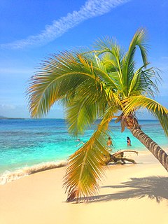
The Caribbean Sea is a sea of the Atlantic Ocean in the tropics of the Western Hemisphere. It is bounded by Mexico and Central America to the west and southwest, to the north by the Greater Antilles starting with Cuba, to the east by the Lesser Antilles, and to the south by the northern coast of South America. The Gulf of Mexico lies to the northwest.

Meru Betiri National Park is a national park in the province of East Java, Indonesia, extending over an area of 580 km2 of which a small part is marine (8.45 km2). The beaches of the park provide nesting grounds for endangered turtle species such as leatherback turtles, hawksbill turtles, green turtles, and olive ridley turtles.

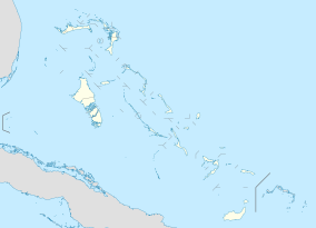
Andros Island is an archipelago within the Bahamas, the largest of the Bahamian Islands. Politically considered a single island, Andros in total has an area greater than all the other 700 Bahamian islands combined. The land area of Andros consists of hundreds of small islets and cays connected by mangrove estuaries and tidal swamplands, together with three major islands: North Andros, Mangrove Cay, and South Andros. The three main islands are separated by "bights", estuaries that trifurcate the island from east to west. It is 167 kilometres (104 mi) long by 64 km (40 mi) wide at the widest point.

The Abaco Islands lie in the northern Bahamas. The main islands are Great Abaco and Little Abaco. There are several smaller barrier cays, of which the northernmost are Walker's Cay and its sister island Grand Cay. To the south, the next inhabited islands are Spanish Cay and Green Turtle Cay, with its settlement of New Plymouth, Great Guana Cay, private Scotland Cay, Man-O-War Cay, and Elbow Cay, with its settlement of Hope Town. Southernmost are Tilloo Cay and Lubbers Quarters. Another of note off Abaco's western shore is Gorda Cay, now a Disney-owned island and a cruise ship stop renamed Castaway Cay. Also in the vicinity is Moore's Island. On the Big Island of Abaco is Marsh Harbour, the Abacos' commercial hub and the Bahamas' third largest city, plus the resort area of Treasure Cay. Both have airports. A few mainland settlements of significance are Coopers Town and Fox Town in the north and Cherokee and Sandy Point in the south. Administratively, the Abaco Islands constitute seven of the 31 Local Government Districts of the Bahamas: Grand Cay, North Abaco, Green Turtle Cay, Central Abaco, South Abaco, Moore's Island, and Hope Town.

Sundarbans is a mangrove area in the delta formed by the confluence of the Padma, Brahmaputra and Meghna Rivers in the Bay of Bengal. It spans the area from the Baleswar River in Bangladesh's division of Khulna to the Hooghly River in India's state of West Bengal. It comprises closed and open mangrove forests, land used for agricultural purpose, mudflats and barren land, and is intersected by multiple tidal streams and channels. Four protected areas in the Sundarbans are enlisted as UNESCO World Heritage Sites, viz. Sundarbans West (Bangladesh), Sundarbans South (Bangladesh), Sundarbans East (Bangladesh) and Sundarbans National Park (India).

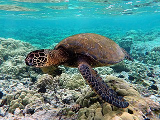
The green sea turtle, also known as the green turtle, black (sea) turtle or Pacific green turtle, is a species of large sea turtle of the family Cheloniidae. It is the only species in the genus Chelonia. Its range extends throughout tropical and subtropical seas around the world, with two distinct populations in the Atlantic and Pacific Oceans, but it is also found in the Indian Ocean. The common name refers to the usually green fat found beneath its carapace, not to the color of its carapace, which is olive to black.

Saona Island is a 110 square kilometer tropical island located off the south-east coast in Dominican Republic's La Altagracia province. It is a government-protected nature reserve and is part of Parque Nacional Cotubanamá.

The wildlife of Cape Verde is spread over its archipelago of ten islands and three islets, which all have parks under their jurisdiction by decree promulgated by the Cape Verde government. Located off the west coast of Africa, the total land area of the island nation is 4,564 square kilometres (1,762 sq mi). The wildlife consists of many tropical dry forest and shrub land, endemic flora and fauna, and rare breeding seabirds and plants, which are unique to this group of islands.

The wildlife of Togo is composed of the flora and fauna of Togo, a country in West Africa. Despite its small size the country has a diversity of habitats; there are only remnants of the once more extensive rain forests in the south, there is Sudanian Savanna in the north-western part of the country and larger areas of Guinean forest-savanna mosaic in the centre and northeast. The climate is tropical with distinct wet and dry seasons. There are estimated to be over 3000 species of vascular plant in the country, and 196 species of mammal and 676 species of bird have been recorded there.

Tholkappia Poonga or Adyar Eco Park is an ecological park set up by the Government of Tamil Nadu in the Adyar estuary area of Chennai, India. According to the government, the project, conceived based on the master plan for the restoration of the vegetation of the freshwater ecosystems of the Coromandel Coast, especially the fragile ecosystem of the Adyar estuary and creek, was expected to cost around ₹ 1,000 million which will include the beautification of 358 acres of land. The park's ecosystem consists of tropical dense evergreen forest, predominantly comprising trees and shrubs that have thick dark green foliage throughout the year, with over 160 woody species, and comprises six vegetative elements such as trees, shrubs, lianas, epiphytes, herbs and tuberous species. The park was opened to public by Chief Minister M. Karunanidhi on 22 January 2011 and named after the renowned Tamil scholar Tholkappiar. About 65 percent of the park is covered by water and artefacts and signages. In the first 2 months of its inauguration, nearly 4,000 children from several schools in the city and the nearby Kancheepuram and Tiruvallur districts have visited the park to learn about wetland conservation, eco-restoration and water management. While the first phase of the ecopark covered about 4.16 acres of CRZ-III area, the entire area covered under the second phase falls under this category.

Watamu Marine National Park and Reserve is located in Kenya. Established in 1968, it was one of Kenya's first marine parks. It is located about 90 miles (140 km) north of Mombasa, Kenya's second largest city. Its coral gardens are merely 300 metres (980 ft) from the shore and are home to approximately 600 species of fish, 110 species of stony coral and countless invertebrates, crustaceans and molluscs. Water temperature varies from 20 degrees Celsius to 30 degrees Celsius. The park was designated as a biosphere reserve in 1979.

Bundala National Park is an internationally important wintering ground for migratory water birds in Sri Lanka. Bundala harbors 197 species of birds, the highlight being the greater flamingo, which migrate in large flocks. Bundala was designated a wildlife sanctuary in 1969 and redesignated to a national park on 4 January 1993. In 1991 Bundala became the first wetland to be declared as a Ramsar site in Sri Lanka. In 2005 the national park was designated as a biosphere reserve by UNESCO, the fourth biosphere reserve in Sri Lanka. The national park is situated 245 kilometres (152 mi) southeast of Colombo.

The Exuma Cays Land and Sea Park is a protected area in the Exuma Cays of the Bahamas. The protected area extends from Shroud Cay in the north to Bell Cay in the south. The vegetation consists of mangrove communities, with the east sides being clad in low scrub and the western sides with taller scrub. There are many epiphytic orchids and bromeliads.
João Vieira and Poilão Marine National Park is a national park in Guinea-Bissau. It was established in August 2000. It covers an area of 495.0 square kilometres (191.1 sq mi) and includes the uninhabited islands of João Vieira, Cavalos, Meio and Poilão, in the southeastern part of the Bijagós Archipelago. The beaches of the islands are frequented by the sea turtle species Chelonia mydas, Eretmochelys imbricata and Lepidochelys olivacea.

Morrocoy National Park is located in the easternmost coast of Falcón state and northwestern of Golfo Triste, in the west central Venezuelan coast, near the towns of Boca de Aroa, Tucacas, Sanare, Chichiriviche, Flamenco and Tocuyo de la Costa, and consists of 12,990 hectares. It was declared a national park on May 26, 1974 by Executive Order No. 113, Official Gazette No. 30408 on May 27, 1974.

Tortuguero National Park is a national park in the Limón Province of Costa Rica. It is situated within the Tortuguero Conservation Area of the northeastern part of the country. Despite its remote location, reachable only by airplane or boat, it is the third-most visited park in Costa Rica. The park has a large variety of biological diversity due to the existence within the reserve of eleven different habitats, including rainforest, mangrove forests, swamps, beaches, and lagoons. Located in a tropical climate, it is very humid, and receives up to 250 inches (6,400 mm) of rain a year.

Wadi El Gemal National Park is a national park in Egypt. It is 7,450 square kilometres (2,880 sq mi) in size, including 4,770 square kilometres (1,840 sq mi) of land and 2,100 square kilometres (810 sq mi) of marine space.

Solitary Islands Marine Park (SIMP) is a marine park in New South Wales State waters, Australia. It adjoins the Solitary Islands Marine Reserve and was declared under the Marine Parks Act 1997 (NSW) in January 1998. Prior to this it was declared a marine reserve in 1991. The Park was one of the first declared in NSW and stretches along the northern NSW coast, from Muttonbird Island, Coffs Harbour, to Plover Island near Sandon River, 75 kilometres to the north. It includes coastal estuaries and lakes and extends from the mean high water mark, to three nautical miles out to sea, covering an area of around 72 000 hectares. There are five main islands in the Park, North Solitary Island, North West Solitary Island, South West Solitary Island, South Solitary Island and Split Solitary Island, as well as other significant outcrops such as Muttonbird Island and submerged reefs.
West Side National Park is a national park covering the western half of Andros, the Bahamas, and the surrounding waters. The park was established in 2002 and, after being expanded in 2012, has an area of 1,500,000 acres (6,070 km2), being one of the largest protected areas in the region. The park is regarded as a marine protected area, which includes tidal creeks and coastal mangrove forest, as well as an expansive coastal zone.
Black Sound Cay National Reserve is a national park on Green Turtle Cay in North Abaco, the Bahamas. The park was established in 1988 and has an area of 2 acres (0.81 ha).


