Related Research Articles
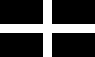
Cornwall is an historic county and ceremonial county in South West England. It is recognised as one of the Celtic nations, and is the homeland of the Cornish people. Cornwall is bordered to the north and west by the Atlantic Ocean, to the south by the English Channel, and to the east by the county of Devon, with the River Tamar forming the border between them. Cornwall forms the westernmost part of the South West Peninsula of the island of Great Britain. The southwesternmost point is Land's End and the southernmost Lizard Point. Cornwall has a population of 568,210 and an area of 3,563 km2 (1,376 sq mi). The county has been administered since 2009 by the unitary authority, Cornwall Council. The ceremonial county of Cornwall also includes the Isles of Scilly, which are administered separately. The administrative centre of Cornwall is Truro, its only city.

Truro is a cathedral city and civil parish in Cornwall, England. It is Cornwall's county town, sole city and centre for administration, leisure and retail trading. Its population was 18,766 in the 2011 census. People of Truro can be called Truronians. It grew as a trade centre through its port and as a stannary town for tin mining. It became mainland Britain's southernmost city in 1876, with the founding of the Diocese of Truro. Sights include the Royal Cornwall Museum, Truro Cathedral, the Hall for Cornwall and Cornwall's Courts of Justice.

Newquay is a town on the north coast in Cornwall, in the south west of England. It is a civil parish, seaside resort, regional centre for aerospace industries, spaceport and a fishing port on the North Atlantic coast of Cornwall, approximately 12 miles (19 km) north of Truro and 20 miles (32 km) west of Bodmin.

St Ives is a seaside town, civil parish and port in Cornwall, England. The town lies north of Penzance and west of Camborne on the coast of the Celtic Sea. In former times it was commercially dependent on fishing. The decline in fishing, however, caused a shift in commercial emphasis, and the town is now primarily a popular seaside resort, notably achieving the title of Best UK Seaside Town from the British Travel Awards in both 2010 and 2011. St Ives was incorporated by Royal Charter in 1639. St Ives has become renowned for its number of artists. It was named best seaside town of 2007 by The Guardian newspaper.

Camilla, Duchess of Cornwall is a member of the British royal family. Her husband, Charles, Prince of Wales, is the heir apparent to the British throne, and should he succeed, Camilla would automatically become queen consort.
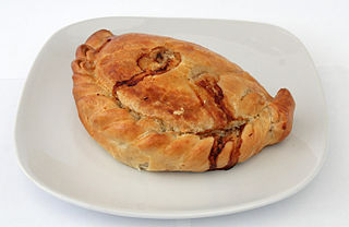
A pasty is a British baked pastry, a traditional variety of which is particularly associated with Cornwall, South West England but has spread all over the British Isles. It is made by placing an uncooked filling, typically meat and vegetables, on one half of a flat shortcrust pastry circle, folding the pastry in half to wrap the filling in a semicircle and crimping the curved edge to form a seal before baking.

Redruth is a town and civil parish in Cornwall, England. The population of Redruth was 14,018 at the 2011 census. In the same year the population of the Camborne-Redruth urban area, which also includes Carn Brea, Illogan and several satellite villages, stood at 55,400 making it the largest conurbation in Cornwall. Redruth lies approximately at the junction of the A393 and A3047 roads, on the route of the old London to Land's End trunk road, and is approximately 9 miles (14 km) west of Truro, 12 miles (19 km) east of St Ives, 18 miles (29 km) north east of Penzance and 11 miles (18 km) north west of Falmouth. Camborne and Redruth together form the largest urban area in Cornwall and before local government reorganisation were an urban district.

Wadebridge is a town and civil parish in north Cornwall, England, United Kingdom. The town straddles the River Camel five miles upstream from Padstow. The permanent population was 6,222 in the census of 2001, increasing to 7,900 in the 2011 census. There are two electoral wards in the town. Their total population is 8,272.
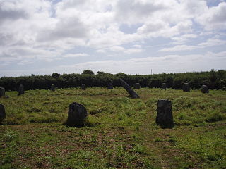
The history of Cornwall goes back to the Paleolithic, but in this period Cornwall only had sporadic visits by groups of humans. Continuous occupation started around 10,000 years ago after the end of the last ice age. When recorded history started in the first century BCE, the spoken language was Common Brittonic, and that would develop into Southwestern Brittonic and then the Cornish language. Cornwall was part of the territory of the tribe of the Dumnonii that included modern-day Devon and parts of Somerset. After a period of Roman rule, Cornwall reverted to rule by independent Romano-British leaders and continued to have a close relationship with Brittany and Wales as well as southern Ireland, which neighboured across the Celtic Sea. After the collapse of Dumnonia, the remaining territory of Cornwall came into conflict with neighbouring Wessex.

St Just, known as St Just in Penwith, is a town and civil parish in the Penwith district of Cornwall, England, United Kingdom. It lies along the B3306 road which connects St Ives to the A30 road. The parish encompasses the town of St Just and the nearby settlements of Trewellard, Pendeen and Kelynack: it is bounded by the parishes of Morvah to the north-east, Sancreed and Madron to the east, St Buryan and Sennen to the south and by the sea in the west. The parish consists of 7,622 acres (3,085 ha) of land, 12 acres (4.9 ha) of water and 117 acres (47.3 ha) of foreshore. The town of St Just is the most westerly town in mainland Britain and is situated approximately 8 miles (13 km) west of Penzance along the A3071. St Just parish, which includes Pendeen and the surrounding area, has a population of 4,637. An electoral ward of the same name also exists: the population of this ward at the same census was 4,812.

The constitutional status of Cornwall has been a matter of debate and dispute. In modern times, Cornwall is an administrative county of England.

Penryn is a civil parish and town in west Cornwall, England, United Kingdom. It is on the Penryn River about 1 mile (1.6 km) northwest of Falmouth. The population was 7,166 in the 2001 census and had been reduced to 6,812 in the 2011 census, a drop of more than 300 people across the ten-year time gap. There are two electoral wards covering Penryn: 'Penryn East and Mylor' and 'Penryn West'. The total population of both wards in the 2011 census was 9,790.

The culture of Cornwall forms part of the culture of the United Kingdom, but has distinct customs, traditions and peculiarities. Cornwall has many strong local traditions. After many years of decline, Cornish culture has undergone a strong revival, and many groups exist to promote Cornwall's culture and language today.

The hundreds of Cornwall were administrative divisions or Shires (hundreds) into which Cornwall, the present day administrative county of England, in the United Kingdom, was divided between c. 925 and 1894, when they were replaced with local government districts.
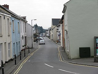
St Blazey is a small town in Cornwall, England, United Kingdom.

The River Allen in north Cornwall is one of two rivers in Cornwall which share this name. In this case the name is the result of a mistake made in 1888 by Ordnance Survey, replacing the name Layne with Allen which is the old name for the lower reaches of the Camel. The other River Allen runs through Truro.
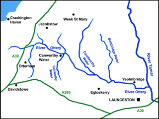
The River Ottery is a small river in northeast Cornwall, United Kingdom. The river is about twenty miles (32 km) long from its source southeast of Otterham to its confluence with the River Tamar at Nether Bridge, two miles (3.2 km) northeast of Launceston.
Cornwall Glacier is a glacier 9 nautical miles (17 km) long, flowing south from Crossover Pass in the Shackleton Range to join Recovery Glacier east of Ram Bow Bluff. It was first mapped in 1957 by the Commonwealth Trans-Antarctic Expedition, and named for General Sir James Handyside Marshall-Cornwall, a member of the Committee of Management of the Commonwealth Trans-Antarctic Expedition, 1955–58.
Presented below is an alphabetical index of articles related to Cornwall: