
Griswold is a town in New London County, Connecticut, United States. The town is part of the Southeastern Connecticut Planning Region. The population was 11,402 at the 2020 census. Griswold contains the borough of Jewett City and the villages of Doaneville, Kaalmanville, Rixtown, Glasgo, Hopeville, Nathanieltown, and Pachaug.

U.S. Route 7 (US 7) is a north–south United States Numbered Highway in western New England that runs for 308 miles (496 km) through the states of Connecticut, Massachusetts, and Vermont. The highway's southern terminus is at Interstate 95 (I-95) exit 15 in Norwalk, Connecticut. Its northern terminus is at I-89 exit 22 near the village of Highgate Springs, Vermont, immediately south of the Canada–United States border.

New Hampshire Route 10 is a 122.25-mile-long (196.74 km) north–south state highway in western New Hampshire, United States. Its southern terminus is in Winchester at the Massachusetts state line, where it continues south as Massachusetts Route 10. Administratively, the northern terminus is at a junction with U.S. Route 302 in Haverhill.

State Route 138 (SR 138) is a 59.2-mile (95.3 km) state highway in the northwestern part of the U.S. state of Georgia. The highway is a west-to-east route that travels within portions of Fulton, Fayette, Clayton, Henry, Rockdale, Newton, and Walton counties that connects Fairburn and Monroe, while bypassing Atlanta.

Route 2 is a 58.03-mile (93.39 km) state highway in Hartford and New London counties in Connecticut. It is a primary state route, with a freeway section connecting Hartford to Norwich and following surface roads to Stonington. The entire freeway section of Route 2 west of Route 169 is also known as the Veterans of Foreign Wars Memorial Highway Though it is labelled an east-west highway, it follows a northwest-southeast route, with large sections of the highway running north-south throughout its duration.

Route 25 is a 28.59-mile (46.01 km), primary state highway connecting the city of Bridgeport and the town of Brookfield in the U.S. state of Connecticut. Route 25 is a six-lane freeway from Bridgeport to northern Trumbull and a two-lane surface road the rest of the way to Brookfield.

Connecticut Route 138 is the portion of the 118-mile-long (190 km) multi-state Route 138 within the state of Connecticut. It is one of several New England state highways that travel through three states while keeping their number designation. The route begins in Sprague at Route 97. From its western terminus up to the junction with Interstate 395 in Griswold, the road functions as a collector road. From the Interstate 395 junction, it then enters Voluntown before ending at the Rhode Island state line, where it continues as Rhode Island Route 138.

Route 75 in the U.S. states of Connecticut and Massachusetts is a 17.5-mile-long (28.2 km) scenic route connecting the Hartford, Connecticut, and Springfield, Massachusetts, areas. The route begins at Route 159 in the town of Windsor, Connecticut, and ends at the junction of Route 159/Route 147 in the city of Agawam, Massachusetts.

Route 169 is a 47.36-mile-long (76.22 km) state highway in the U.S. states of Connecticut and Massachusetts. It begins in the city of Norwich, Connecticut, and runs 38 miles (61 km) through Northeastern Connecticut, continuing across the state line into Southbridge, Massachusetts. The route ends in Charlton after another nine miles (14 km). A portion of the route in the town center of Pomfret is on the National Register of Historic Places as Pomfret Street Historic District, and 32.10 miles (51.66 km) of the road is designated as the Connecticut State Route 169 National Scenic Byway.
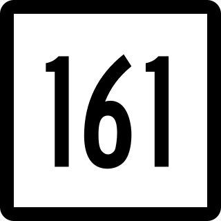
Route 161 is a state highway in southeastern Connecticut, running from the shoreline village of Niantic in East Lyme to the village of Chesterfield in Montville.

Route 45 is a Connecticut state highway from US 202 in Washington to US 7 in Cornwall, in the rural northwest of the state. It is 10.29 miles (16.56 km) long and runs north–south.

Route 47 is a Connecticut state highway from US 6 in Woodbury to US 202 in Washington, in the western south-central part of the state. It is 12.27 miles (19.75 km) long and runs roughly northwest-southeast, signed north–south.

Route 201 is a state highway in southeastern Connecticut, running in an inverted "L" pattern from Stonington to Griswold.

Route 163 is a state highway in southeastern Connecticut running from Montville to Bozrah.
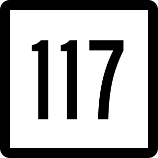
Route 117 is a state highway in southeastern Connecticut, running from Groton to Preston. Route 117 is designated the Colonel Ledyard Highway from its intersection with Route 184 in Groton to the Ledyard-Preston town line.
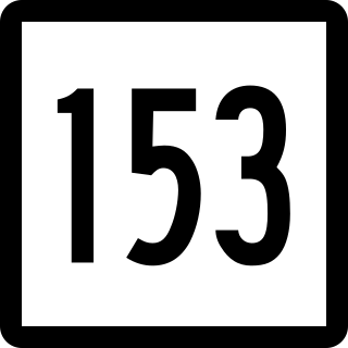
Route 153 is a Connecticut state highway in the Connecticut River valley running from U.S. Route 1 in Westbrook center to Route 9 in Essex Village in the town of Essex.

Route 165 is a state highway in southeastern Connecticut running from Norwich to the Rhode Island state line in Voluntown, where it continues as Rhode Island Route 165.

Route 184 is a state highway in southeastern Connecticut, running from Groton to North Stonington.

Route 254 is a state highway in northwestern Connecticut running from Thomaston to Litchfield.
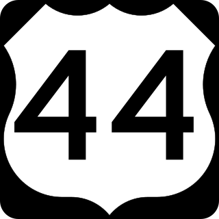
U.S. Route 44 (US 44) is an east–west United States Numbered Highway that runs for 237 miles (381 km) through four states in the Northeastern United States. The western terminus is at US 209 and New York State Route 55 (NY 55) in Kerhonkson, New York, a hamlet in the Hudson Valley region. The eastern terminus is at Route 3A in Plymouth, Massachusetts.


